|
At last report we overnighted at Walmart in Layton, Utah. We've been several nights at Walmarts, but as you can see the scenery is frequently quite good.  The weather on our entire trip has been unseasonably cold and wet. Our time in Salt Lake City was no different. Our main place to visit here was the Mormon Tabernacle. This is the home of the famed Mormon Tabernacle Choir. We were not there at a time to hear a performance, but we were able to hear a 30 minute organ recital. The Tabernacle is a large domed building which is nearly acoustically perfect inside.  The organ consists of over 11,600 pipes and makes a magnificent sound. The recital was very classical, and not our favorite music, but a real experience.   There are a number of buildings on the Temple grounds. This is the Temple which is not open to non-members and is used for special services. (Notice all the umbrellas at the bottom. Wet and Cold!!!) The weather cleared a bit in the afternoon, so we traveled a few miles out of town to visit a great wonder. The Kennecott Copper Mine. This is the only man-made feature that is visible from outer space. (Click for larger image)   Here's an aerial photo. This pit is 2-3/4 miles across and 3/4 mile deep. The dump trucks that crawl around in the mine are larger than a small house. The driver rides 18 feet above the ground! Other amazing facts can be found here (click.)  A photo from their site.  These tires are over 12 feet tall (and also 12 feet wide - duh!) and weigh over 10,000 lbs. Costing around $25,000 and last 9-12 months. Six on each truck.  This was one of the more spectacular places we have visited. We stayed in the city another night, and the next day was, guess what... wet and cold. The morning was spent shopping for a new laptop, (Chuck's crashed) and having our RV batteries checked. Headed south in the afternoon, hoping for better weather, but noooo. It actually did clear up a bit as we checked in to Yuba Lake State Park. This is a very pretty park.     The morning here has dawned wet and cold as usual. The temperature is around 40 degrees and totally dreary. We planned to head south again today, but we hear that I-15 south of here has been closed for awhile because of snow! So we may stay here another night and maybe wait out this weather. Stay tuned.
1 Comment
We survived our near death experience of high winds, rain, and cold. The next morning dawned sunny and with the help of our neighbor, and wire Chuck found along the fence (you can always find wire along a fence), the awning was wired up securely and ready to travel.  Underway again, we were continually amazed that the cultivated fields were all over mountains, wondering again how the tractors can make it on the hillsides.   On our way to Salt Lake City, we realized that we were close to Promontory, Utah, which is the place where the Continental Railroad was completed. Not only is this a well known place and event, but we have read a book by Steven Ambrose about this entitled 'Nothing Like it in the World'. It describes how the surveyors were 100 miles out, followed by the graders who prepared the grade, filling low places and building trestles over those too deep to fill. Great read. To review history, after the Civil War, the building of the intercontinental railroad was begun. The Union Pacific began work at Omaha, Nebraska going west, and the Central Pacific started at Sacramento, California working eastward. They met at Promontory, Utah. At the meeting, a golden spike was the final one driven to complete the railroad, and the event was telegraphed to both coasts, triggering celebrations across the country. This is the place.  The locomotive Juniper from the Central Pacific and the #119 from the Union Pacific met here on May 10, 1869. The above photo shows exact replicas of those locomotives, and are fully operational. The Juniper burns wood and the 119 burns coal.   They both backed up and came down the track with the steam whistle blowing and bell ringing. Quite a treat.  Notice there is nothing here but the Visitor Center. There was nothing here when the track was completed. Sometime later a monument was placed and remained the only marker of the spot for some time.  Nearby are remnants of the old railbed. Here is a 'cut' through a hill.  In the photo below, the railbed can be seen and where it extends through a 'cut' to the right. Notice the horizontal lines on the hillside. More about them later.   This is Chinese Arch. Naturally formed, but dedicated to the contribution of Chinese laborers on the construction of the railroad. Leaving the area, we skirted the Wasatch Mountains. Again, notice some horizontal lines on the side of the mountain. Years ago this area was covered with water and was known as Lake Bonneville, which at that time was about the size of Lake Michigan. The horizontal lines represent the levels of the 'lake' as it fluctuated. About 11,000 years ago, a natural dam gave way, releasing a great flood of water. This formed the gorge at Twin Falls already mentioned. The great Salt Lake and the Bonneville Salt Flats speedway are all that remains of Lake Bonneville.  We continued on and made it to Layton just north of Salt Lake City for the night, getting ready for the big city the next day. Stay Tuned.  Weather report: This is the first day in several weeks that we did not have to turn on the heater in the morning! OK so we made it to Idaho. We're glad to finally get out or Oregon. Not that we didn't like it, but seems like we were there forever. Our first stop was Boise, just to look around. We left the RV at a truck stop. We were playing with the big boys.  One of the main tourist attractions in Boise is the Idaho State Penitentiary, now a museum. We went there but didn't go in, because after Alcatraz, what can you see? The women's ward was on the grounds and we did venture in there. It's within these walls. Notice the hill behind.   Inside the wall, there is the women's jail house.  This is a cell for two. Crowded?? We found out that the massive walls were not built to contain the vicious women. This was originally where hangings took place. Hangings were somewhat of a social event and people would come from miles around to see them. All the sightseers got to be a problem, so the wall was erected to cut down the congestion. So the gawkers simply walked up the hill behind the walls and could see the hanging anyway. 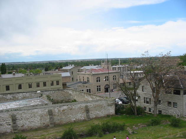 Boise has exclusive subdivisions built up the hillsides. We went to a high point and took the following panorama. Click for lager image.  Driving I-84, we are experiencing vicious winds, adding significantly to the driving experience. As we approached Twin Falls we stopped at a State Park attraction called Malad Gorge. It cost $5 to get in. Were we gouged at the gorge? I guess it was worth it.  We go over the walk bridge to get the view.  Here's the gorge. If this looks like a good hideout for outlaws, it actually was!! I forget the time period, but three convicts escaped from the penitentiary we just visited in Boise, and were hunted for days by the sheriff and his posse (volunteers), but the story is a good one. The bad guys finally surrendered when they ran out of food.  This hole looks like a good hiding place. It almost looks like someone is in there now! We had passed several dairy operations and were told that Idaho is 3rd in the nation in dairy production. And some of the dairy farms had over 20,000 cows. Here is one from the road as we passed. Sorry for the quality of the picture.  We made it into Twin Falls for the night. The next morning we attended a local church and then went to see Shoshone Falls. We had been told that now was the peak of one of the better seasons to make the falls the most spectacular. They were.    This is the Snake River again, by the way. (that's a rainbow) Here's the whole scene. Click on the photo for lager image.   This shows where Evel Knievel jumped the gorge in 1977.  Here is the bridge over the Snake River coming in to Twin Falls.  Below the bridge are two golf courses.  Recalling the high winds from the day before we had very strong winds overnight. It was still windy on Sunday. When we left Twin Falls the winds on the highway were very strong. After about 20 miles our awning began to unroll at the back only. We pulled off to a 'parking' area, and Chuck tied and taped everything.  After a few miles everything had come undone, so we pulled into another 'parking' area off the road. There was already an RV in there who decided to ride out the wind overnight. We joined them. It was too windy and cold to work on the awning some more, so we will hope the morning brings calm. It's also cold and in the 30's.  So here we are, stranded in the wilderness. Will the winds calm? Can we get the awning secured for travel? Can we make it back to civilization? Stay tuned.
Odds and Ends:
Finishing the PT boat tour about 12:30, we headed east on I-84, again through the Columbia River Gorge. We've shown pictures from here, but the views are so awesome, it's hard not to continue taking pictures.   Washington State is on the other side of the Columbia River. See the trucks on the highway over there?  We found it fascinating to see the trucks and cars wending their way on the distant highways. We saw more of it along this highway. In some areas, tall, slim junipers are planted close together in rows as a windbreak, usually around houses. In the photo below, apparently even the crops (unknown) were protected. Notice the windmills on the hilltops.  Once we passed the Gorge, the terrain became more like desert. Flatter, drier, and without trees. This was better to see the countryside, although this particular stretch was not that scenic. The land eventually changed to green, smooth rolling hills. Crops began to appear for miles and miles. 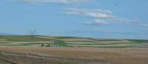 This field may have been alfalfa and some had been harvested (or perhaps aliens may have made these designs in the field). Among these pretty hills a valley appeared with a small town in it. This was Pendleton, Oregon, and we stopped for the night at the Wildhorse Casino, outside of town. From this point we could see the trucks on I-84 making their way up the hills in the distance.  We both agree that I-84 up to now has been one of the most scenic and pleasant drives we have been on. The next morning we drove into the town of Pendleton and took a tour of the Pendleton Woolen Mill.   Spools of woolen yarn.  Raw wool comes to this machine already washed and dyed (red in this case). It is brushed and cleaned of remaining trash. (is there a red-headed ghost in this picture? Lower left?)  Bundled strands are laid out for the next machine which makes loose strings.  Loose strings are spooled.  The strings from the spools are then twisted for strength and then wound on these bobbins.  This is a loom making blankets. the white strands in the foreground are cotton to make the blanket hold shape.  Here comes the finished blanket material. Since this is Indian country, the blankets are Indian patterns.       Following the tour, we departed the Casino and joined the trucks laboring up the hills to the east.   The view from the top. See the trucks coming up?  We were puzzled by the bright yellow field in the distance. We heard later that it was probably canola! Moving on down the road, we came to Baker City and visited the Oregon Trail Interpretive Center, located high on a hill several miles out of town. We hadn't realized we were pretty much following the Oregon Trail. As a history refresher, this was the trail the settlers used coming to Oregon from the east. This was a 6 month, 2000 mile trip, mostly walking and enduring considerable hardship moving the wagons over mountainous terrain. There was an excellent movie on the subject.  The center also had excellent scenes depicting life on the trail and giving an appreciation of the hardships endured in making this trip.            View from the top  Think anyone could make off with this table? Look at the size of the timbers!  These are ruts left from the wagons along the actual Oregon Trail.  Back to the RV More scenes from the road as we head down the other side of the Blue Mountains.   Our destination this evening was the Walmart in Ontario, Oregon, and our spot was right on the banks of the Snake River. Lewis and Clark spent time on the Snake River and we thought maybe they had camped here too, or even picked up a few things at the Walmart, but we found out that they were not on this part of the river. Darn!  Mary Lou ventured to the river, but decided not to when she discovered a new 'friend' that she didn't want to get close to.  (That's a skunk, in case you can't tell.)  Map of two days' travel from Portland to Ontario, Oregon Idaho is just across the river from where we are. and tomorrow we go there. Stay tuned.
OK, now the event we came for twice has happened. As I said the ladies may not be too interested, but it was a rare opportunity. We were able to visit and tour the only operational WWII PT boat in the world. (PT stands for Patrol/Torpedo) It's PT 658 and was completed in 1945 and never saw action. Restoration was begun in 1992 by a group of PT boat veterans (no longer actively working on the boat) and was considered operational in 2004. Structural restoration continues although the boat is taken out for special occasions. Below is a WWII photo of a PT boat with General MacArthur aboard. I've included that to give a feel for what these boats were like in wartime. Notice there are no types of railings around the deck. Gunners and loaders stood out there in action. Seems precarious. (Click on picture for larger image)  Next is a stock photo of a recent cruise of PT 658.  It is based at the Coast Guard/Navy Reserve base in Portland, and the first time we showed up there, we, including the guys that work on the boat were not allowed on the base because of heightened security the day after the killing of Osama Bin Laden. The guys working on the boat are very conscientious about getting all the details just right and preserving it so that it will last a long, long, time. When we visited, they had just put a new deck on the boat and therefore all the guns and fittings were not installed. They have built a boat shed for protection from the elements. This is the bow.   The stern (back of the boat).  This is the forward crew's quarters and mess hall (the galley is here too, behind us). There are berths for 8, 4 of which are in the little oval cubby holes.    The Galley.  An old photo of actual conditions. In one family touring the boat at another time, a lady recognized her father in one of these pictures. An emotional time.  The Captain's quarters And for the reader with a restroom fetish, here is the officer's head.  We were honored to have on our tour (4 people) a real, honest-to-goodness PT boat veteran. His name is Stan Richards and he was there with his daughter. He had been a Motor Machinist on PT 244 and saw action at Rendova in the Solomon Islands. His job was to maintain the engines and he also manned a 20mm machine gun. Here he is in the engine room. There are 3 V-12 Packard engines with 1850 horsepower each.  These boats had a top speed of around 45 knots (51 MPH) and could actually outrun their own torpedoes, so they had to be careful about that.    View of the after deck, looking forward.  This is the 'office' on the pier. With the deck in disarray, it may not have been the best day to visit, but the work is on-going. But having the old (older) veteran here this day was a real stroke of luck because everyone was interested in his stories about how it really was in combat on these boats. On the occasions when they take the boat out, PT boat veterans are always invited. This gentleman will be back for a ride. Here we are with Stan and his daughter.  For more information and pictures, the group has a website, http://www.savetheptboatinc.com/index.htm. Not only do they appreciate financial donations, but they are looking for other stuff from the period. So if you have some Navy enlisted silverware, or a 60mm mortar, or a Mark 31 Torpedo Director laying around, they would like to hear from you.
Many thanks to our brother-in-law, Phil, for alerting us to this PT boat by sending a link to a youtube video about it. I hope you haven't been too bored, but we had a wonderful experience and it was worth backtracking to Portland. But as usual, there's more experiences to come. Stay tuned. We spent some time this morning planning the next couple of days, since rain is in the forecast and we want to see Mt. St. Helens. So, after working out the plans, we jeeped about 60 miles north, past Seattle, to Everett, Washington, and the Boeing assembly plant. This is where they assemble their largest airplanes. The plant tour does not allow cameras or cell phones or any electronic device. So there are not any pictures from inside the plant. Below is the assembly building. Each of the six large doors are at the end of six assembly lines. The building is so large that Disneyland (including the Matterhorn) would fit in there plus 12 acres of parking.  Below is a panorama of the far side of the runway. The assembly building is on the left. Click on the photo for larger image.   There were big planes all over the place. There was a gallery of exhibits.  This is an engine. (the one on the left).  'Come fly with me'. 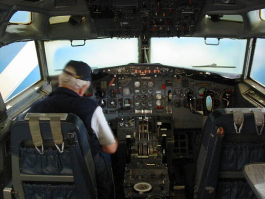 Where are the cup holders? On our long jeep ride back to our campground, we did get a glimpse of Mt. Ranier, one of the highest mountains in the lower 48 states. 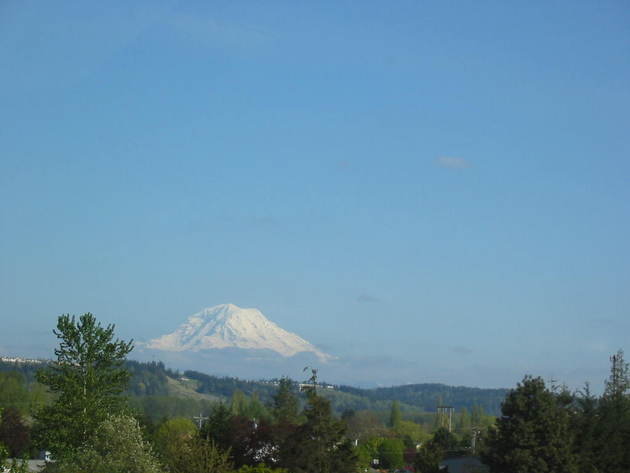 This day turned out to be nice and sunny and fairly warm. The next day turned out to be raining all day. This was the day to visit Mt. St. Helens, the site of the great volcanic eruption of 1980. There was a movie in the visitor center which depicted the eruption. There had been rumblings for about a month, so people had been watching with cameras and captured the entire event. It basically exploded and sent a plume of ash about 50,000 feet into the air. The blast leveled entire forests, breaking all the great trees off at ground level. Rivers of mud and trees wiped out everything in it's path. Anyway, from the Visitor Center we jeeped the 30 miles up toward the mountain and encountered this:   This is the best view we could get on this day. (there were even some other fools up there) That has to be a magnificent view on a clear day. Anyway it was cold and rainy all the way down the mountain, and on into Vancouver, Washington. After we parked at the Clark County Fairgrounds, the sun finally came out.  Vancouver, Washington is just across the river from Portland, Oregon. You may recall that we came to Portland before for an important experience that didn't happen. Well, we revised our plan to come back here, because tomorrow we expect it to finally happen. The ladies may not be too interested, but the guys might be. To Chuck, it is HUGE. Stay tuned.
We were reluctant to leave our friend's house in Port Angeles, but after some computer work, we finally left at 11am. Stopping for gas after a few miles, we discovered that the little jeep didn't want to go and had locked her brakes like a stubborn child. Solving that problem, we were underway again at 1pm. We made a stop at a little town called Poulsbo, which has a Norwegian heritage.  The draw here was a bakery, and we couldn't resist a few treats. Below is a shot through the window, giving a reflected view of the street.  We have noticed several newer subdivisions out here that seem to have a lot of similarity in the houses. What you might call 'cookie cutter' homes. Have a look.  Now we get down to the real reason we chose to visit Bremerton, Washington. There is a Viet Nam era destroyer (Navy warship) there which is a museum open to the public. It's newer and somewhat bigger than the ship that Chuck served on, but it was close. It's the USS Turner Joy, which is one of the ships attacked in the Tonkin Gulf which then was the impetus to become involved in the Viet Nam war.   Crew's quarters.  Crew's mess hall.  Sick Bay One of our faithful readers has expressed an interest in seeing restrooms, and always trying to please, here are a couple of restrooms on this ship.   Leaving this trip down memory lane about 6pm, we headed for a short trip to the Walmart in Puyallup, south of Tacoma. (that's pronounced pu-YALL-up). In the morning, we'll move to the nearby fairgrounds for at least a couple of nights. That's because we have another couple of exciting destinations in mind. Stay tuned.  From Astoria, Oregon, we headed north over the big bridge that spans the Columbia River.  Along the way we encountered the following sight and even turned the RV around to go back for a photo. A chimney complete with smoke coming out of an RV!!  We are spending the weekend here in Port Angeles at the home of old friends from Navy days. We are at the 'apex' of our trip. We have been gone 5 weeks now and we are as far from home as we are going to get. 1960 miles as the crow flies. (Can a crow fly that far??). When we leave here, our heading will be east and south, instead of west and north (hoping to find warmer weather). Port Angeles is on the northern tip of the Olympic Peninsula, west of Seattle. The peninsula is home to Olympic National Park with majestic mountains, rainforests, and scenic seashores. We toured this area 3 years ago over a long weekend, but didn't have time for a ferry ride to Victoria, British Columbia, Canada. That was the focus of this visit. Our friend is a bee keeper and we have learned a lot about bees, but only a fraction of what beekeeping is all about.   They have a successful small business selling the honey. In addition to gift shops in the area, the weekly Farmer's Market is another outlet. 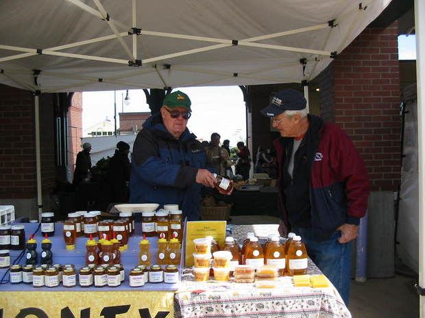 Since Saturday was a rainy day, Mary Lou and Winona spent the day making doll clothes.  Winona is into quilting, and below is an amazing quilted wall hanging she made.  Port Angeles is a quaint little town nestled between the Olympic mountain range and the Strait of Juan de Fuca which leads to the sea.  Note the murals on the buildings and the large ship which is the ferry to Victoria.  The ferry ride to Victoria takes about 90 minutes. Ferries are a major way to get around in this area, and several operate out of Seattle to the various islands and even to other parts of the mainland. They are quite comfortable with a snack bar, rest rooms, etc.   Victoria is a fun tourist town with the usual shops and seaport sights.  The Empress Hotel (to the right in the photo above) and the Provincial Capital building are magnificent sights from the Harbor.   We have established a little fun thing about Mary Lou's friends. Below is another 'friend' photo, but this one should have been Chuck's friend! From the side, she had good legs too. Sorry we missed this opportunity.  We took a 30 minute bus ride to the premier attraction of Victoria, and really, the main reason to come here. Butchart Gardens has been an attraction for over 100 years. Once the limestone quarry on the property played out, Mrs. Butchart began developing the gardens. The plants are changed out each season of the year with special attention at Christmas time. It take about 2 hours to spend time wandering around, but best to follow the prescribed route to see it all. The following photos are a brief sampling of the beauty of the layout as well as the flowers.    Click small images below.  This day was Mother's Day and the British Columbia Concert Orchestra was here for their annual Mother's Day performance. What luck!  Another friend. Victoria harbor had these little local ferries that seemed to scurry around like water bugs.   There were houseboats here, too. We've had a great visit here, but Monday we head south. But not far. Stay tuned.
So we go back to the Oregon coast at Astoria. Astoria is where the Columbia River meets the sea, and this is where Lewis and Clark ended their amazing journey across the continent. We wanted to visit this place since we had been to their starting place at St. Louis, Missouri, last year. 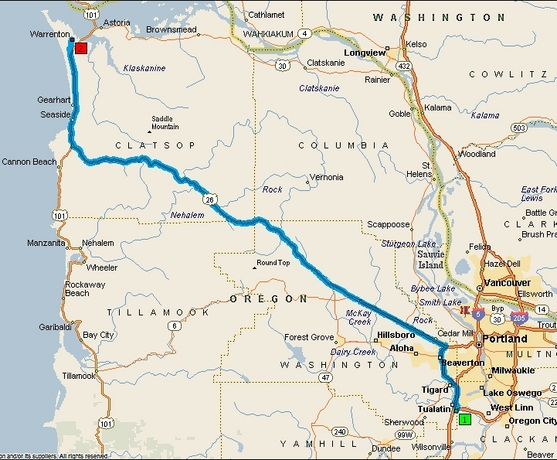 We checked into the Fort Stevens State Park on the peninsula near Warrenton (see Map). Our campsite is nestled among stately Sitka Spruce trees.  The park includes most of the beach area around the peninsula and is very accessible, including being able to drive on the beach is some areas (we were surprised at this).  We encountered the following at one area of the beach. It seems an infantry company was conducting a live fire exercise further down.  The statue below represents Lewis and Clark near the water's edge at the 'end of the trail' after an arduous journey of about 18 months. What a moment that must have been.  Our exploration of the area began with Fort Clatsop, the winter encampment of Lewis and Clark. They arrived in the area in November of 1905, and by the end of December, had constructed this small fort to spend the winter. There was a total of 33 in their party. This fort is a scale replica of the original and probably more painstakingly constructed.    A group of 3 men were sent to set up camp close to the coast and to boil sea water to extract the salt. Salt was needed for the return trip to cure meat and for seasoning. It took 2 months to acquire the required 4 bushels of salt.  Driving around Astoria we discovered that they has very steep streets much like San Francisco. Below is the most elaborate of several Victorian homes in the town. This is the Flavel house, built in 1886. Flavel was a prominent businessman and river pilot.  We also discovered the Astoria Tower, constructed around 1929. The outside is decorated with a spiral mural depicting scenes of Lewis and Clark's journey. There are 164 steps to reach the top.  The view from the top is, of course, spectacular. According to locals, this was the first clear day they have had in awhile, so we were fortunate. Mary Lou was thrilled to be able to see Mt. Ranier and Mt. St. Helens in the distance. The next day was dreary again.  Astoria is a major deep-water port. On this day a cruise ship was in port, and of course, logs are a major export.  The cruise ship docks where the logs are.  We saw many of these on the roads. The ship departs past our vantage point at the tip of the State Park.  And so we depart the Pacific Ocean for the last time. (The shipwreck was grounded here in 1906.)  We will spend time in the Seattle area and then head east and south. Stay tuned.
After the Spruce Goose museum, we made a short drive to a very nice RV park just south of Portland. On Monday the event that Chuck was excited about didn't happen because of the Osama Bin Laden thing. Now figure that out!! It may still happen, so I won't reveal it just yet. So we proceeded with our plan to make the drive east through the Colombia River Gorge, which is supposed to be scenic and featuring spectacular waterfalls. There is an old road paralleling I-84 which, built in the early 1900's, is a national scenic byway. It was built in the Model T days when touring was popular, and it was built not to scar the landscape but to blend with it.    This route is noted for spectacular waterfalls.  This is Bridal Veil Falls      The crown jewel of waterfalls is Multnomah Falls at over 600 feet high.  In the late '90's, a 400 ton rock fell into the upper pool, splashing water all over a wedding party on the observation deck. A view house was built as a rest stop along the way. It now has a visitor center, gift and coffee shop and of course, rest rooms. It actually has stained glass windows.   Here's a view of the Columbia River from the View House.  There are a couple of dams and locks along this stretch of river and they both have 'fish ladders' for the salmon that return upstream to their place of birth to spawn and die. Without the ladders, they couldn't get past the dams.  This is a fish ladder. They swim upstream and jump up the steps of the ladder. They are then funneled through a narrow channel with a window. A 'fish counter' sits in a cozy, dimly lit room counting the fish as they swim upstream.  Reaching the quaint hillside town of Hood River, we turned north to circle Mt. Hood and return to our campsite south of Portland. Outside Hood River were many orchards of pears, and apples, all in bloom. The hillsides were white. This route is called the 'fruit loop'.  Mt. Hood is a very tall mountain that we spotted from a distance on Sunday, the clear day. It looks like Mt. Fuji in Japan. On this day the weather was not cooperating and along the river, it was overcast with occasional rain. Heading around the mountain we encountered rain, snow and sleet, followed by nice sunshine as we approached Portland.    Here is our route this day. It's about 185 miles. Tomorrow we move back to the coast for a last look at the Pacific Ocean. (that's not why we are going). Stay tuned.
|
Who Are We?
Chuck and Mary Lou have been traveling in their RV since 2002 and have lately been taking longer, extended trips. This is our way to share our experiences. 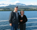 Trip Reports
All
|
 RSS Feed
