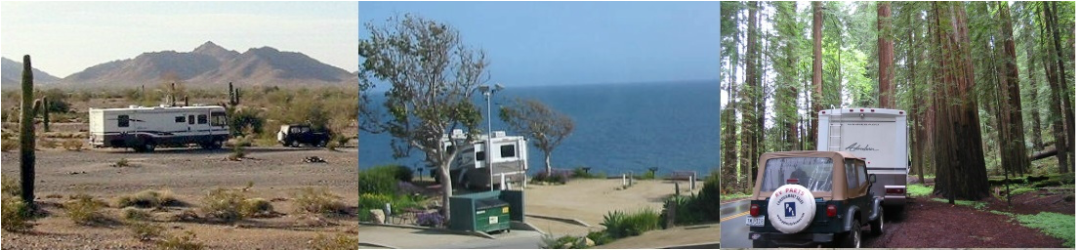
|
So we are about at the end of the trail. We have been gone 9 weeks and traveled 6600 miles (plus almost 3000 jeep miles), in 9 states. 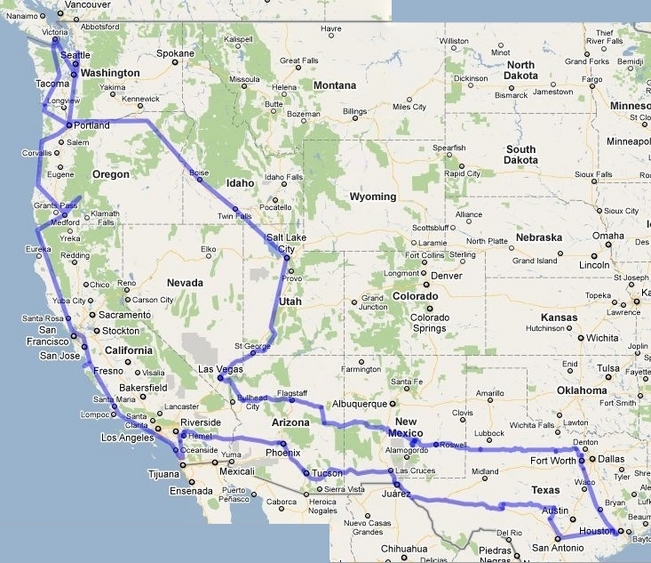 We have seen great natural beauty everywhere. We have seen vast vistas of mountains, valleys, rivers and gorges. We have seen all kinds of rock formations and geological strata. We have visited national and state parks and various boats, ships, trains and airplanes. We have gained an appreciation of the great effort and hardship it took to explore and settle this land.
Our pictures cannot completely capture what we have seen. They go some of the way to convey the grandeur of this great land that we are blessed to live in. We hope all who have kept up with our reports have gained more of an appreciation of this. And we appreciate all the emails and comments from you. You have been with us as we consider what would be of interest in our reports. Today we will be home and as we come to the end of this magic journey, we thank you for coming with us. So until the next trip, God willing, ... Stay tuned.
20 Comments
Sunrise on our last morning at a favorite spot. 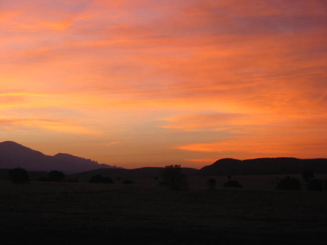 Leaving the campsite and heading toward Roswell, New Mexico, we shortly came to the town of Lincoln. This is a very small town with a lot of history. Everything appeared to be closed so we didn't stop and didn't take pictures. Two major things are Lincoln's claim to fame. Back on the 1870's, Lincoln was a very prominent place in the New Mexico territory. Competition between two influential merchants, led to what is called the Lincoln County War. It went on for several months and 19 people were killed, wild west style (posses and such). Lincoln's other claim to fame is the fact that the famous 'Billy the Kid' was involved in the conflict. Here is a link to a very good account of the story. It is a short drive into Roswell, New Mexico, which is known for UFO sightings. We didn't see any UFO's, but we did have an 'out of this world' experience! We found gas for $3.29! We crossed the line into Texas at 2:40 pm, Texas time. While good to be back in the home state, we have to admit that the scenery was pretty blah. There were some new additions to the landscape, however. 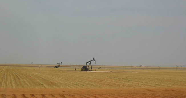 We stopped early at a city park with hookups in Brownfield, Texas. We're pacing ourselves to be in Graham (240 miles away) tomorrow for dinner with friends. If there is anything of interest here, we'll let you know. 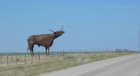 This metal Longhorn was the only thing of interest! 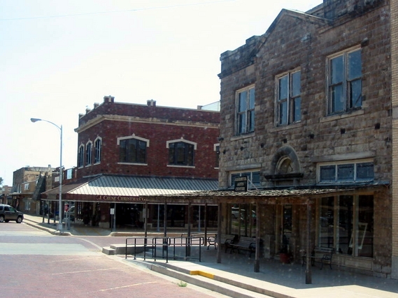 And the typical old Texas towns. Arriving in Graham, we checked into one of 3 city parks that have hookups. We find that many small town City Parks have RV hookups and are very nice and reasonably priced ($10-12) on the honor system (some we have not felt comfortable staying overnight in).  Thursday it's on to Keller, Texas, just north of Ft. Worth to see the grandkids.  Tomorrow is the day we go home. Stay tuned.
Show Low, Arizona, has an interesting name and an interesting legend as to how it came to be. The photo below and the story is taken from another website. 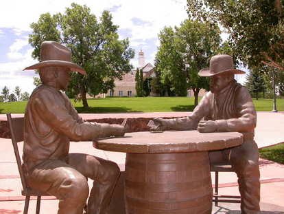 "Marion Clark and Corydon E. Cooley owned a 100,000 acre ranch. They had a falling out and decided to play a game of cards and the winner would own the ranch outright. The game lasted all night. When the last hand began, Cooley needed one point to win. Clark told Cooley “SHOW LOW and the ranch is yours.” Cooley turned up the deuce of clubs, thereby naming Show Low. The main street became the Deuce of Clubs." The roads from Show Low to Capitan, New Mexico are mostly smooth, mostly straight, and mostly deserted. That makes for pleasant driving. There are mountain passes followed by vast stretches of range land, varying from desert to grassland. 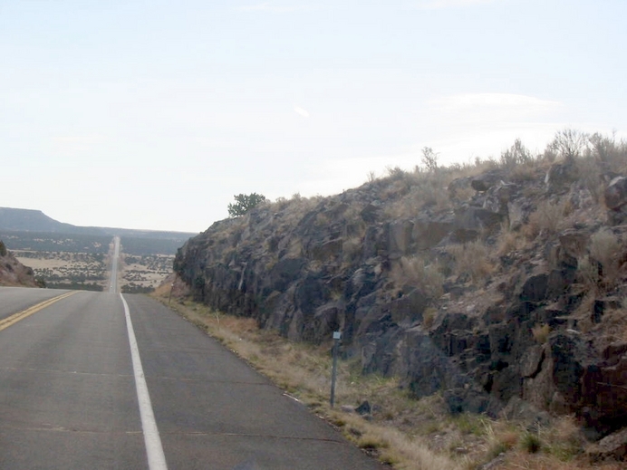 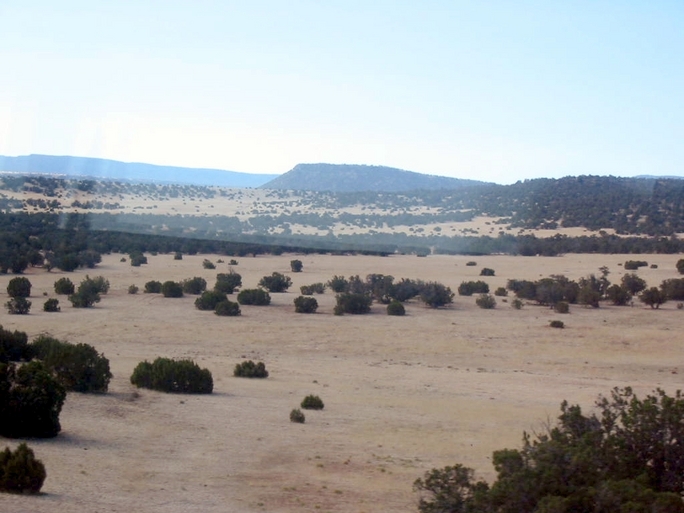 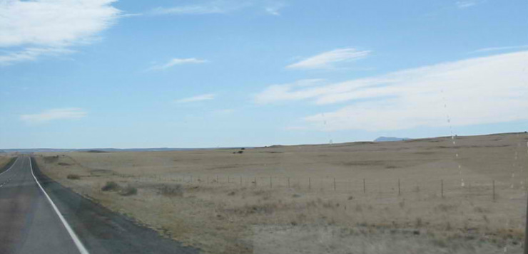 We had seen something on the map about VLA. Upon investigation, we discovered that it meant Very Large Array. Upon further investigation, we discovered that this was an array of radio telescope dishes, which receive radio signals from space and feed all the info to a central location. This data is combined to make a 'picture' of something out there. It's like looking through a really powerful telescope at an observatory. Therefore this place is called an 'observatory'. 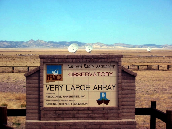 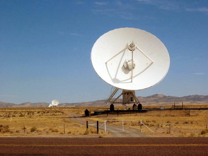 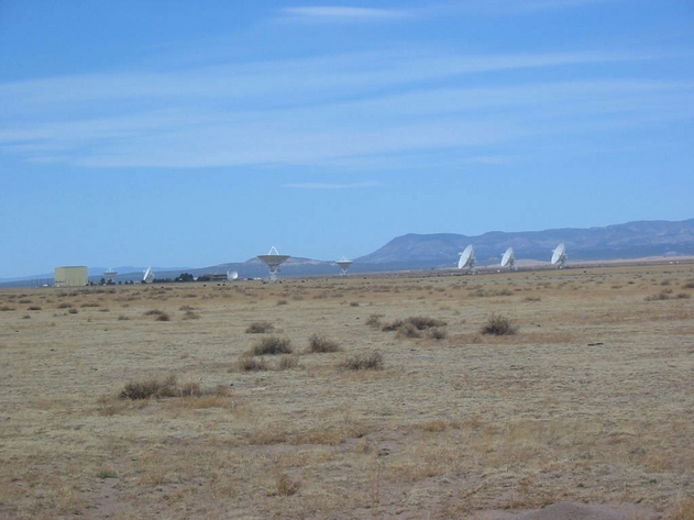 There are 27 of these out in the desert in a 'Y' shape. 9 in each leg. Each dish is 82 feet in diameter and they say a baseball diamond (infield) would fit inside. These arrays are the equivalent of a very large telescope, and the farther apart the dishes are, the larger the telescope. There are some larger arrays in other locations in the world. Scattered around the United States there are 10 dishes linked together to form a huge telescope. One of them is in Fort Davis, Texas. As we crossed New Mexico, the towns of Socorro, Carizozo, and Capitan got progressively smaller, dustier, and poorer. Camping outlook was poor until we discovered BLM (Bureau of Land Management) land near Capitan. As you may recall, there are ‘boondocking’ (camping with no hookups) opportunities in these areas at little or no cost. We have come to love camping in these places because of the peacefulness and solitude. In this case, there is an Equestrian Trail Head facility where people come park their horse trailers and ride the many trails. When we got there we also found electrical hookups for $8. Ideal! (We're not completely alone. There is a 'host' or caretaker about 100 yards away.) 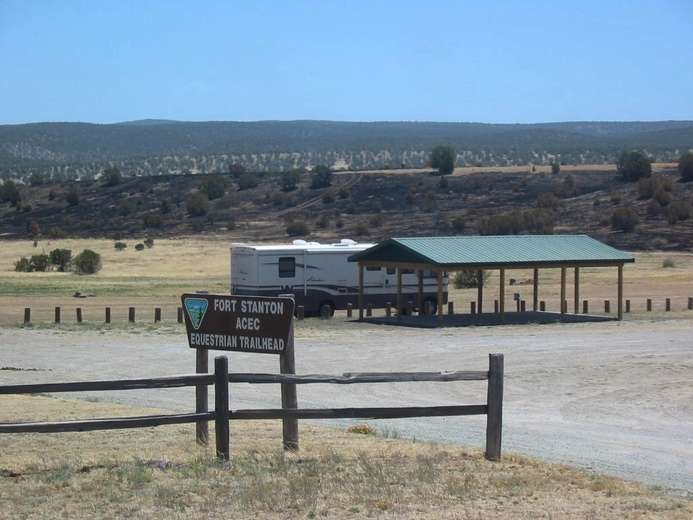 In the evening and early morning there were several pronghorns (like deer, but more related to antelopes and goats) grazing nearby. Taken from the front window, over the top of the jeep. 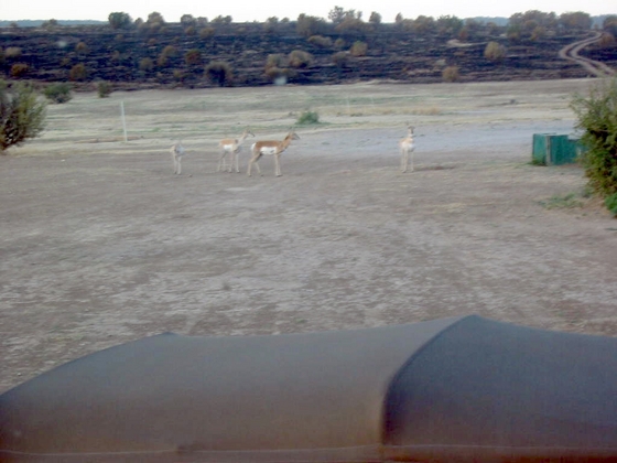 It was totally dark at night, so all the stars were clearly visible. We stayed two nights. Our goal here was to visit friends in Ruidoso, about 20 miles away. We jeeped there and found the town to be a tourist mecca, much like Sedona. One highlight was the 'Inn of the Mountain Gods' Casino. All the casinos in Arizona and New Mexico are operated by American Indian tribes. This one is operated by the Mescalero Apache Indians and is probably the most elegant we have seen. The outside, while imposing, is rather plain. 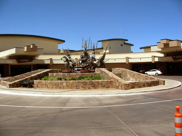 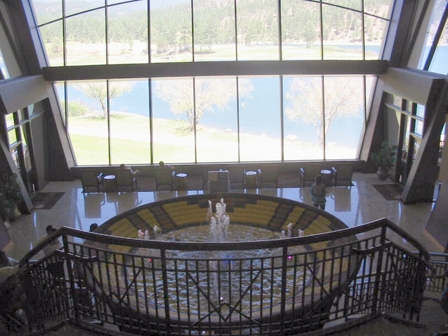 This is the main hotel lobby area. Note the view of the lake. 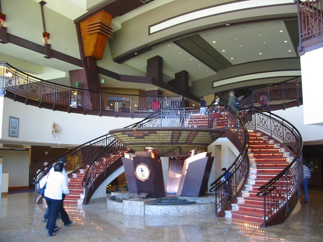 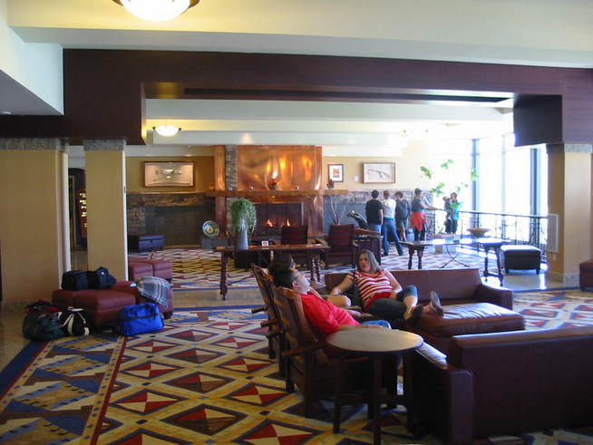 Enough of Ruidoso and back to Capitan whose main claim to fame is Smokey Bear. This is his final resting place. 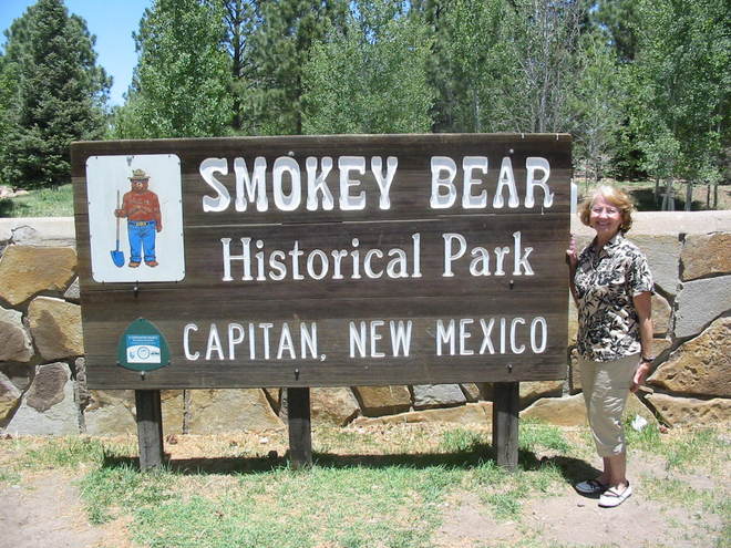 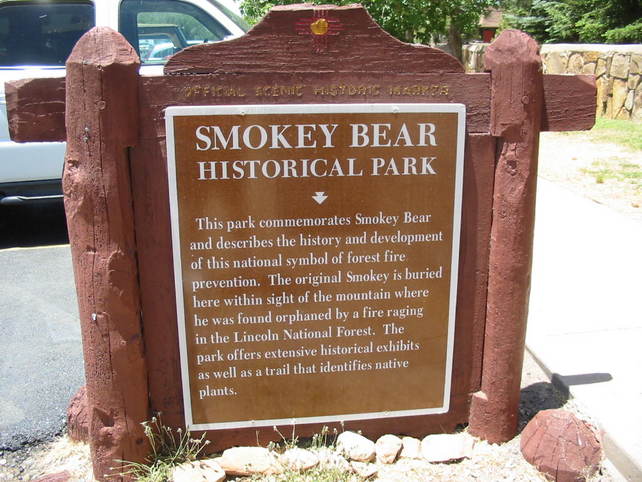 We spent the afternoon exploring some of the backroads on the BLM land. The roads were not too rough and afforded wonderful vistas on both sides as we traveled along a high ridge. Great fun. 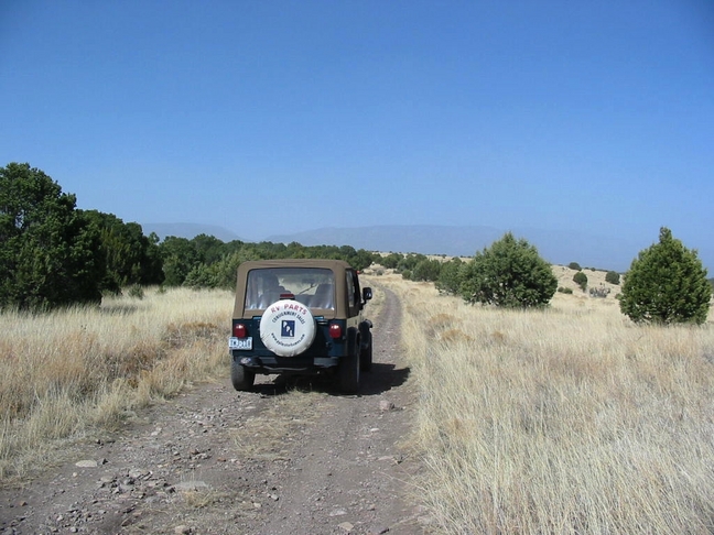 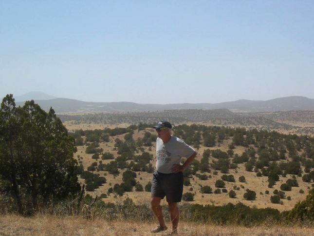 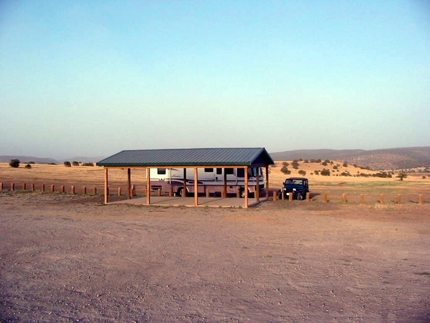 Back at our nice campsite, we spent a last night stargazing and enjoying the solitude. Tomorrow we head for TEXAS, baby!! Stay tuned.
Before leaving Flagstaff, we drove around to see a bit of the old Route 66 landmarks. 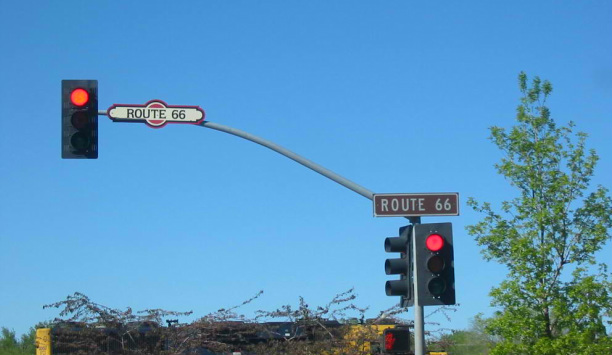 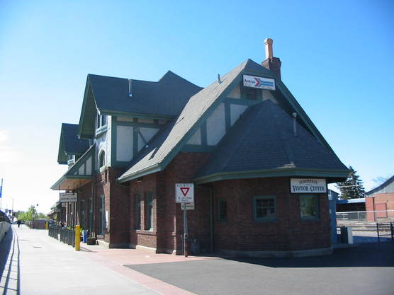 The old train station is still an Amtrak stop for passengers, plus housing the Visitor Center. Leaving Flagstaff, we encounter more heavy winds. We later learned from a newspaper headline on a local paper that 30-40 mph winds were forecasted for the weekend, with gusts to 75 mph. We soon came upon and stopped for an RV on the side of the road with the awning billowing up over the top. After helping the man put straps over the top of the RV to hold down the canopy, we followed him to a stop where he could park the RV with the awning to the downwind side. We were able to extend the awning and roll it up properly, and he secured it for the trip home to Livingstone, Texas. 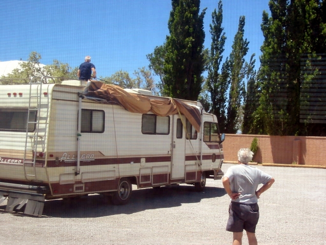 Later in the day we came upon another RV whose awning was gone. The roller, fabric, and main arms were just gone. All that was left was a couple of inner arms, and the metal wrap that covers the awning when rolled up. I don't know how that survived. He didn't need my help, so we moved on. One of the main attractions in this area is Meteor Crater. This is a crater that is almost a mile across and 550 feet (a 60 story building) deep. The floor would hold 20 football fields and the sides of the bowl would seat more than 2 million spectators. The crater was formed about 50,000 years ago when a meteor approximately 150 feet in diameter struck the earth. 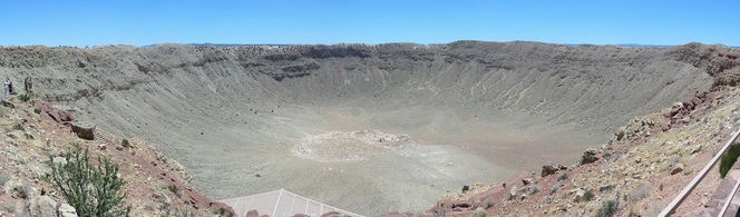 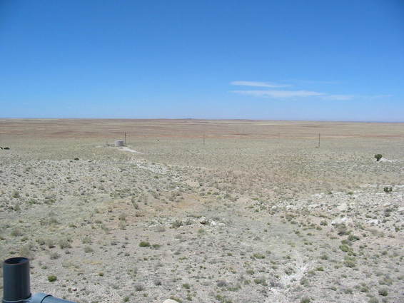 It's located on ranch land that is desolate as far as the eye can see. Going on east on I-40, we soon came to Winslow, Arizona. This was made famous by the song by the Eagles, 'Standing on a Corner in Winslow, Arizona' (seven women on my mind). 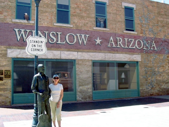 Notice the upper right window. 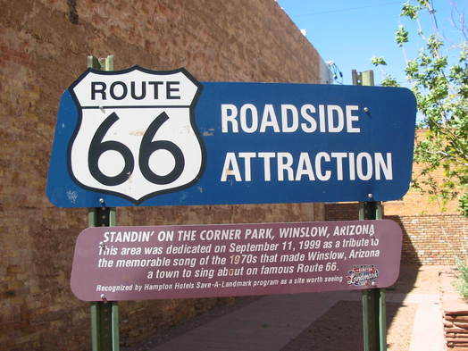 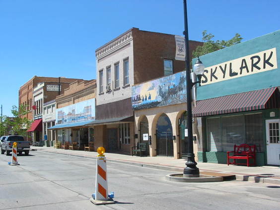 Buildings along the old highway. Also in Winslow is the La Posada Hotel. This is a fancy old landmark that was once a 'Harvey House'. This was the last and most elegant of the Fred Harvey Hotels built by the Santa Fe Railroad. All the passenger trains that ran between Chicago and Los Angeles stopped here. Many celebrities including Bob Hope and John Wayne stayed here. 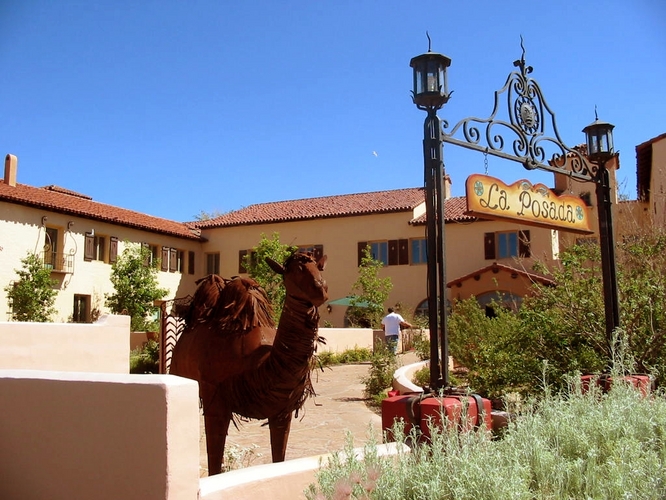 Scenes from the interior. 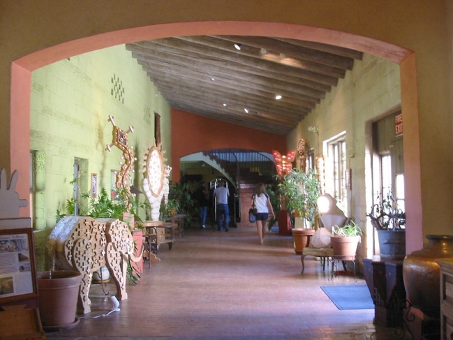  On down the road there was a typical, for the day, Route 66 sight. A teepee motel. I don't know if this is an active motel, or an attraction, but notice the vintage (to the younger people) cars parked by the teepees. 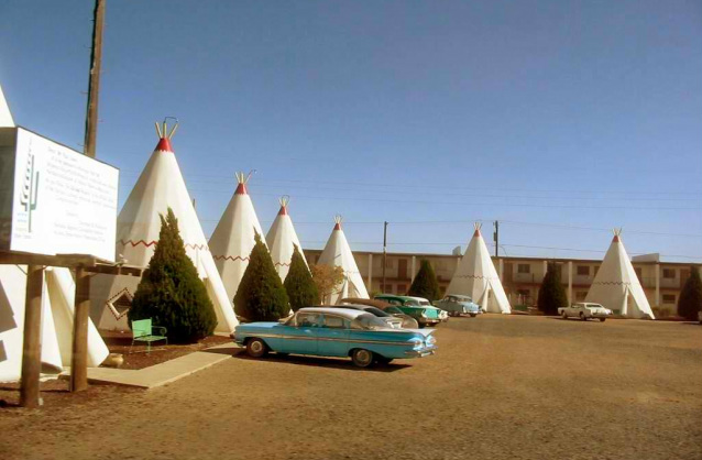 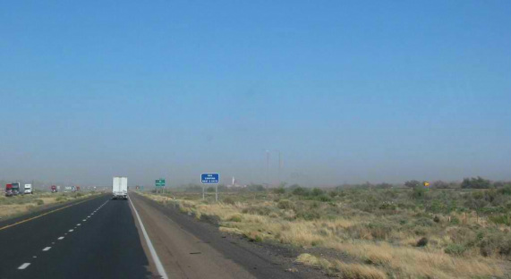 It's not uncommon for I-40 to be closed because of blowing dust. It's like everybody's ranch was shifted down to the next one. Since we planned to visit Ruidoso, New Mexico, we had to go south. Rather than stay on I-40 to Albuquerque and drop down, we decided to go south at Holbrook and go to Show Low, Arizona, where we spent the night. More about that is the next report. Stay tuned. 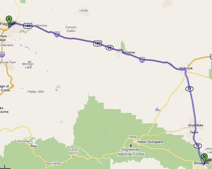 Headed east from Kingman on I-40, we are on the old historic Route 66. The terrain is desert-like and pretty. 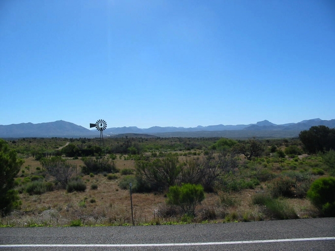 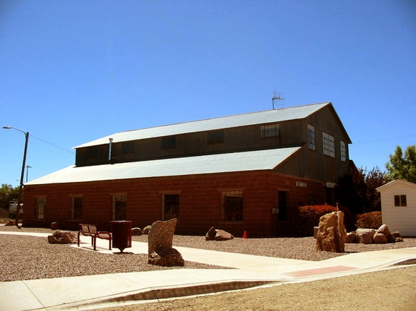 We stopped at the visitor center in Ash Fork. It is in an old highway maintenance barn. In the little museum, there was a model of main street as it was in the early '50's. In the recent past an email came through with close-up photos of this or something like it. Close up, it is very realistic looking. 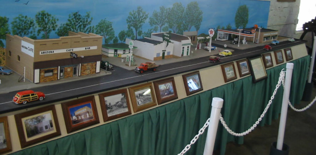 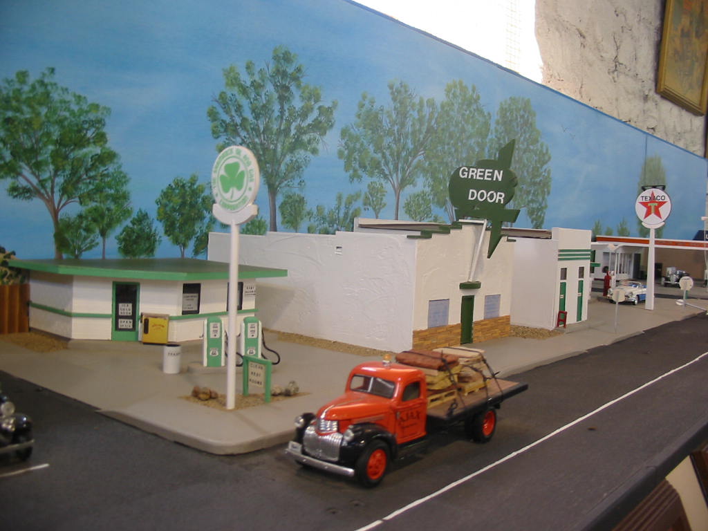 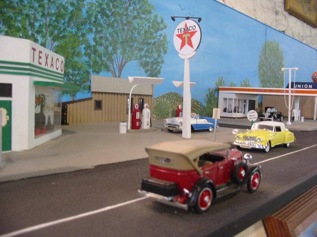   We went on down the road to Flagstaff, parked the RV and took off for Sedona, 25 winding miles to the south. Sedona is a place for hikers, artists, and tourists, and is known for it's red mountains and soil. The road drops 2500 feet into a canyon and in the canyon floor, follows Oak Creek. Slide Rock State Park is a popular swimming spot. 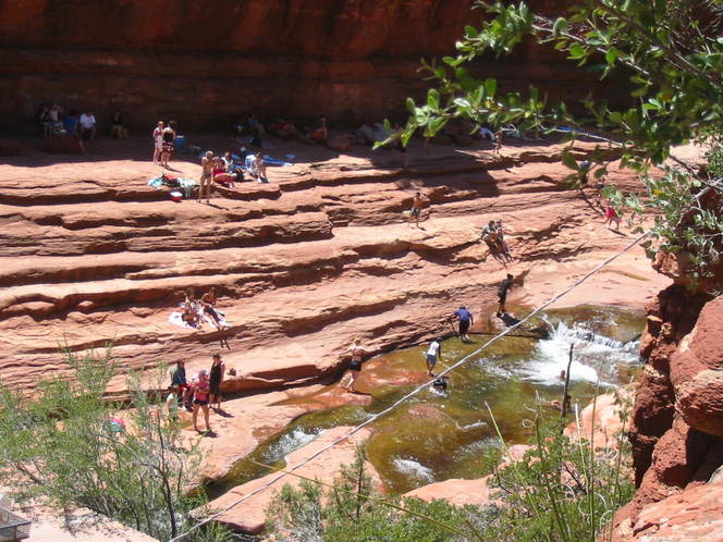 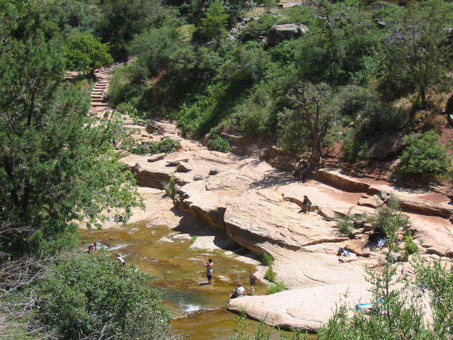 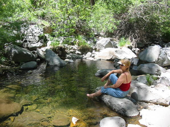 Mary Lou found a cool spot! 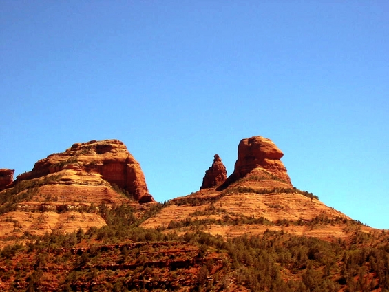 Here are a couple of the mountains. 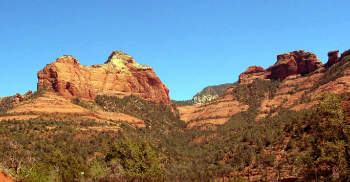 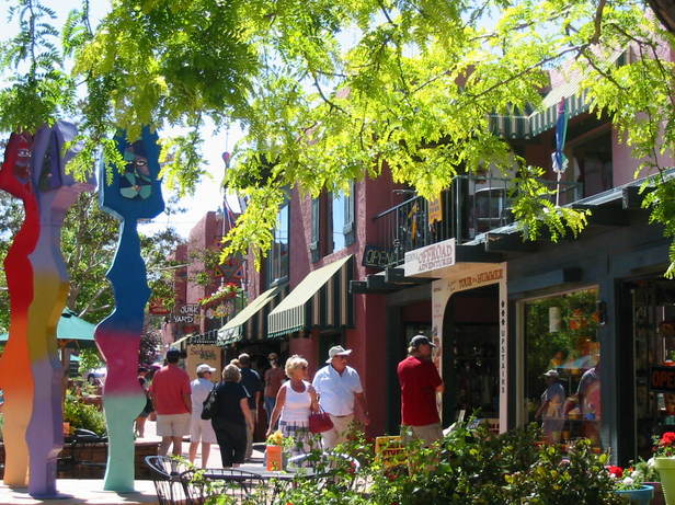 Shops in Sedona. 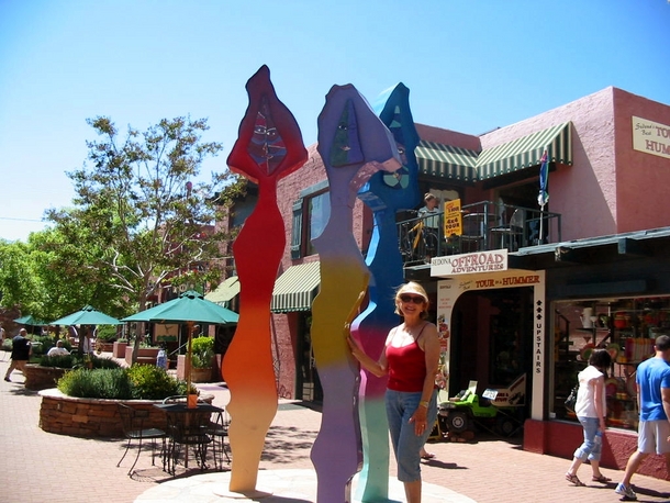 Mary Lou's got some weird new friends! 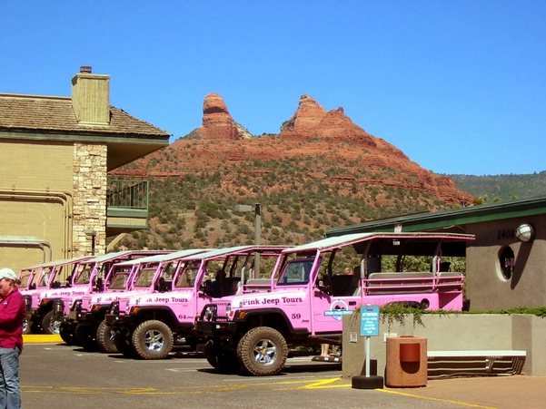 Jeep rides are popular. You can have pink, yellow, or red jeeps. These are the pink ones. 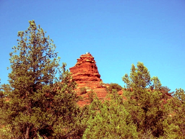 We did a little backroading ourselves and came upon this little peak. There are people up there!! We drove up to the airport which is on a mesa overlooking the town. Here's the view of the town. Click for larger image. 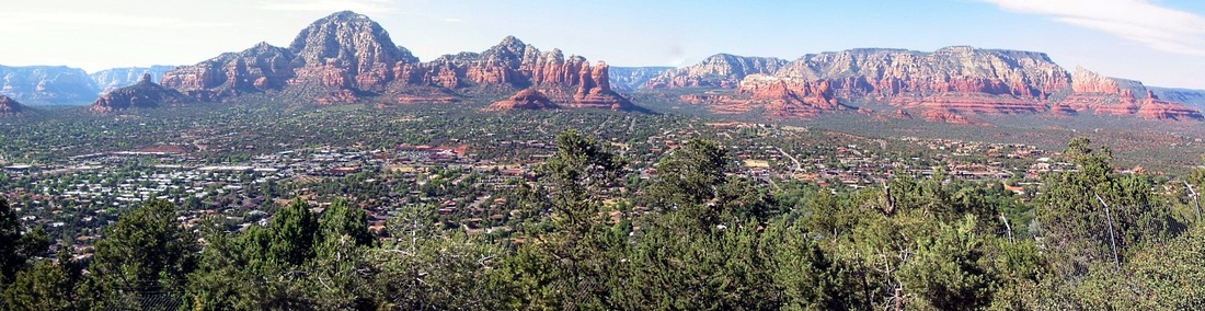 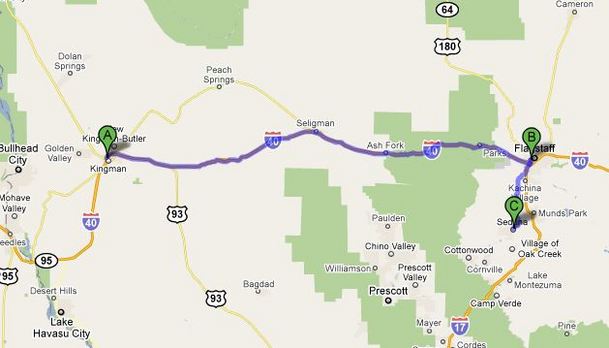 Here's the map for the day. We'll spend the night in Flagstaff, and continue along Route 66 for awhile. Next stop ... who knows. Stay tuned.
We had a great time in Vegas, but were ready to move on. It's not far to Hoover Dam, and we had heard that vehicles were searched, particularly RV's, taking a lot of time, so we left the RV in Boulder City and jeeped to the dam and the new bridge. Hoover Dam was built in the 1930's and was a monumental feat for then, and would be today. 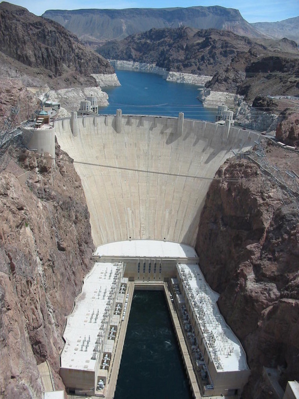 The remote location require building of roads and railroads to the site, as well as housing and amenities for the work force. It took just over 4 years to build and was completed two years ahead of schedule and well under budget. (where is that contractor today??) Two years were spent digging diversion tunnels to reroute the flow of the Colorado River so that work on the dam could begin. It's hard to conceive these statistics: 3.25 million cubic yards of concrete, height of the dam, 726 feet, thickness at the base, 660 feet. 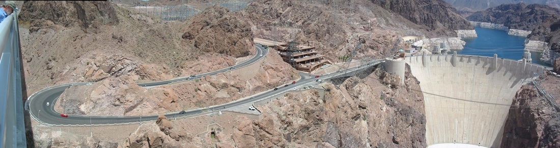 This dam provides electricity for Nevada, Arizona, and California, sales of this power has paid for the dam. There are generators powered by turbines driven by water passing through pipes in the dam. Here are some of the generators. 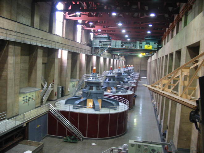 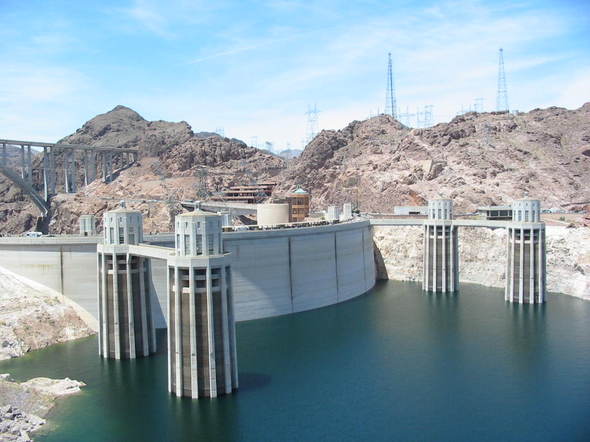 These towers are the intake for the water going to the turbines. 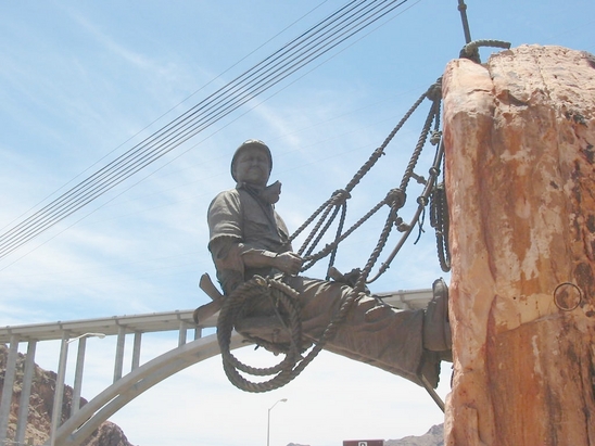 This is a sculpture of a 'high scaler' who dangled over the side of the canyon wall to drill holes for dynamite to blast off loose rock. A very dangerous occupation. 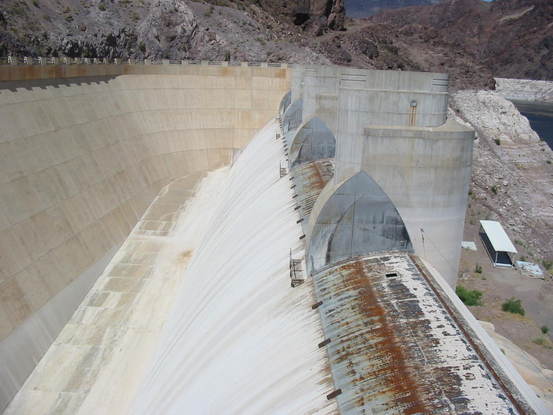 On either side of the dam are spillways in case of serious flooding. This has only happened twice since the dam was built. 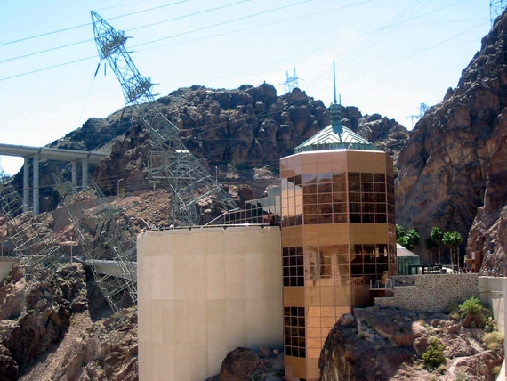 An observation and exhibit building. The towers in the background are tilted so the wires coming down would not be too close to the canyon wall. 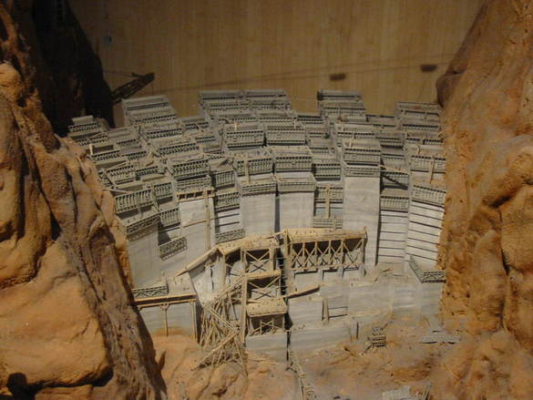 A model of how the concrete was poured in interlocking blocks. For most of the dam's life, Highway 93 passed over the dam. In the early days cars parked on the dam to take the tours. As the highway became more active with truck traffic, the dam crossing became a bottleneck. So a bypass bridge has been built to take the traffic off the bridge. It just opened in October of 2010, and it's construction was quite a feat in itself. Some fabulous pictures came around on the internet awhile back, which I no longer have, so here are a couple of links to other photos and interesting facts. A photo gallery. And a good news article. 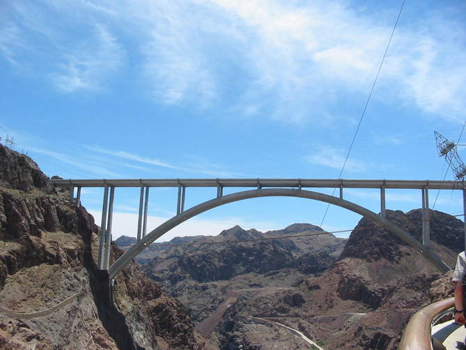 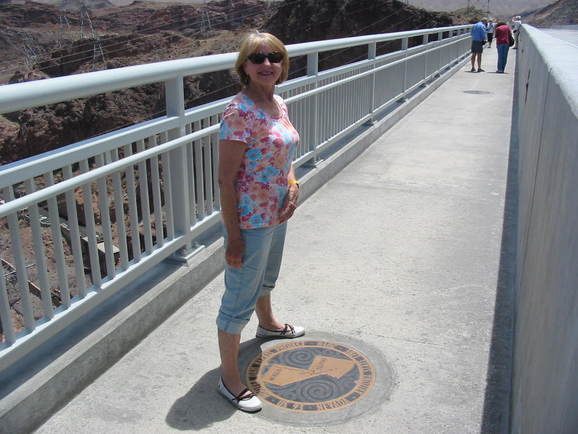 We walked to the center of the bridge and Mary Lou couldn't decide whether to be in Nevada or Arizona. These were massive engineering feats and make us proud of the accomplishment. Driving on, the highway engineering also made us proud. 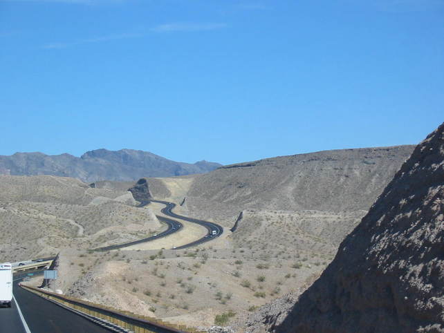 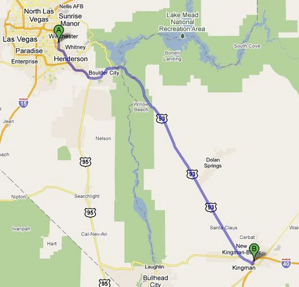 Map from Las Vegas to Kingman, Arizona. 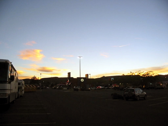 And finally, sunset at the Walmart in Kingman. Tomorrow, moving on to Flagstaff, and Sedona, Arizona. Stay tuned.
On Monday we head for Las Vegas. Again, I-15 is a great drive. It passes through a mountain range with gorges cut by the same Virgin River flowing the great canyon at Zion National Park. Only a couple of pics...   Arriving in Las Vegas, we check in to Sam's Town RV Park. The first order of business is to put on short-sleeved shirts for the first time in a long while. We finally found warm weather. The park is nice and reasonably priced, but it is 7 miles from the strip, which is ok. It's actually nice to be back in civilization for a change. 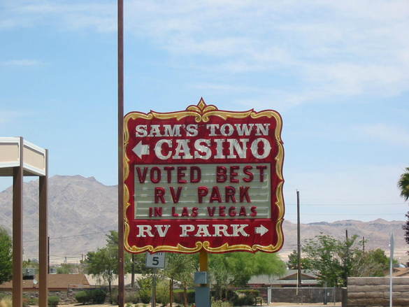 I don't know who did the voting. 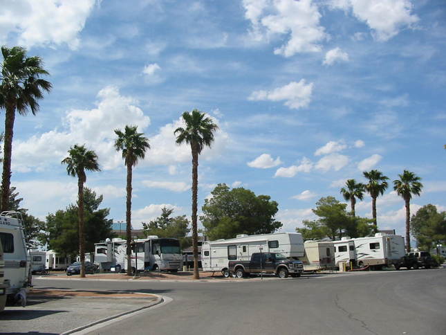 Once settled in and turned on the air conditioning, we headed for the famous Las Vegas strip. The hotels/casinos are huge and sometimes have multiple towers and take up maybe a city block. Many of them have themes that are reflected in the architecture and outside decor, as well as the inside, all very opulent. 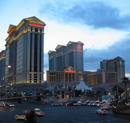 For example, this is Caesar's Palace in the Roman style. All those buildings! 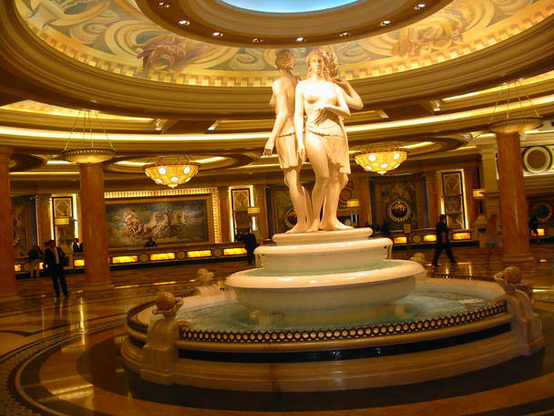 Inside decor. 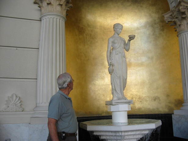 Chuck has a new friend. Want to go to Paris? 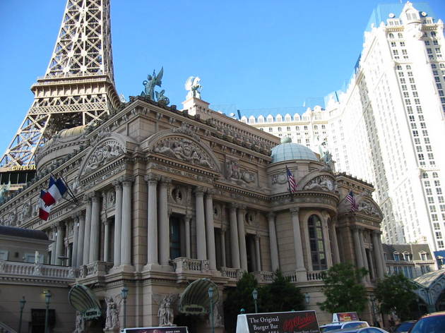 Note the Eiffel Tower. 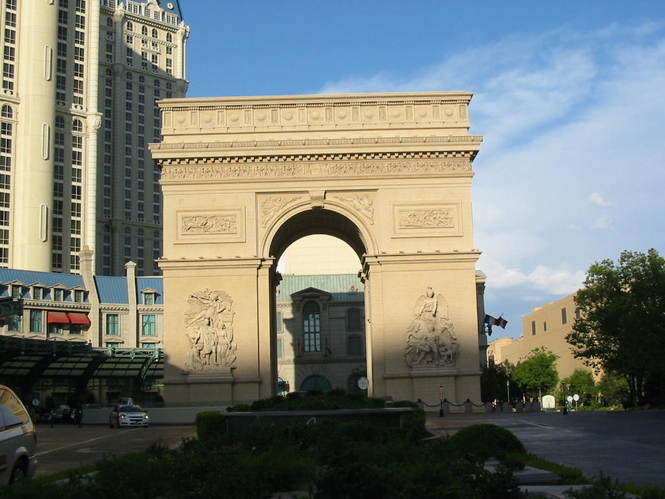 Arc de Triomphe 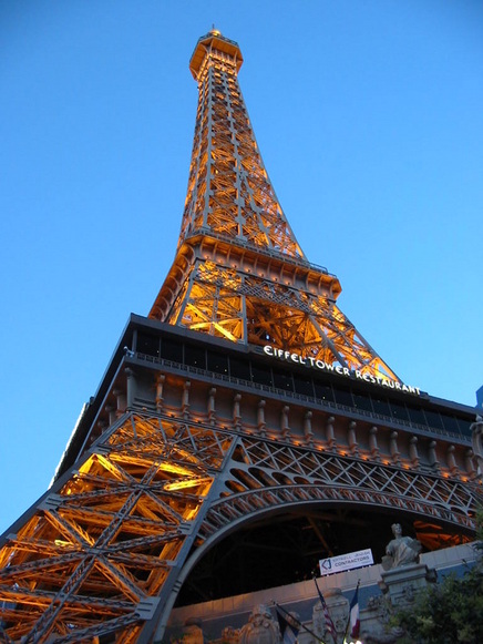 This is a half size replica of the Eiffel Tower in Paris. It's over 400 feet tall. We took a ride to the top of the tower for a view of the strip. While there, we were able to view the dancing waters show at the Bellagio across the street. 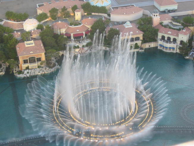 Also while up there, we noticed something going on, which turned out to be a marriage proposal (and acceptance). Here's the happy couple. Notice the ring. 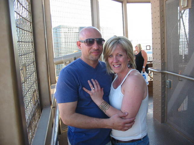 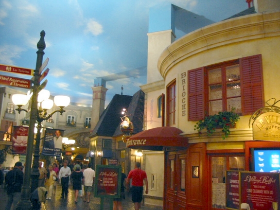 Stroll down a Paris street. Notice the sky painted on the ceiling. 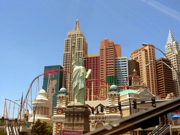 How about New York City? 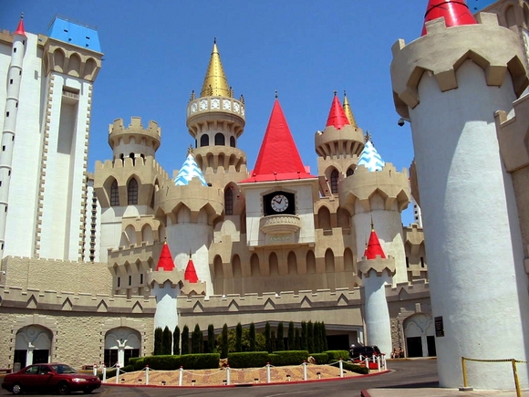 Disneyland? (Excalibur Hotel) 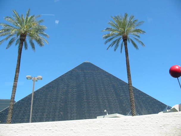 Egypt? 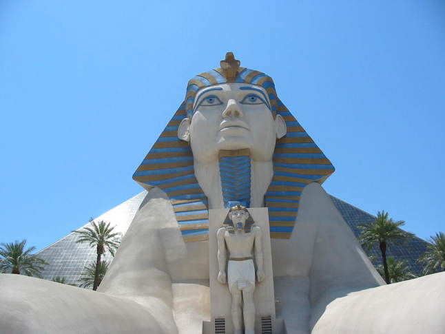 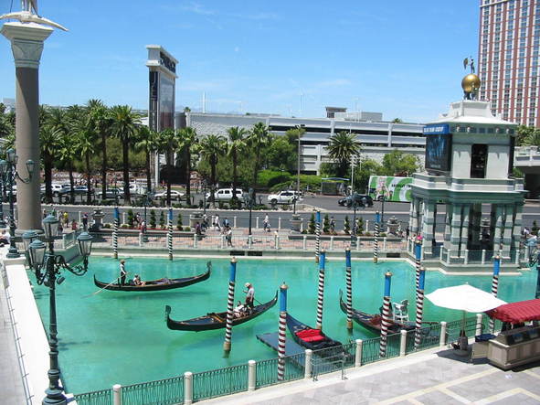 Want to ride a gondola in Venice? 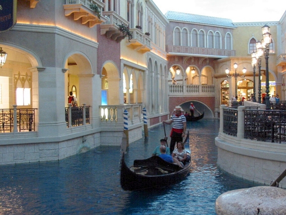 This is inside the building, complete with painted sky and singing gondoliers. Very realistic. 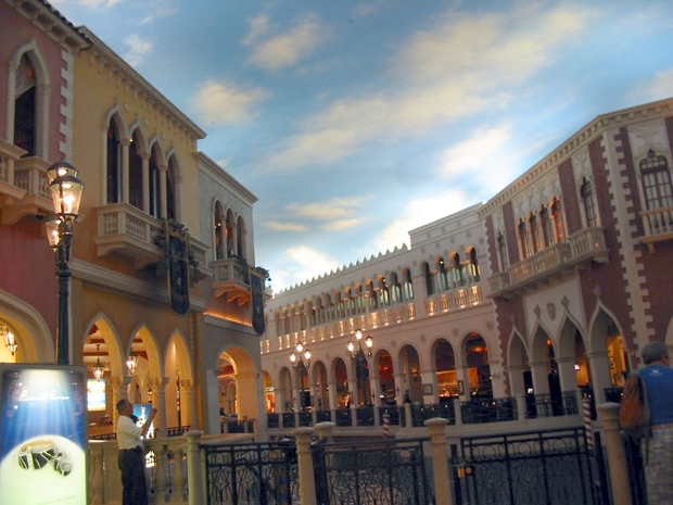 A Venice street with the painted sky. They are so cool! 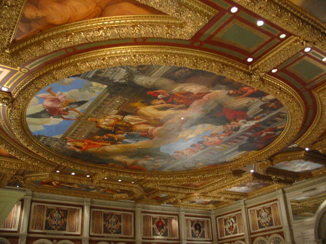 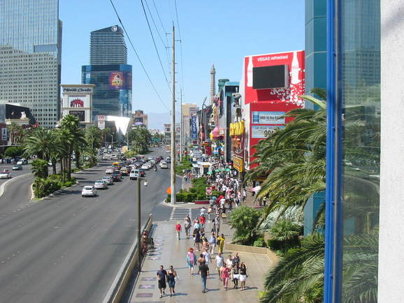 People are strolling the street all the time. At night there are thousands out there. Las Vegas is known for it's bright and glitzy lights. Below are some random shots. (click on small images.) Well, we've had two and a half days here and had a great time. We're ready to move on south and east, in the general direction of home. But remember, 'what happens in Vegas, stays in Vegas'. Stay tuned.
Before departing our 'disbursed' camping spot, we drove down the dirt road a bit. This is government land and is open to different uses. 4-wheeling on ATV's is big all around here and there are concessions to rent them and conduct trail rides, although people bring their own and just go off on the trails. This is such a place. Down the road was a corral with saddled horses, waiting for the dudes to come on a trail ride. Cattle also graze out here. I know pictures of mountains are getting kind of boring, but here's where we turned around. 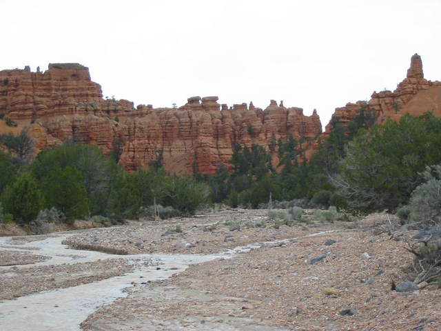 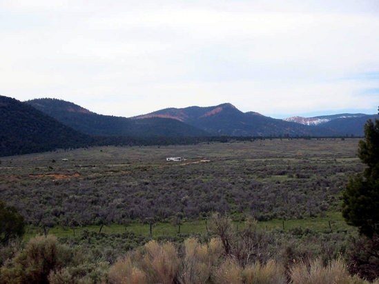 We returned to the RV to get ready to depart. See it right there in the middle? We planned to 'do' Zion and move on to Hurricane, Utah for the next night. It's less than 100 miles, but the 12 miles or so approaching the Visitor Center at point B is something else!! The road descends into the canyon on a very winding road. Even though it's a through highway, all traffic must pay the $25 park entry fee (unless you have the $10 lifetime Senior Pass, then it's free). If you are in a dually pickup, are pulling a trailer, or an RV, you must also pay a $15 'escort fee' to go through the 1.1 mile tunnel. No 18 wheelers! (we saw one get turned back at the park entrance.) 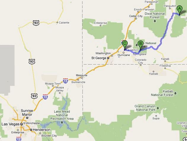 Much of the drive was done creeping along at 15-20 mph, even before the tunnel. 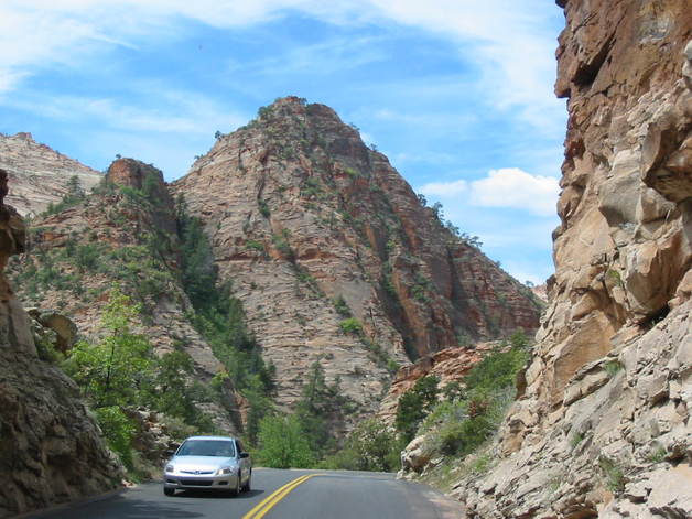 The reason for the tunnel fee is that all oncoming traffic must clear the tunnel before we could go through. Of course all traffic behind us had to wait as well. The height limit at the center of the tunnel is 13' 1" and we are under 12', so we are OK in the middle of the road. 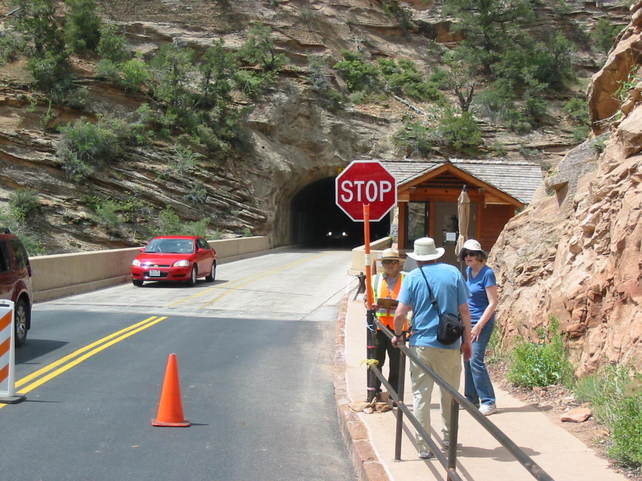 Entering the tunnel was a little 'dicey' before my eyes adjusted to the dark. I tried to keep the center of the RV on the yellow lines on the center of the road and was apparently successful, since we didn't scrape the roof anywhere. It was totally dark except for occasional openings in the side wall. It was a tense drive, and remember it's 1.1 miles. 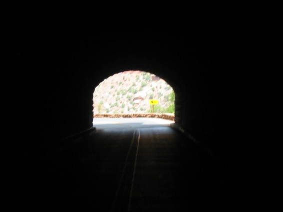 Finally the light at the end of the tunnel! 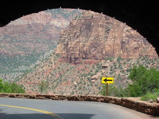 From here there was a series of 180 degree switchbacks. Very scenic for those not driving. (arrow points to the road after the turn) 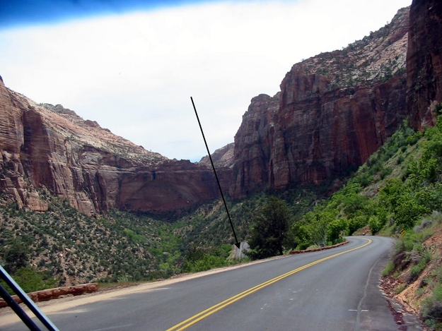 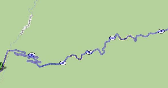 Here's a map of this stretch of road. 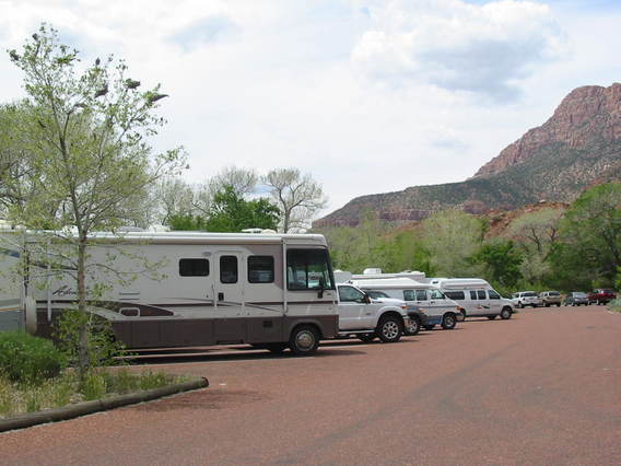 Finally resting at the RV parking area at the Visitor Center. Zion Park, like Bryce Canyon, is popular with hikers, as there are many trails throughout the parks. Whereas Bryce is viewed from the rim of the canyon, Zion is viewed from the valley floor, which follows the Virgin River. The river formed the canyon over the centuries and continue to erode and change the valley. 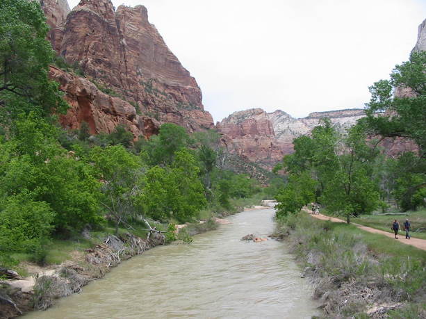  Notice the canyon walls. 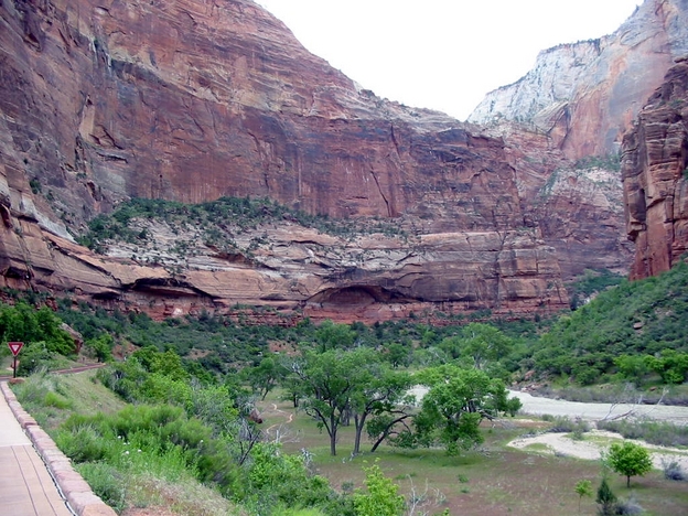 Access to the valley is by shuttle buses that run every 5 minutes or so. There are stops at scenic spots and trailheads, and you can get on and off as you like. Here's one of the stops. 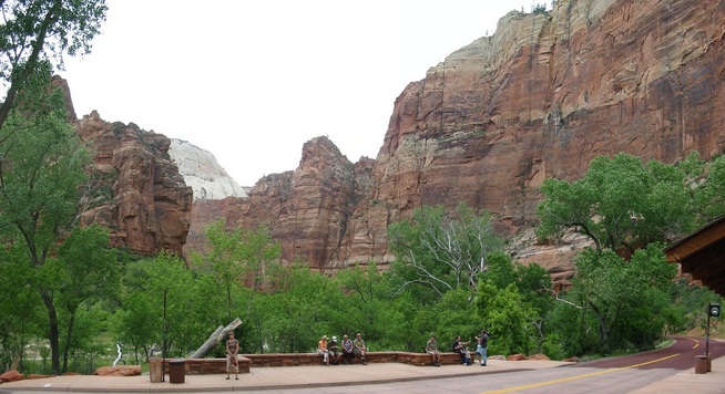 The hiking trails here are mostly climbing, in fact we saw a climber scaling a sheer cliff. In the next photo, we could see people on the rim, 1400 feet up, who had hiked up there. 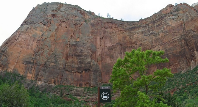 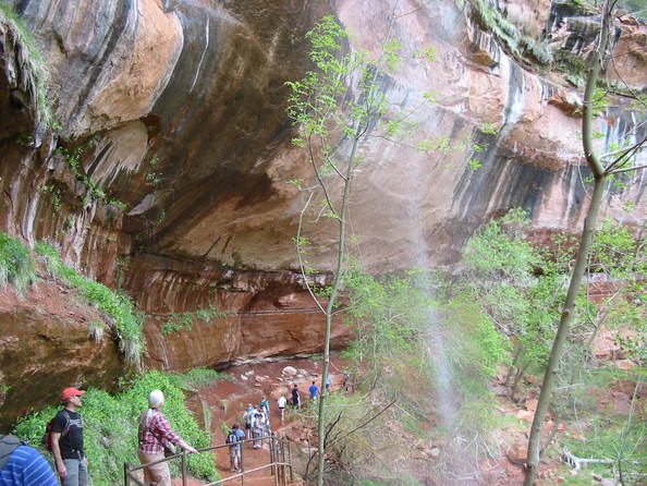 A short trail along the river. 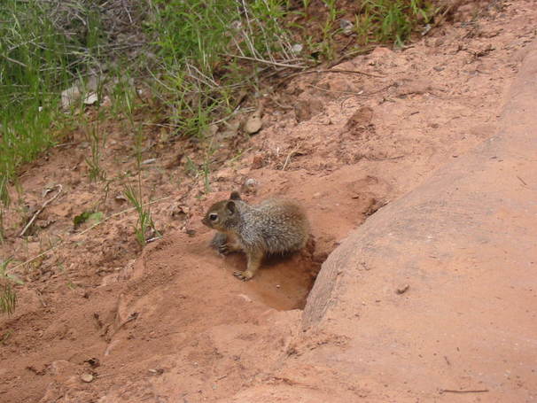 And another friend! Zion was breathtaking, but we were glad to move on to spend the night in Hurricane, Utah. We are surprised to see apparent signs of prosperity in this small town, mostly new and attractive buildings, nicely landscaped. The Walmart was on the outskirts. 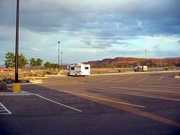 Tomorrow we head for VEGAS, BABY! Stay tuned.
Saturday dawned with a temperature of 32 degrees and frost on the jeep.  Today we will drive past Bryce Canyon on highway 12, which is designated as one of America's Best Scenic Byways. And scenic it was. Here's the route, about 75 miles one way. 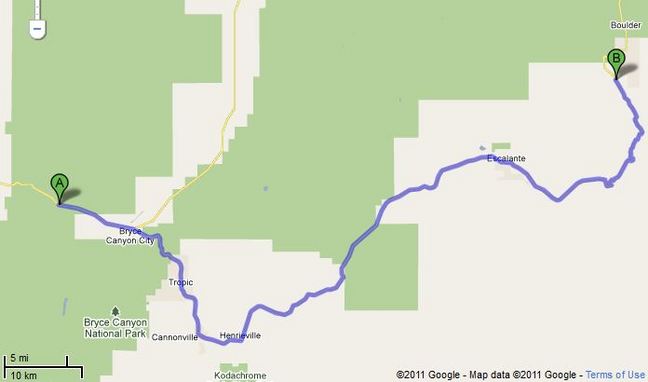 Here are a few scenes from along the way. 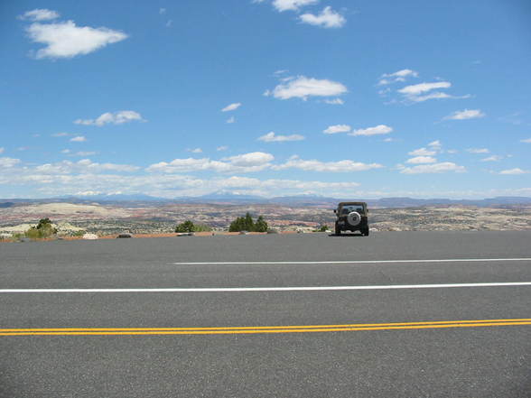 This view stop overlooked a vast vista. The road winds down the hill and crosses this great expanse. 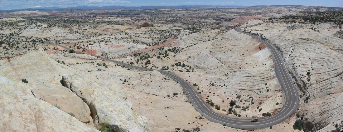 Click to Enlarge It looks pretty desolate down there, but beauty abounds. 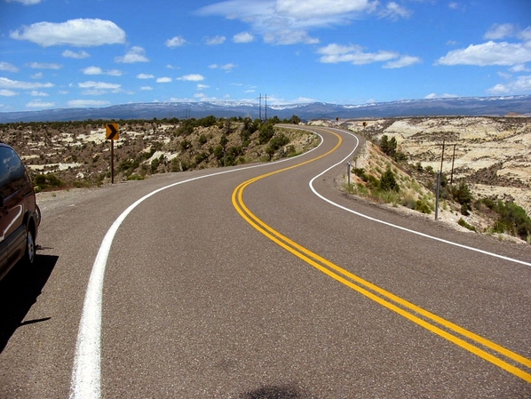 One part of the road is along the top a ridge with drop-offs on both sides. Throughout southwest Utah, even along I-15, little towns are scattered about. This is Cannonville on highway 12. 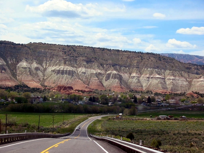 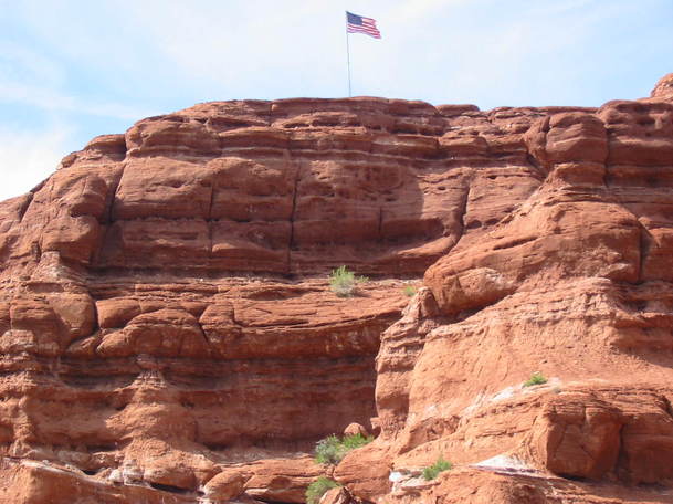 It's a patriotic place. I think we are beginning to suffer scenic overload, are you?. But we are not done yet. Tomorrow is Zion National Park. Stay tuned.
At last report we were debating about staying an extra day at Yuba Lake State Park to wait out some bad weather that was predicted. We heard that I-15 south of us had been closed because of snow! We stayed and enjoyed a cozy day catching up on computer work and napping. The weather cleared in the afternoon, and the next morning we left for Bryce Canyon. 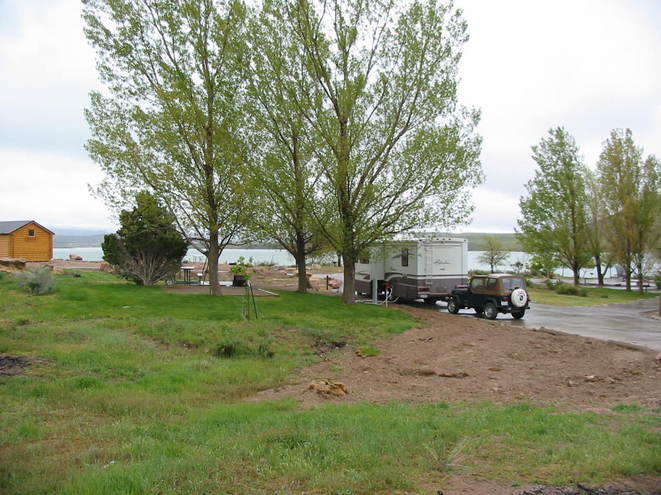 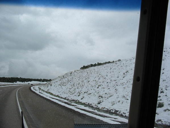 This is probably the area where the road was closed. 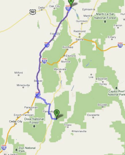 Map to Bryce Canyon National Park. I-15 through most of Oregon and Utah has been a real pleasure to drive. The road is good, and the scenery is awesome. Mountains all around and the flat valleys have vast fields or cattle. We even saw a couple of roundups, complete with cowboys, and cows, of course. We have decided that we like 'boondocking', or camping without hookups, when we can and we found that we could park just off the road, and camp as long as we like. We did this in Quartzsite on Bureau of Land Management (BLM) land. It's also called 'disbursed' camping. We have the place to ourselves and a great view. 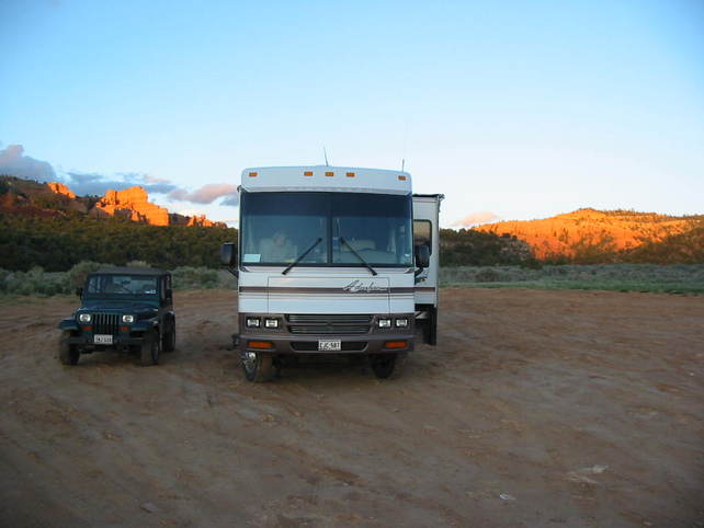 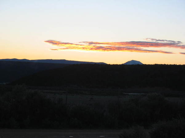 Sunset view out the front. We parked and still had time to venture into Bryce Canyon National Park. The weather had cleared and was partly cloudy. On the way up there the road goes through Red Canyon. This was our first glimpse of the fantastic rock formations we were to encounter. The red color in these mountains is due to iron oxide. 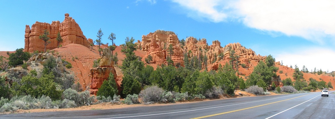 Click to enlarge Bryce Canyon National Park consists of an 18 mile drive along the rim of the canyon, with numerous 'view points' from which to view the spectacle of the canyon. There are also many hiking trails. There is a convenient shuttle bus system to take people from view point to view point. The views are vast and breath-taking. Unbelievable rock formation too numerous to capture in pictures. Here are some of them. 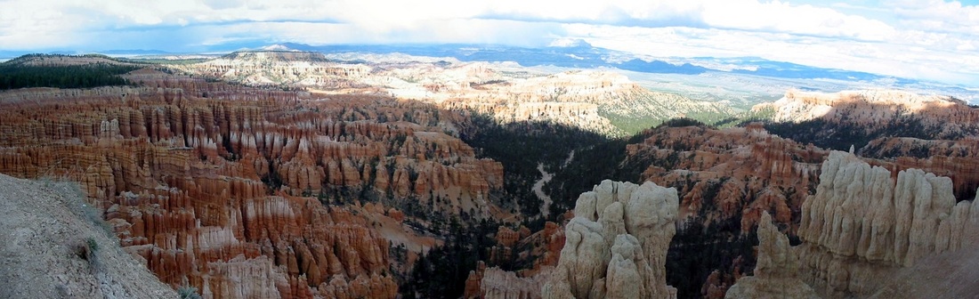 Click to enlarge 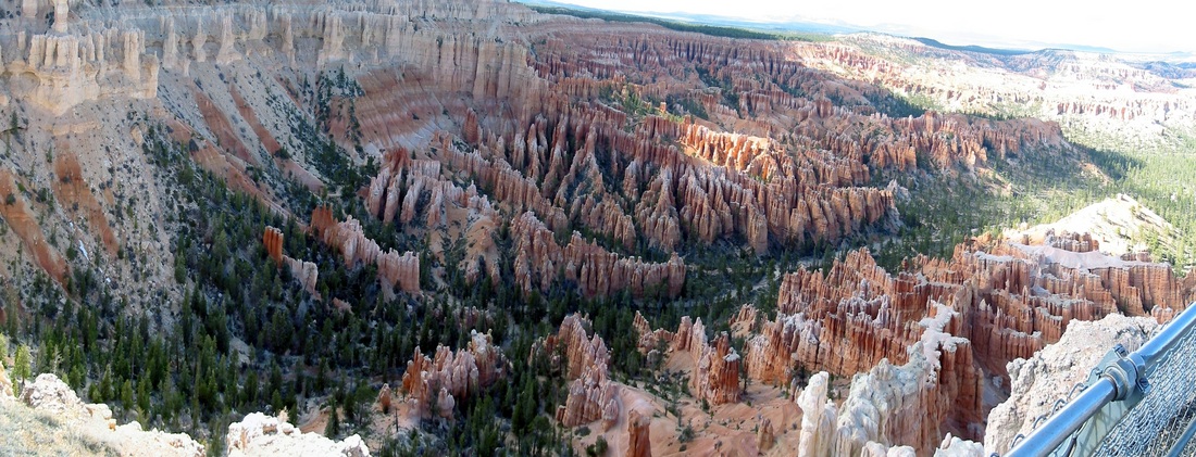 click to enlarge Here is a slideshow of some of our 200 photos. 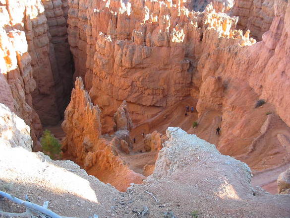 A trail leading into the canyon. 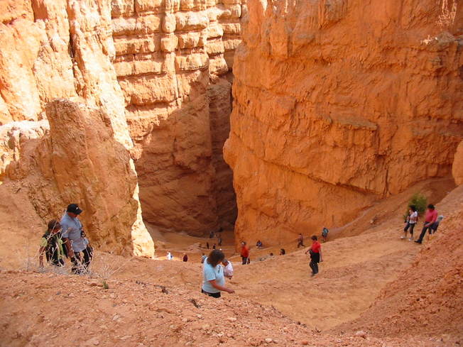 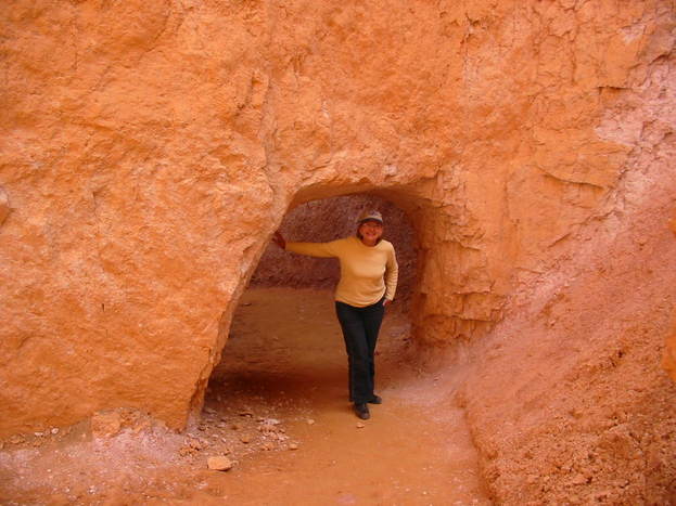 We made the trip! 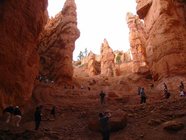 Looking up at the trail of 'ants'. Almost everyone we met here were either European or Asian. Foreigners seem to really like touring our great country. 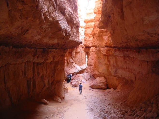 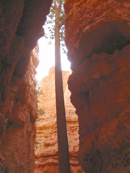 A tree growing out the gap!! 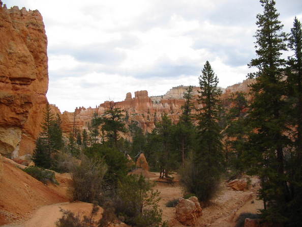 The canyon floor. 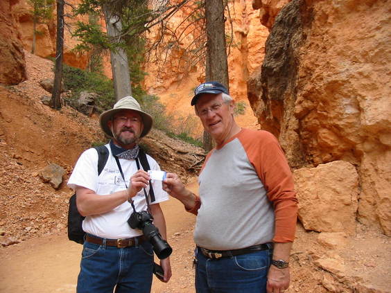 Presenting a business card to a PPL customer down in the canyon! They're everywhere! We survived the long climb back out of the canyon and were glad to head back to the RV. Here's a pronghorn along the road. 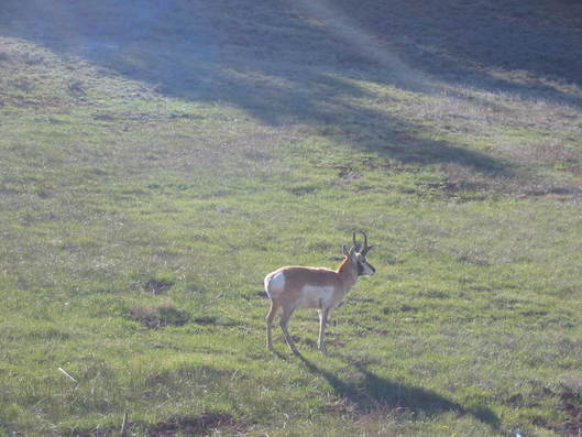 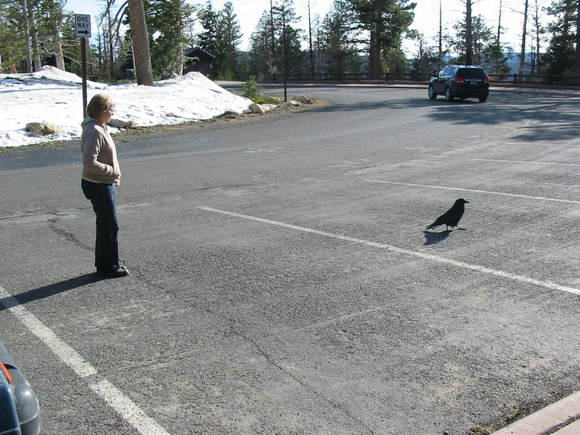 Mary Lou trying to make a new friend! Quoth the raven, "Never more". 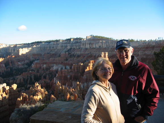 Mary Lou with her 'old' friend. Tomorrow we take a drive on one of America's most scenic highways. Stay tuned.
|
Who Are We?
Chuck and Mary Lou have been traveling in their RV since 2002 and have lately been taking longer, extended trips. This is our way to share our experiences.  Trip Reports
All
|
 RSS Feed
