|
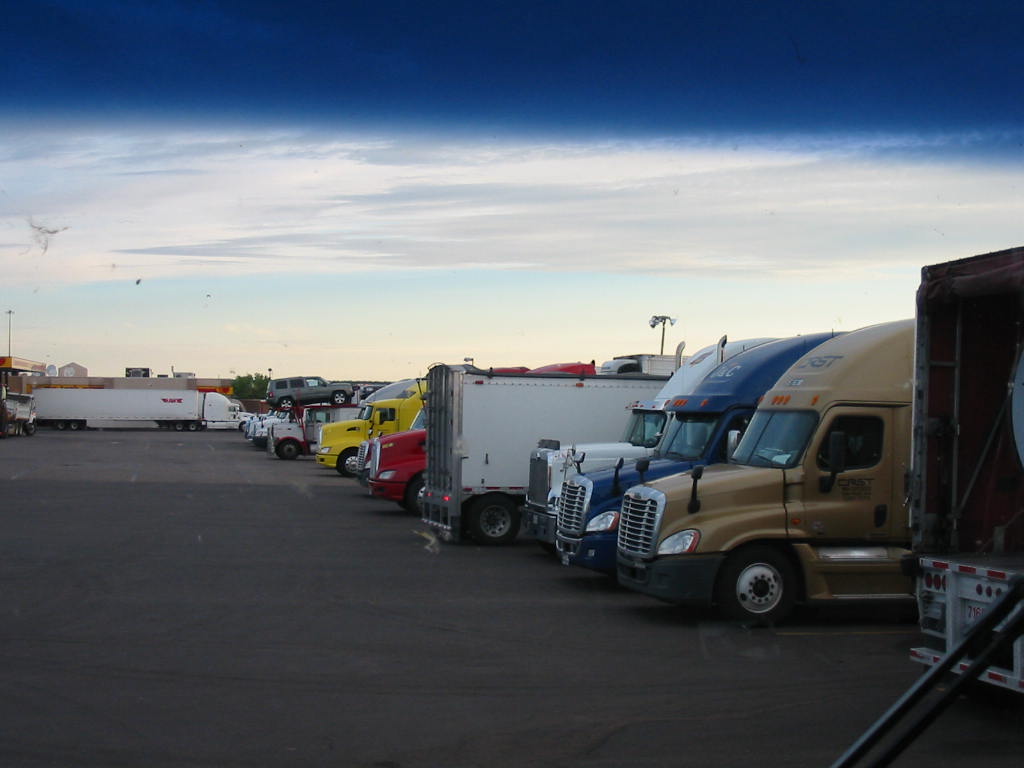
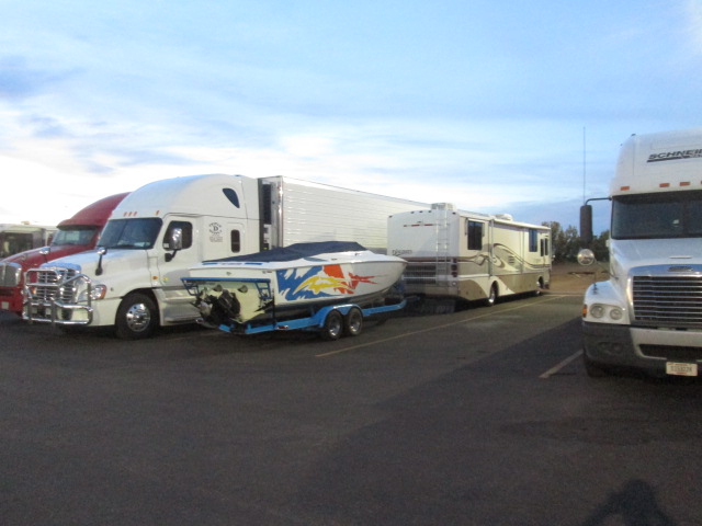
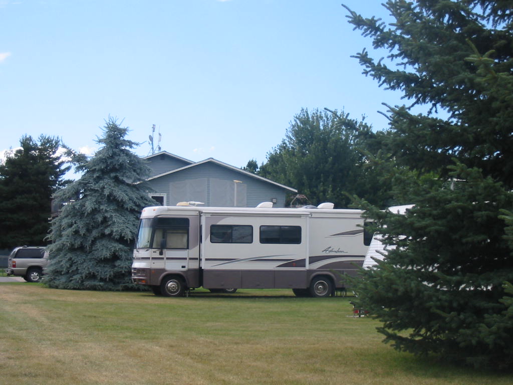
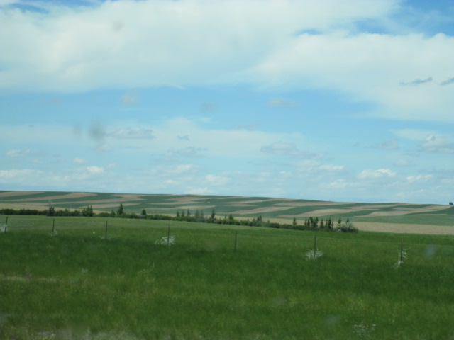
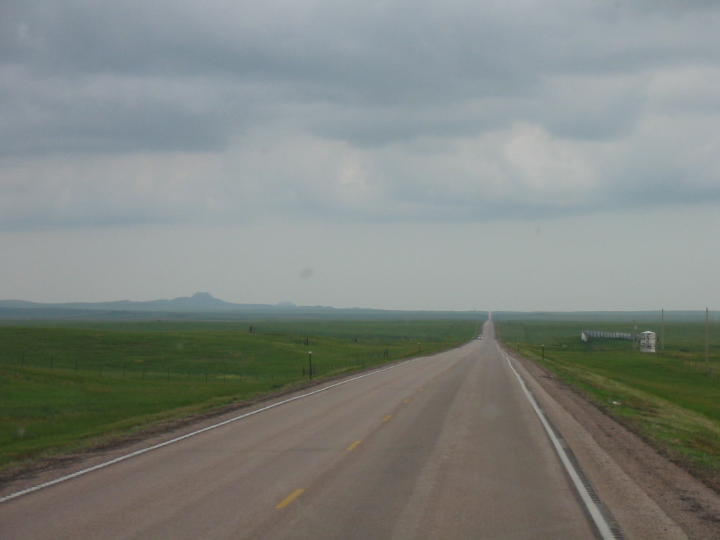
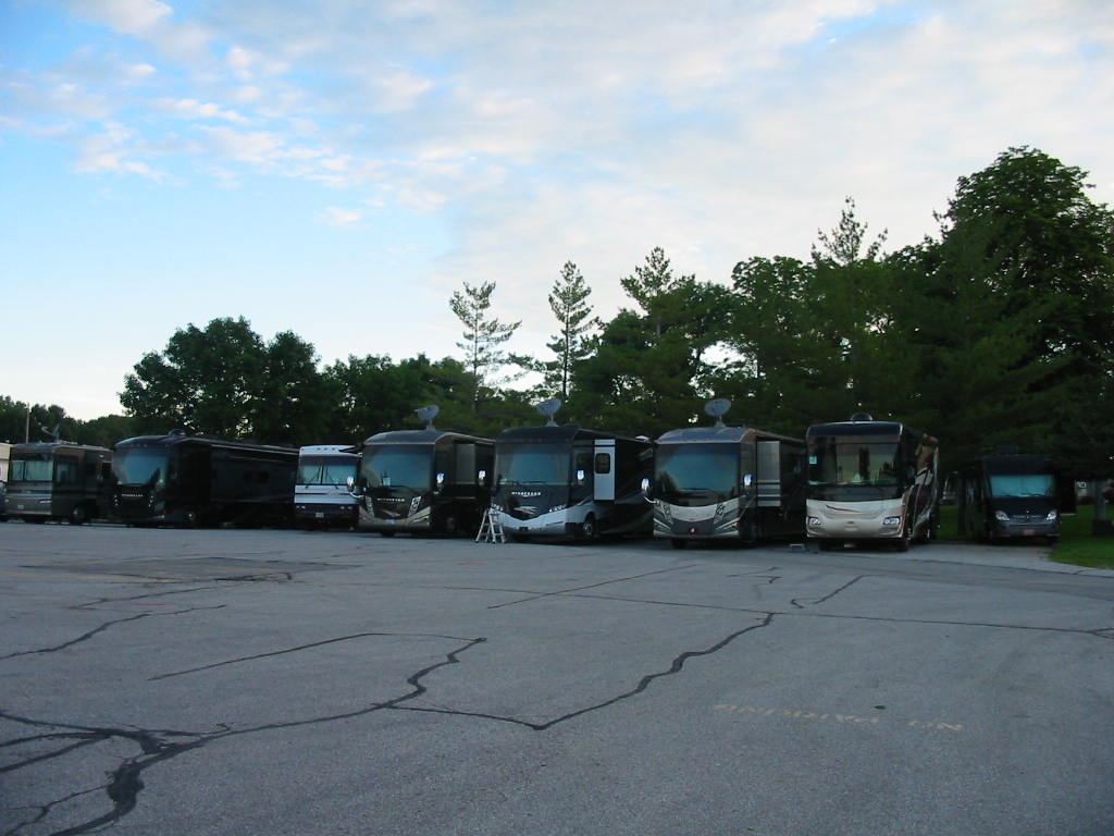
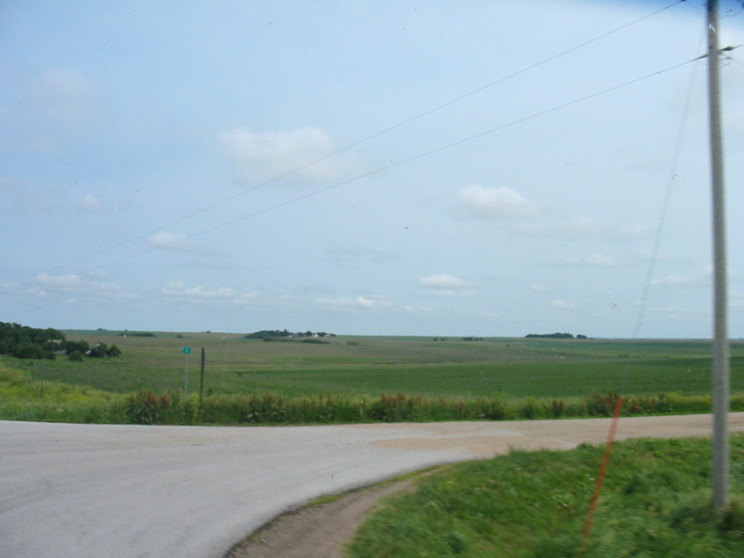
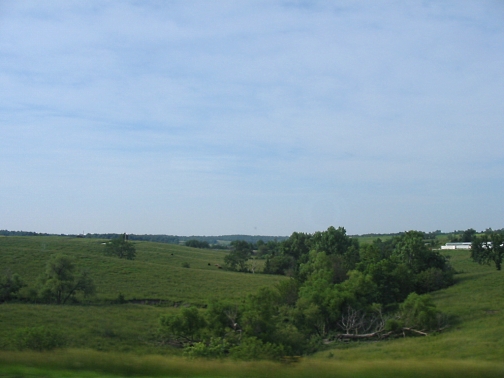
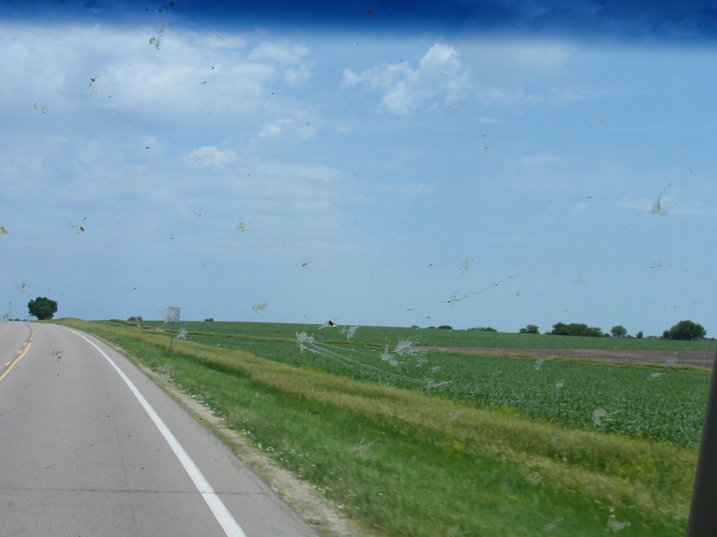
Mesa Verde was the last place we had on our itinerary for this trip, so we are headed for home. After a 400 mile day, we stopped for the night at a Love's truck stop in Santa Rosa, New Mexico. There are no Walmarts in these little towns. But this was on a hill overlooking the town, and we had an end spot with a view of the New Mexico landscape on one side (and a semi on the other). 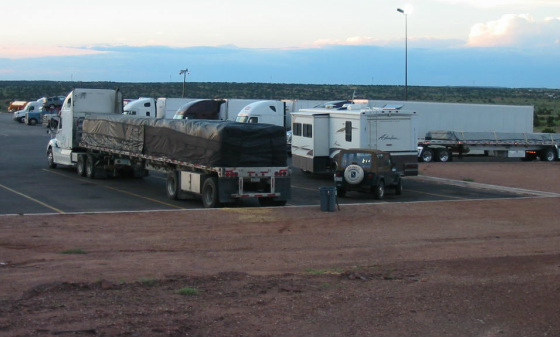
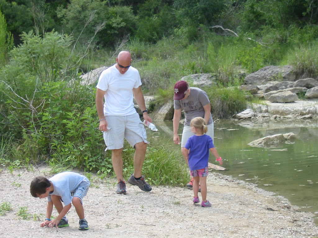
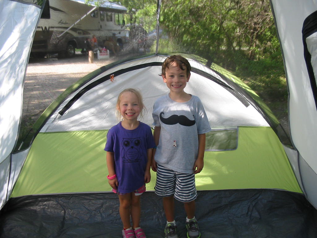
We still had cool weather for sleeping, and the gentle hum of 50 diesel engines bothered Mary Lou, but not me. In the morning I counted over 70 trucks and 2 other RV's in the place. ML liked the colorful array of trucks. Another 400 mile day brings us to the Walmart in Eastland, Texas. Overnighting in places like this is so much easier when all you need to do is sleep and move on. Our final night was spent in Dinosaur Valley State Park near Glen Rose, Texas. We met the grandkids from Keller (Fort Worth) and looked for dinosaur tracks (found 'em too!) and hiked to some geocaches. So we are about at the end of the trail. We have been gone 7 weeks and traveled 5850 miles (plus over 1220 jeep miles), in 15 states. 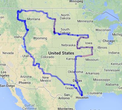
Our sentiments at the end of this trip are the same as they were at the end of our West Coast trip, so I will use that brilliant prose again here. We have seen great natural beauty everywhere. We have seen vast vistas of mountains, valleys, rivers and gorges. We have seen all kinds of rock formations and geological strata. We have visited national parks and various other attractions. We have gained an appreciation of the great effort and hardship it took to explore and settle this land.
6 Comments
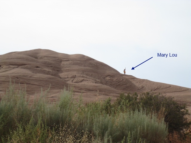
Monument Valley was a neat place to drive through, although Goulding's was an interesting place. We were ready to move on.  Moving on. (Navigator, photographer, and part-time bombardier. 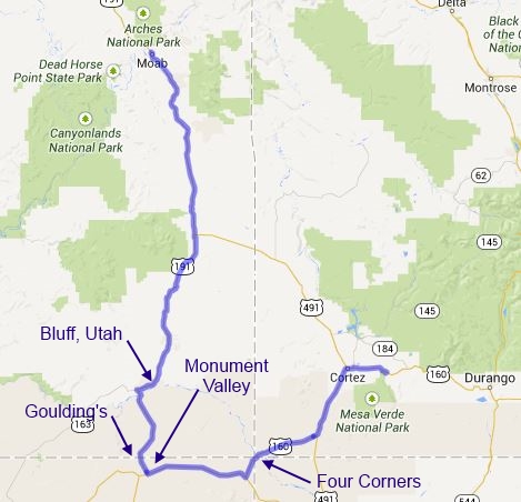
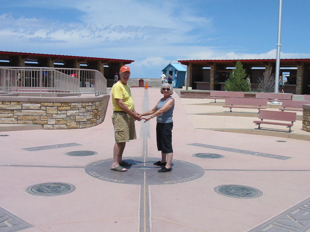
Dropping down into Arizona for cheaper gas took us up through Four Corners. This is the place where Utah, Colorado, Arizona, and New Mexico meet. 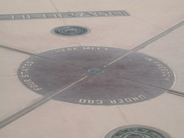
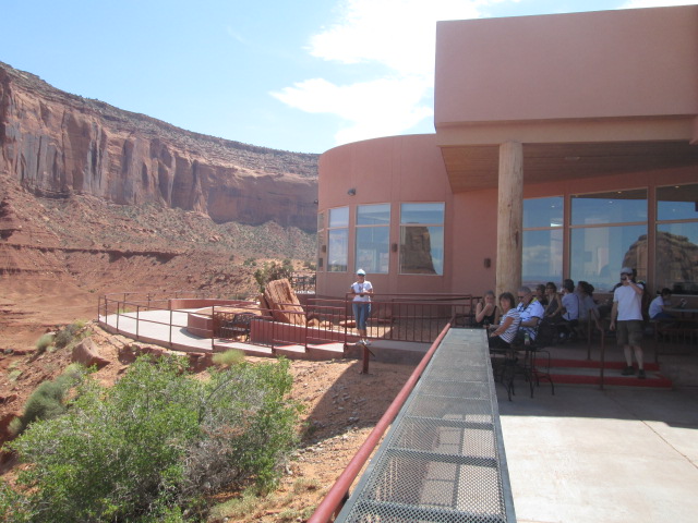
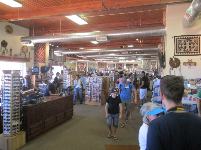
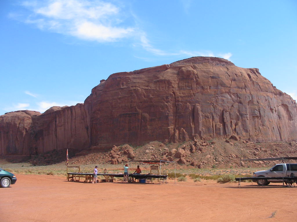
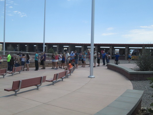 Waiting to get pictures at the spot. As it turns out, this place is on Navajo land, and is therefore run by the Navajo Nation. The place is nicely designed and clean. Notice the permanent booths bordering all sides. These are the ever-present jewelry and Indian crafts sales. I wonder if they pay sales tax in whatever state their booth is in (I wonder if they pay sales tax!!) 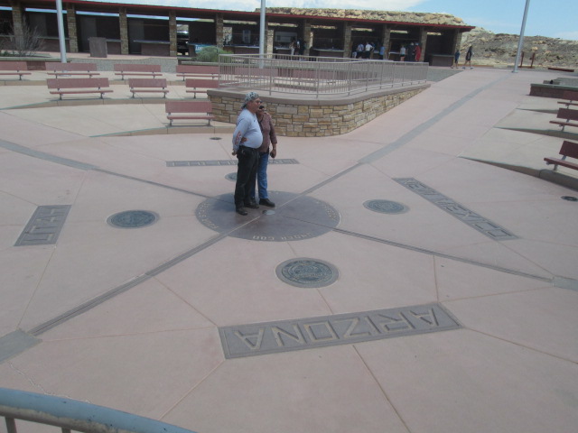
Like the Visitor Center in Monument Valley, the facility itself is very nice and professionally done, but the roads, and in this case the parking lot, is rough gravel and generally unappealing. There is a number of BBQ pits installed, suggesting a possible RV park, or potential picnic areas, but there must have been 20 or so scattered around. 
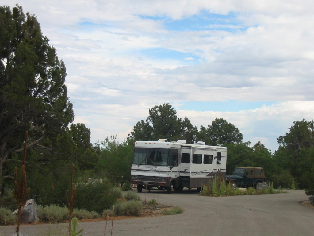
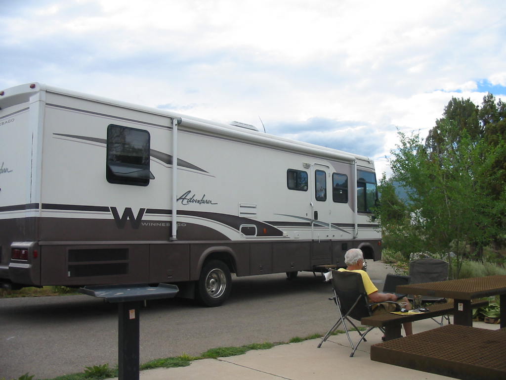
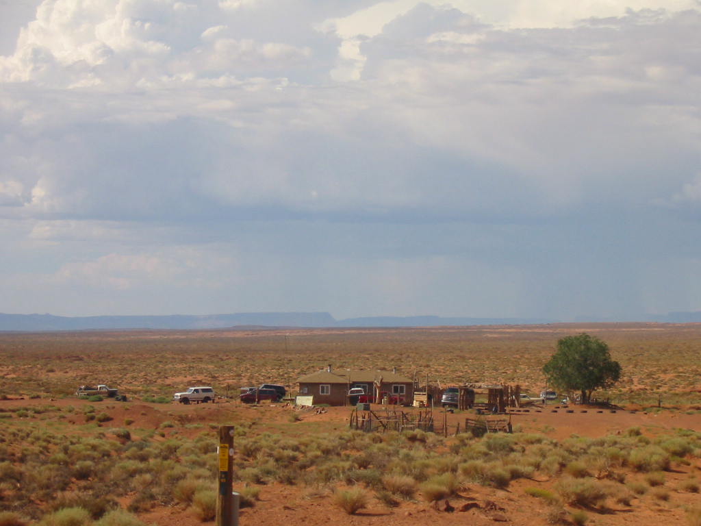
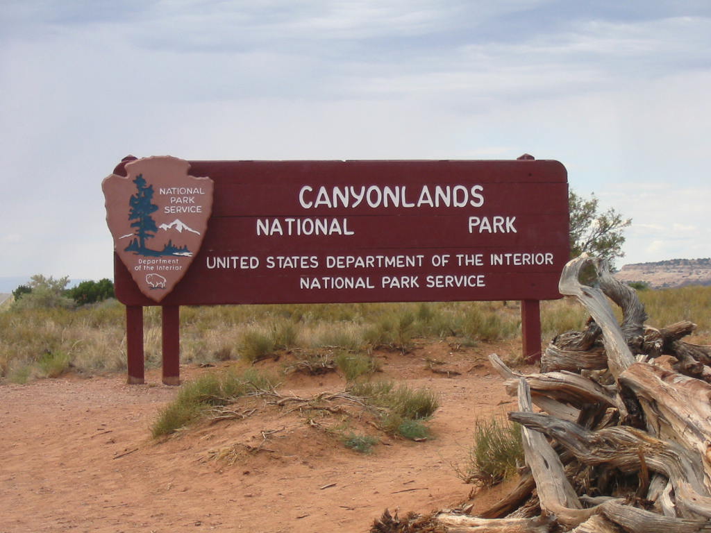
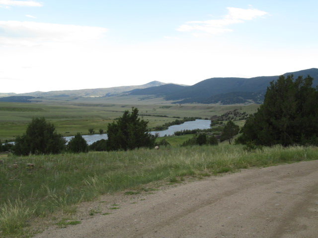
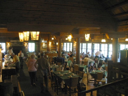
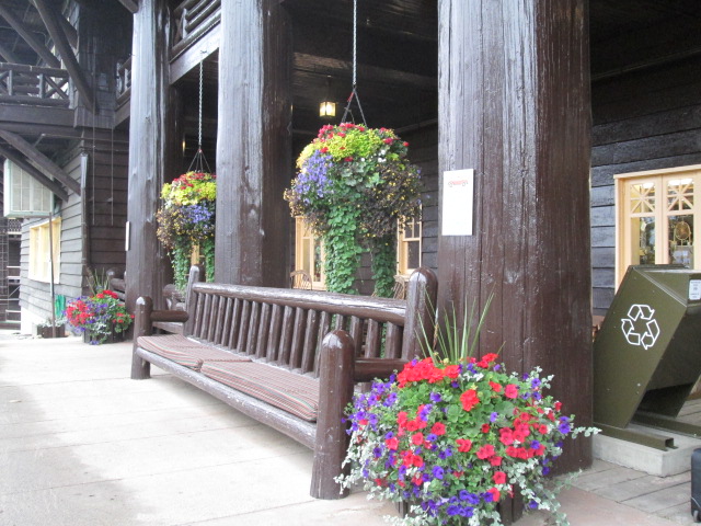
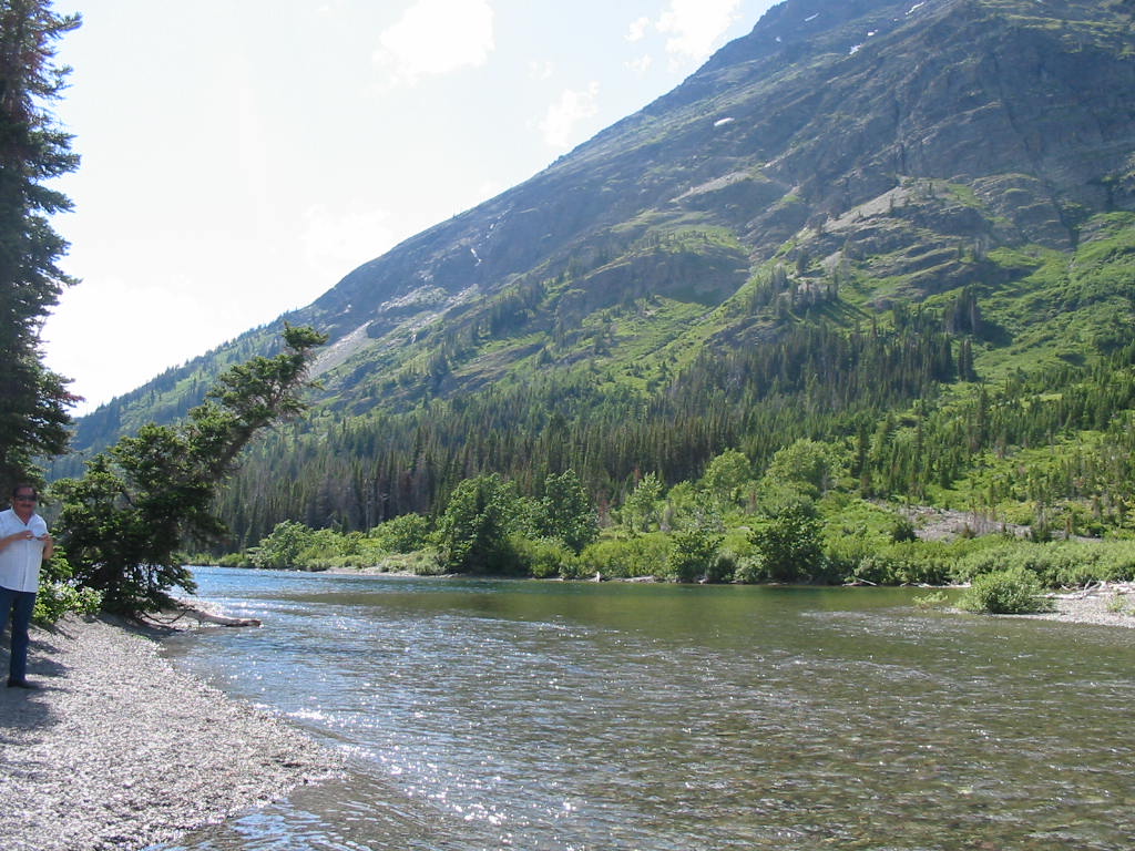
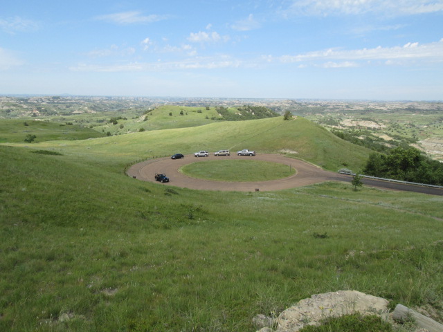
Our destination now is Mesa Verde National Park. We found an excellent RV park about a mile from the entrance to the park. 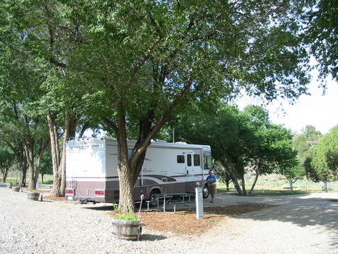
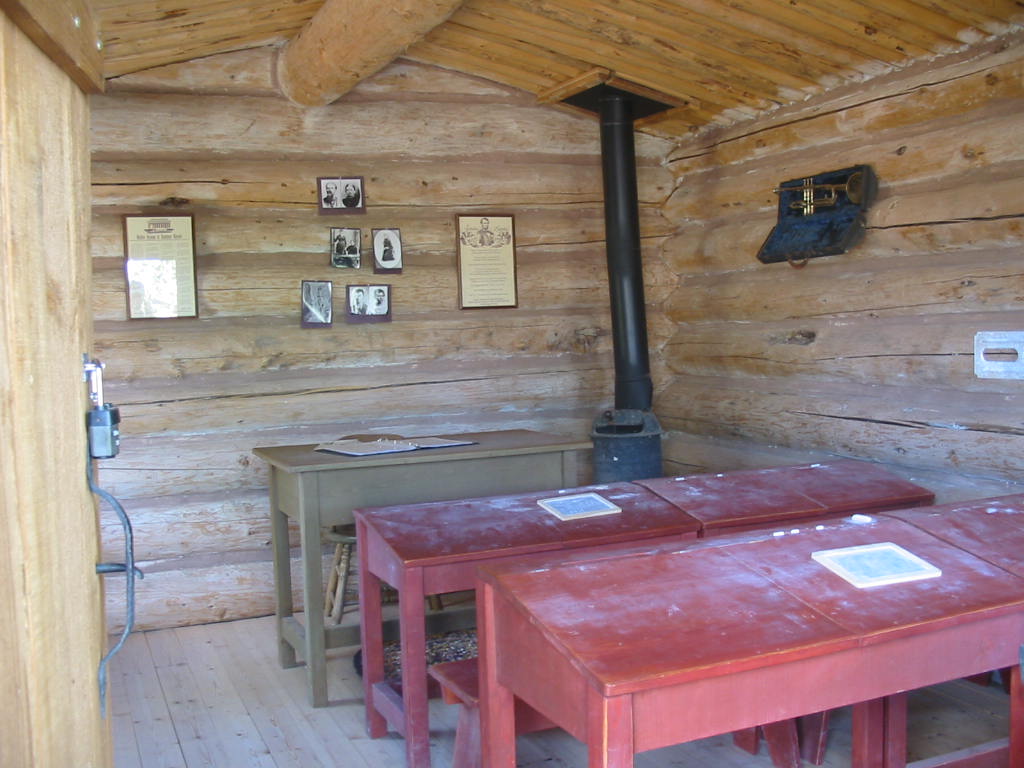
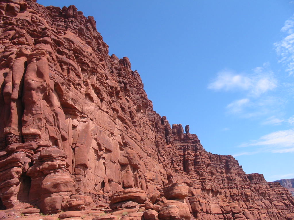
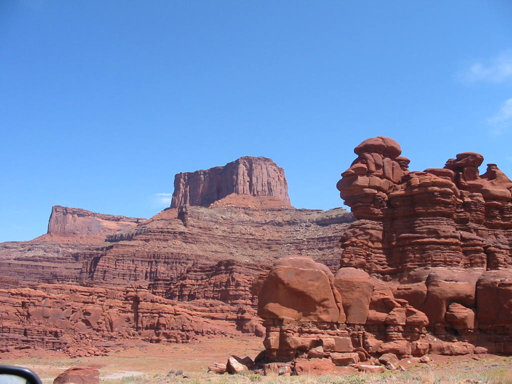
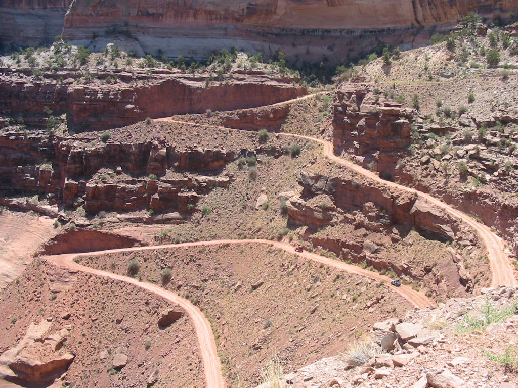
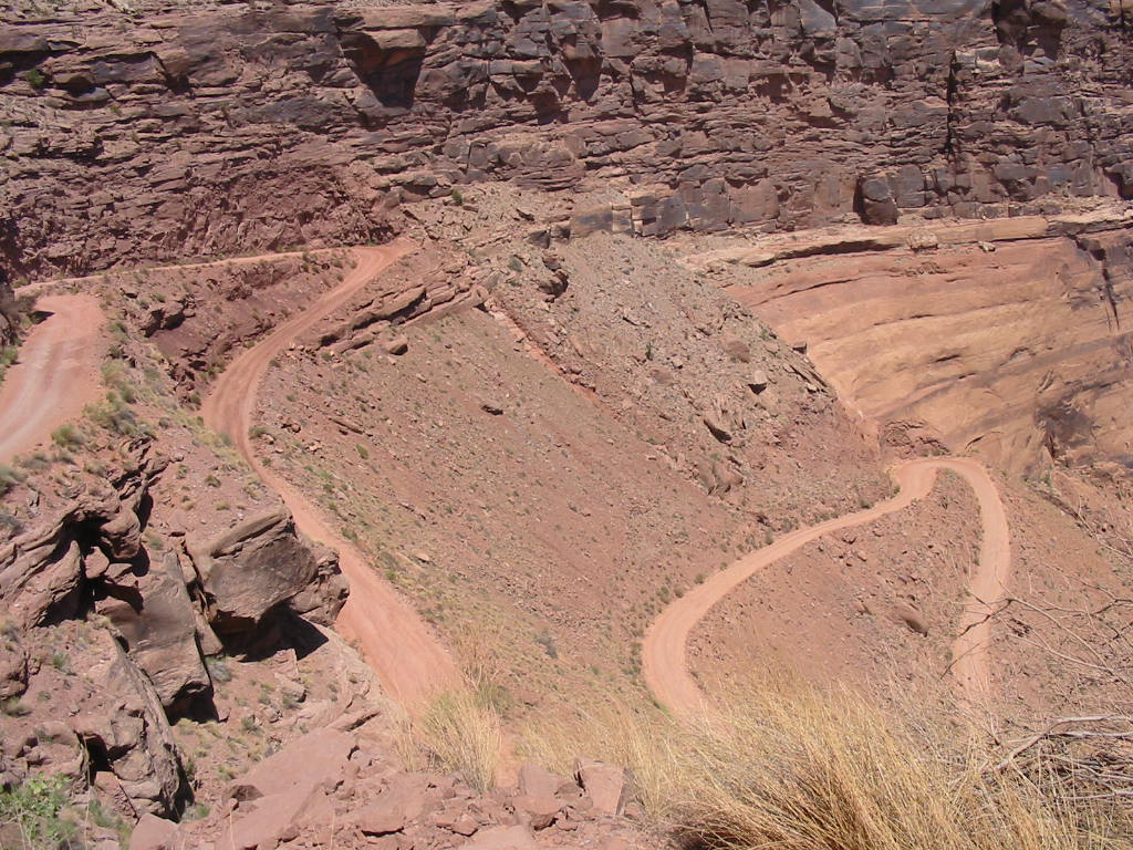
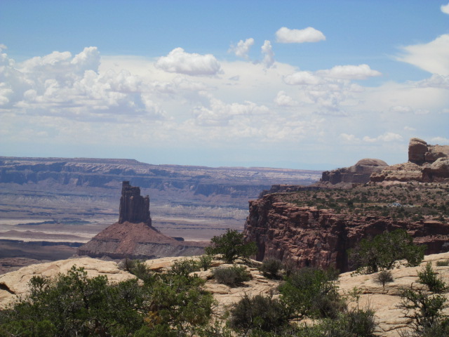
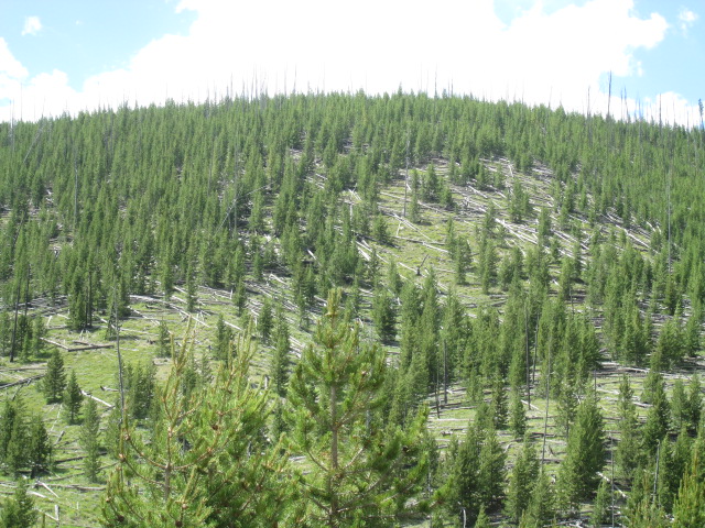
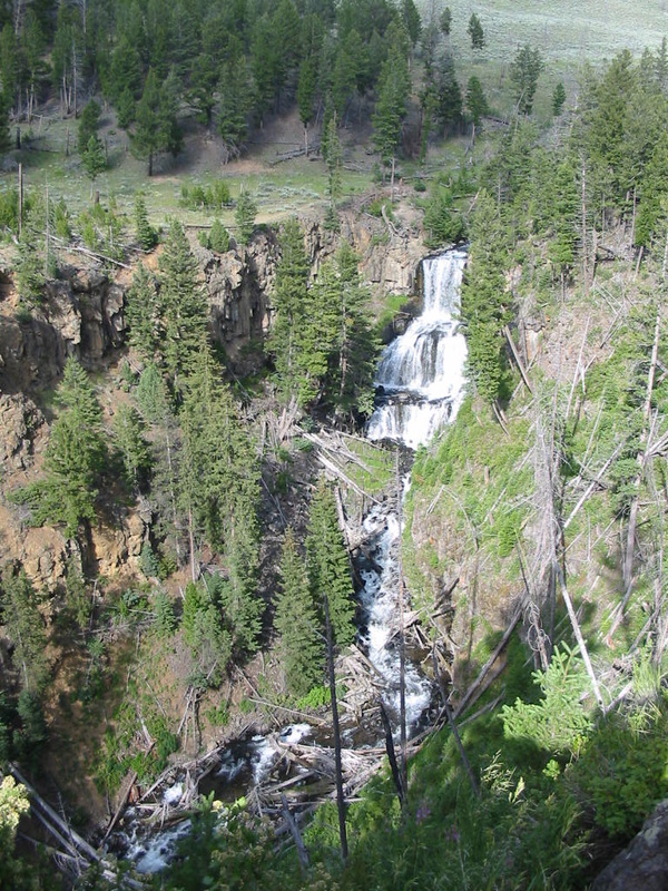
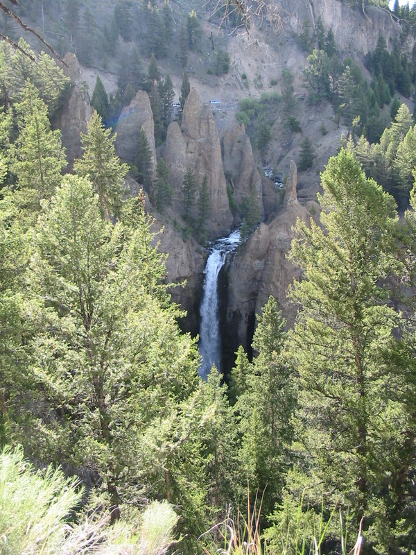
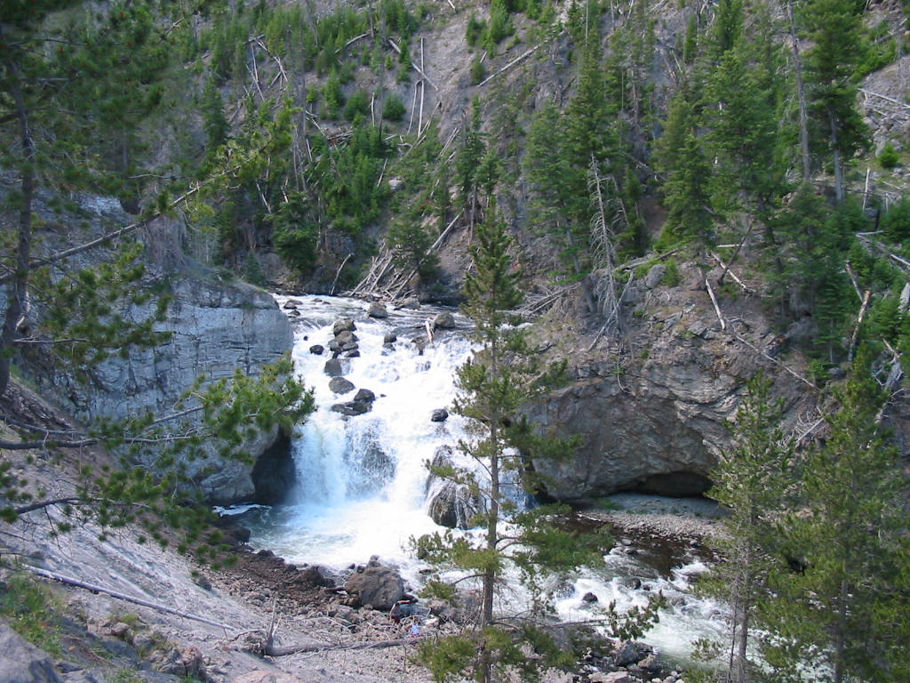
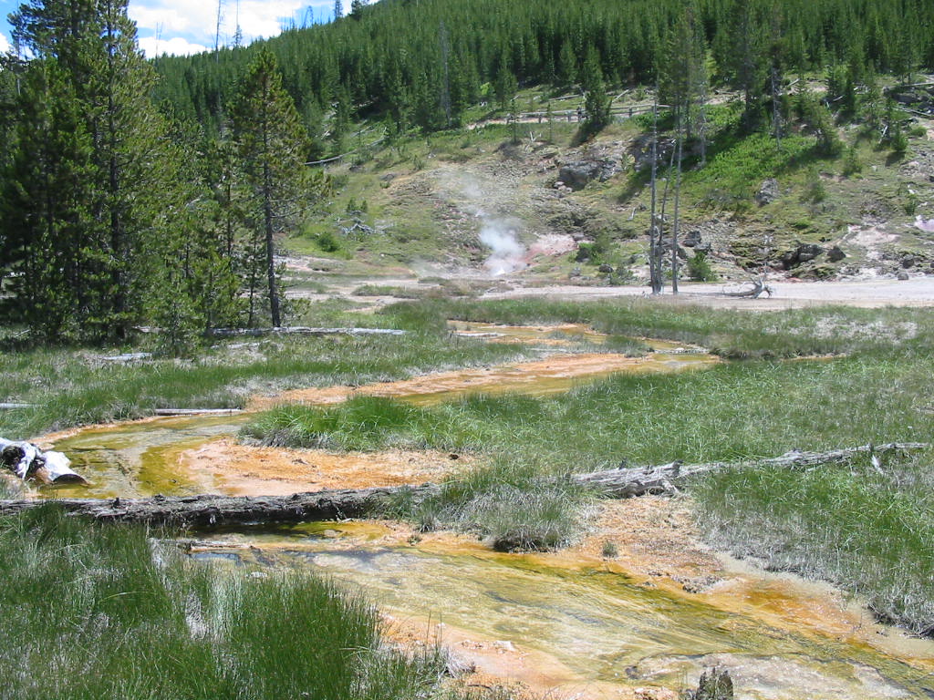
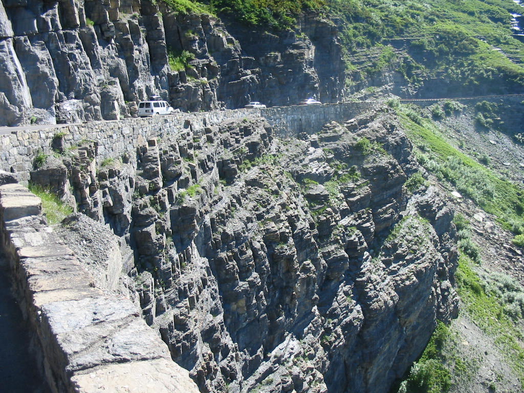
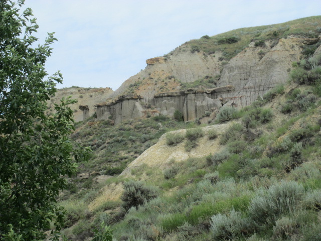
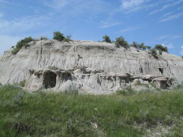
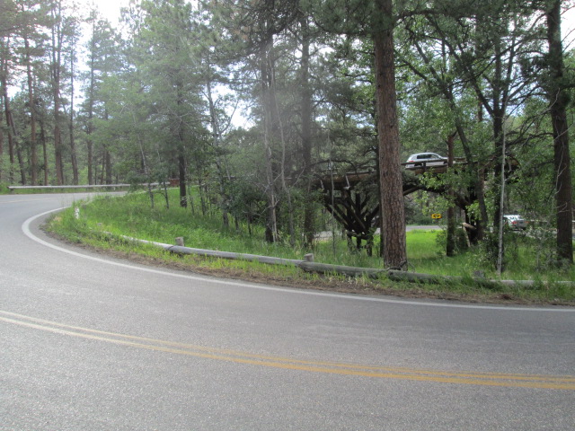
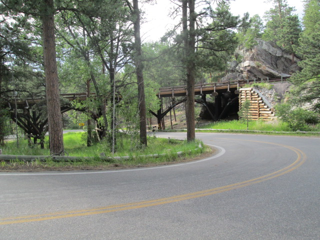
Mesa Verde was the home of Pueblo Indians in the period 600 to 1200 A.D. As I understand it, the term pueblo is not a specific tribe, but a term applied to peoples adopting a community type lifestyle, like cliff dwelling. That's not a good explanation, but if you are picky, look it up. Anyway the term 'mesa' means tabletop and generally is the flat surface at the top of a mountain. Mesa Verde is high on a mountain top, but has many deep gorges or valleys running through it. The Pueblo people built communities in the cliffs here, and many have been excavated and partially restored. We visited a couple of them. Here is a map of the park. The entrance is at the upper right. The places we visited are at the ends of the two legs near the bottom of the map. Notice the hairpin roads between them. 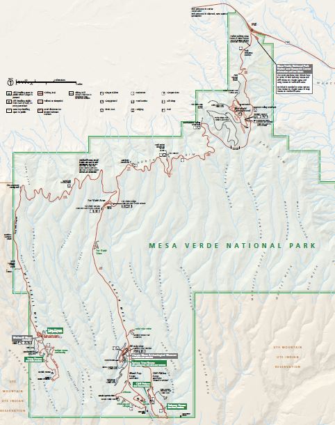
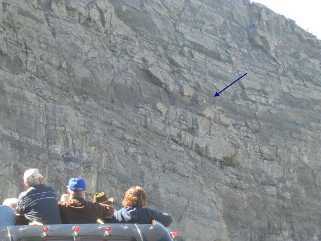
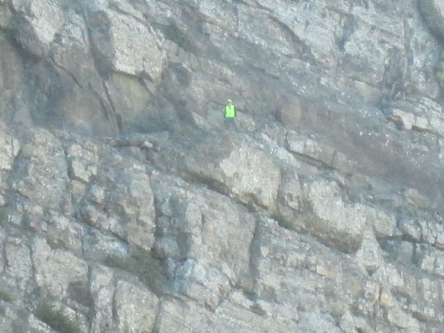
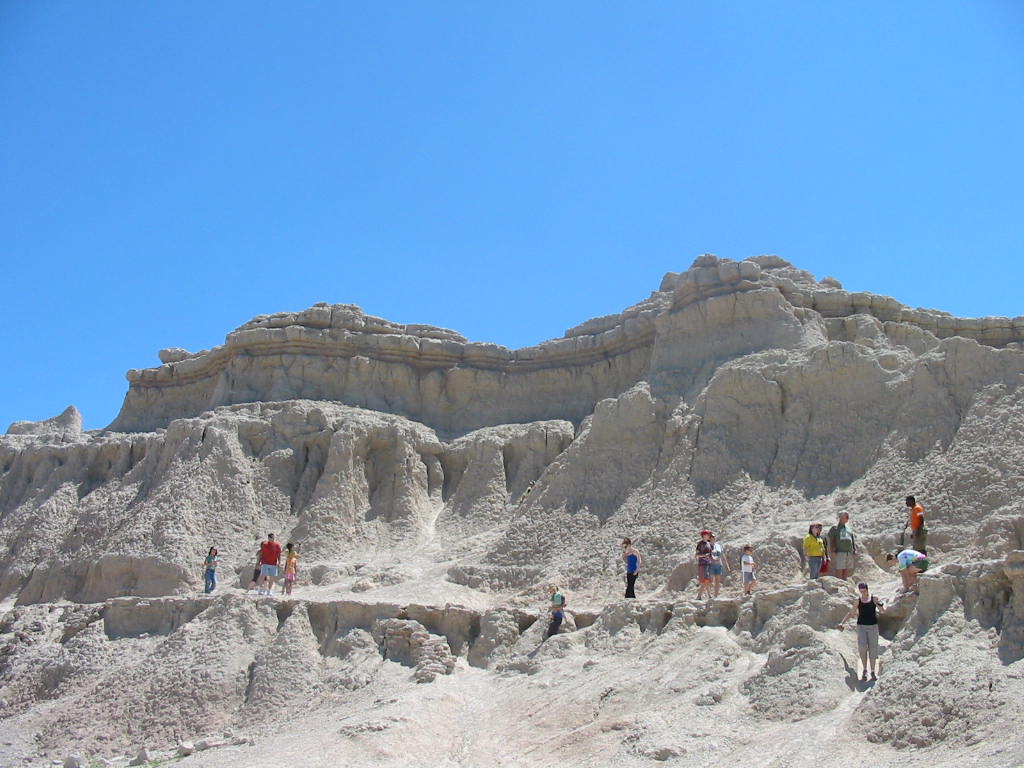
One of the ridges was covered with burned trees from past fires. In the words of Mary Lou's Alabama uncle, they were 'burnt plumb up'! 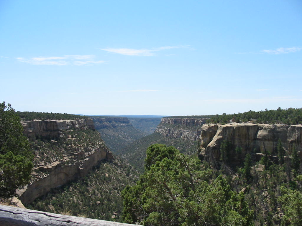 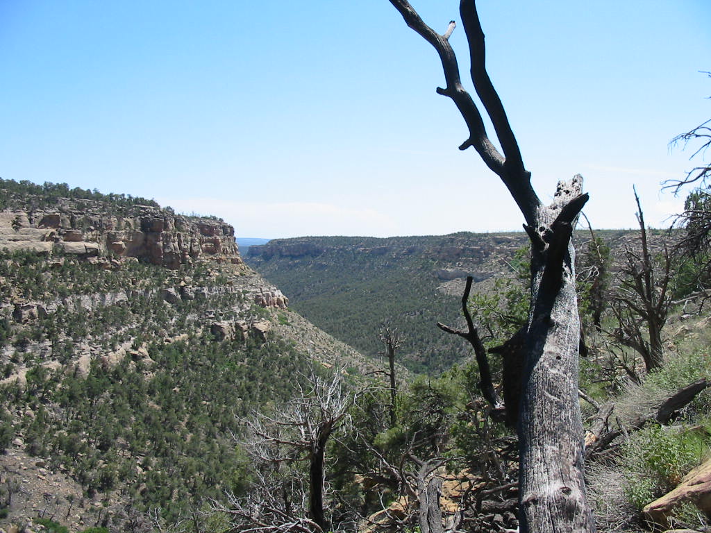 A visit to the site of the cliff dwellings began with a hike down the canyon wall. One tour began with a bus ride. As usual, click the photos for larger images. 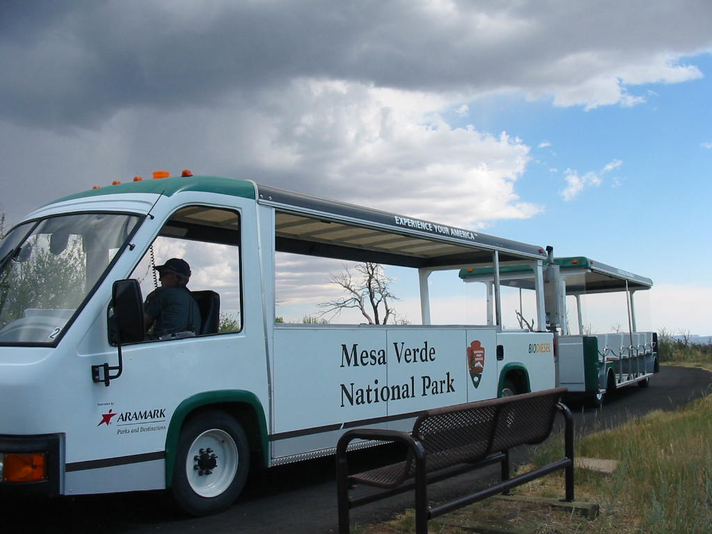 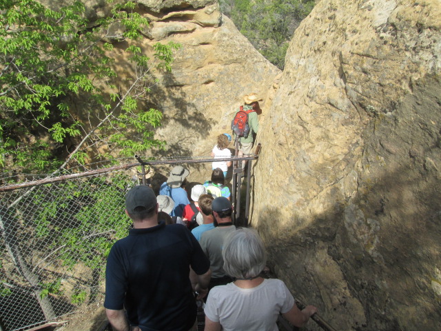 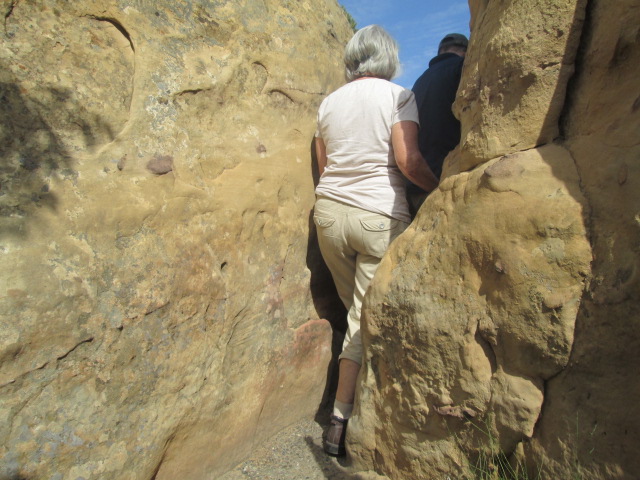 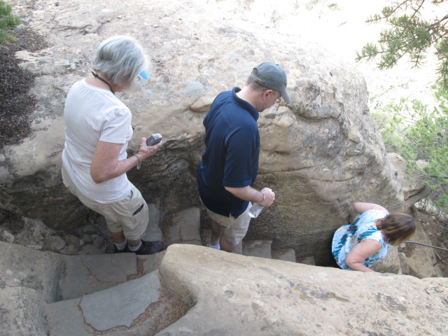 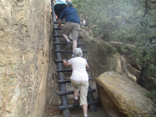 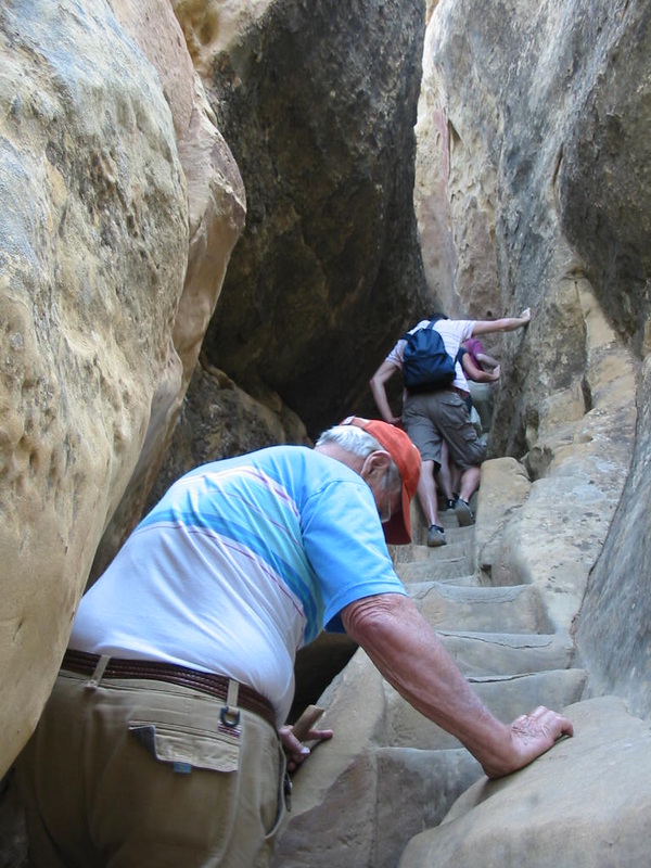 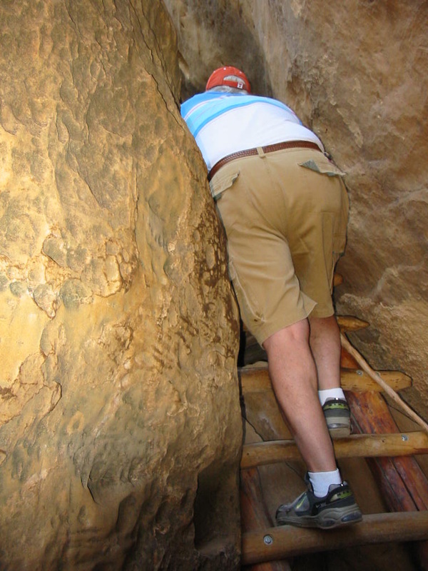 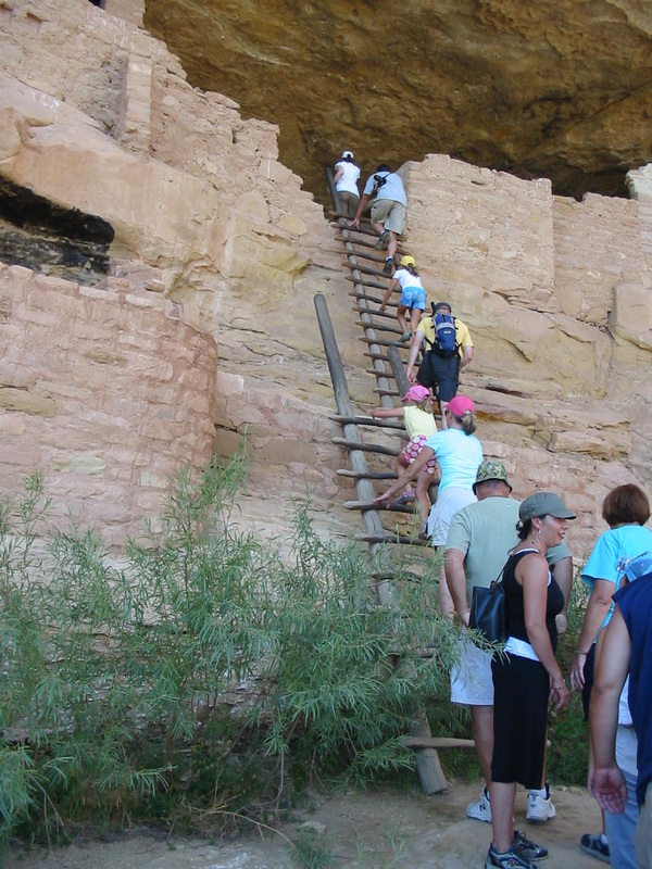 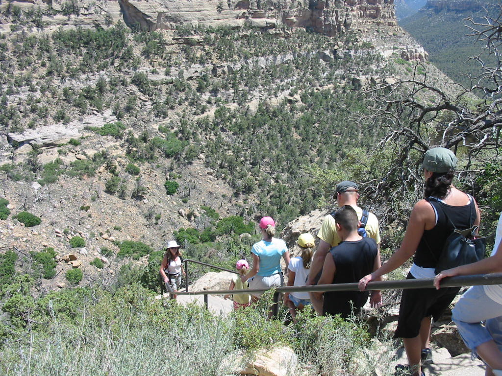 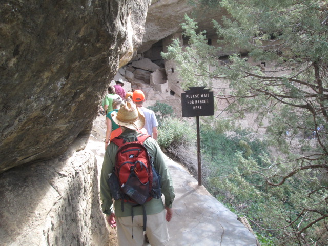 And finally, the destination. 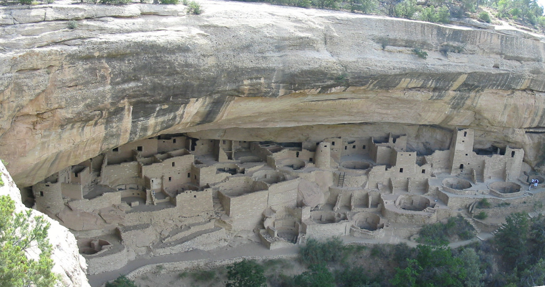
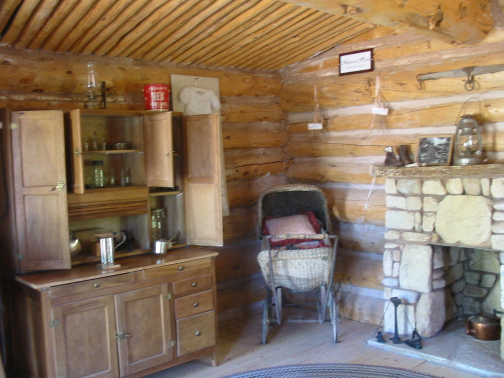
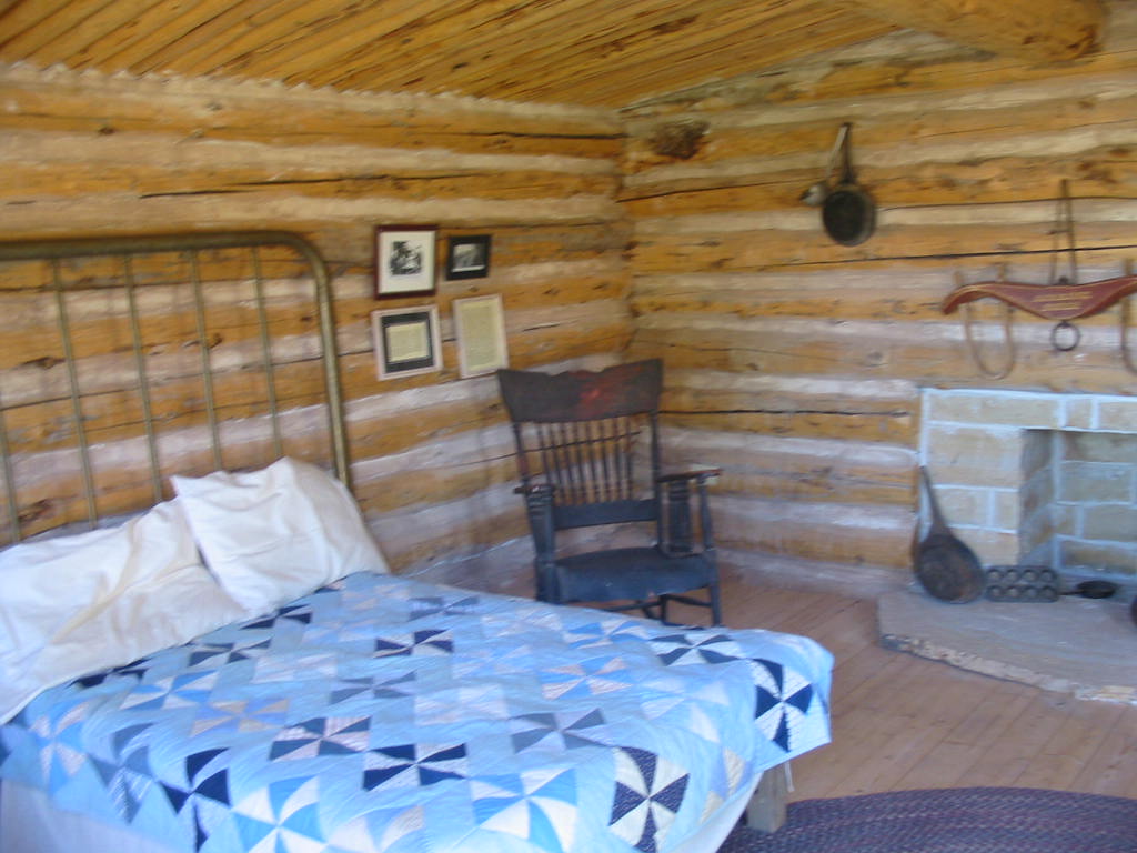
The round rooms are called kivas and had strong roofs with a square hole in the middle. Entry was through this hole via a ladder. There is speculation as to how these rooms were used, most likely for families. There are square rooms of various sizes. Note the windows up high at the top. These rooms were likely storage, accessable by ladder?? 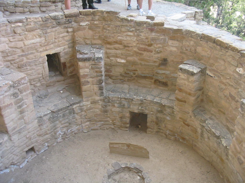 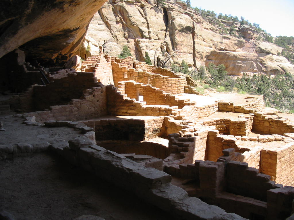  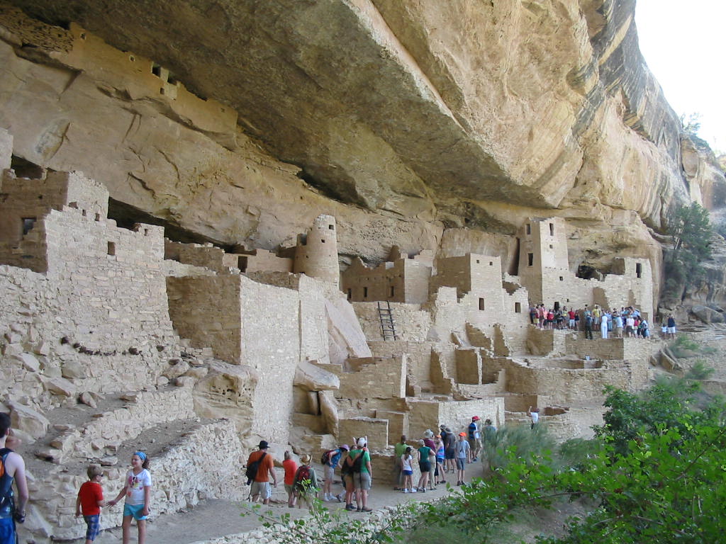 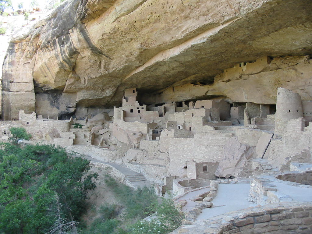 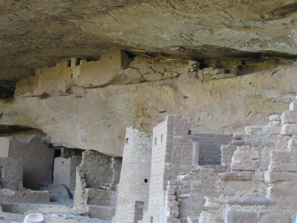 Water was concern for these people and it was obtained from water seeping out of the sandstone cliff, which acted as a sponge when it rained. Seeping water was caught in pots if dripping, or channeled into small pools from which it was ladled out. 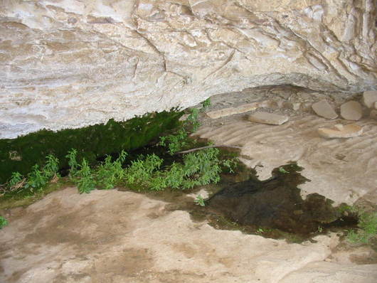
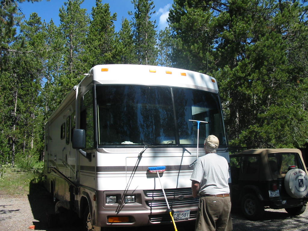
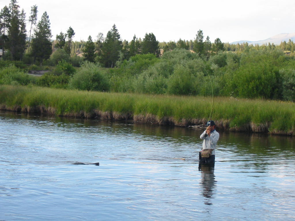
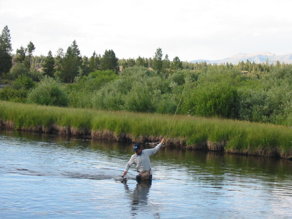
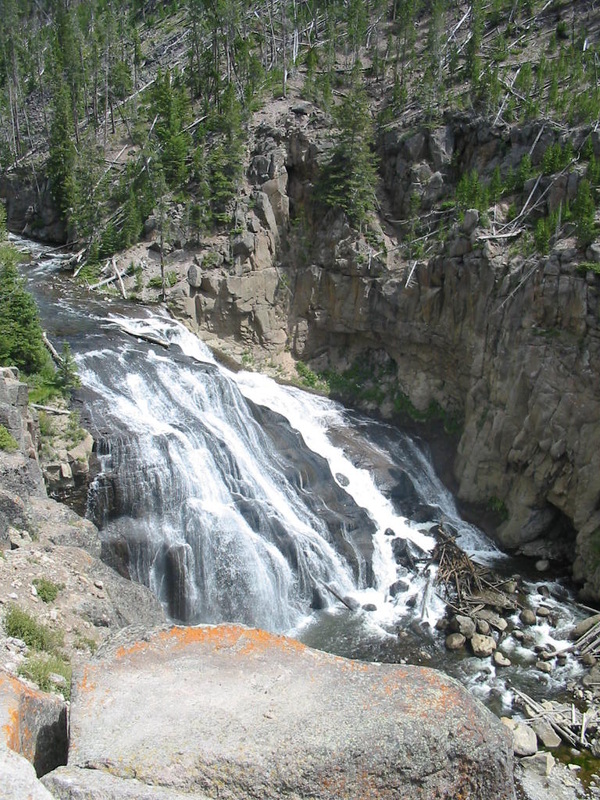
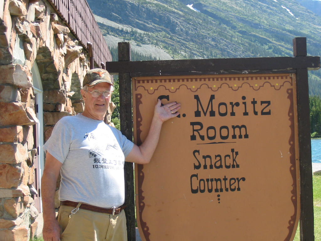
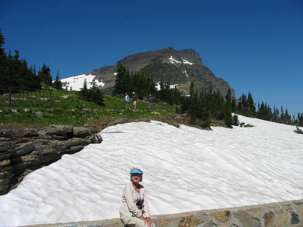
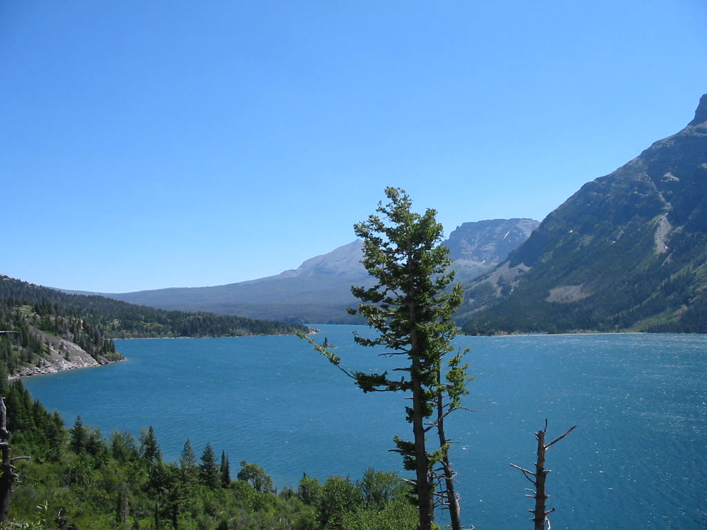
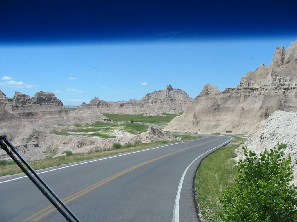
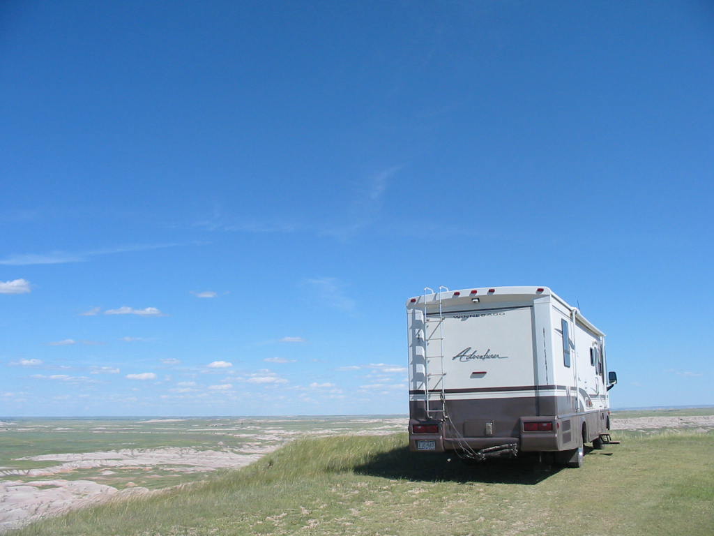
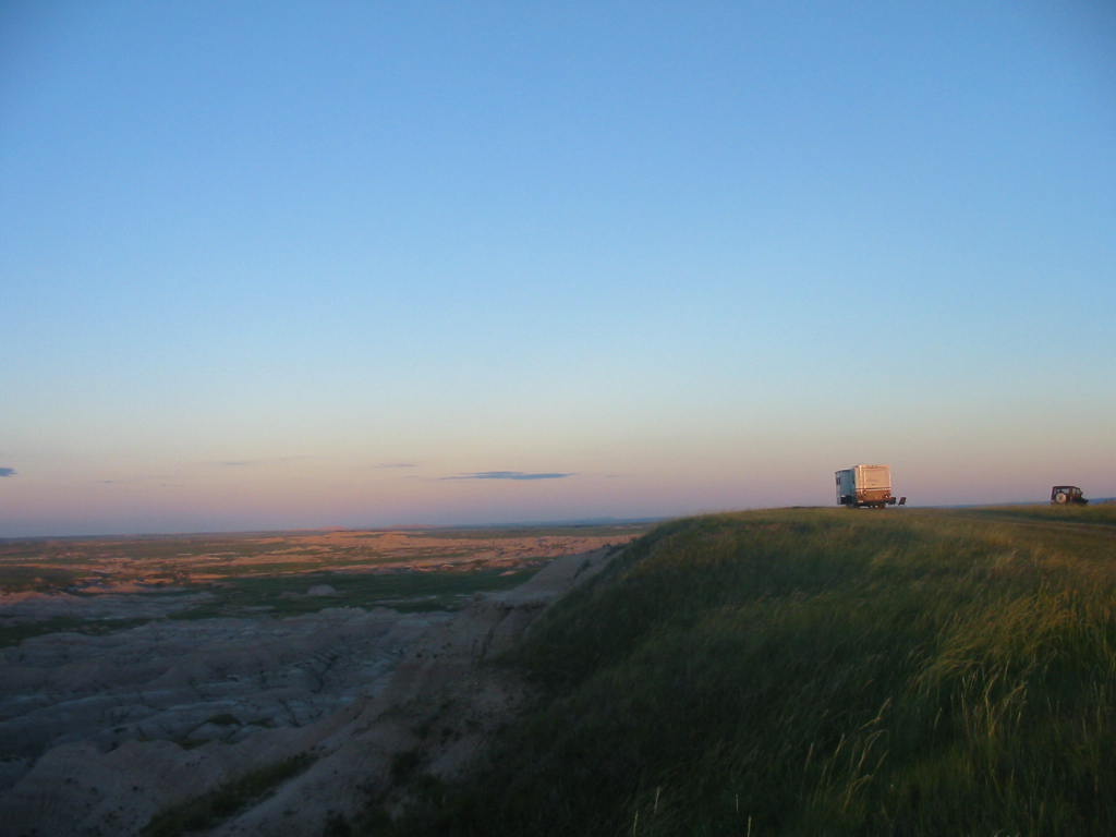
Crops were planted on top of the mesa, accessed by ladders or hand and toe holes in the side of the cliff. Water was collected from the seeps and carried to the top to water the crops (how do they know this??) 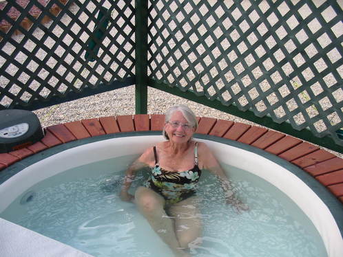 Well after a day of climbing around cliffs and driving on cliff-hanging hairpin switchback roads, we retreated to one of our favorite activities. The hot tub. 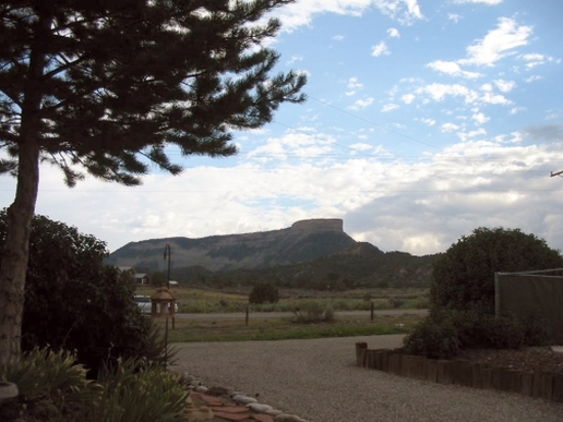 The view from here is much better than the view from our hot tub at home. That's Mesa Verde. Tomorrow we leave and drop down into New Mexico, heading southeast for Texas. We really hate to leave this cool weather!! Our adventure is nearing its end. Stay tuned.
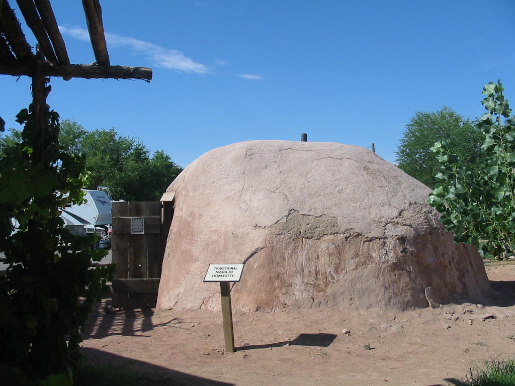
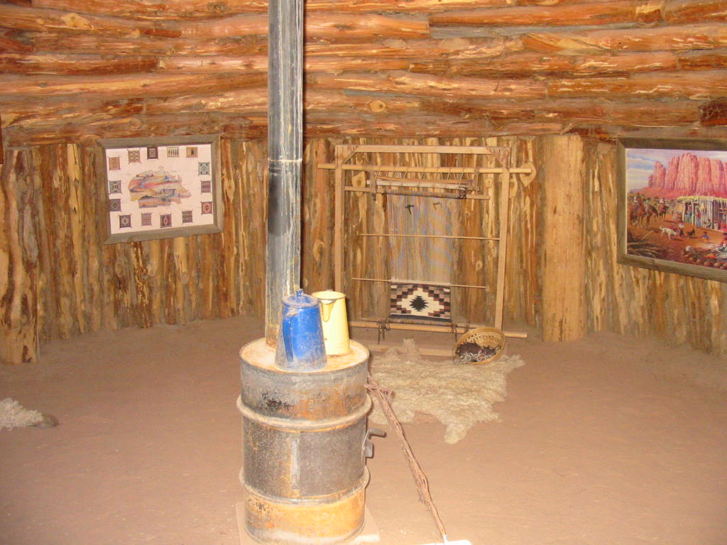
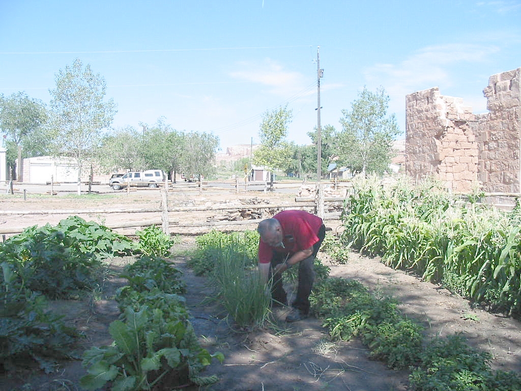
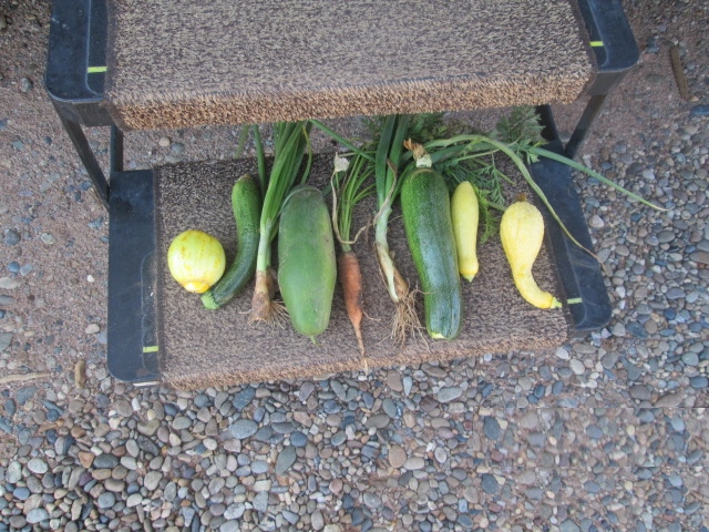
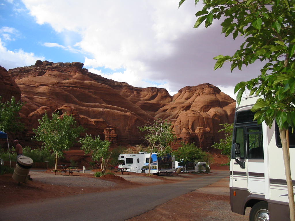
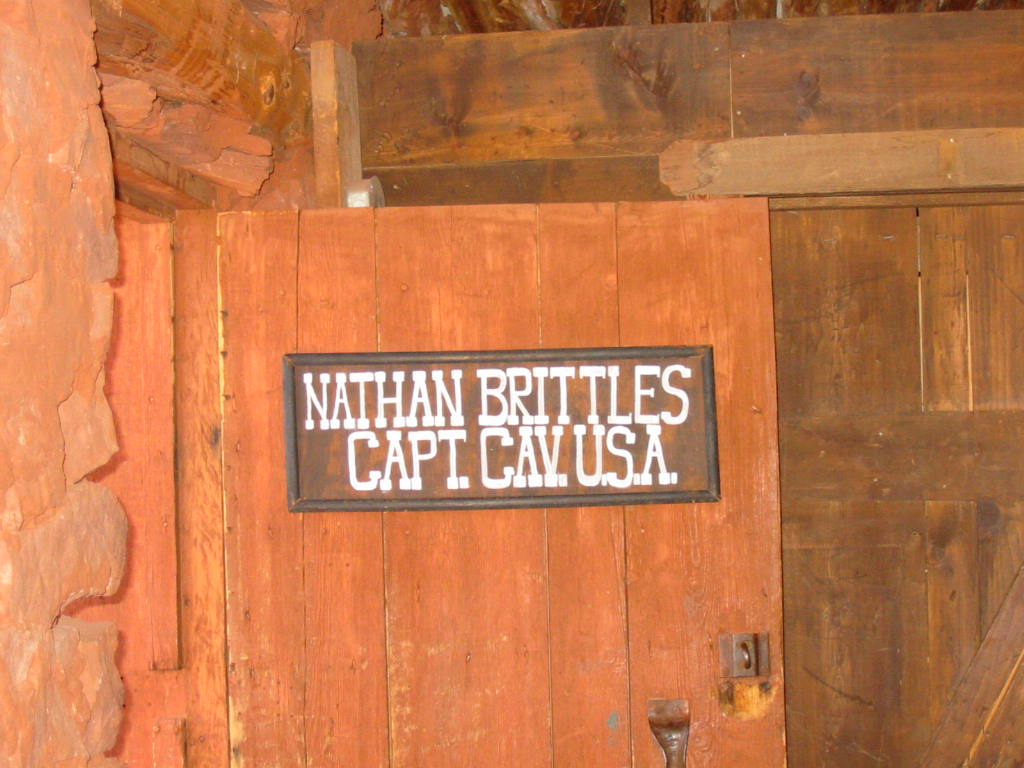
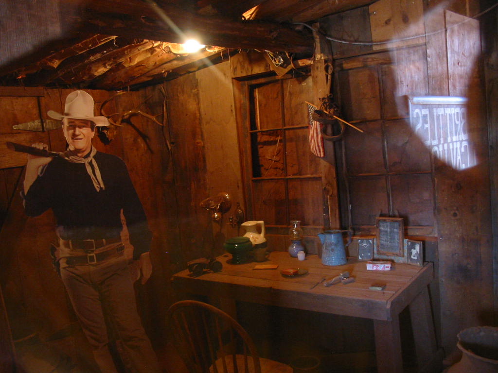
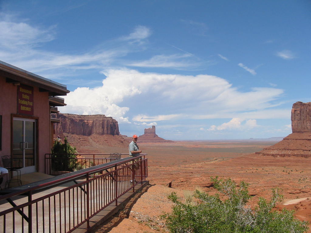
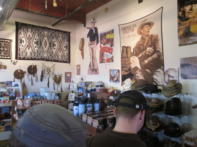
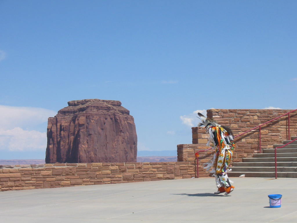
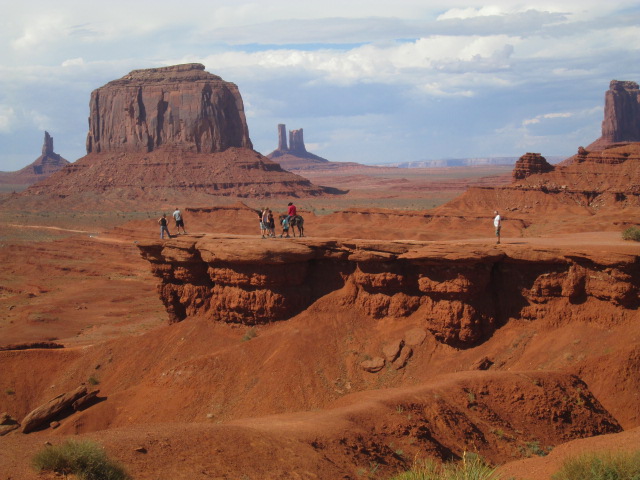
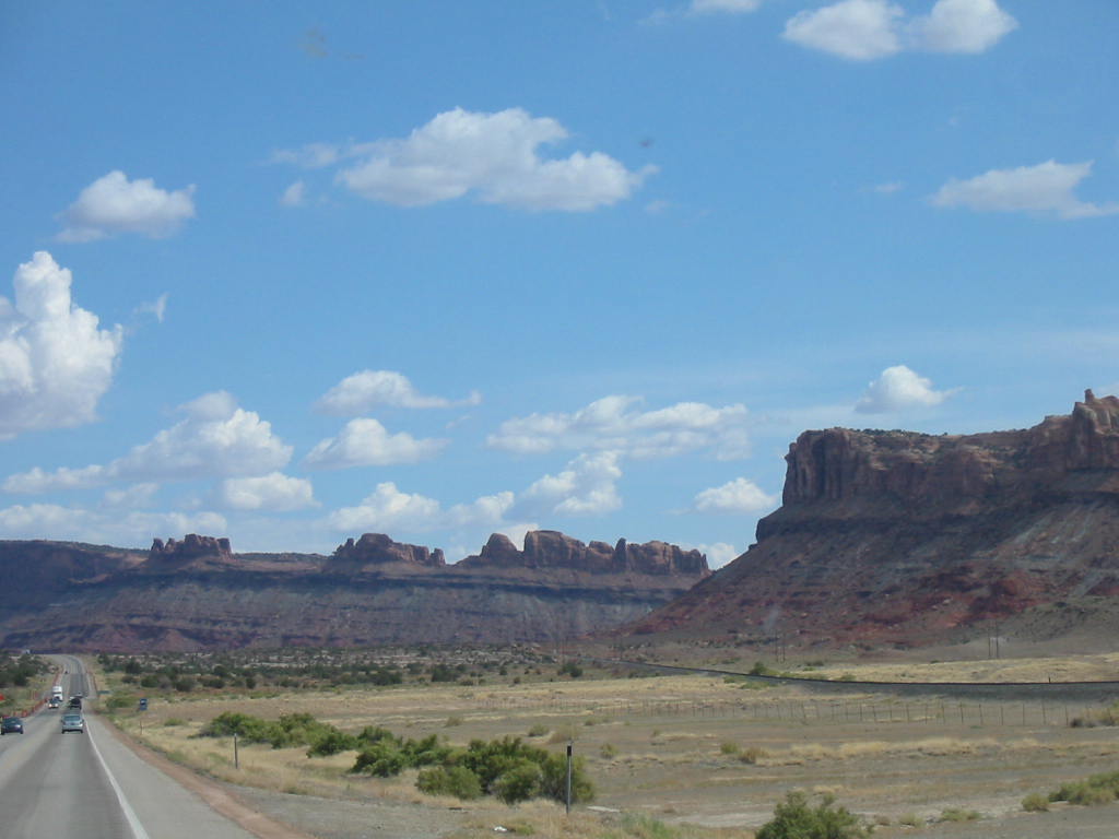
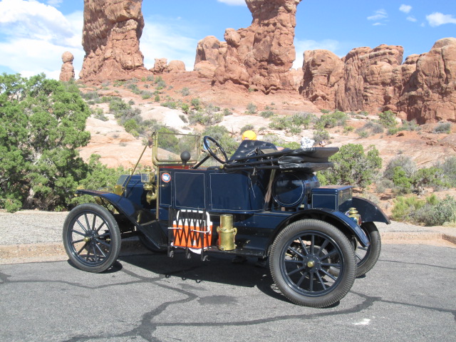
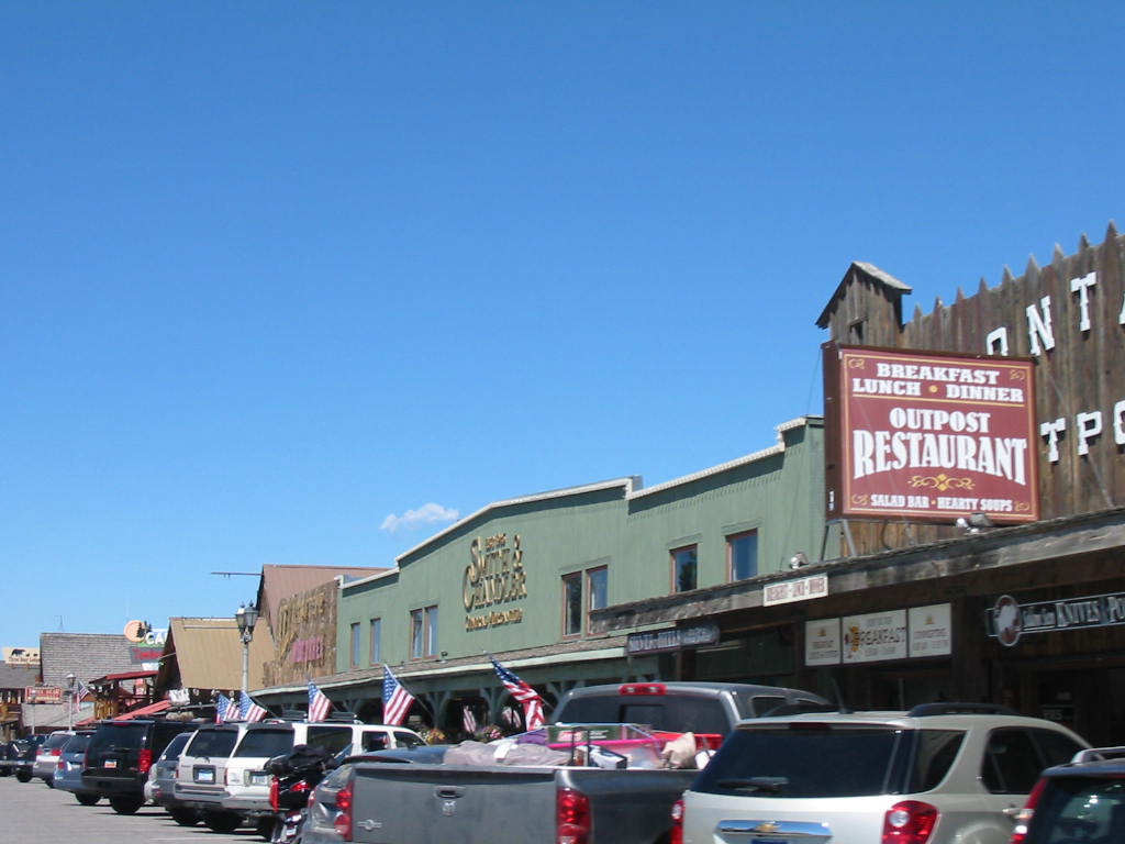
Having had our fill of jeeping around all that scenery, we headed south toward Monument Valley. Just have to share this photo of a truck hauling large square bales of hay. We have seen plenty of the big round bales, but these are new to us. 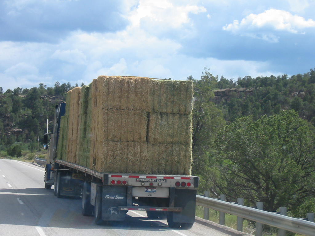 Before we left Moab, we visited the local BLM (Bureau of Land Management) office and were told about a Forest Service campground on our way. We found it and it turned out to be nicer than many pricey resorts (but no hookups). Paved roads, parking, picnic areas, and nice native landscaping. 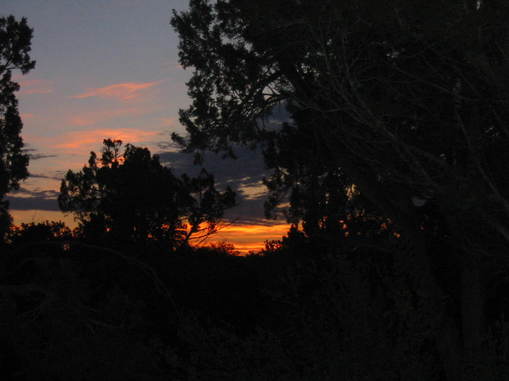 And the sunrise!! Shortly after leaving this fine campsite, we came to the little town of Bluff, Utah. There is only a couple of side streets with no visible signs of support, but there was a nice visitor center. It was established by Mormons, as was the town, and is still run and supported by them. They have a very nice video about the journey of the original settlers and the hardships they endured to get there. The Mormons were 'called' to spread, settle and populate all parts of Utah (or something like that), so a group of families set out to the area which is now the town of Bluff. The more passable routes were about 450 miles, while going directly east was only about 200 miles, but it was more rugged terrain and there would be a problem crossing the Colorado River gorge. A split was found in the rock face of the cliff, and it was undertaken to widen and fill the crack so the wagons could come through. Blasting and chiseling and ingenious methods accomplished the task, but the way down was rough. This place is called 'Hole in the Rock'. It's a fascinating story and illustrates the hardships that the people who settled our country endured, seeking a new life. The Wikipedia article about the Hole in the Rock gives a much better account and it is required reading (there will be a quiz later!). Click here. The settlers were commissioned to befriend (and convert) the Indians, but when they began having trouble with the Indians, they were advised to 'fort up'. So they built their little cabins close together, facing inward, with a fence between them. Here's a replica of a cabin. 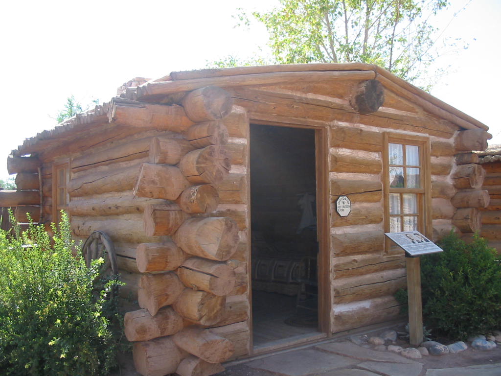 There were 12-15 of these cabins forming a part of a rectangle, each representing the family that lived there. When the Indian problem was over, each family dismantled their cabin and took it to the land they were allotted, and reassembled them. The replica cabins that are here were rebuilt, each by the descendants of the original family. Interiors are furnished with nice old stuff, but not fully representative of what actually would be in the house. The grounds of this outdoor 'museum' has tools, wagons and other things common to the period. Here is a Navajo 'hogan', a common dwelling for that tribe. Made of cedar posts, covered with mud. Notice how the ceiling is domed with no interior support. The cedar beams are placed to be self-supporting (go figure!). 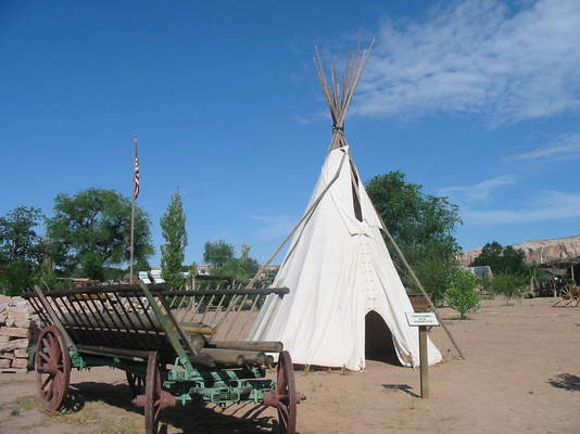 The Ute Indians used tepees. 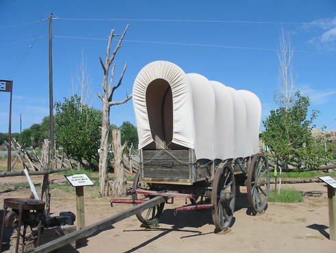 This is a replica of the type of wagon that made the trip. 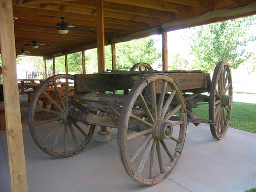 And here is one that actually made the trip. 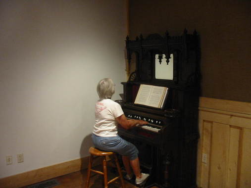 Mary Lou was invited to play the old pump organ in the visitor center. Free fresh vegetables were offered in the visitor center, and when we expressed interest, we were taken out to the garden for some fresh-picked. This turned out to be a very interesting and pleasant stop (how does she find these places??). Our destination today is Monument Valley whose main claim to fame is the location for filming several western movies, mostly with John Wayne. Most notable are 'Stagecoach', 'She Wore a Yellow Ribbon', and 'The Searchers'. There is a famous photo of a long straight road approaching some 'monuments'. We think this may be the place. 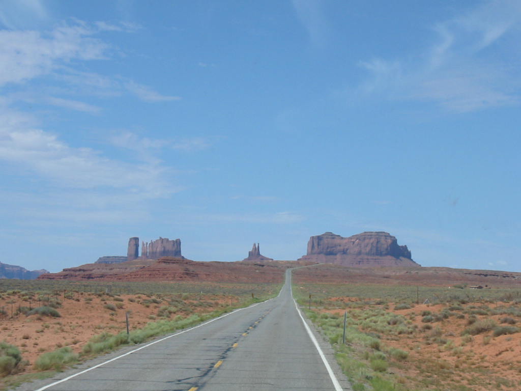 We stayed at Goulding's Trading Post & RV Campground (and motel, grocery, gas station, airport, and health clinic)(could have had a bait shop, except there was no water around). The second photo below is of the many rental RV's we encountered in the Utah parks, used mostly by European tourists (they were also driving rental cars). There were many French and German, some Italians, Swiss, and oriental. Harry Goulding and his wife Leone, nicknamed 'Mike', purchased this property in the 1920's when the Paiute Indian reservation was moved away, and set up a trading post, trading mostly with the local Navajo people. The depression of the 1930's brought hard times, and having heard of a movie company looking for filming locations in the Southwest, Harry approached director John Ford and sold the idea of filming in Monument Valley. The rest is history. The photo below shows the original trading post with the Goulding's residence on the upper floor. Both floors are open to the public as a museum, and parts of the lower floor have been used in films.  The view from the Trading Post and residence.  Behind this building is a small structure that was used in filming 'She Wore a Yellow Ribbon'. It served as the quarters of the Army Officer played by John Wayne.  The Navajo Nation owns or has jurisdiction of the land of Monument Valley. I don't know the political arrangement. There is a very nice visitor center, motel, and restaurant, plus a driving tour of the valley.  We took pictures of each other across the patio. The major draw here is a 17 mile drive around the floor of the valley. 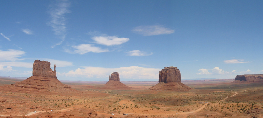 Navajo jewelry stands were everywhere, and even pictures on a horse for $2. 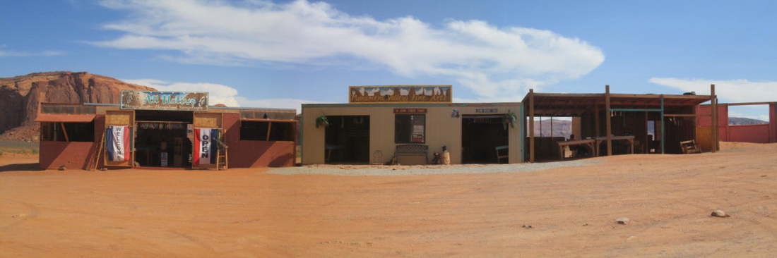 The main feature of the 17 mile road was rocks, potholes, and dust. Tours were around $70 (from Gouldings, free if you drive yourself) and we feel this was the least enjoyable activity of our whole trip. We were really glad we didn't pay for a tour. 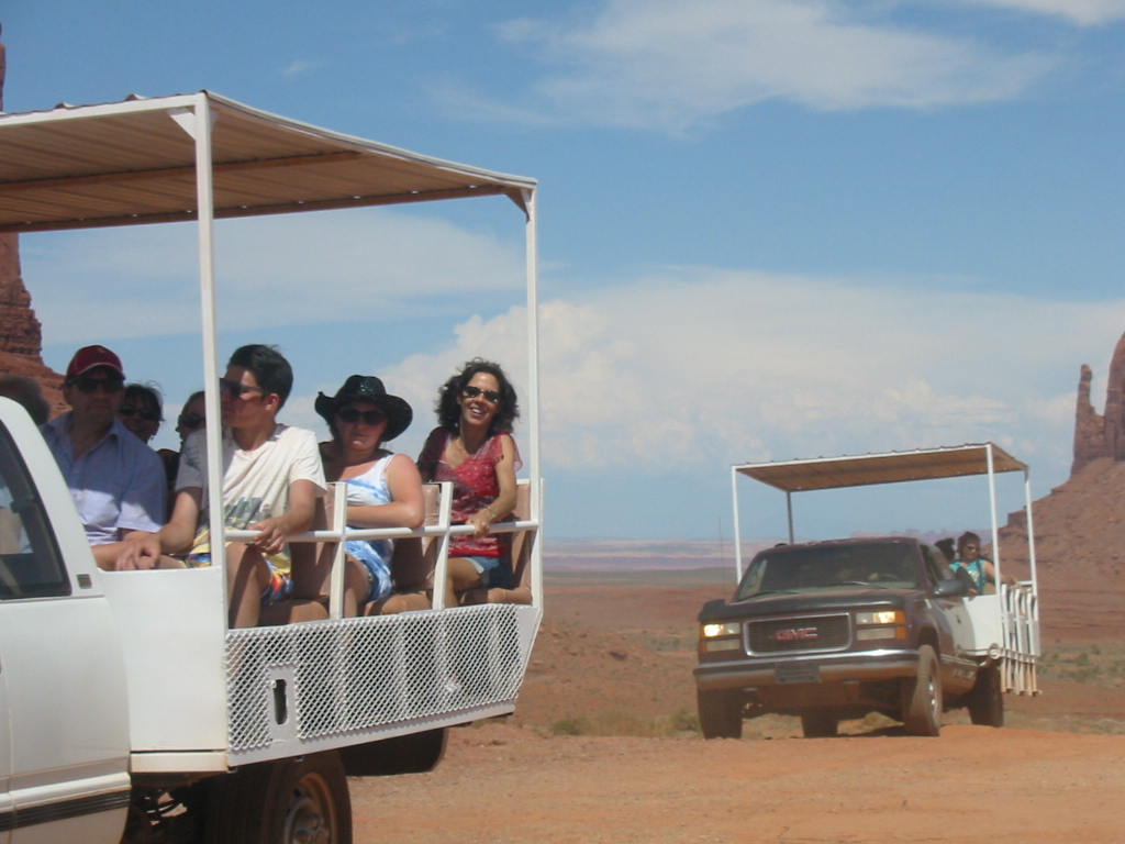 We found it interesting that homes were scattered about the desert landscape. I don't know what the livelihood of these people is, unless it's driving tour trucks or making jewelry. Having had enough of the red dust of Monument Valley, we moved on to the next adventure. Stay Tuned.
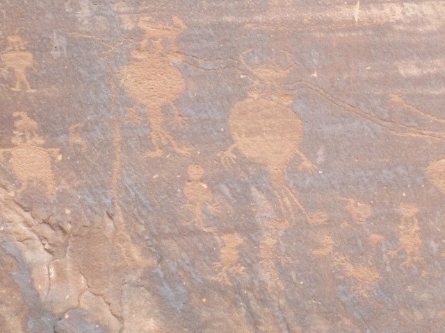
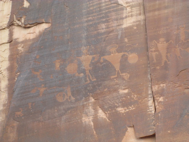
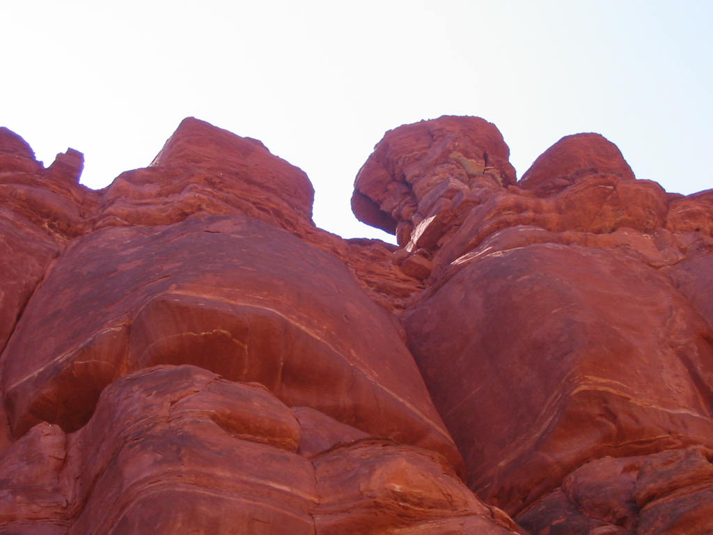
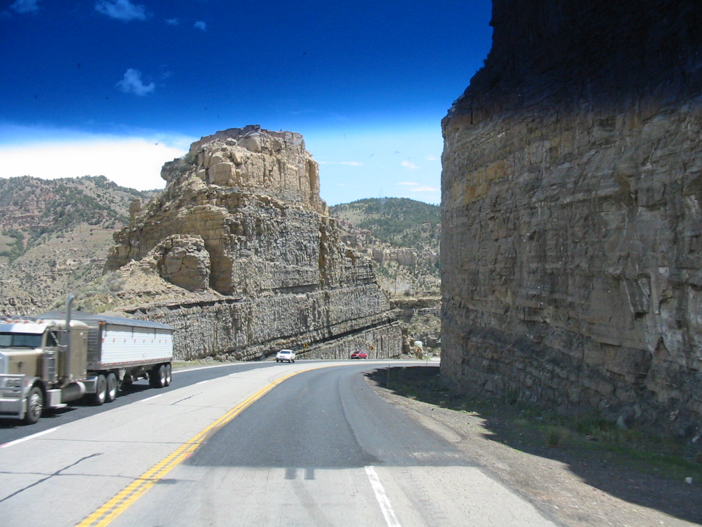
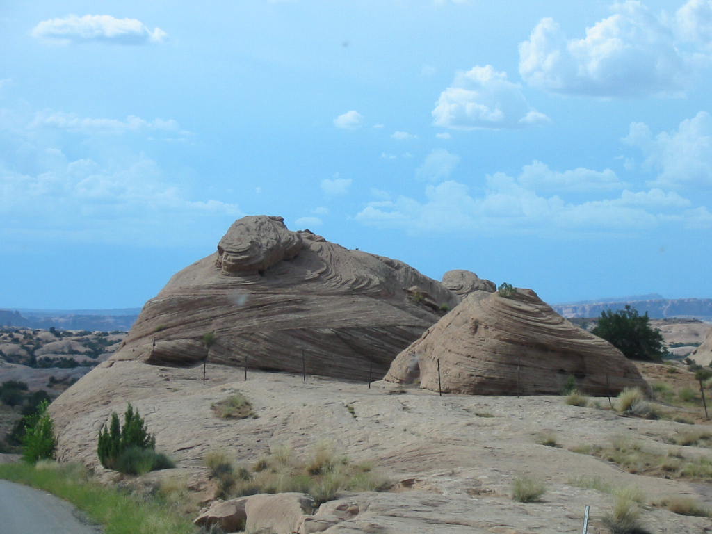
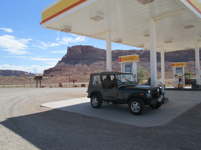
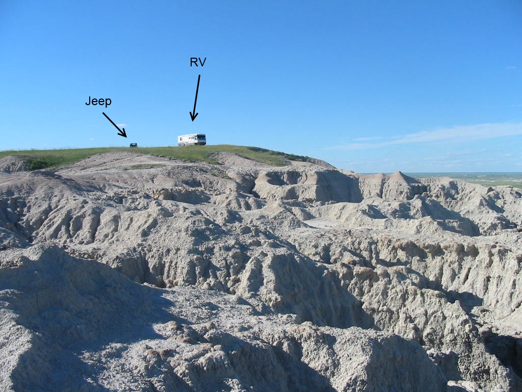
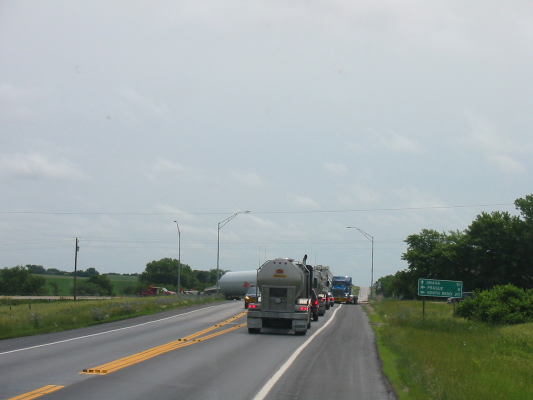
The next morning (after an exhausting day of touring Canyonlands and Arches National Parks), we embarked on an off-road jeep ride. It started out on a paved road which followed the Colorado River (the one that goes through the Grand Canyon).  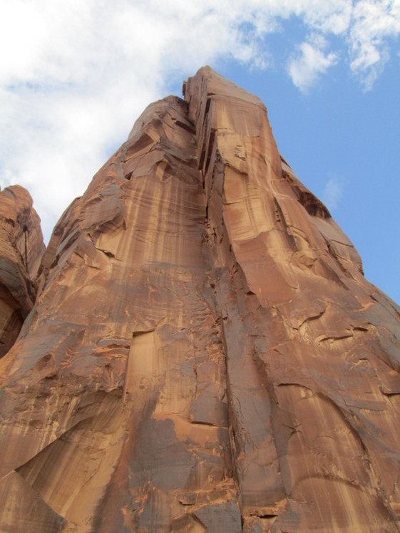 This rock towered over the road. The photo can’t convey the massiveness. These rocks had ancient Indian writings on them. I can’t tell you what they say, but it may have been their method of facebooking. Factoid: pictographs are painted on, and petroglyphs are carved or etched into the rock. I don’t know which these are. At one of our stops we noticed activity across the river. Some cars were there, and an 18 wheeler, plus another truck with a trailer, loaded with 4-wheel off-road vehicles. It’s a rental outfit bringing them to a trailhead. A big operation. 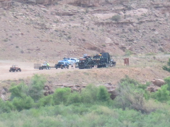 As we got deeper into the wilderness, we came upon this facility. It felt a little spooky, like something from a James Bond movie. Turns out it is a potash mining operation. 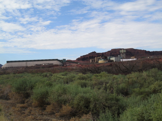 Past this point the road was no longer paved. 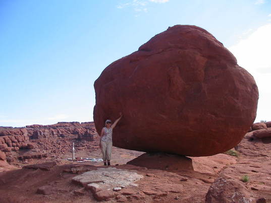 Another balanced rock. But notice what’s to the left of Mary Lou. Here’s another little facility here in the middle of nowhere. Really spooky here. I kept expecting a black helicopter to come rising up and heading our way. No telling what manner of mysterious stuff goes on out here 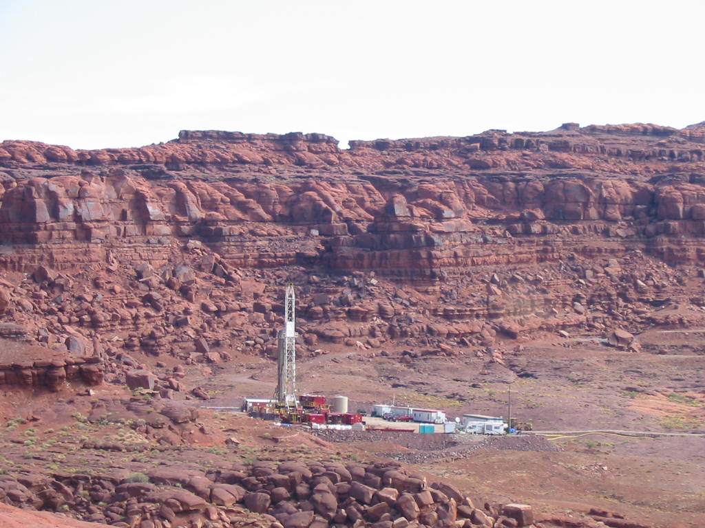 We came upon yet another operation out there. Moab Salt company must have been refining salt in great ponds. Not sure how all that worked, but the ponds were bright blue rimmed with white salt. I have since gotten new information. Potash is defined on Wikipedia as “various mined and manufactured salts that contain potassium in water-soluble form”, mostly used in fertilizer. The article even mentions the potash evaporation ponds near Moab, and has a picture similar to the one below. 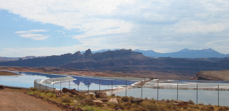 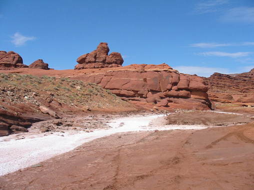 A salty stream. (we tasted it!) A hairpin bend in the Colorado River. Notice how red it is, particularly on the right side. 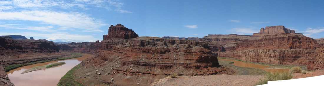 Rocks, rocks, and more rocks. And the last part of the road. We had come from here. 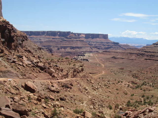 And we assaulted the cliff on this switchback road. Click the photos. And finally the little jeep is triumphant! 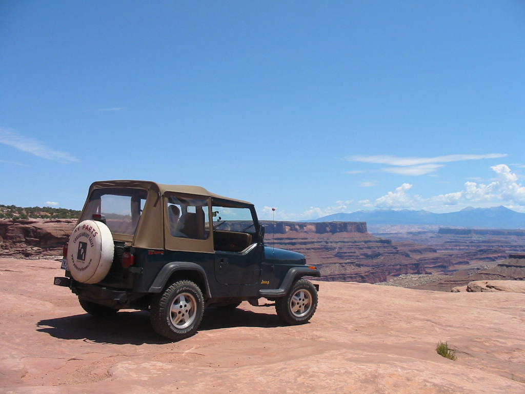 The map on the left is the entire route. The right map shows the road up the cliff (the turkey foot). 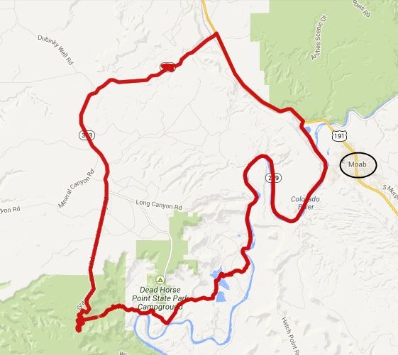 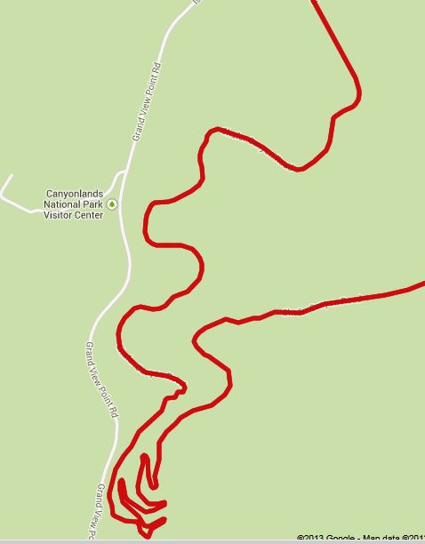 After this fun ride, we still had time to retrieve the RV and head on down the road for more fun and adventures. Stay tuned.
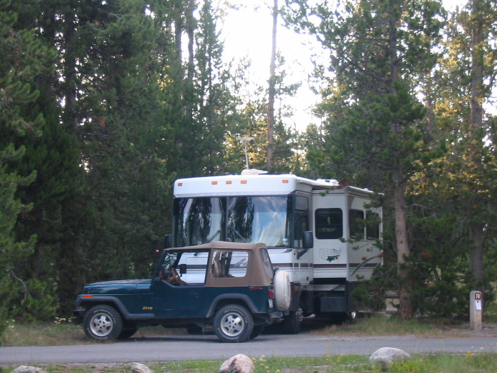
Leaving West Yellowstone heading south was fairly uneventful, overnighting in a campground in Ogden, Utah. The next day we made it to Moab, Utah, which, like West Yellowstone is a hub for activities in the area. Canyonlands and Arches National Parks are within easy driving range, but the area is also popular for jeep, ATV, motorbike, and mountain biking trails of varying levels of difficulty. Moab had shops, restaurants, ATV and bike rentals, and guide services for all of the above. 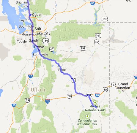
Guess where the following photo was taken. Note the fake fireplace and big screen TV, with sofa and lounge chairs. 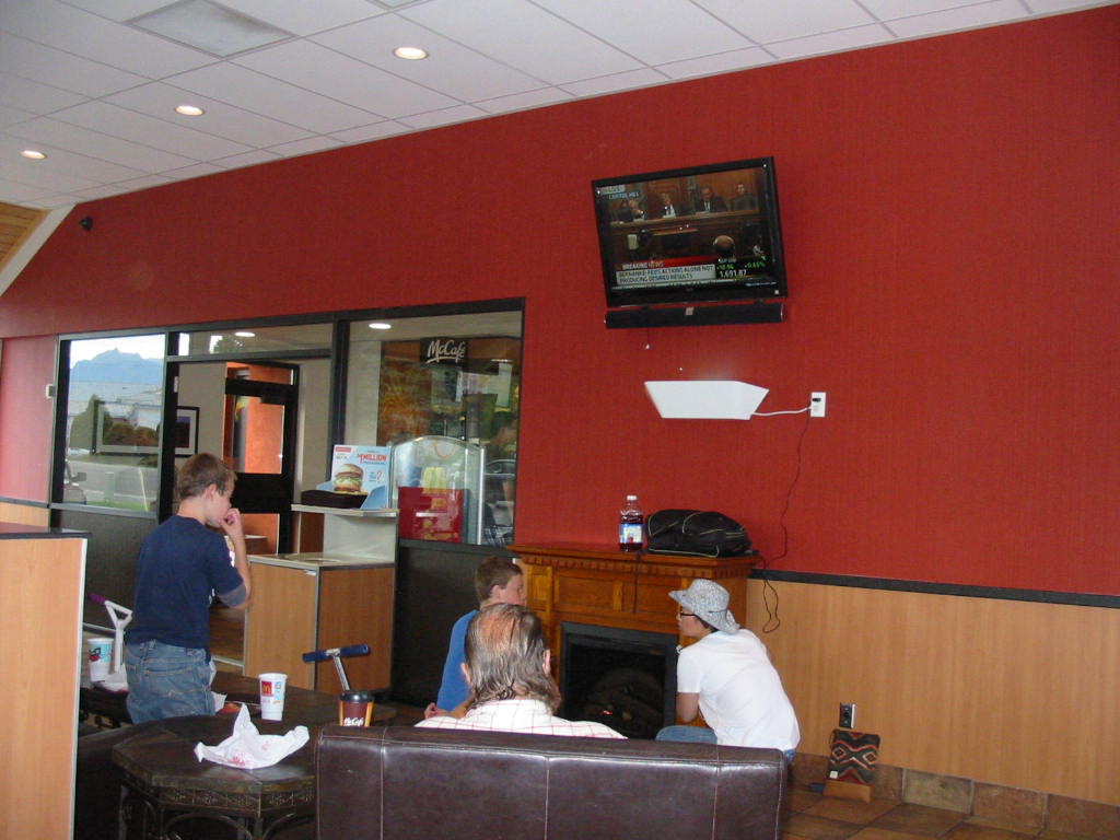
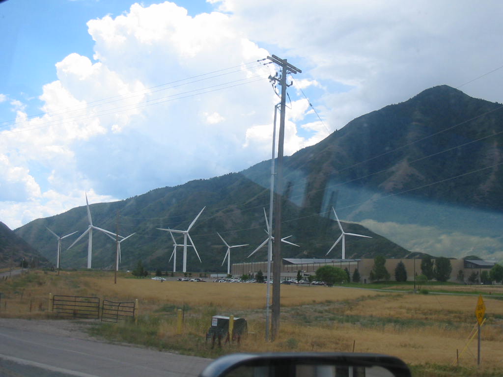
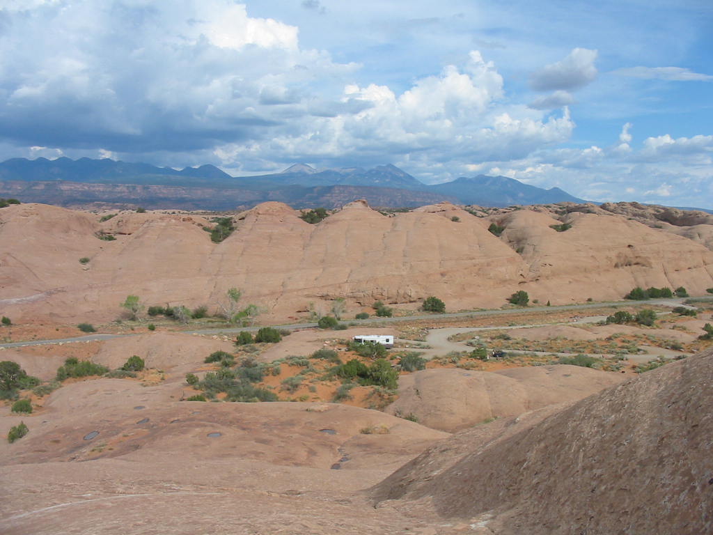
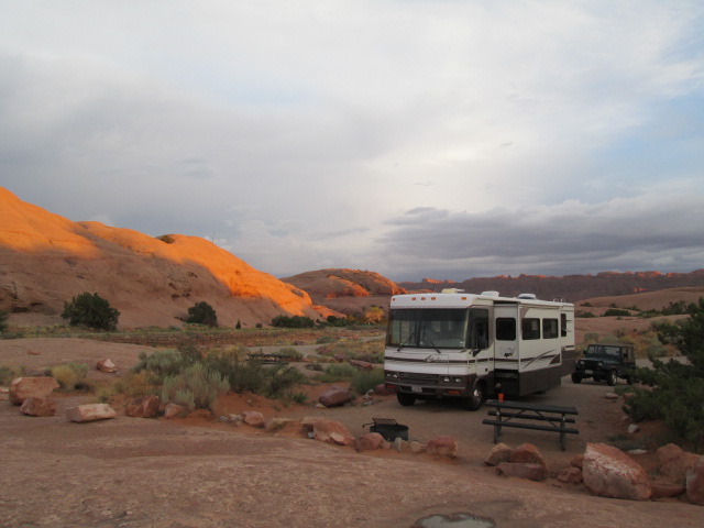
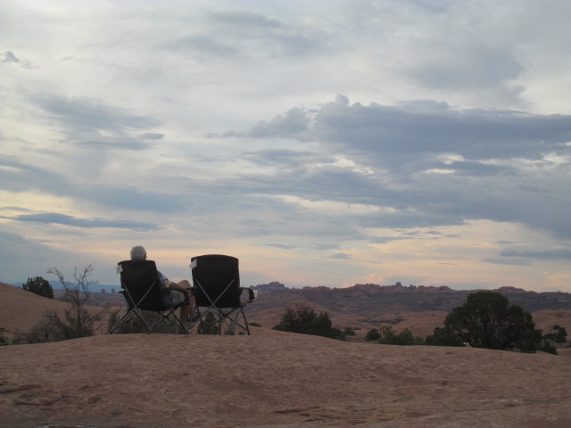
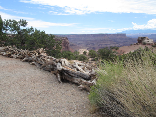
It’s a McDonalds!!! Sorry, but I can’t resist some road shots. This part of the country has gorgeous mountain scenery which photos do not do justice. The small group of windmills is positioned in the mouth of a pass through the mountains which has a funnel effect. We found a campground on a hill just on the edge of Moab on Bureau of Land Management (BLM) land, but administered by the county. This was another great site. Great view with hardly anyone else around. The mountains in the distance are in Arches NP. 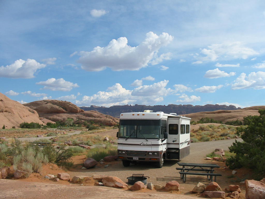
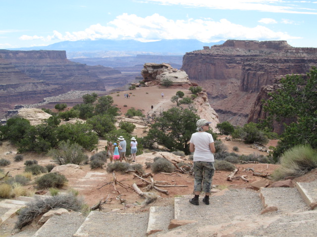
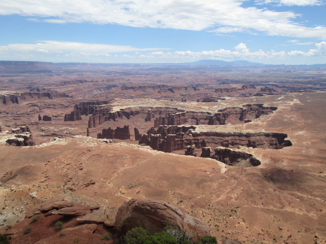
Mary Lou climbed (walked up) the nearby mountain and took the photo of our camp. 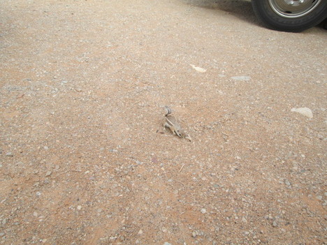 As we were enjoying the evening, this little guy came within 4 feet and checked us out. (I need to bone up on little ground critters as there are several different kinds we have seen). Evening sunset. 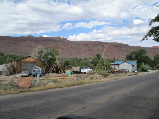 Here are some tepees without the wrapper. I call them 'naked tepees'. 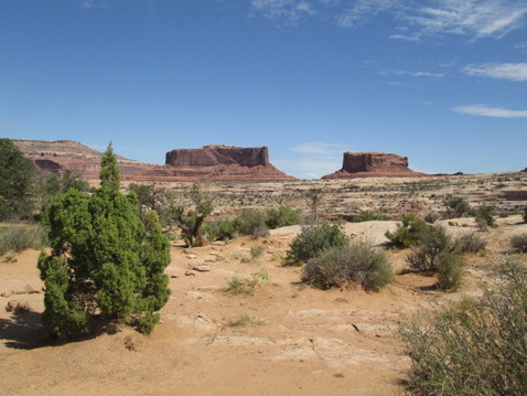 Entering Canyonlands Park, we find the Monitor and Merrimack, named for the civil war ironclad warships. Note the railing in the 3rd picture. I think it took some artistic talent to lay them in an attractive manner. Here is one of the more popular sights in the park. Mesa Arch. Photographers hike up here in the dark to catch the sunrise through the arch, casting a red glow on the underside. We know one such fool (who shall remain anonymous), but he got a great photo. 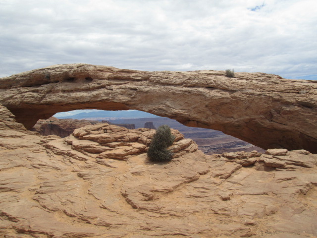
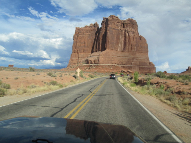
 The arch from the side. Note the canyon wall through the lower opening.  On the trail.  Green River Valley. Out on the main highway near the road to the park entrance (30 miles from the highway) is a lonely gas station and RV park. I was impressed with the remote feeling. (gas was $4.09) We squeezed in a ride into nearby Arches National Park, making for a long, tiring day. 
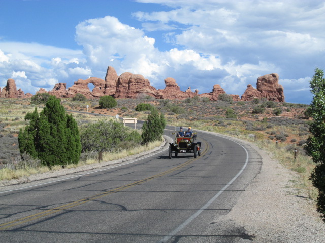
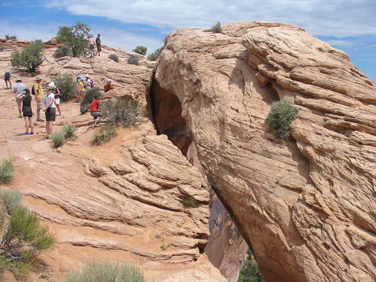
Most of the arches required a considerable hike which in most cases we were not inclined to take, so we got photos where we could. Here is Double Arches (north and south windows). 
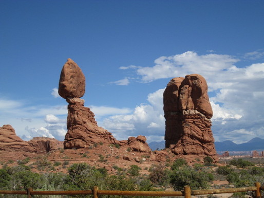 Balanced Rock. All kinds of vehicles on the road!  Another famous and much photographed arch is ‘Delicate Arch’. The hike was too long, so we got the best shot we could. There is speculation that an arch may have existed here at one time. Hence the term ‘fallen arch’ (yuck, yuck). Mary Lou thinks that calls for arch supports? (groan). 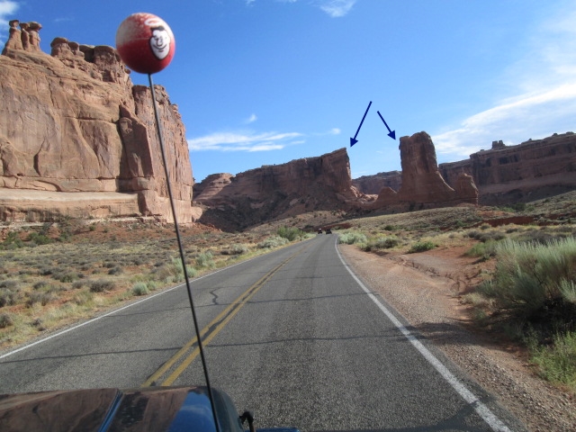
Parting shots. This report is already too long, so I will close it out, but be ready for tomorrow's adventure. Coming soon. Stay tuned.
Still on the road to Yellowstone, I can’t resist photos of the landscape. Such a beautiful world! This photo shows a natural dam created by a deadly earthquake in 1959. The right part of this lake covers what was a campground at the time. It happened at night while campers were asleep along the river bank. The earth shook and rock and mud slides came down on the people, several of whom died and were never found. Others died from the flooding. It's now called Earthquake Lake. 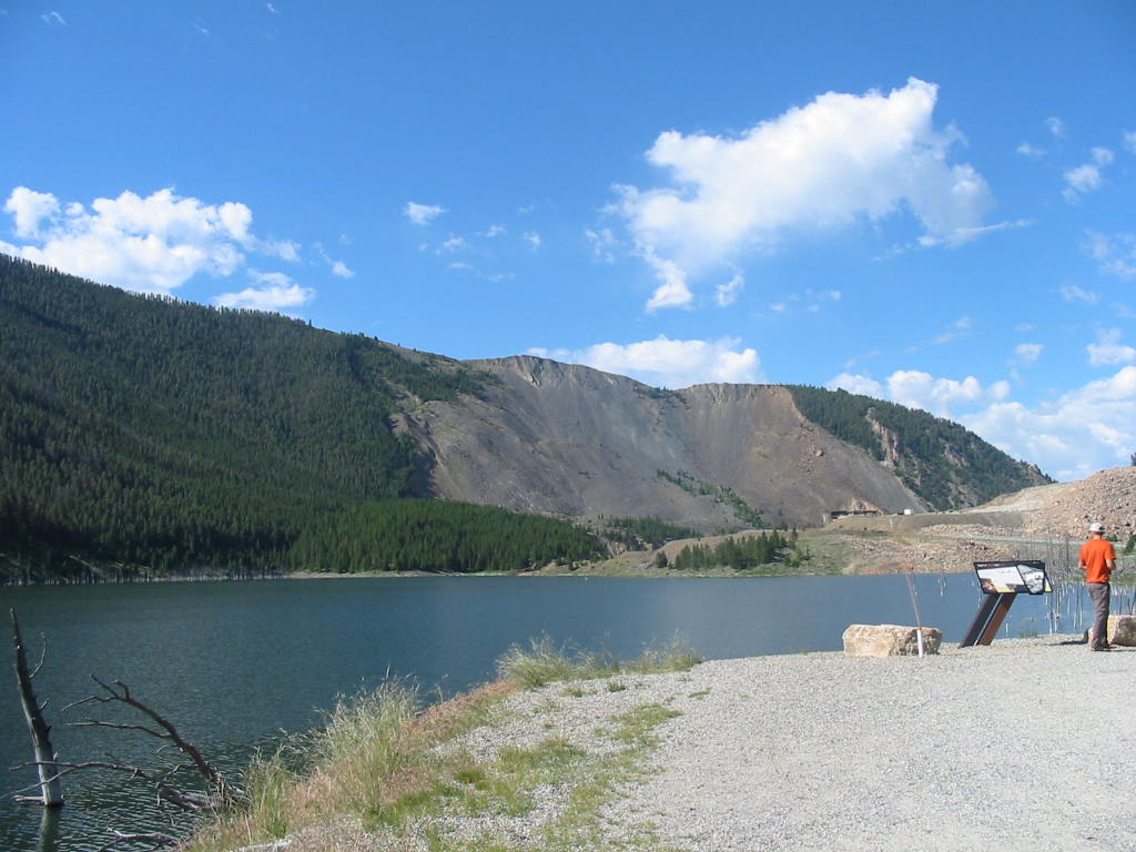
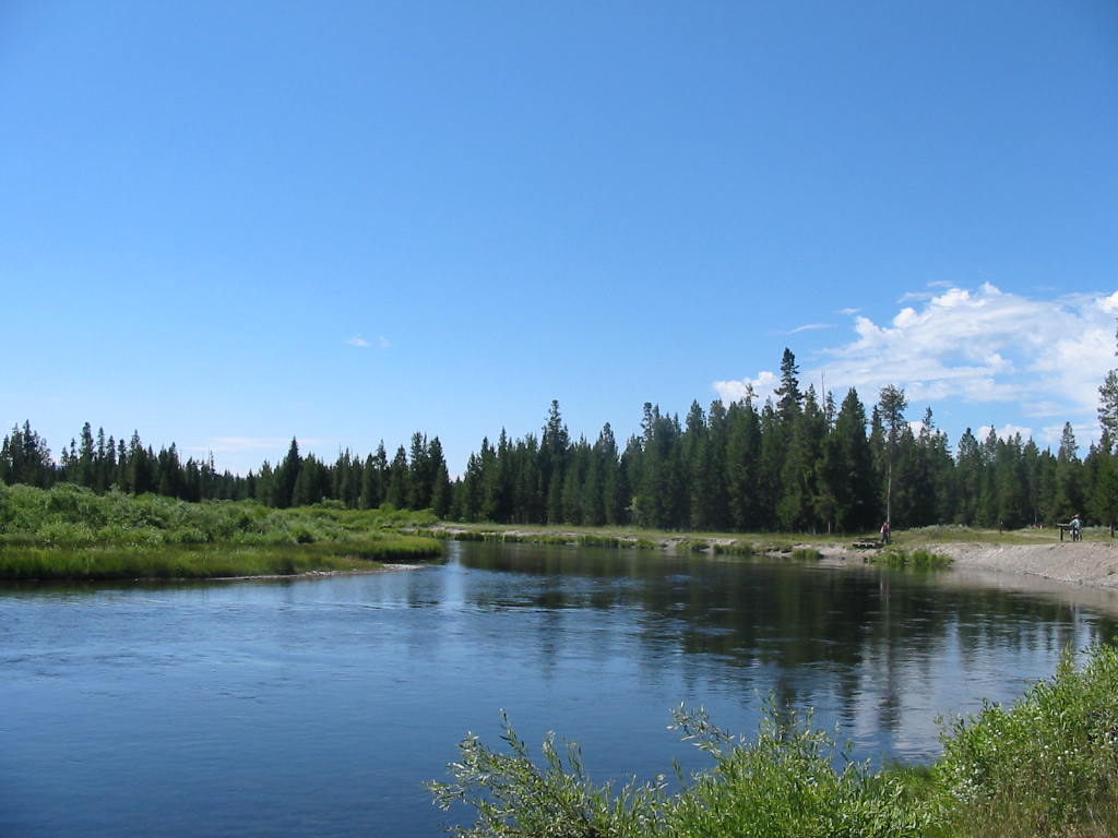
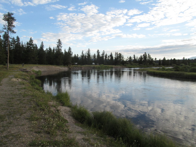
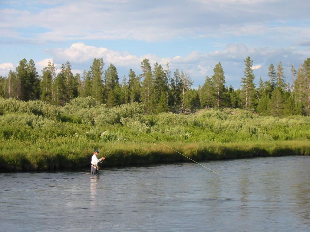
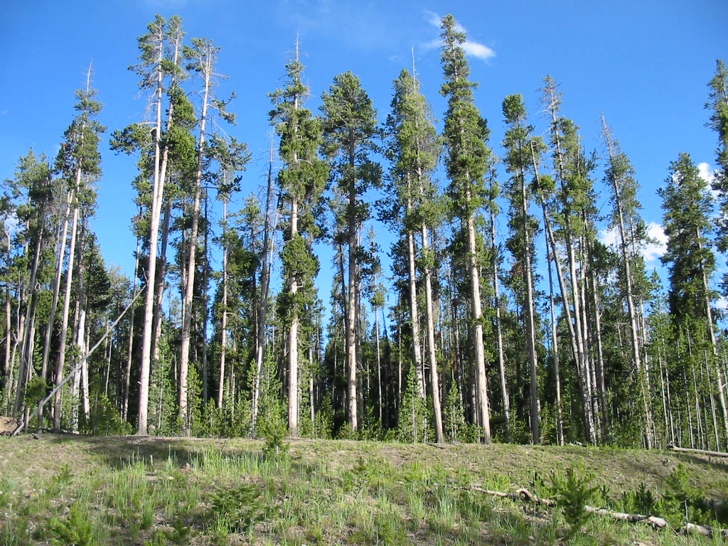
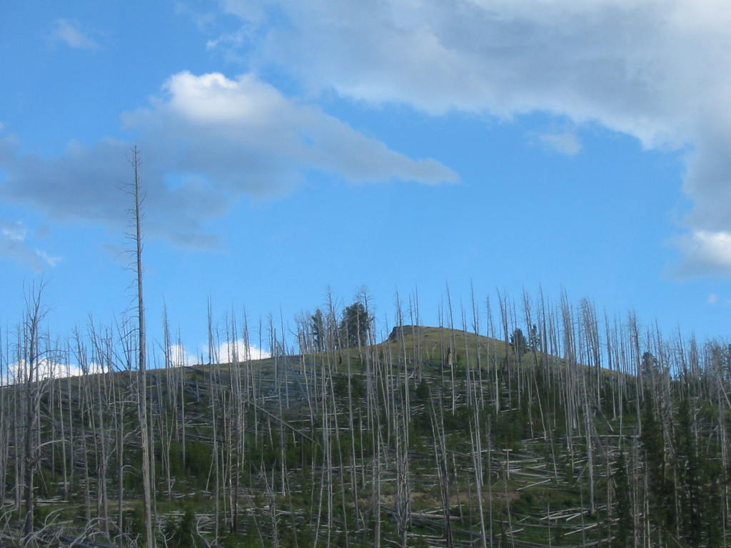
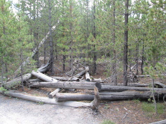
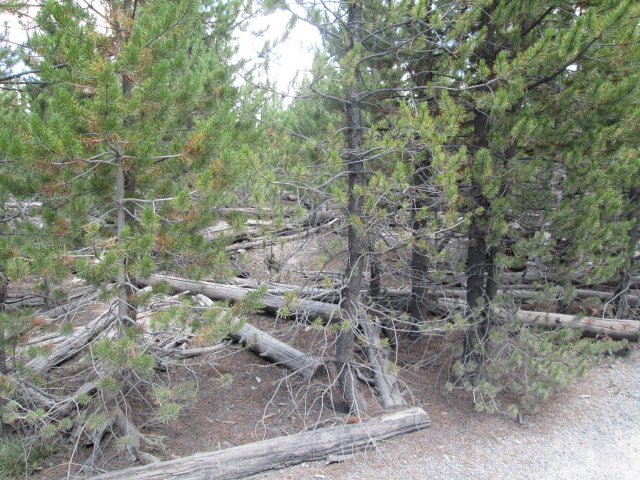
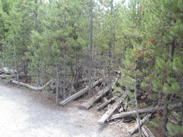
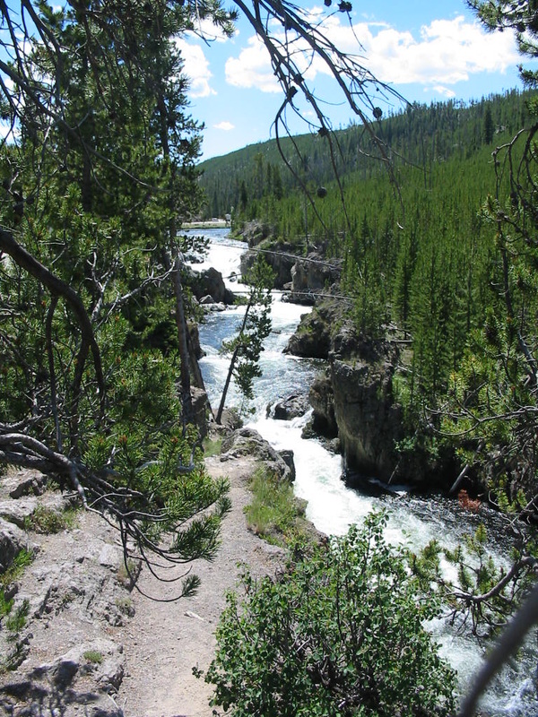
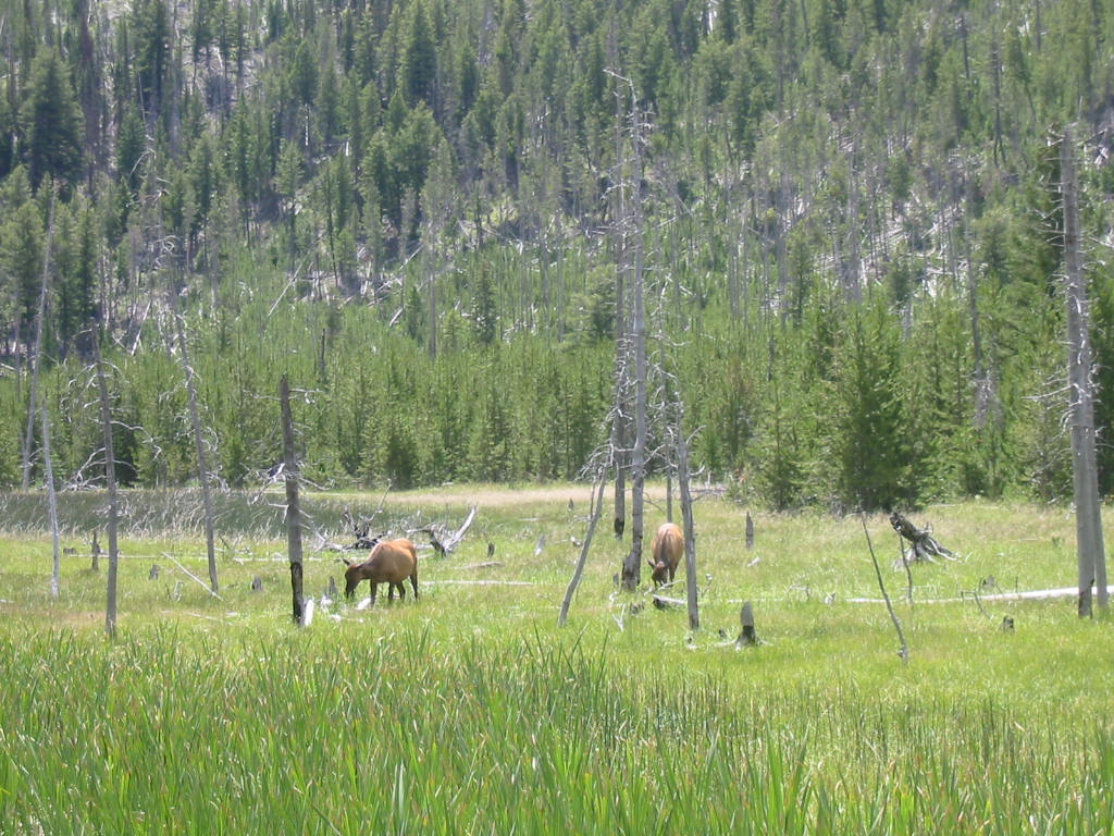
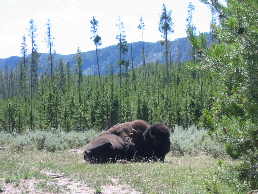
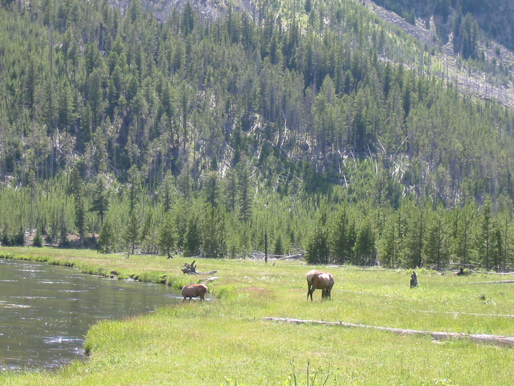
We chose a National Forest campground about 3 miles north of the town of West Yellowstone. There are about 70 sites on a first-come-first-served basis with enough daily turnover that we had no trouble getting a spot. Most campgrounds in the park are full. Here’s our site, and Chuck doing his ‘post-driving’ chore. (As usual, click on the photos for larger view.) Our site was about 50 yards from the Madison River (I told you to remember that name!) which is the same river we camped by the night before. See the RVs in the second photo. Much of the road into the Park follows the river as it meanders through the valley and many fly fishermen were fishing in it. Remember the statue of the fly fisherman in Ennis?? This is fly fishing country. This part of the Madison River is were trout come to spawn, while the lower part, where we were last night, is popular for fishing all year 'round. Our campground neighbor was a young man from Texas who comes here every summer to fish. We watched as he hooked a big trout that took him about 20 minutes to land. He estimated it about 20 inches, which is big for trout, and then let it go. Unfortunately, the picture of him holding the fish did not really show the fish at all. The town of West Yellowstone is the gateway to the Yellowstone National Park on the west side. It's in Montana, but the Wyoming border is crossed just after entering the park. During the 'season' it's a happening place, with lots of tourists and t-shirt shops, and lodging facilities. Lots of cute little cabins to rent. Yellowstone National Park is the first and largest of our national parks. We have to say that our parks are well run and cater to the enjoyment of visitors. Much of the park is covered by the Lodge Pole Pine tree. These trees are straight and tall, so named I think because they were used by Indians to construct their lodge buildings. I'm sure they are great for log cabins as well. A fire in 1980 burned a large part of the forest, and the dead trees are still standing or laying like 'pick-up sticks', scattered over the landscape. I'm told they are left there to replenish habitat, but the trees would take over 100 years to rot to compost. I think it is unsightly and wasteful, but what do I know?? They say the cones of these pines must be burned in fire to produce seedlings, so in the areas of the fire, little trees are too thick to walk through. The taller ones will thrive while the little ones will wither, probably in another generation. Rivers run through much of the park, and where there are rivers and mountains, there must be waterfalls. Wildlife is plentiful in the park. We were bear 'hunting' the whole time, but never did see one. You always know when you come upon an animal sighting. 
There were a couple of moose (is the plural 'meese'?), a lone buffalo every now and then, and elk. Here is the prize!! Yellowstone was formed by volcanic activity and today there are over 10,000 'thermal features' where steam and hot water bubble to the surface, sometimes offering various colors according to mineral content. The photo below is of the 'Artist's Paintpot'. 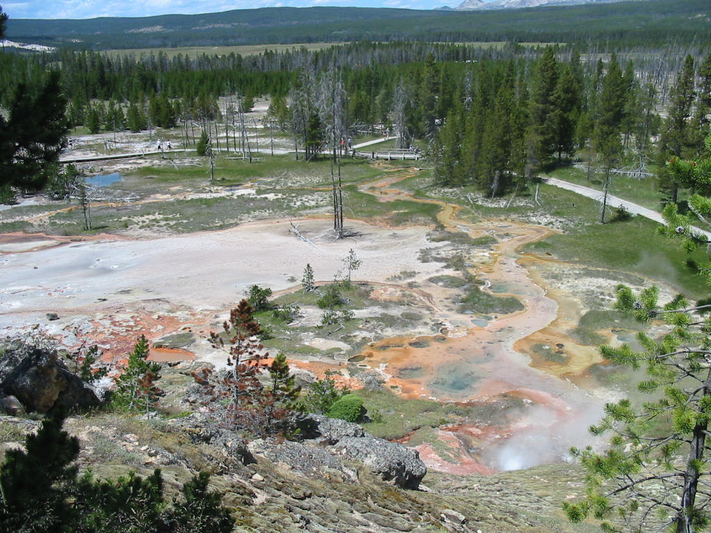
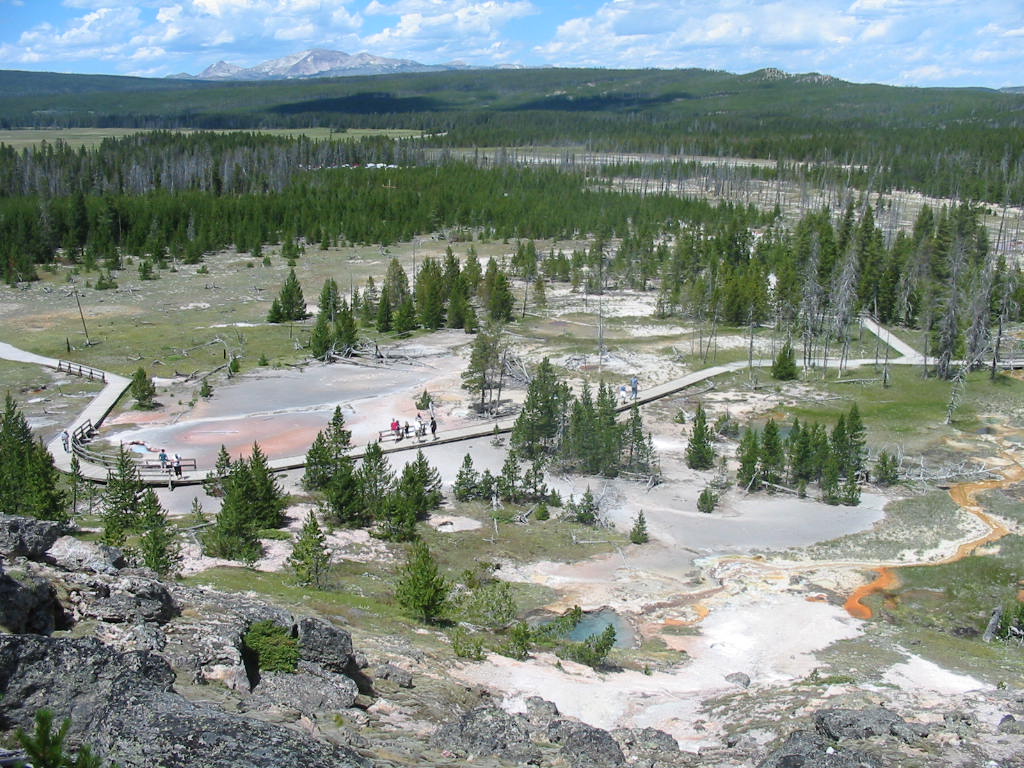
Here is a bubbling 'mud pit'. The center of the pit pulsated like something from a horror movie, and every now and then would spit little mud balls about 6 feet into the air. 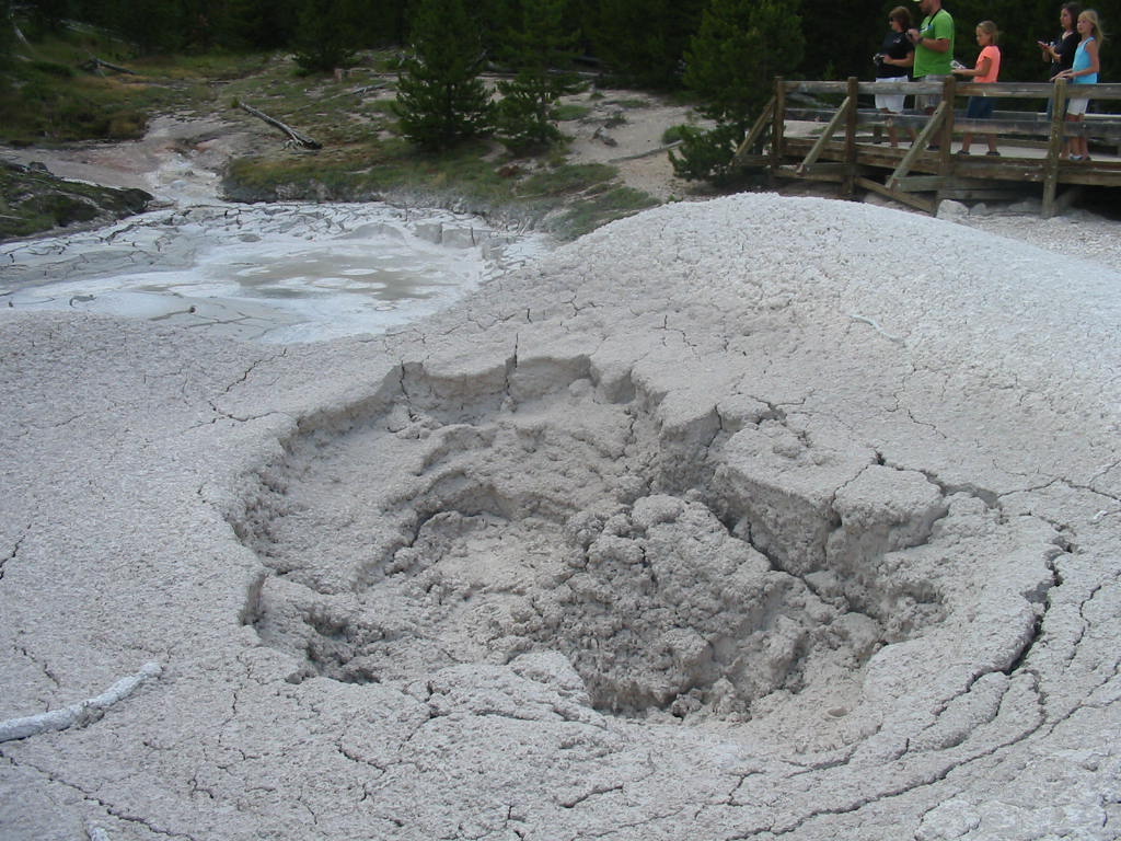
The area below is called the 'Porcelain Basin'. The white material is travertine, a form of limestone, deposited by the water coming up from the steam vents. 
There is an area called Mammoth Terraces where large amounts of travertine has been deposited over a hillside in a series of terraces. Here is the top. 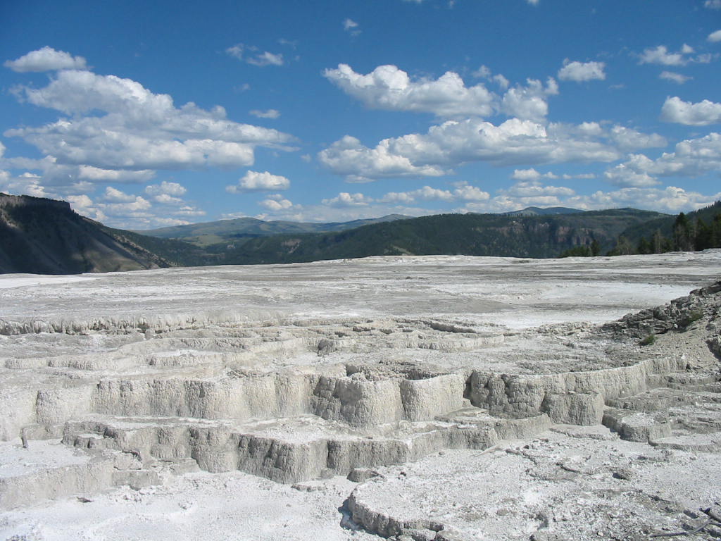
And here is the side view. 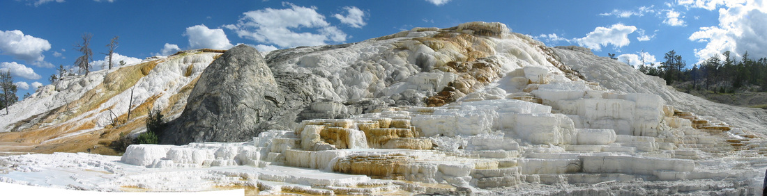
And the best part! 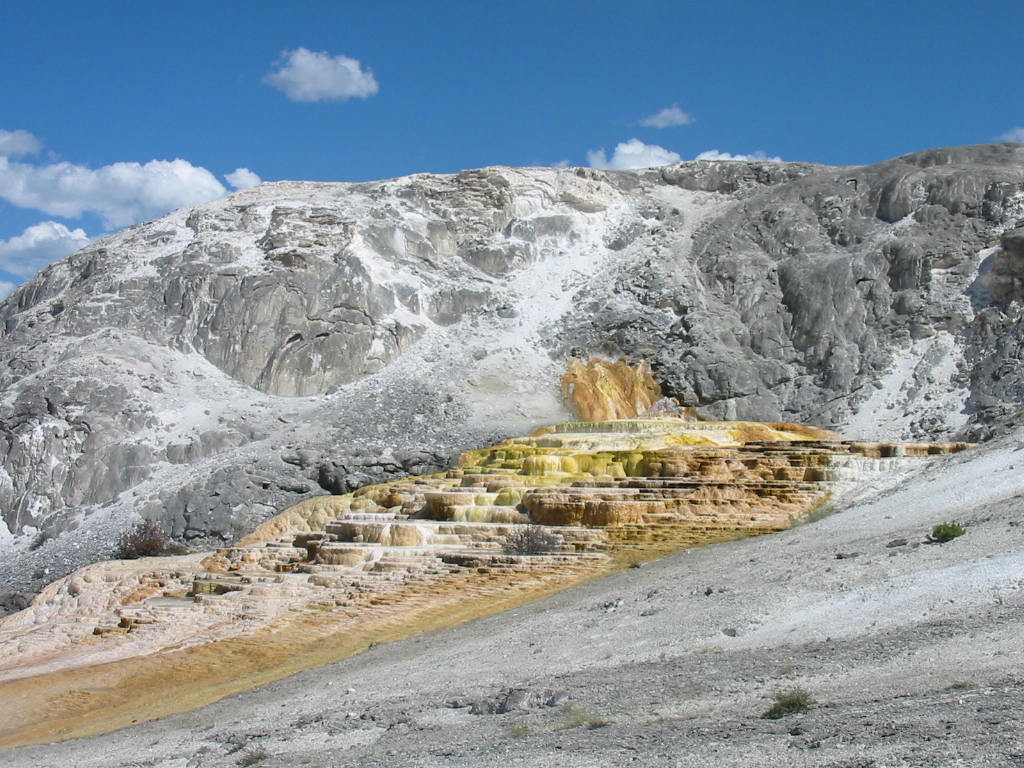
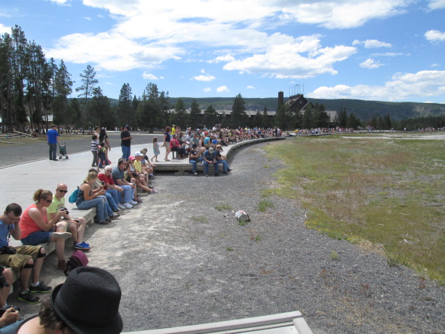
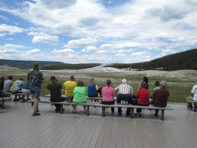
And what is a visit to Yellowstone without Old Faithful. This is the famous geyser that has been erupting regularly for who knows how long. The first people to see and report this activity were not believed, as they were mountain men known to be tellers of tall tales. It used to go off at hourly intervals, but this time has gradually lengthened to about 1 hour and twenty minutes. There were probably 1000 people there when we were. An eruption begins with a series of small bursts of water and steam about 6 feet in the air. 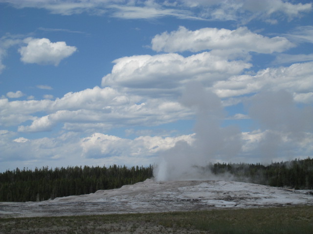
Then, 'Thar she blows'! Steam and water go about 60 feet in the air with a slight pulsation, and lasts about 30-45 seconds. (people have been waiting up to an hour for this!) 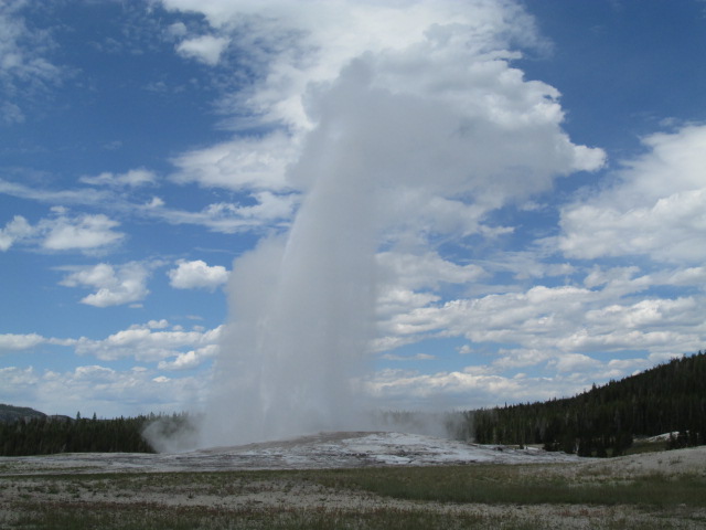
After this climactic event, we were ready to relax back at the camp. We sat out by the river and watched our young friend catch his fish. We made our plans for the next day, which included heading further south, heading for the great parks of eastern Utah. And it looks like we are headed back to hot weather. Stay tuned. 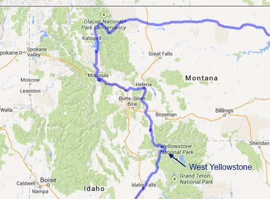
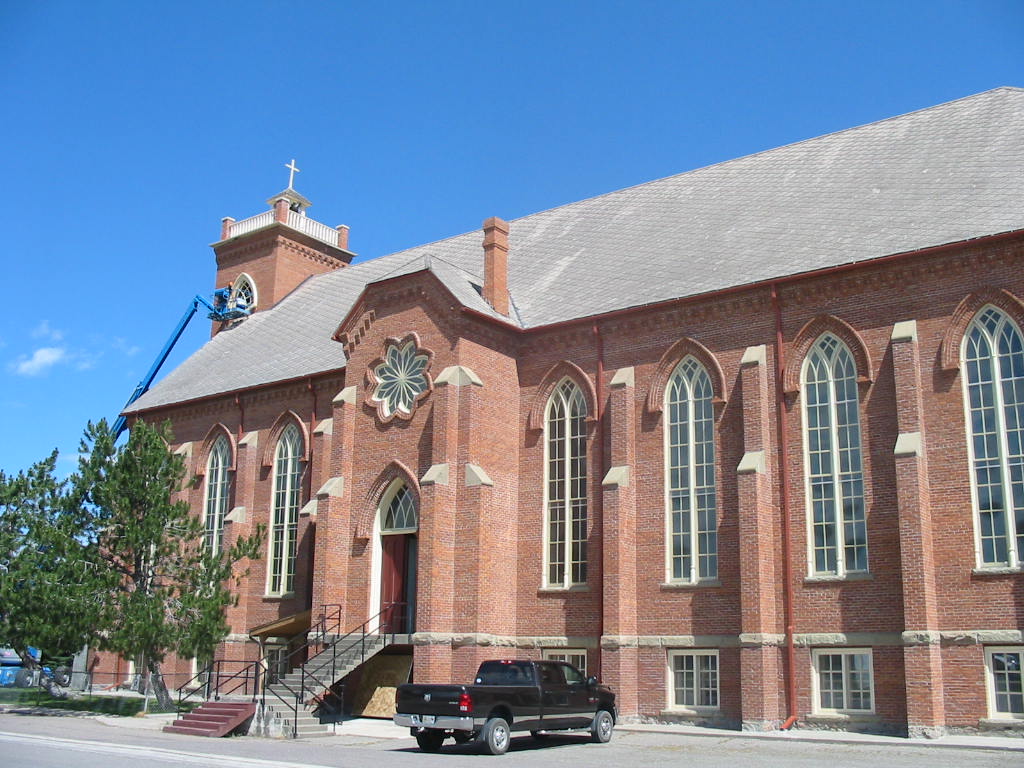
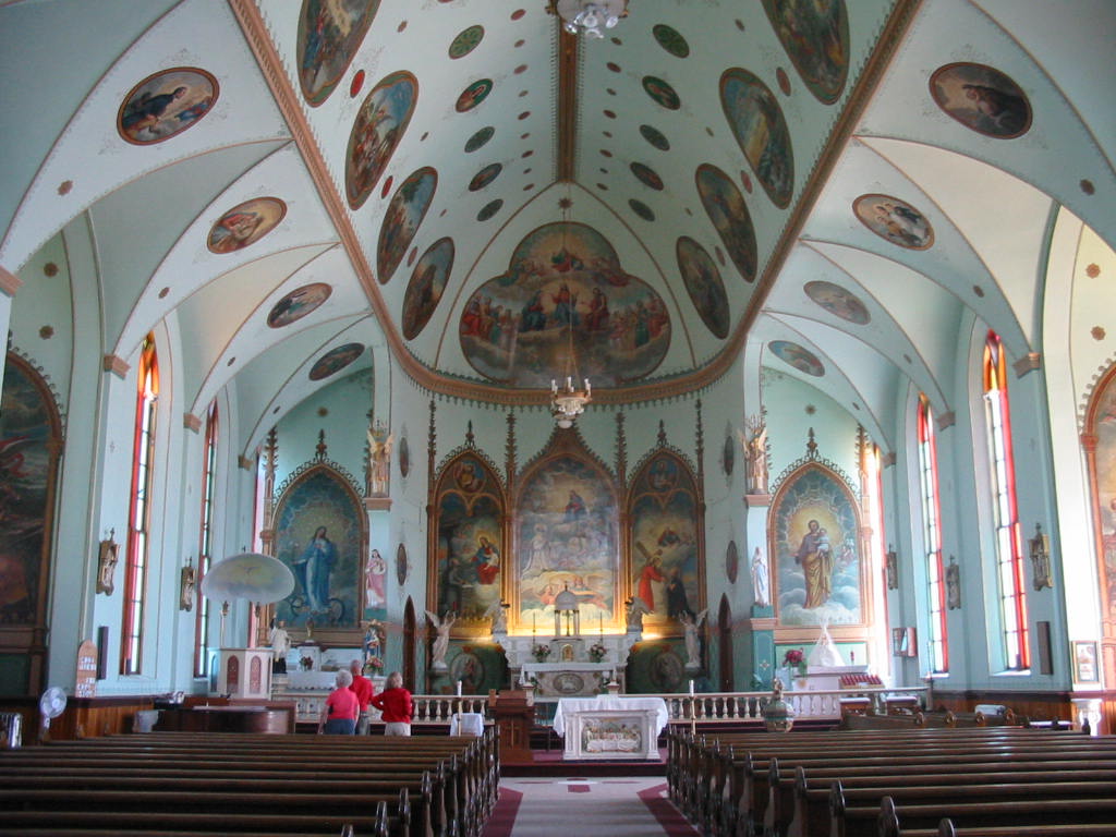
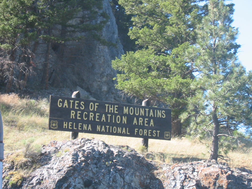
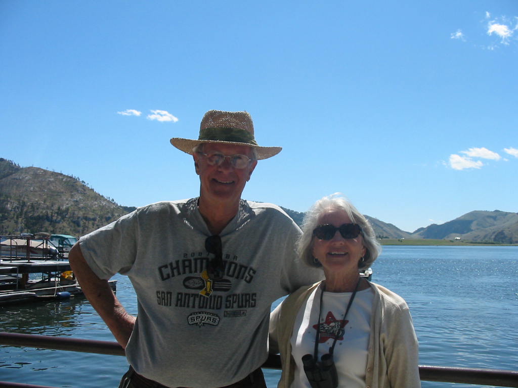
Our trip south from Glacier park included a stop in Polson, Montana, on the shores of Flathead Lake. We needed to pick up some parts we ordered that we had sent to a friend’s house. Plus having hookups and good wifi for the first time in 5 days was rejuvenating. The road south toward Helena, Montana, goes through small ‘tribal towns’. All of the land in this area still has heavy Indian influence in that tribes are organized and active and have some political authority. Anyway, the little towns are generally poor, and St. Ignacius was no different. But it does have a beautiful Catholic church, built in 1881. Helena is a nice town in one of the fertile valleys common to this area and is the state capitol of Montana. We explored the town and found the ‘Mansion District’ with stately old homes. A lot of money was made here in gold mining. The main reason for coming to Helena was to take a boat tour called Gates of the Mountains (how does she find these things?). This tour is on Lake Holter, formed by damming up the Missouri River. The Missouri River, starting in St. Louis, was the main ‘highway’ used by Lewis and Clark in their quest to find the Northwest Passage. More about that later. The tour boat held 70 people and was driven by an excellent tour guide. 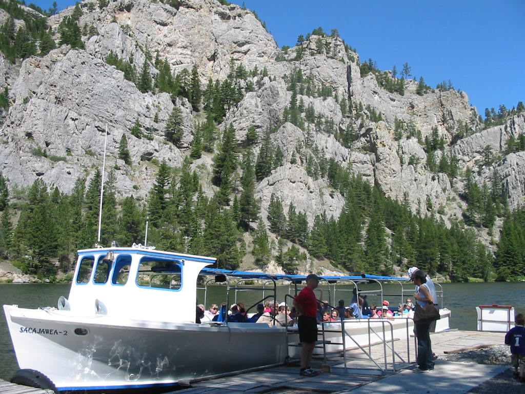
The tour begins in a smaller ‘upper lake’ and heads downriver through Great White Rock Canyon, which after several miles opens into the main lake. As the Lewis and Clark expedition (also called the Corps of Discovery) made their way up this river (a free flowing river, not a placid lake like this) the mountainous wall before them suddenly revealed the passage shown in the photo below. Quote from Lewis' journal. Hence the name. 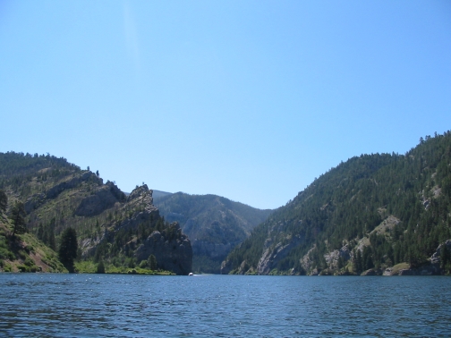
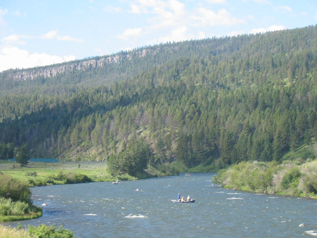
As we headed on south we went through the little town of Ennis, Montana. Just a little dot on the map, we didn’t expect much, but were surprised to find a thriving place with cute shops on the main street. There was also a statue of a fly fisherman. Later we came to understand the significance. We like to ‘boondock’, or camp in isolated places, and we found a Forest Service campground called Ruby Creek on the banks of the lower Madison River. Very peaceful but two miles of washboard road made it no fun getting there. A hunting trip by jeep ride into the hills beyond y The Madison (remember that name) is a scenic flowing river which attracts fishermen who apparently hire guides to guide the boat with oars floating downstream while two customers fish. We saw many going by. This was also the place to fix the generator, finally. No more boiling water for coffee. Yea! 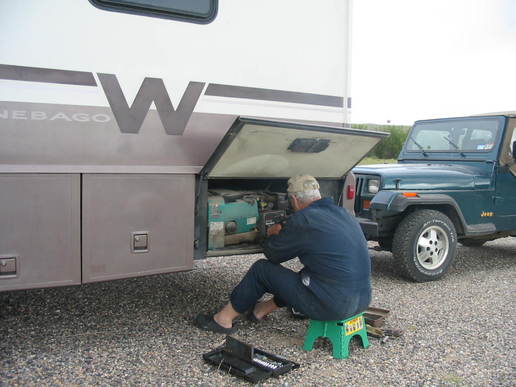
But we had to leave this great spot, endure the 2 miles of washboard road back to the highway, and continue on to Yellowstone National Park. Stay tuned.
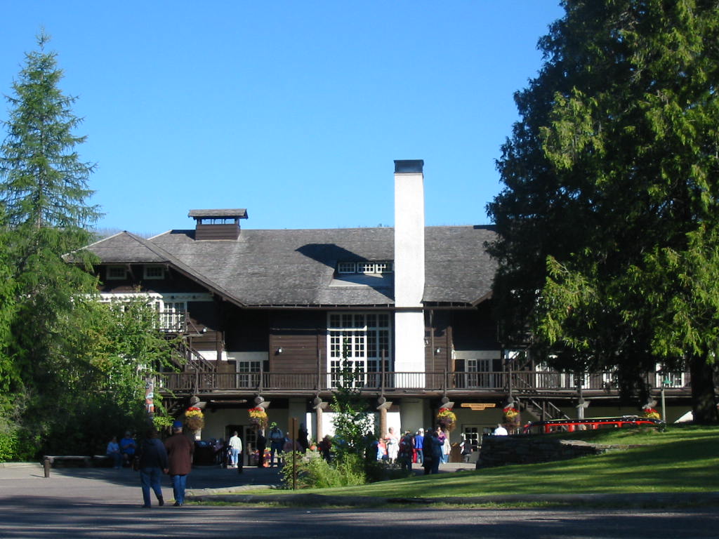
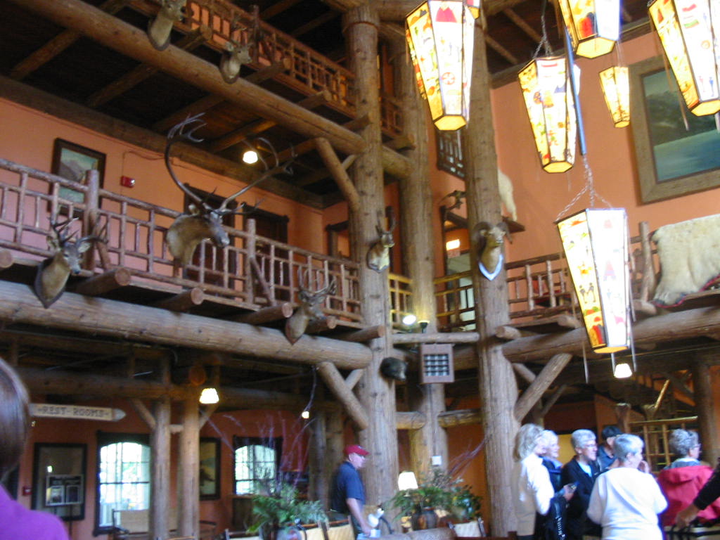
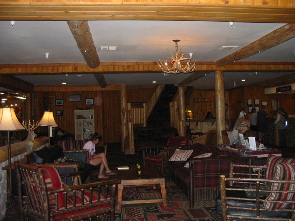
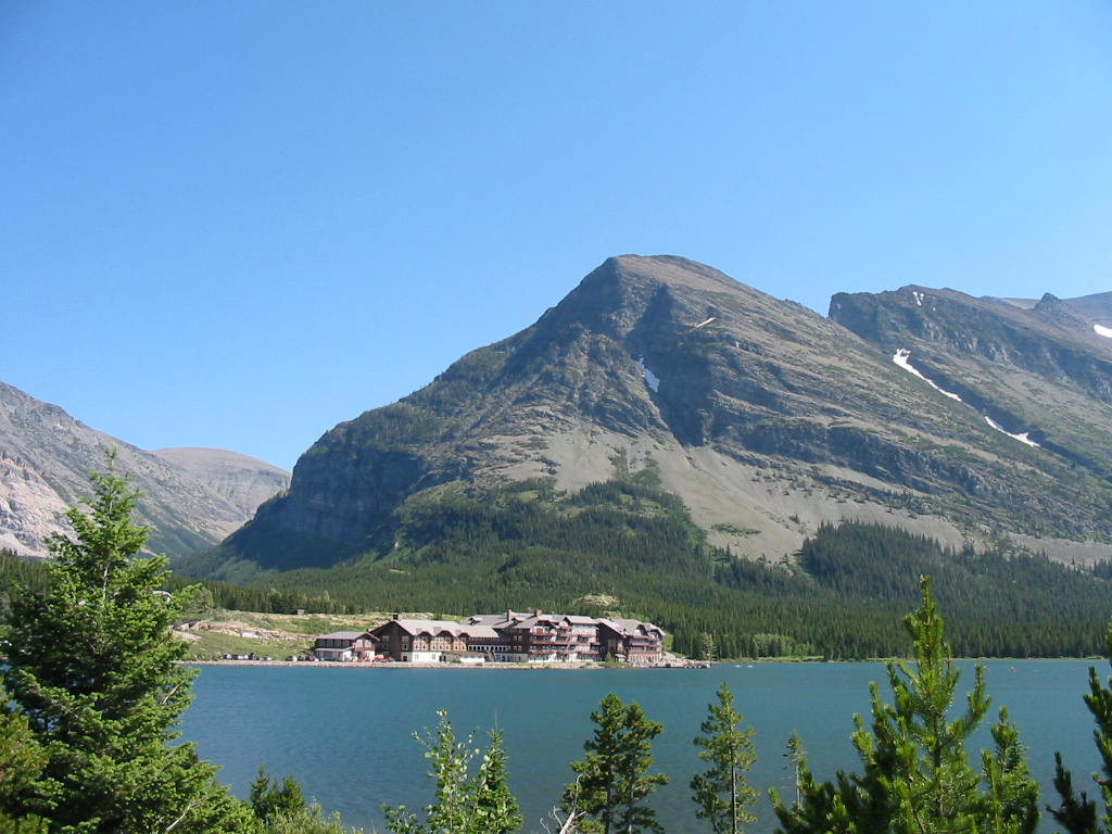
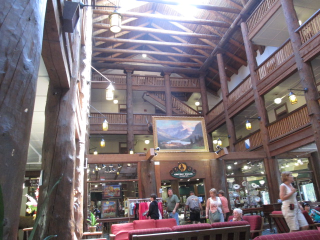
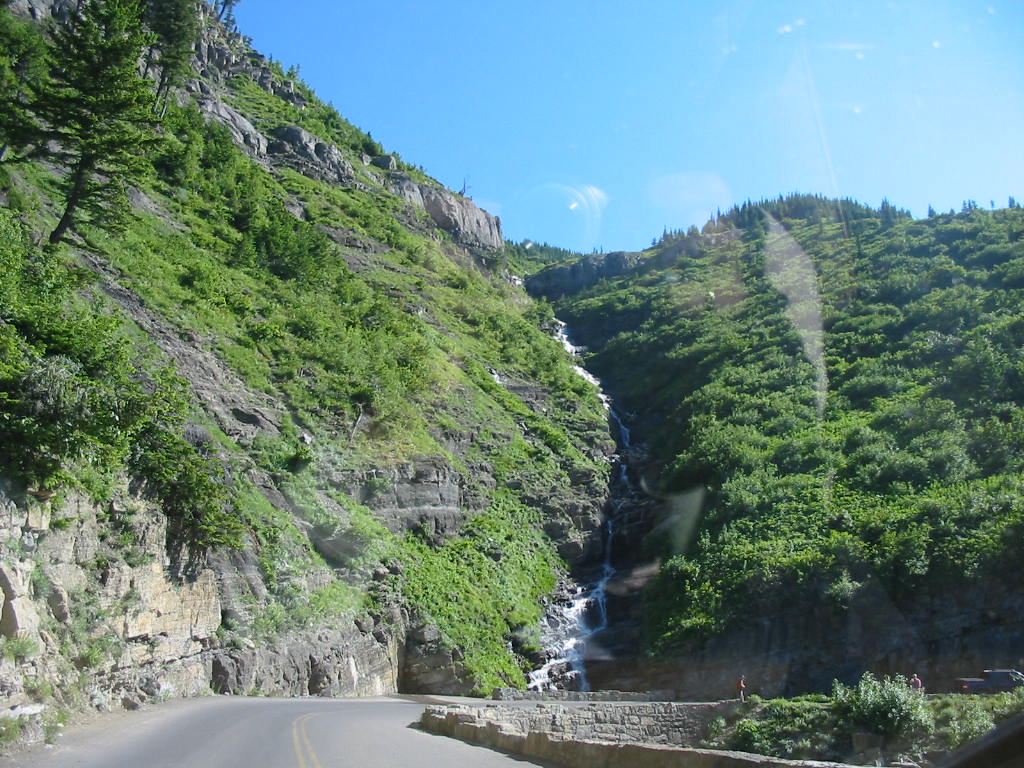
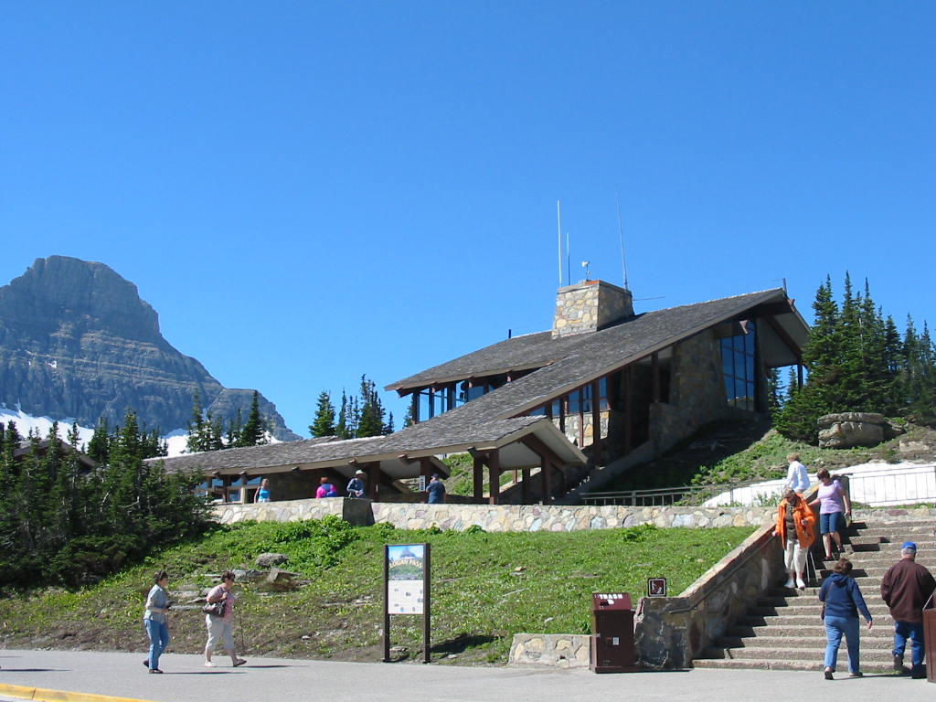
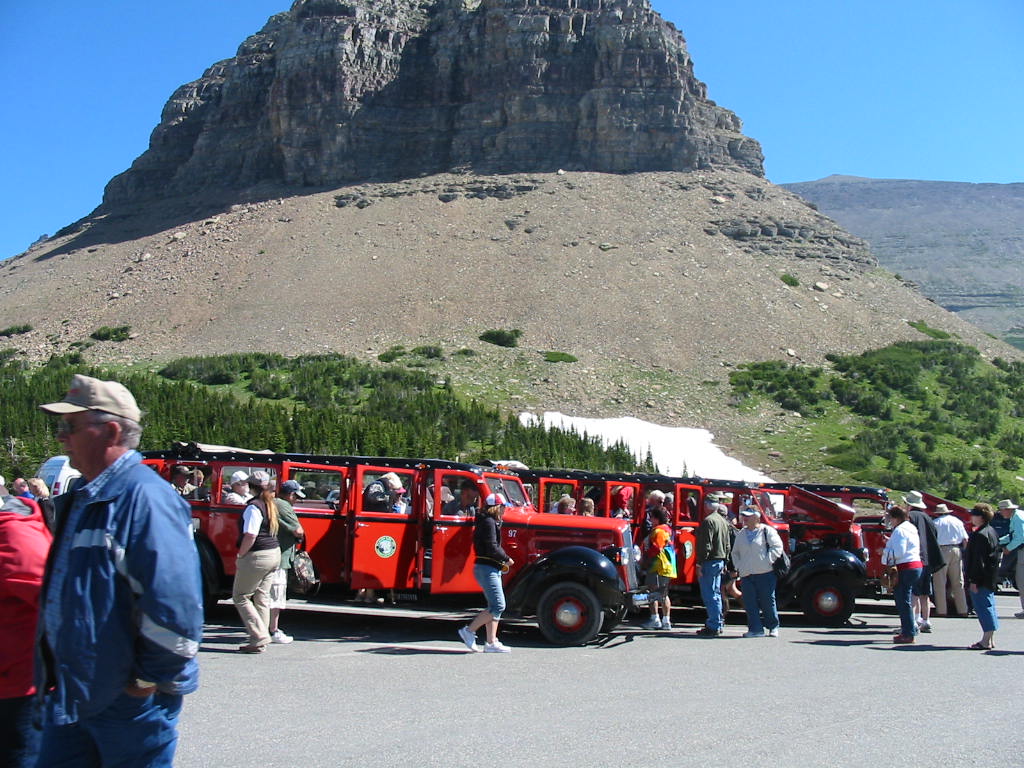
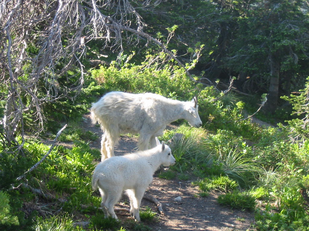
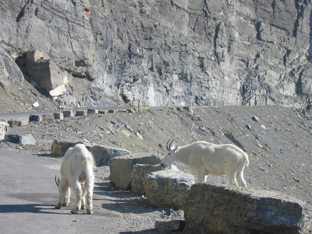
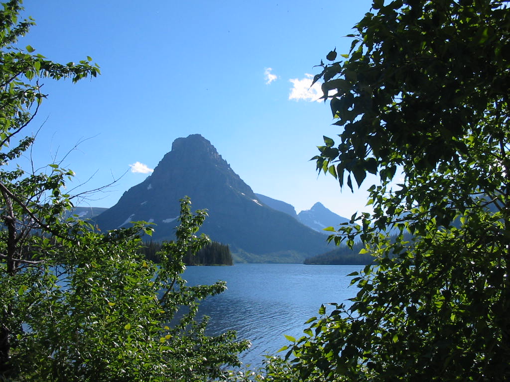
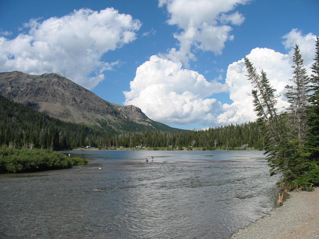
UPDATE BULLETIN!! We have since learned that the beautiful yellow fields are not sweet clover, but CANOLA! Who knew? (well the person that told us knew). Departing our campsite by Two Medicine Lake, across from Rising Wolf Mountain (dig those Indian names!), we took the southern loop (the only way) around to West Glacier and Apgar Village/campground. Lake McDonald is there, but the campground is across the road among tall trees. 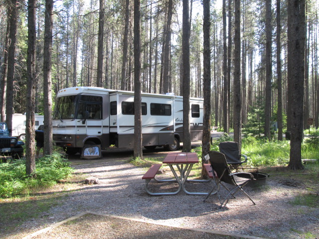 We managed to go kayaking on the lake but the big thing to do here is drive the Going-to-the Sun Road. This is a 50 mile road across the park, winding through lush valleys, along mountain sides and over the Continental Divide. 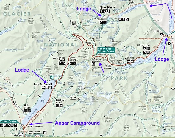 We left the Apgar Campground, made the transit to St. Mary, left the park, and went up and around, back in the park to Many Glacier lodge - another 20+ miles. Before we talk about the road, I will talk about the lodges. The last report described Glacier Park Lodge on the east side and it is the premier showcase. The three lodges we visited on this trip, all had the same inside appearance (heavy log construction), the same elegance, and all the attributes of a fine hotel. And all are served by the Red Bus Tours. McDonald Lodge: St. Mary Hotel Many Glacier Hotel 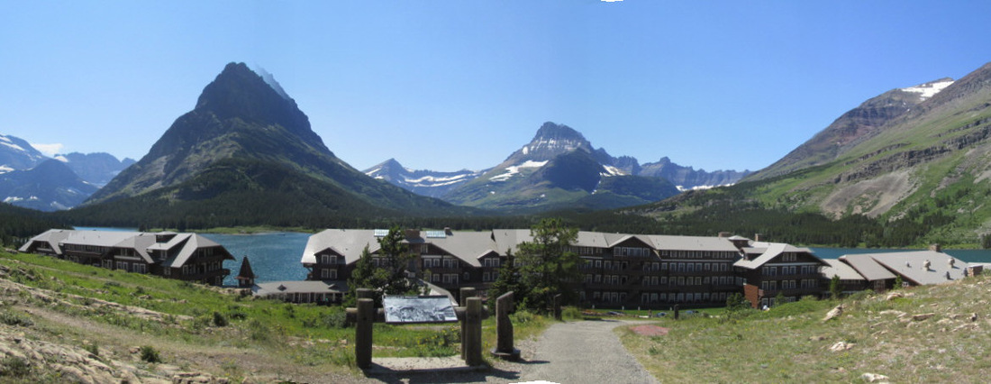 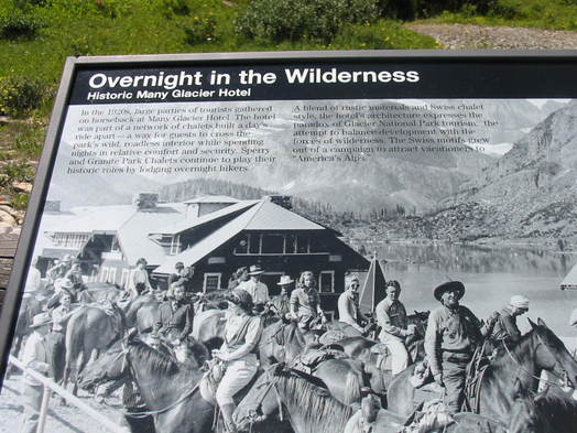 A photo taken in 1920 shows tourists who visit these lodges which are said to be placed one day's ride apart. Now ... about the Going to the Sun Road. Completed in 1933, the construction involved carving part of the road into the side of the mountain and building retaining walls, some of which are quite tall. We estimate that some parts are more that 2000 feet above the valley floor. Click the pictures for large view. 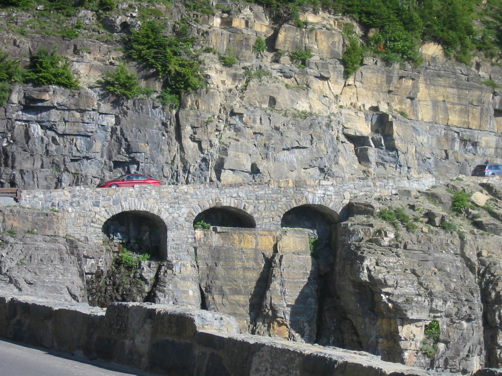 The Red Bus Tours were everywhere. When stopped, the people could stand up through the open top. This would be a good way to see everything with a narrative from the driver. In the photo below, traffic is stopped because the park people were going to blast some of the snow just above the road to prevent it coming down on the road unexpectedly. Didn't seem all that bad, but what do we know? They were having trouble with the wiring, so we were disappointed when they let us go on through while they got it fixed. 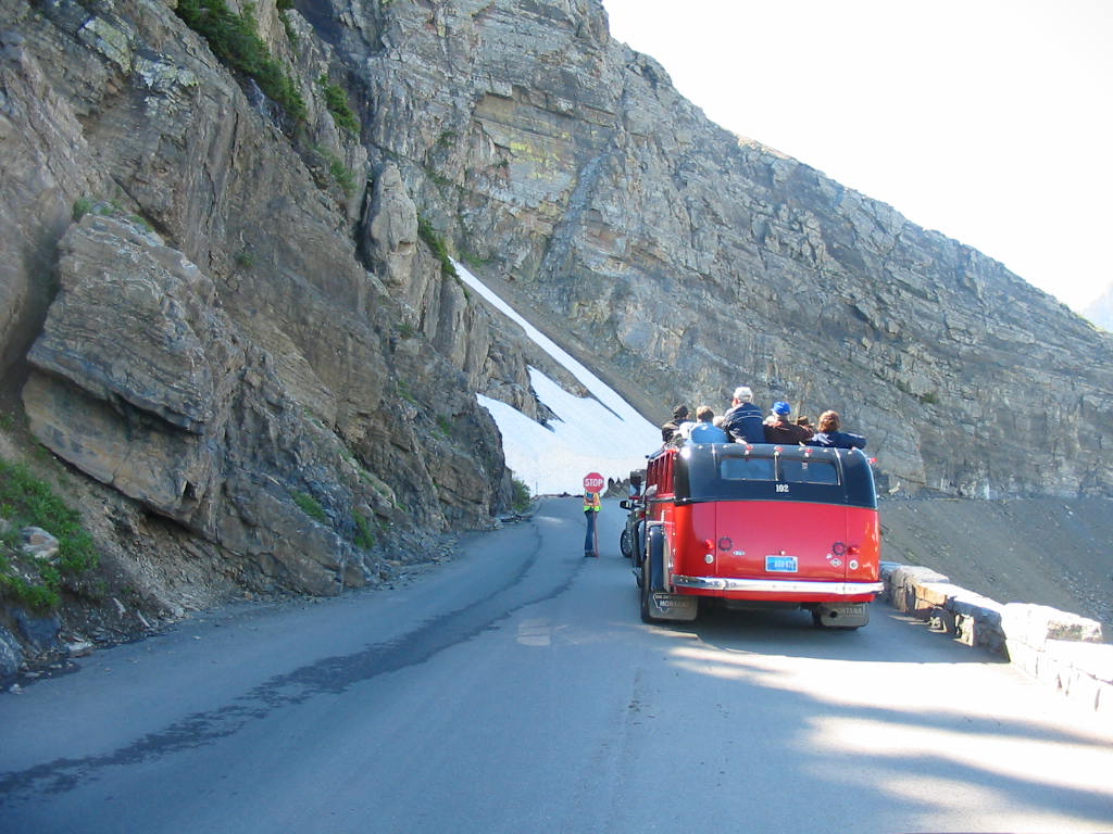 There is a hiking trail high above the road along the face of the mountain (!?!) and there was a 'trail guard' up there to stop any hikers from entering the blast area. When allowed to go on, we drove the short distance up the mountain to the Logan Pass Visitor Center on the Continental Divide (water on the east side runs eventually into the Atlantic Ocean, and on the west into the Pacific). Of course the Red Buses were there. While at Logan Pass we heard the BOOM. In fact we heard several booms as it echoed around the canyons. And finally some scenes from along the road. 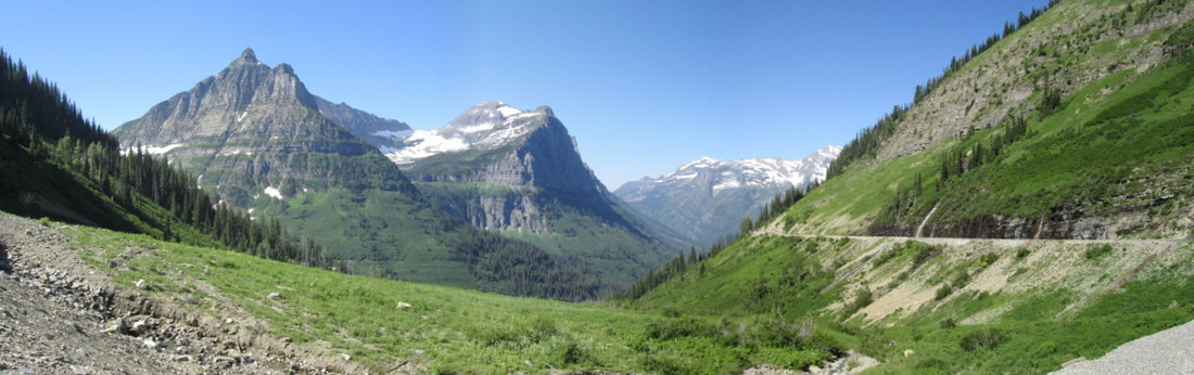 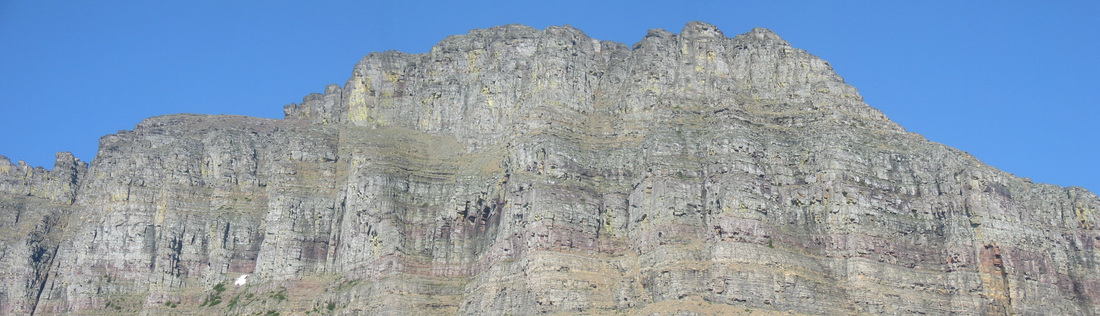 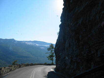 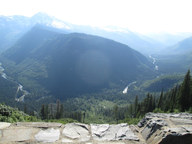 We were pretty pooped at the end of this day. We felt like we had been 'to the Sun' and back. Tomorrow we'll leave the park and head south. Not home, just south. But this is as far from home as we will get on this trip. We have been 5 nights without hookups, and a broken generator. We have really been roughing it - boiling water on the stove to make coffee!!
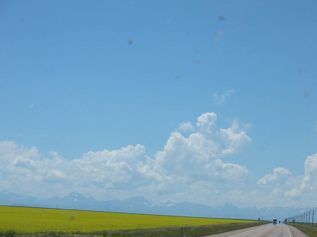
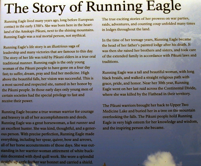
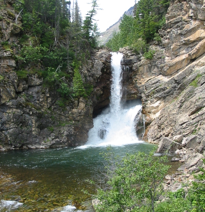
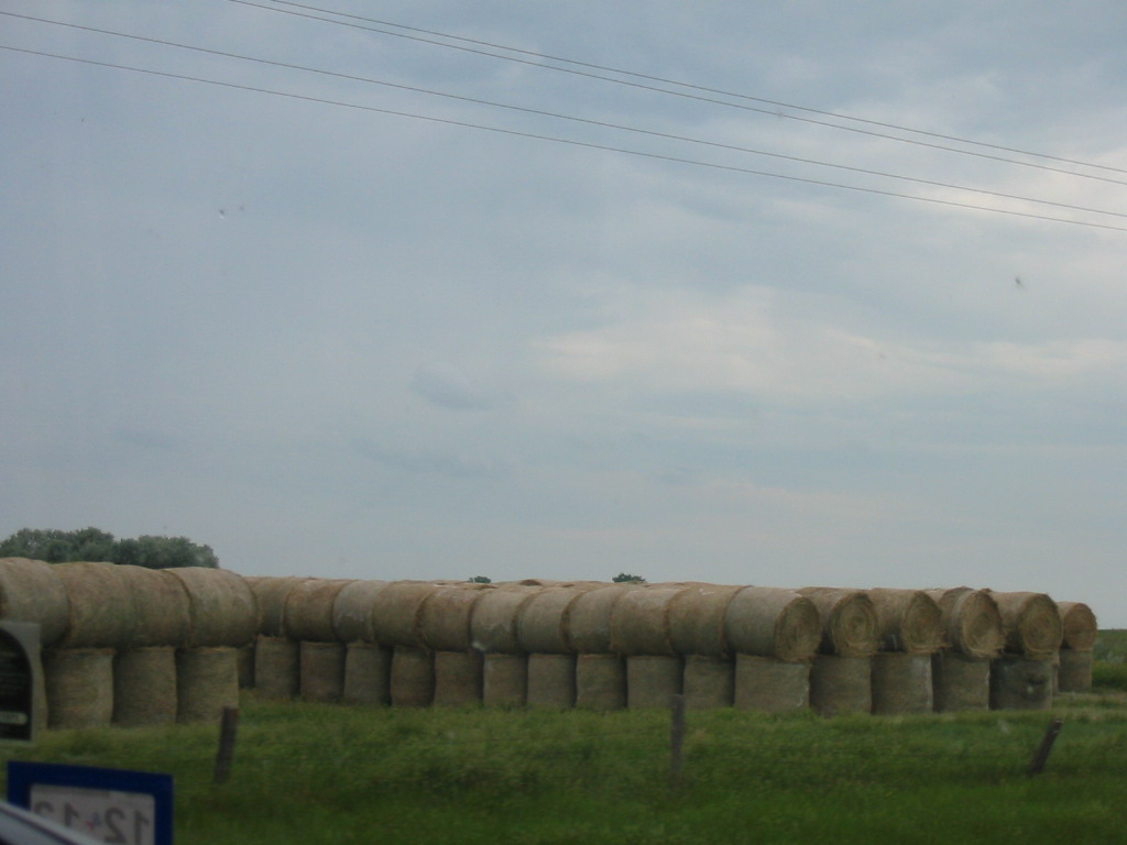
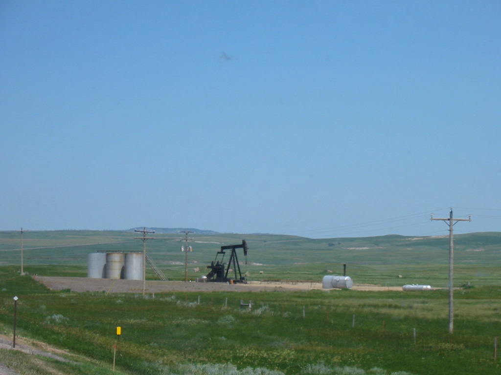
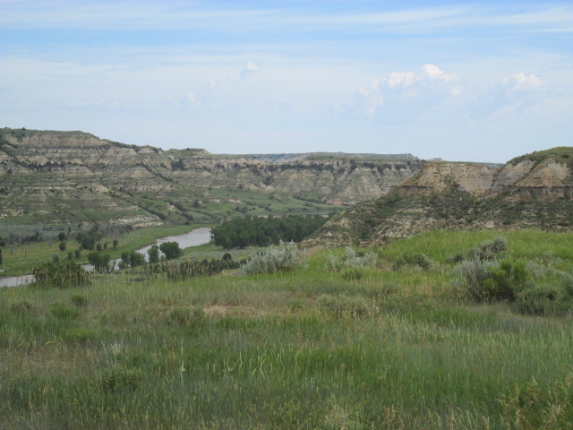
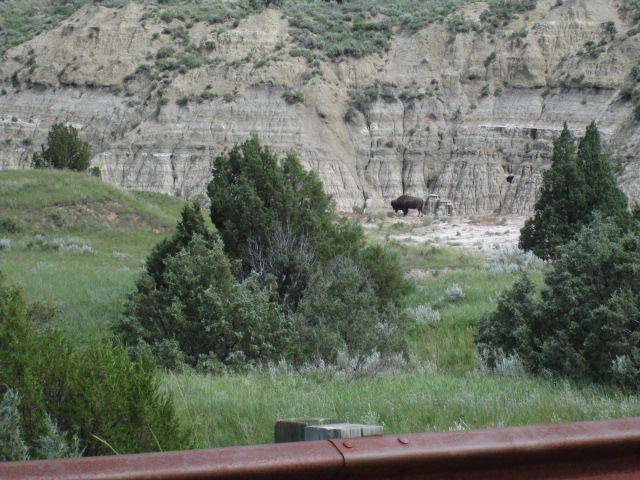
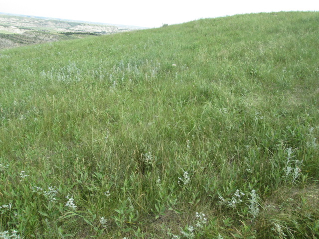
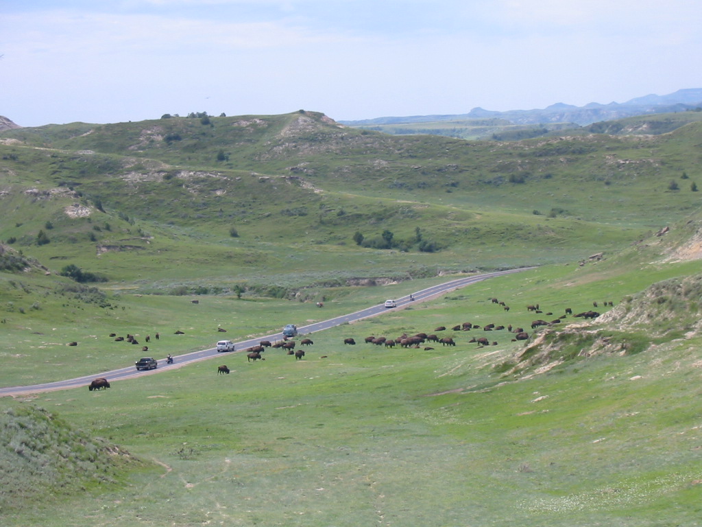
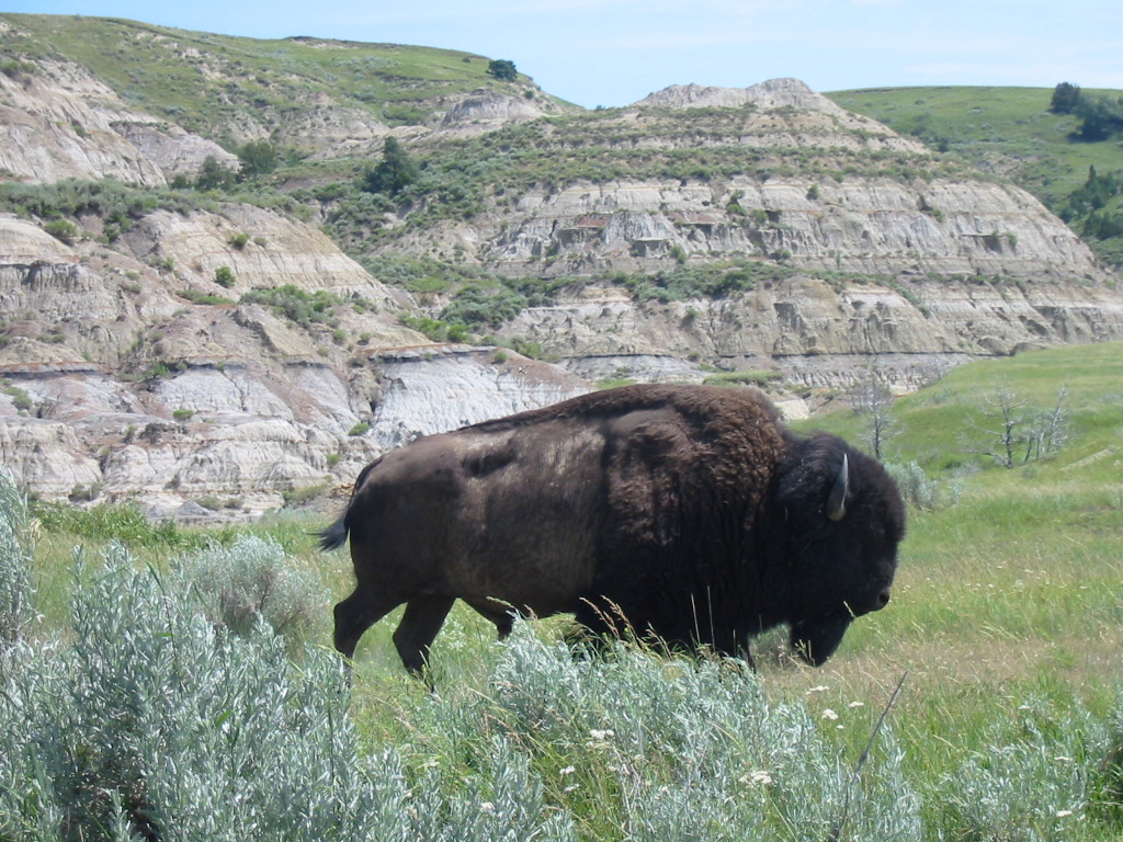
Anyway, stay tuned. Some leftover notes about Medora, North Dakota: We had a little rainstorm come by on our last evening in Medora. It was time for the Pitchfork Steak Fondue up on the mountain, but we knew they had a covered area to cook and eat, but the rain quit in time for the Musical. People were coming into our campground, maneuvering fifth wheels and trailers into campsites and getting set up, only to ‘un-set’ and leave before 8am. Where’s the Walmart when you need one? (just pull in and sleep and move on).  See the guy in the cowboy hat and duster directing him in? This campground had us packed in pretty tight. Finally Medora is a nice little tourist town with two or three streets with tasteful shops, and surprisingly lots of tourists wandering around (how does Mary Lou find these places?). So plan to stop by next time you are in the neighborhood – you’ll enjoy it.  The route we took across Montana was long and straight. The first part was more of the rolling hills, cultivated for miles for a far as the eye can see on all sides. It must get lonely riding that farm equipment over all those miles away from everything. I think they have air conditioning, stereo, gps, and all the comforts of home, although we saw some open tractors at work. We saw some bright yellow fields, which a local person allowed as how they might be sweet clover, a feed crop. NOTE: we have been marvelling about how lush and green the rolling hills are, but now we find out that it's unseasonalbly green for this time of year and normally everything would be brown. Kinda burst our bubble about this land.  First glimpse of the Rocky Mountains. The little town of East Glacier Lake is like the gateway to the part of Glacier Park on the east side of the Rockies. Even though it’s a little town, there were plenty of people there, mostly at Glacier Lodge. Sometime back, we saw a TV show about the grand lodges in the National Parks and this one must have been in it.  Built in 1912 (101 years ago) by the Great Northern Railway, it features immense timbers that were probably 500 to 800 years old when cut and all of them retain their bark (they are so uniform, I thought they might be fake). There are 60 of them, all 36 to 42 inches in diameter and 40 feet long. Posts and railings are also various size timbers. There were a lot of people in the lobby, many of whom were going across the road to the Amtrak Station to ride on to someplace else. A neat idea. Since 1914 the National Park service has commissioned companies to provide tours of the parks. The vehicles have evolved into what is used in this park, the Red Bus Tours. The vehicles are 1937 vintage which were restored by Ford Motor Company. Notice the removable canvas top.  We moved on up the road to Two Medicine campground on the bank of Two Medicine River. It’s a National Park campground with no hookups, but a beautiful spot. We were just across the road from a ‘stream’ of the river connecting two lakes in the shadow of Rising Wolf peak. The water is just below the windshield in the photo. 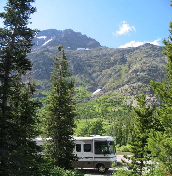 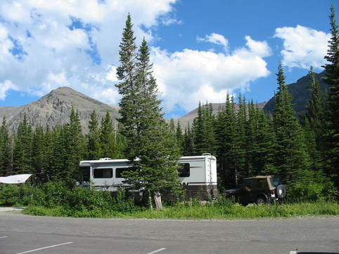 We were nestled in the trees, really a neat spot. Pictures of the upper lake, the stream, and the lower lake. We took a couple of hike to see waterfalls (you’ve seen one, you’ve seen ‘em all!). The best one was Running Eagle Falls. The photo on the right tells the true (not legend) story of the Indian girl who was rather famous among her people. Click to enlarge if you are interested (it’s pretty interesting!). We’ve had a couple of rain showers here, but they didn’t interfere with what we wanted to do, except for cutting short the Ranger talk about bears. Tomorrow we’ll move over to west Glacier for more excitement (!?!) Stay Tuned. 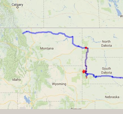 We left Sturgis late morning and made it to Medora, North Dakota in time for their 4th of July parade. We didn't know what to do in North Dakota and thought about going to Fargo, being the most well known place there. But couldn't find anything of interest there, so we decided to 'forgo Fargo' <Chuckle>. Driving north into North Dakota continued the rolling, grass-covered landscape. There are long stretches of perfectly straight highway, and bales and bales of hay. We also began to notice oil drilling activity. Click the pictures to enlarge. 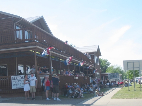 Medora is a quaint little town (aren't they all?) along side a bluff, with long, long coal trains going through. Here are people lined up for the parade. The main attraction here in Medora is a musical that is staged in an amphitheater on a hillside with a gorgeous view of the town in the valley and hills all around. That was the best thing about the whole show, although the singers were excellent.  Here is a view of the stage set and seating area.  Sitting in the cool evening seeing the shadows fall over the distant landscape was almost a spiritual experience. The location of this theater is on top of a nearby mountain. Also up there, along with the usual gift shop, is an outdoor (covered) restaurant which is only open before the musical performances. The main entree is 'Pitchfork Steak Fondue'. We didn't get there in time to see them do it, but steaks are put on pitchfork tines and held in big vats of hot oil to cook. Here are the vats and pitchforks.  The next morning we left to take the scenic drive (never pass up a scenic drive!)around Theodore Roosevelt National Park. The entrance to the park is in Medora so it's very convenient. The Little Missouri River flows through the park, but much of the park is North Dakota Badlands. These badlands don't seem as 'bad' as the South Dakota Badlands (note the buffalo in the 3rd picture). We made a short climb and the view was spectacular. This area is National Grassland (as well as much of South Dakota) and it's easy to visualize the vast herds of buffalo that used to roam these plains. Here's some grass. And we saw more buffalo. They don't seem to be bothered by cars.  One thing different we saw here was wild horses. There were several herds of them, and when close to the road, also were not bothered by cars. 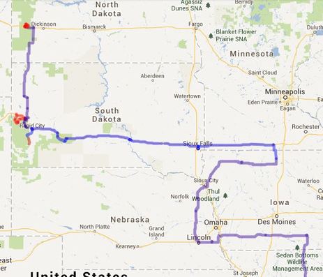 Tomorrow we head west across the vast expanse of Montana (it's only 2/3 of the way across Texas) heading to Glacier Park in the northwest corner. We may be in wilderness (bear country) with limited internet, so you may not hear from us for awhile. But ... stay tuned.
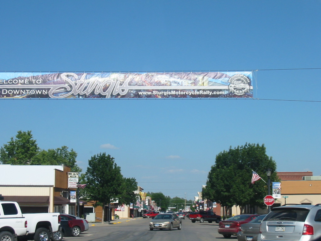
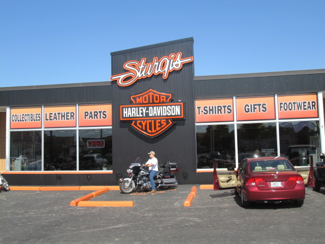
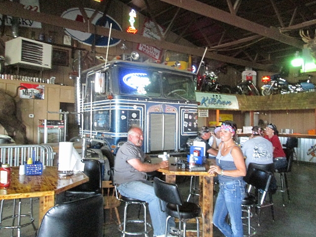
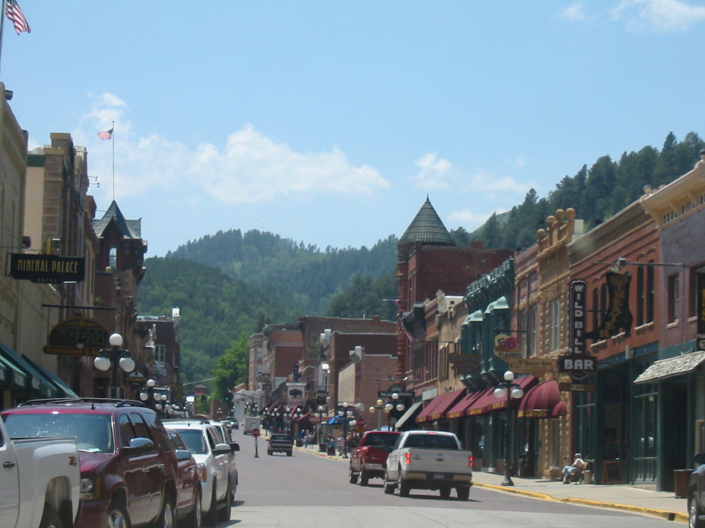
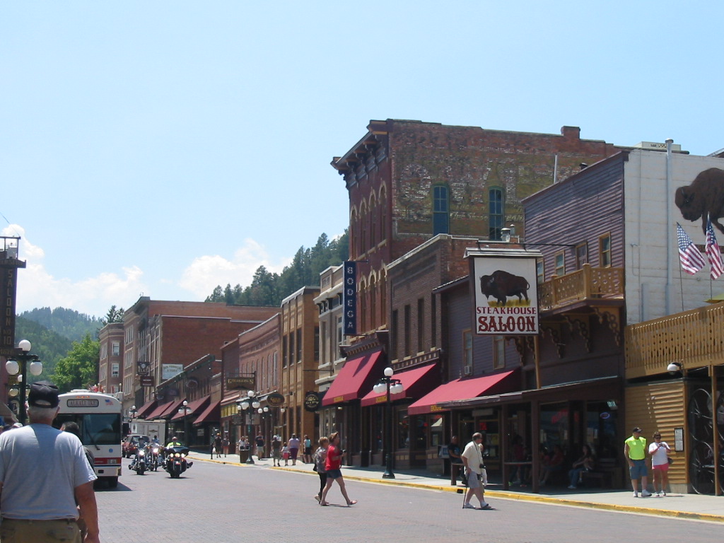
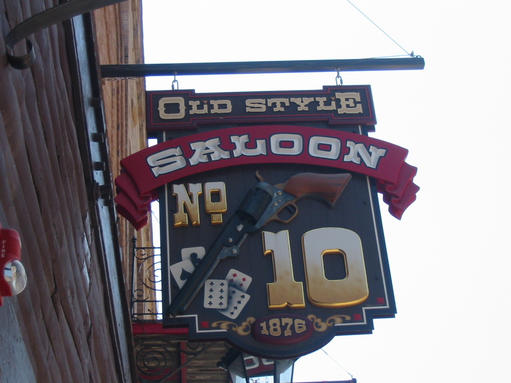
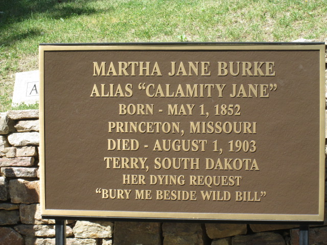
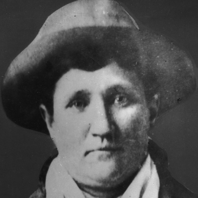
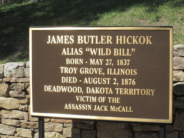
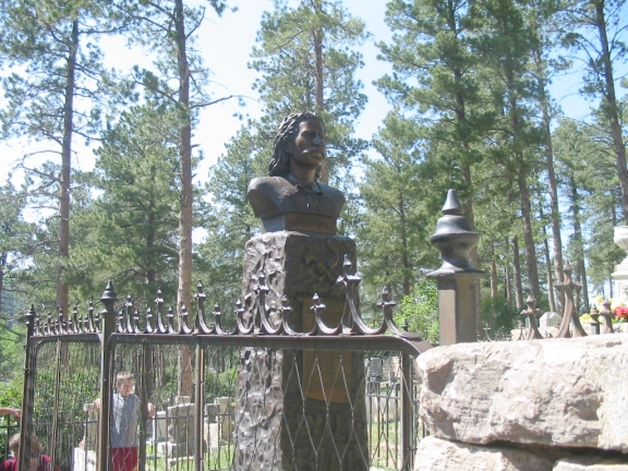
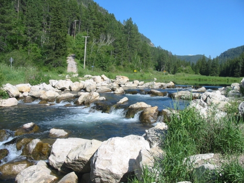
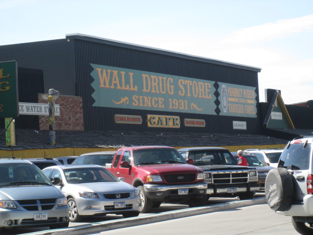
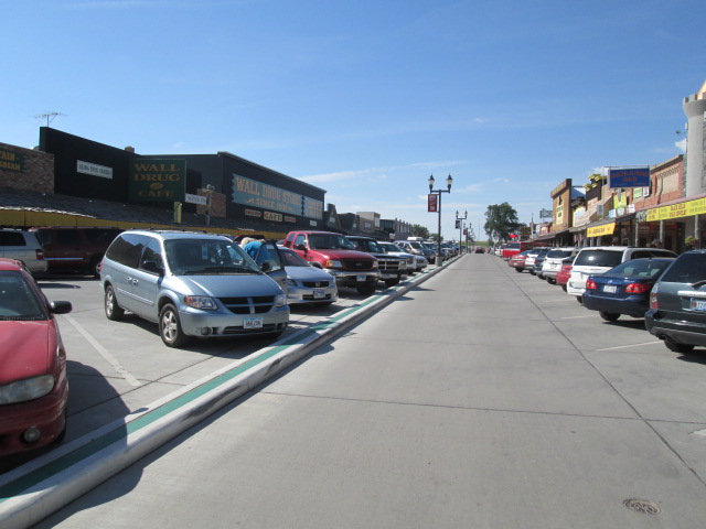
Sturgis, SD, known for the motorcycle rallies, is another small town in the rolling grasslands, but on the edge of the Black Hills. The motorcycle connection began in 1936 when Clarence 'Pappy' Hoel purchased an Indian Motorcycle franchise and the Jackpine Gypsies Motorcycle Club was formed (and you thought it had something to do with Harleys!). The first rally was held in 1938 with a race with 9 participants and a few spectators. Over the years the rally grew until in the year 2000 the estimated attendance was around 600,000. 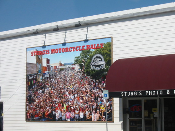 I don't know what year this was taken, but there are a lot of folks! The town of Sturgis is just your typical small mid-west town, except for all the biker bars with their outdoor patios. Most are in a 'holding' mode, waiting for the annual rally. We went to the Full Throttle Saloon 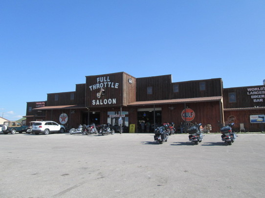 As you can see by the sign on the right, this is billed as the 'World's Largest Biker Bar'. We went right in. Click on the images below to enlarge. And more party space out back. 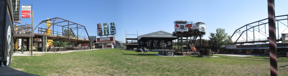 We dropped in to the Chamber of Commerce and Visitor Center and found the most delightful young lady there. She was so expressive and fun that we went back the next morning to have coffee with her and Ernie, an old guy who drops in every morning for his coffee. 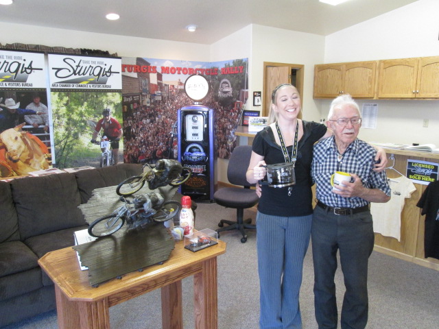 Just a few miles east of Sturgis is Fort Meade, established in 1878 by units of the 1st and 11th Infantry and the reorganized 7th Cavalry (following Custer's defeat at the Little Big Horn) to protect settlers and gold seekers. It was here that the 'Star Spangled Banner first became the official music for the military retreat ceremony, long before it became the National Anthem in 1931 (the wikipedia account does not mention this). Here is the parade ground. 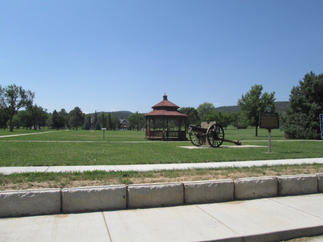 Movie versions of the mounted cavalry in those days show the soldiers riding up on their horses to save the day, and while that may have happened some, we don't realize that movement of army units involved much more than that. The photo below shows a photo of Custer's wagon train on a mission to find a site for a fort in the area that is now Ft. Meade. And since troops had to go on missions into Wyoming and other areas, they had to have a support force of supply wagons, etc. More than what meets the eye! 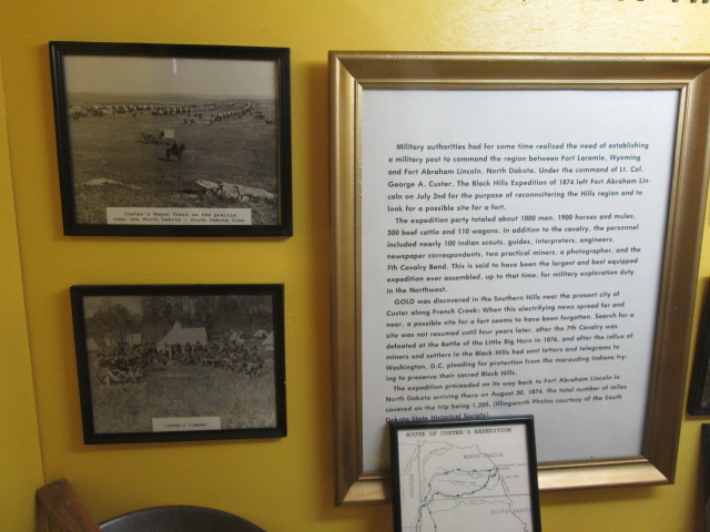 After our coffee with our cute friend, Jennifer, at the Chamber of Commerce, we drove the few miles to the town of Deadwood, in Deadwood Gulch. Deadwood is famous in fact and legend. Born of the gold rush in the Black Hills, it was a rough and tumble town. Older readers may recall Wild Bill Hickok and Calamity Jane. They were real people with connections to Deadwood. Wild Bill was not an outlaw, in fact he was a peace officer on occasion, and was fast and deadly with a gun. He was also a gambler and that's what brought him to Deadwood. While playing poker in the Saloon 10, he was shot in the head by a spectator named Jack McCall. Legend has it that he was holding the two black aces and the two black 8's (plus the 9 of diamonds) and that is now known as the 'Dead Man's Hand'. Calamity Jane was also rather wild, and was a friend of Wild Bill but nothing more. Her rough-riding, gun-slinging reputation is probably the reason she acquired the nickname Calamity Jane. One popular belief is that men were said to be "courting calamity" if they offended her. (See Calamity Jane). After her death, the newspaper reported that 10,000 people attended her funeral, but not one mourner. She and Wild Bill are buried in the cemetery overlooking the town. A short drive from Deadwood is the town of Lead, pronounced Lead, not Lead. OK it's pronounced 'leed'. Another product of the gold rush, it is (or was) home to Homestake Mining Company which operated a large open cut mine. 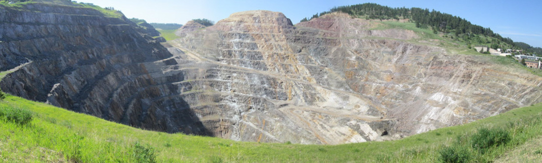 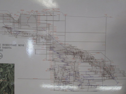 The diagram at right gives an idea of all the shafts and tunnels below the open cut shown at upper left. The mine is 8000 feet deep with 370 miles of tunnels. Homestead closed the mine in 2000 and it was converted into a deep underground laboratory where scientists do experiments to explore the properties of subatomic particles called neutrinos. They are also looking for a mysterious substance called 'dark matter'. They say it's the dominant form of matter in the universe, but remains undetected (if they know it's so dominant, how is it that it's undetected? What's the 'matter' with them??) If you want to know more, look it up! From Lead we took the long way home via a scenic drive through Spearfish Canyon. 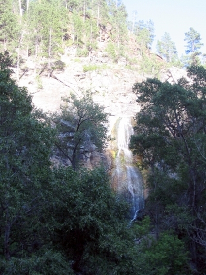 Here is Spearfish Falls Which flows into Spearfish Creek 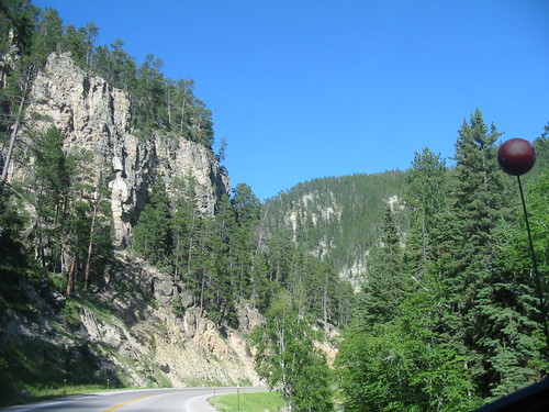 That runs through Spearfish Canyon. To summarize, Spearfish Falls flows into Spearfish Creek, following the course of Spearfish Canyon and Spearfish Canyon Road, leading to the town of Spearfish at the base of Spearfish Peak. (!?!) We retreated back to Sturgis to prepare for the next day's journey. Stay tuned. 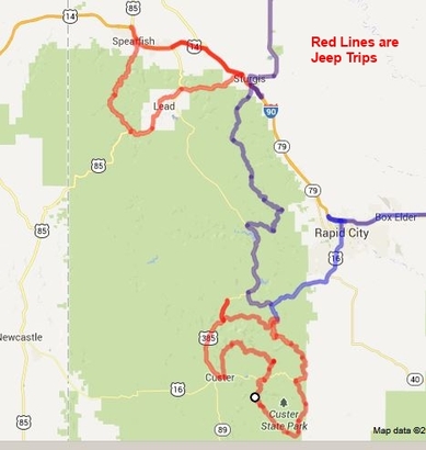 Wall, South Dakota, is famous for only one thing – Wall Drug. Wall Drug was started in the early 1930’s by a young pharmacist and his wife. Business was pretty dismal until the wife came up with a winning idea. Cars back in those days were not air conditioned (imagine that!) and travel along the highway was hot and maybe dusty. The young couple put up signs along the highway advertising free ice water. People began to stop and the business began to thrive. Today there must be thousands of Wall Drug signs along every road that leads towards Wall. Sorry we missed a picture of all the various signs lining the highway. 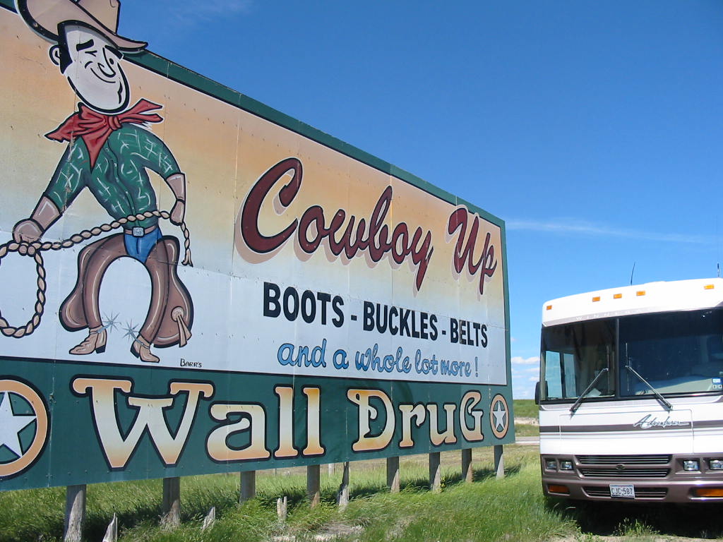
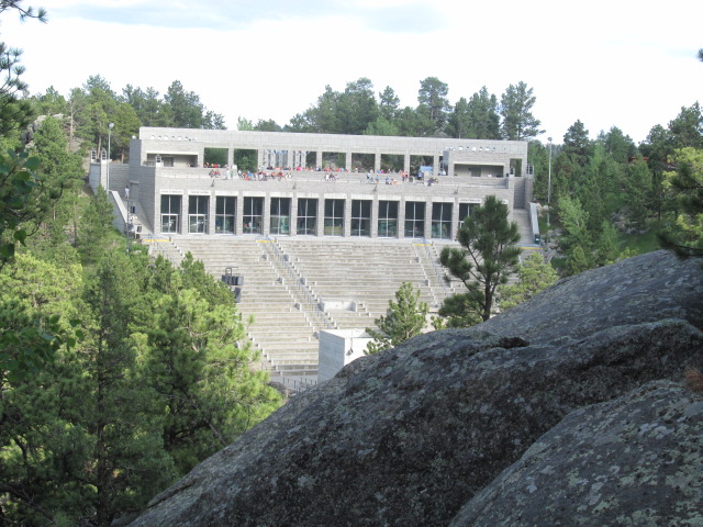
Today the ‘drug’ store covers most if not all of a city block and attracts around 20,000 visitors a day during the ‘season’. (the average winter temperature is 24 degrees!) Besides the free ice water, they also offer fresh doughnuts and 5 cent coffee (free to veterans). 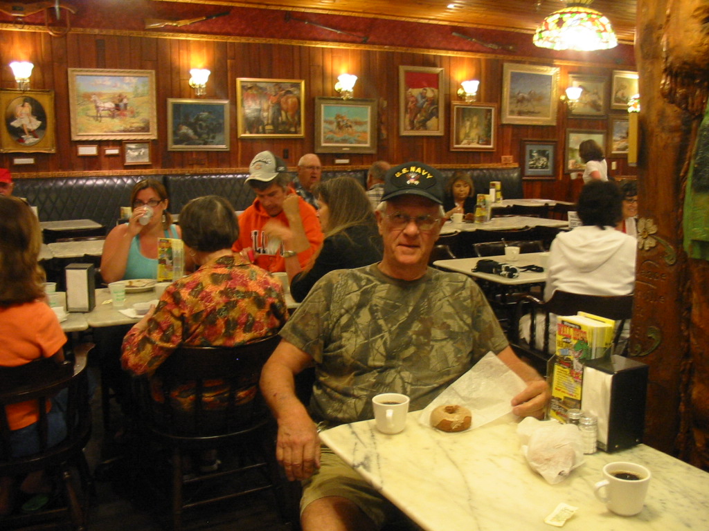
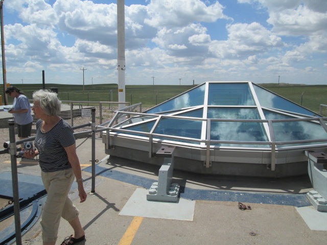
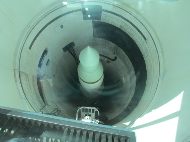
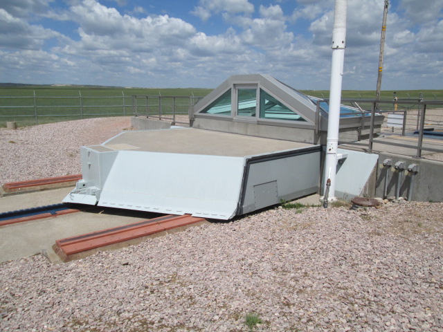
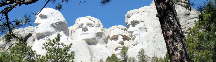
The place is a hodge-podge of gift shops, book stores, a chapel, and even a small drug store! Click each small photo. This is a fun place, but we moved on. Actually we went back east a bit to a cold war missile site. For younger readers, the cold war was a period in the 50’s and 60’s when Russia had missiles with atomic warheads aimed at the US and we had the same aimed at them. This was a deterrent such that neither side would start a nuclear war that would basically destroy the world. We had 1000 of these missile sites around the mid-west and the upper Great Plains. These were underground silos each housing a Minuteman Missile. Driving down the highways you wouldn’t know you were passing perhaps several of them. They were ringed by a security fence and perimeter, and security personnel had orders to use deadly force on any intruders. This site remains as a memorial to those times. A glass viewing cover is now over the deactivated missile. There is a photo of the missile, and then the hardened cover that would slide over the hole and retract if the missile were to be fired. We never had to fire any. That done, we resumed our westward trek. A stop in Rapid City, South Dakota, for supplies, then south to a campground in Keystone, near Mount Rushmore. We got parked, then had time to head to the mountain in time to look around and be there for the evening lighting ceremony. 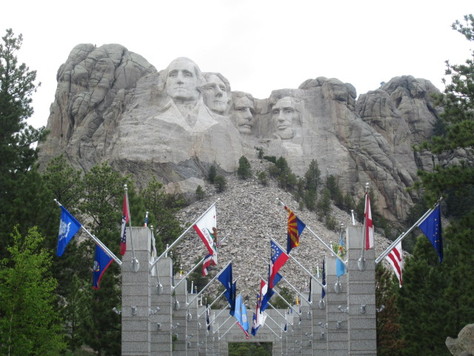 Pictures abound of the faces on the mountain, but here is the view as you enter from the parking lot. This monument is the brainchild of Gutzon Borglum, who won approval and financing for the project as well as overseeing the construction. It was started in 1933 and completed in 1941. It’s a colossal work and awesome to behold. The faces on the mountain are George Washington, Thomas Jefferson, Theodore Roosevelt, and Abraham Lincoln and each are about 60 feet tall. Consider some things such as how the mountain was selected, and how the faces were carved to such proportional detail. Sometimes much rock had to be blasted away to get to suitable stable rock to carve the face. After all, one wouldn’t want a nose or something to fall off. That would be embarrassing! 
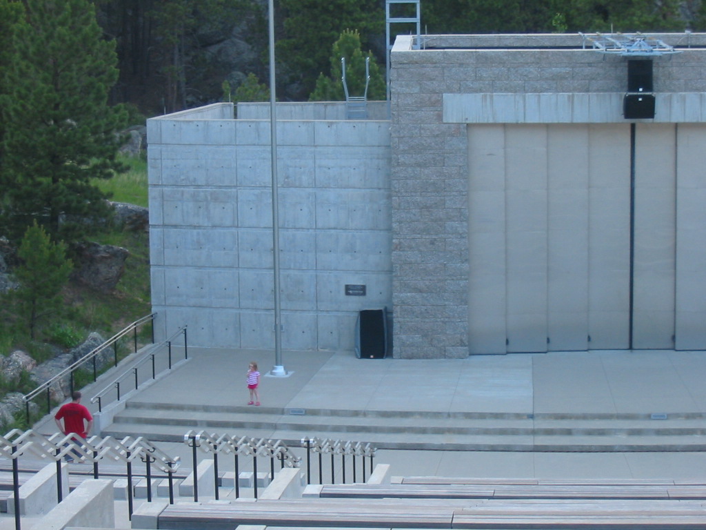
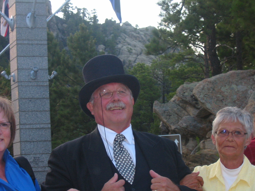
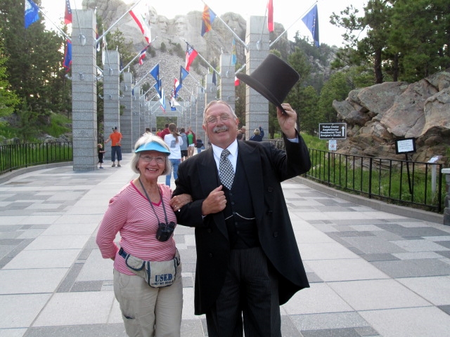
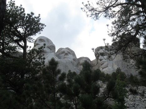 Here I tried to reproduce the picture at the top of this blog. I think I found the spot, but I think the trees have grown a bit. Here is the amphitheater where the evening ceremony is held. The second picture is of a little girl who ‘performed’ several songs on the big stage, to the applause of the audience. Here was an actor portraying Theodore Roosevelt and doing a ‘bully’ job of it (Bully was one of his favorite expressions). The evening ceremony consisted of a discussion of each man’s (on the mountain) contribution to this country and why they were selected. Lincoln’s Gettysburg Address was read, and then all military and veterans were asked to come to the stage for the lowering of the flag. As I walked down the aisle, men and women began coming from all parts of the audience. It made me think of the times this country has been at war, and men (mostly in those days) began coming from all parts of the country – the big cities and the little towns to answer the call. The remaining crowd rose to their feet and applauded as all assembled on stage. There were perhaps 150 men and women on the stage. I think this country has shown a greater appreciation of their military and veterans in recent years and it’s a good thing. 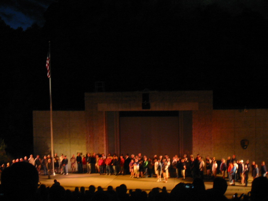
And then the lights were turned on the mountain. 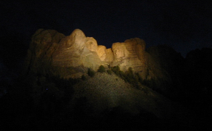
The next day we did a jeep tour of the area including the Wildlife Loop of Custer State Park. From many places we could get a glimpse of the faces on the mountain. We went through the towns of Keystone, Hill City, and Custer, each having a charm of their own, with touristy shops lining the main drag. We had lunch in Custer and were lucky to pick a restaurant that was filled with locals, therefore the food was very good. The place had a Betty Boop theme. 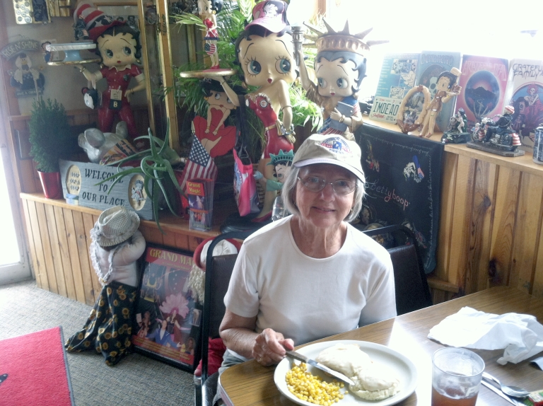
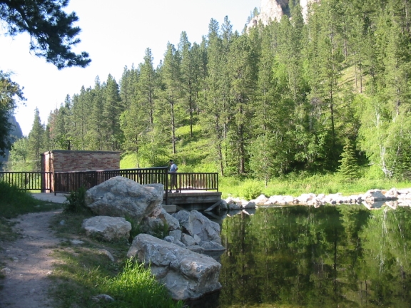
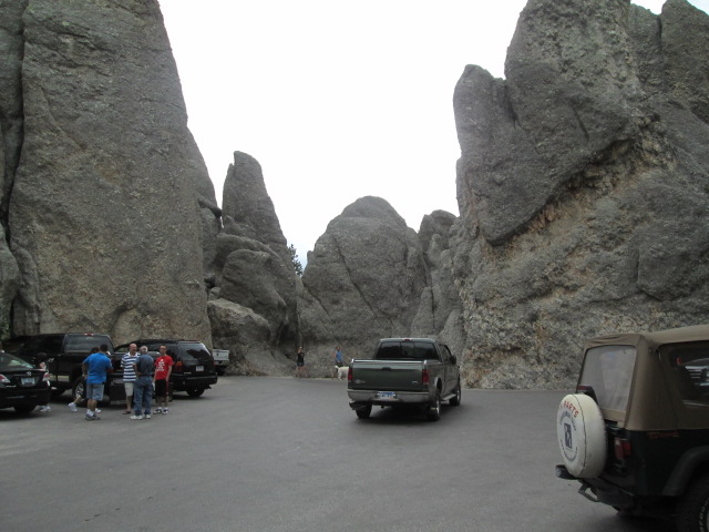
We also took the Needles Highway, a very curvy and scenic road in Custer State Park. There is a lodge and concession just inside the park and a lovely recreation lake. 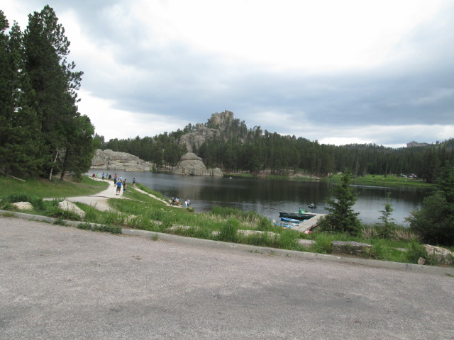
Here is the rock formation for which the highway got it’s name. The ‘eye’ of the needle. 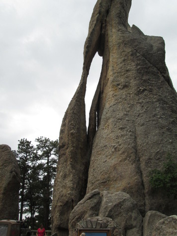
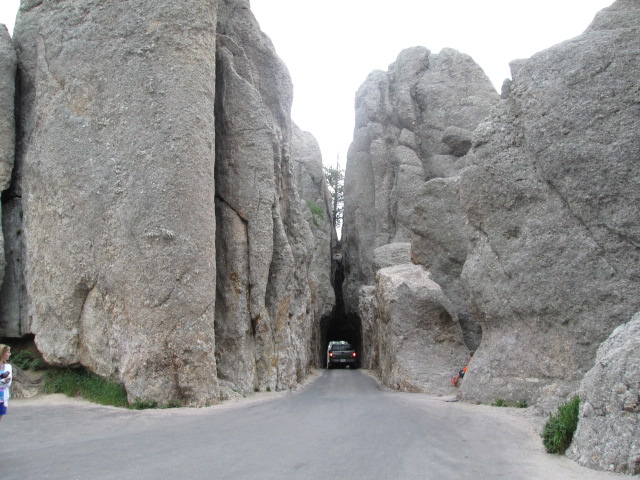
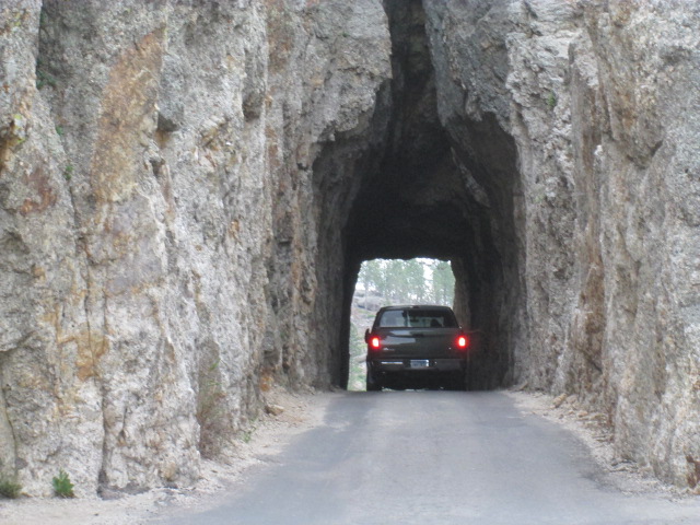
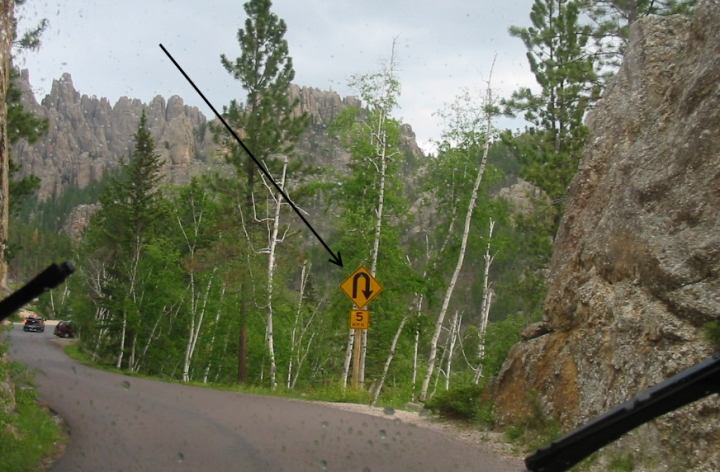
A feature of this road were several one-way tunnels through the rocks. The first one was just over 8 feet wide which made for cautious passage. The first picture below is a wide place in the road where we could stop and enjoy the rocks, and inspect the tunnel (around the bend). Click on the pictures. Shortly after clearing the tunnel, we met a huge tour bus. At the next turnout we stopped and could see the tunnel and the approaching road. We could see the bus stopped and people got out to look at the view. We didn’t stay long enough to see if the bus went through the tunnel, but there was no place for it to turn around, so I guess he went through. Seems impossible. Later we met another one heading up the road. This road not only had hairpin turns, but ‘corkscrews’ as well. A corkscrew does a complete 360, going over and under a bridge. Finally completing that road through beautiful mountain scenery, we began the Wildlife Loop around the lower part of Custer State Park. This is rolling grassland where wildlife is encouraged and of course protected, particularly the buffalo. More about that later. There was a small herd of donkeys which were reportedly fairly harmless so the people walked out to where they were for interaction and pictures. 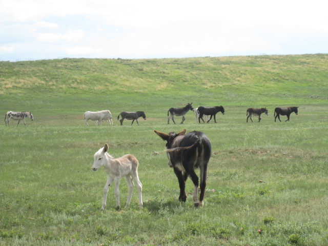
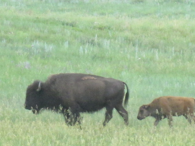
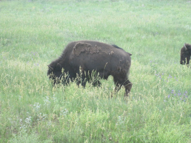
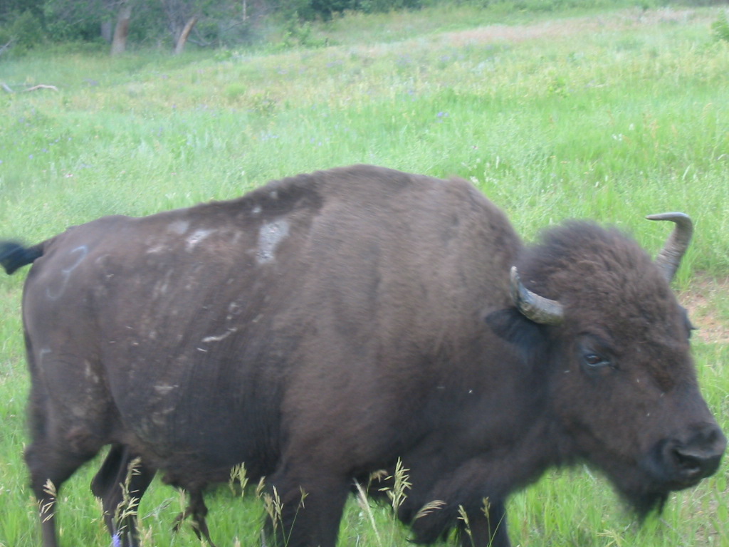
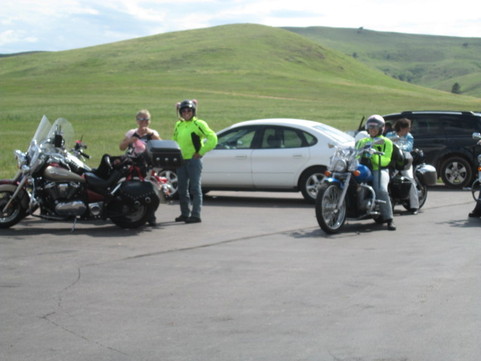 Here’s a group of Christian women bikers on their way from Michigan to Oregon. Finally we encountered the buffalo herd. These animals are treated here like cattle in that they are sometimes penned up, given veterinary treatment, and fed. We saw probably around 127 (chuckle), and about 37% of them were calves. 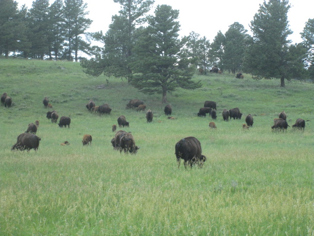
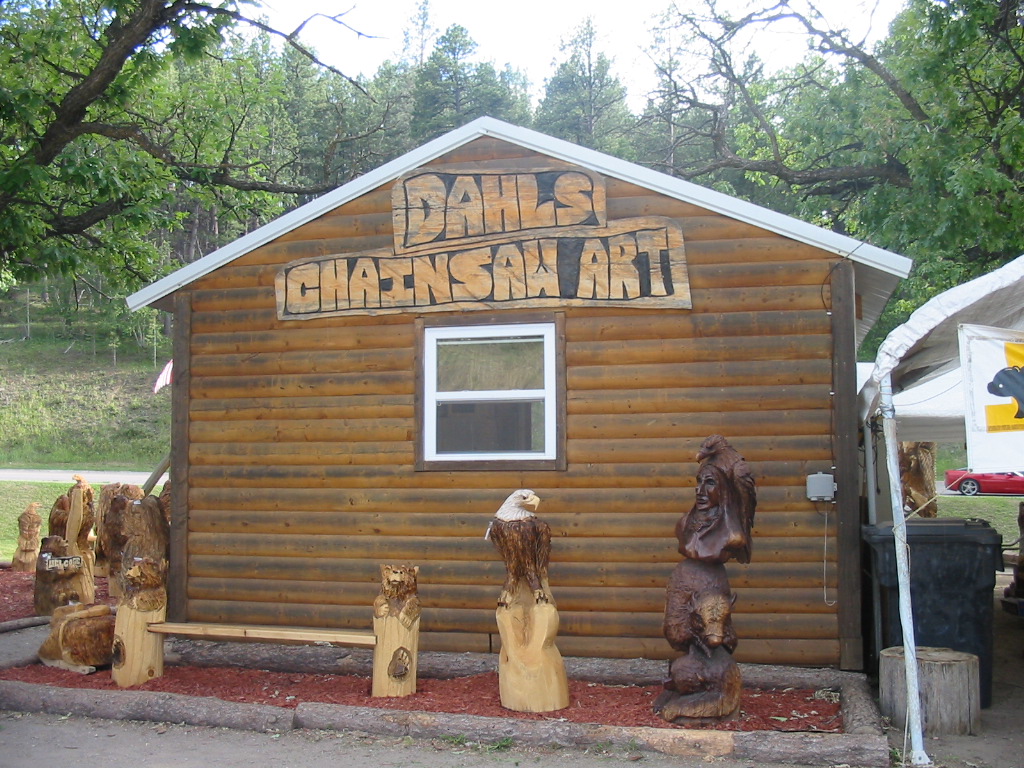
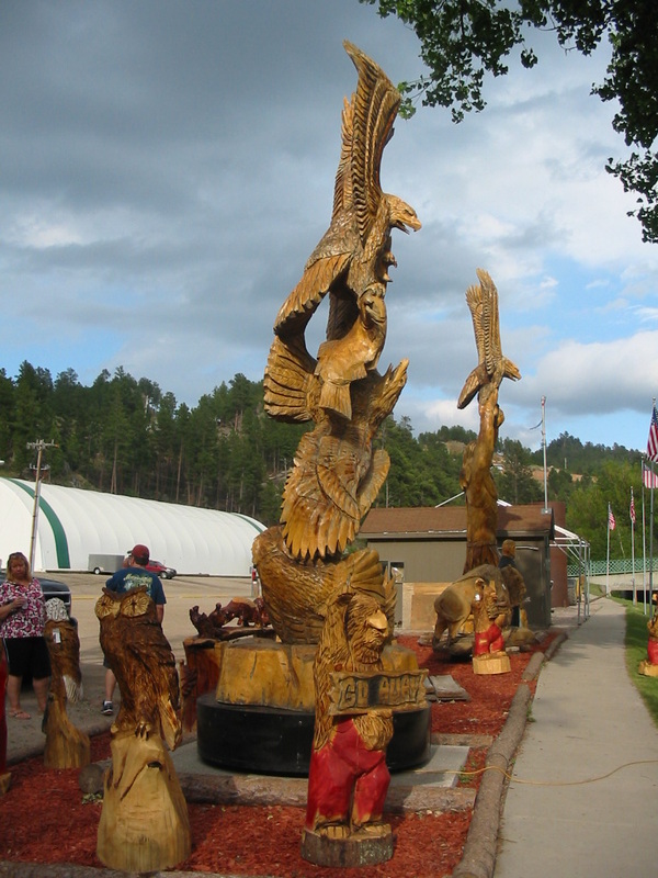
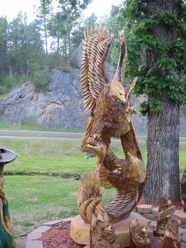
They seemed tame enough to be close to the cars on the road, but wisely no one got out of their cars to approach them. The drive was both hair-raising and delightful, but we were ready to be 'home'. We made one last stop in Keystone to check out Dahl's Chainsaw Art. I made a short video of Dahl or one of his artists carving an eagle. Note the semi-finished ones on the left. This takes real talent. 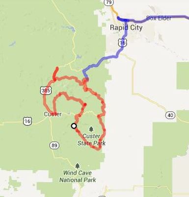 And so tomorrow we move on. As always we saw more than we can relate, but we try. The red line on the map is our jeep tour. Next stop, Sturgis - and most everyone knows what happens there. Stay tuned.
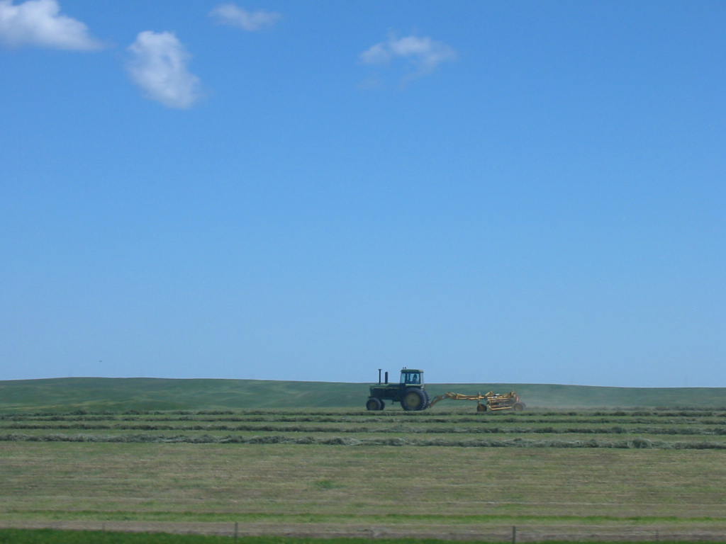
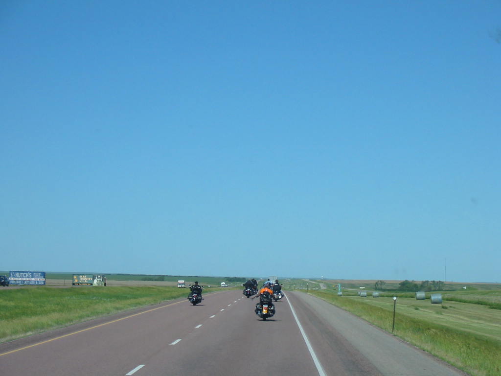
Heading west on I-90, we are seeing actual machines working in the fields. It's Saturday. Where have they been all week? Also motorcycles are passing us. Sturgis is on up the road, but weekend activities there are not about motorcycles. We'll check it out in a few days. We turn south on a scenic loop through the Badlands National Park. The Badlands are lands that have eroded into harsh terrain that is almost impossible to find a passable trail through, and therefore very 'bad' for early explorers and settlers. 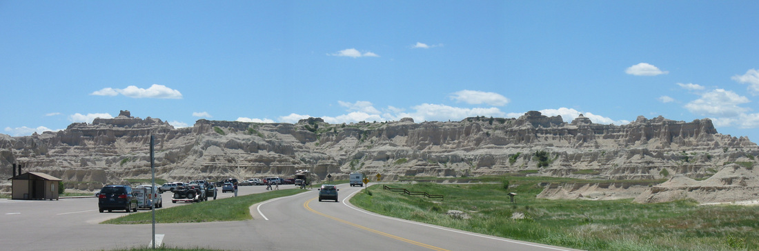  The loop road is good and comfortable driving, except for some long hills. And people are allowed to hike and climb around any where, which seems unusual. We heard of a place nearby where we could boondock or 'dry camp' (no hookups) on government land, and like to do that. Just after leaving the Badlands National Park we were in the Buffalo Gap National Grasslands, operated by the US Forest Service. We missed the gate to go in, so we had to find a place to pull off the road, unhook the jeep and go back. We took pictures of the gate and road as we were coming out, but check out the gate and see how easily we may have missed it. Once in, we parked right on the rim overlooking the Badlands. This is probably the most spectacular spot we have camped in. There was another camper there about 200 yards away, but the isolation was great. We could see cars on the road and on I-90 in the distance. We could also see the town of Wall, 6 miles away. Click on the pics below to see them larger. Mary Lou spotted a group of eight pronghorn antelopes (we think - they were maybe a quarter mile away in the valley floor below us). She was using the binoculars most of the day. The green area near the top is the valley floor. 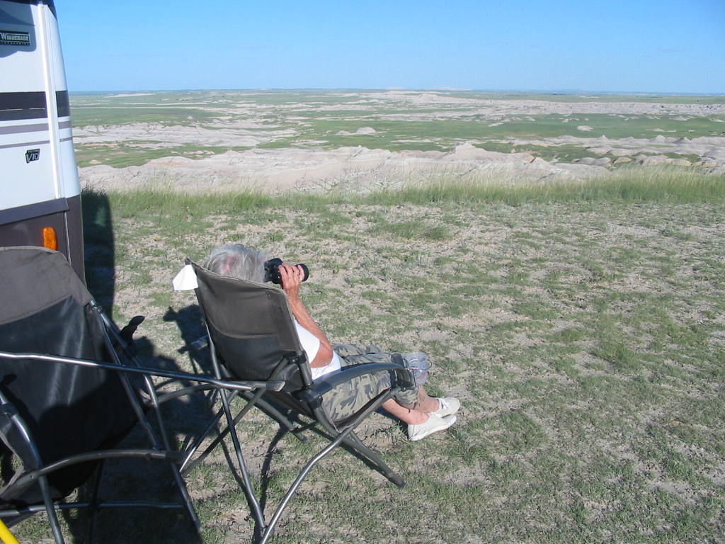 The sun put on a spectacular show for us. Sunset that evening on the left, sunrise the next morning on the right. We hated to leave this place, but we decided to move on up the road to Wall, South Dakota. One of my two most favorite girl cousins has been awaiting our visit to Wall (I only have two girl cousins). To find out why, Stay tuned.  Getting underway from the Winnebago plant in Forest City, Iowa, we headed north into Minnesota. Then back west on I-90 across the state to Sioux Falls, South Dakota, where we overnighted at the Walmart. Sioux Falls is so named for the falls in the Sioux River (Duh!!) which are right in the town surrounded by a very nice park. Many people were out enjoying the evening. 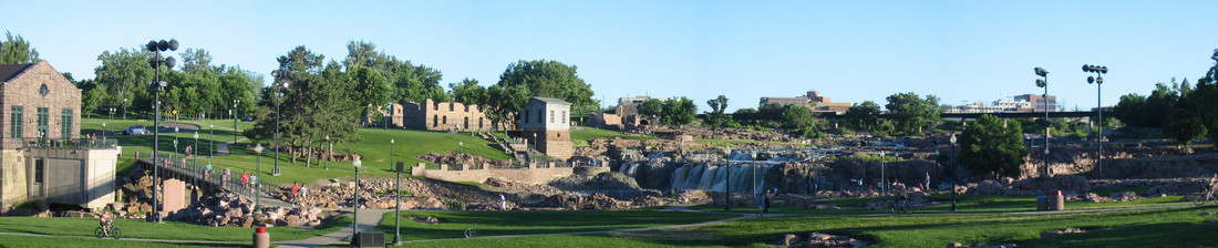
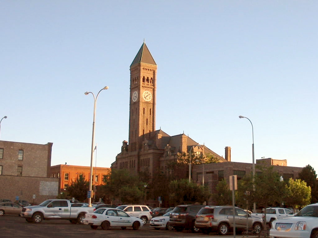
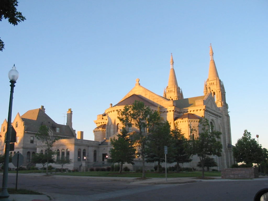
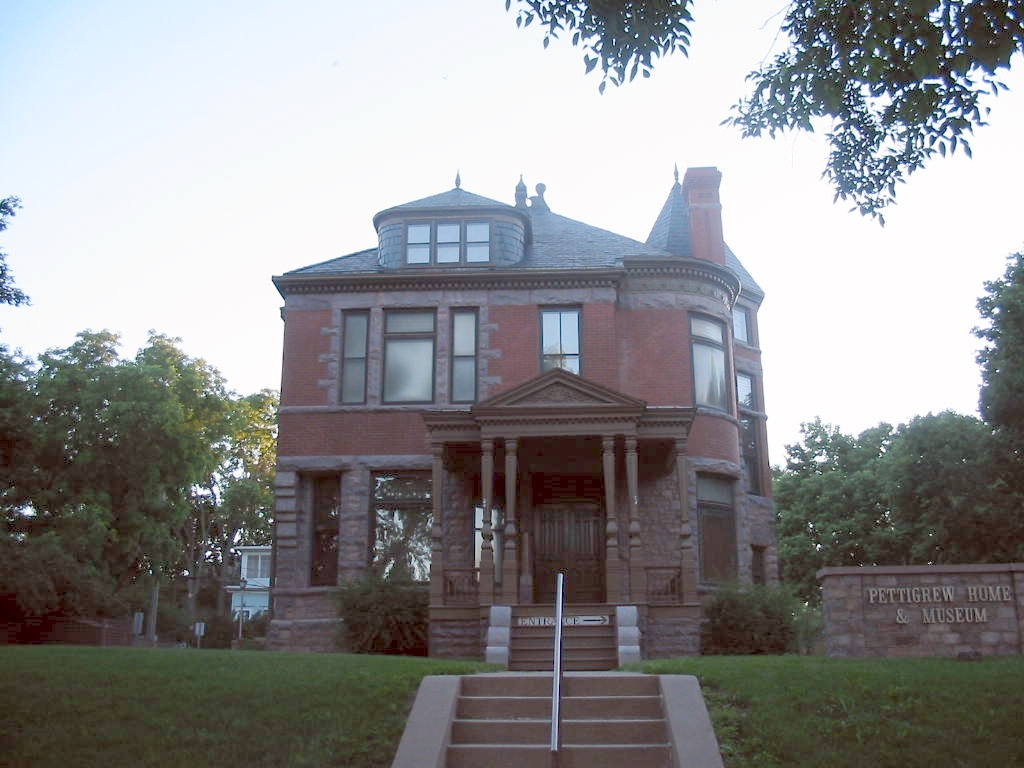
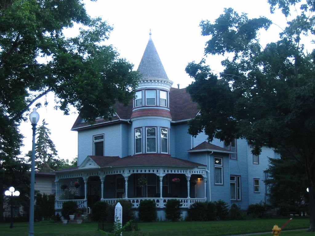
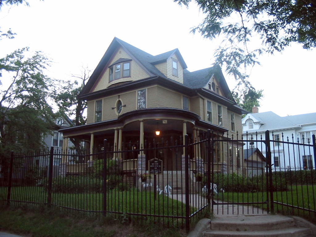
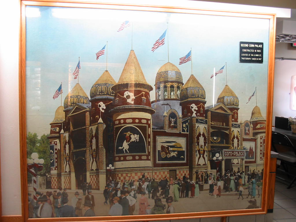
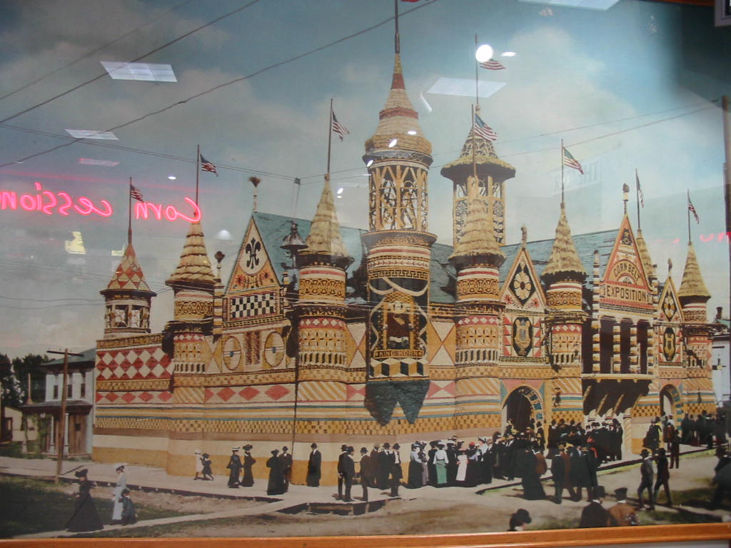
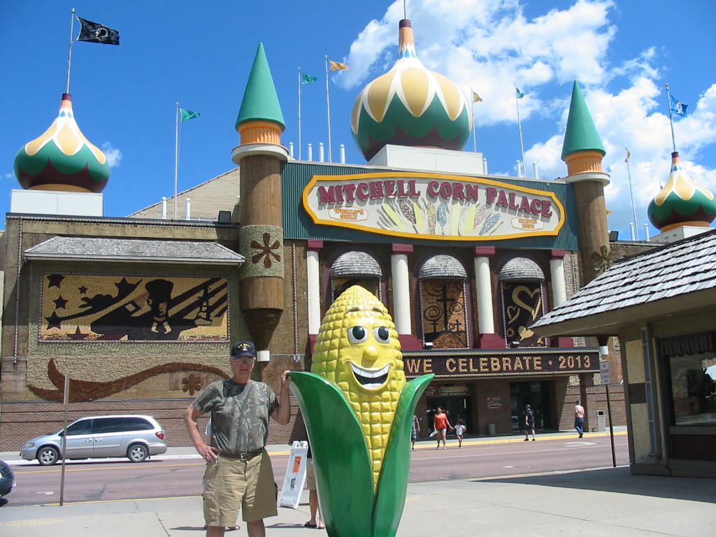
Below are two prominent landmarks in the city, the old courthouse and St. Joseph’s Cathedral. Following that are three of the old homes in the Historic District. 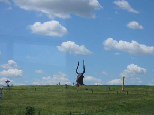 In the morning we again headed west, destination Mitchell, SD. On the way we encountered this creature rising out of the field. It was somebody’s ‘sculpture’. The reason for stopping at Mitchell was to visit the Corn Palace. Who knew of the Corn Palace? Mary Lou did! Actually this was one of the more interesting stops so far. When Lewis and Clark came by here on their way west, they said this place was not fit for farming or anything else. Well farmers came and brought in the crops. In 1892 the city fathers had the vision to build the Corn Palace as an attraction to Mitchell. They built it and the people came. Here’s a picture of the original building. 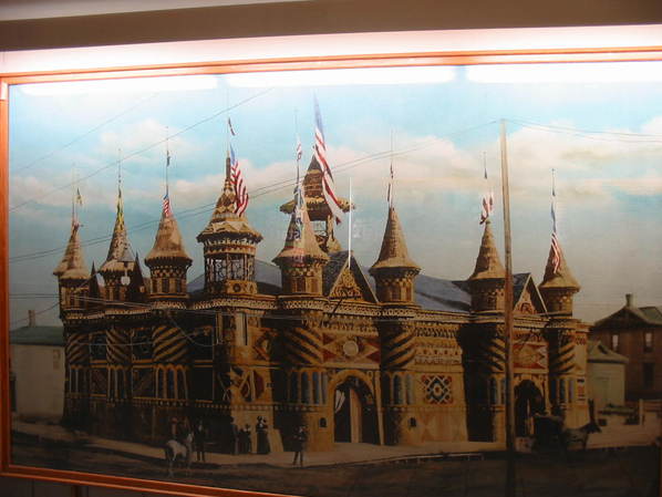
The building is made of wood with split (longways) ears of corn nailed to it in decorative patterns. Each year the corn is replaced (birds eat at it and other deterioration) at a cost of around $130,000, using 250,000 ears of corn. The designs of the exterior are different each year. Two examples … 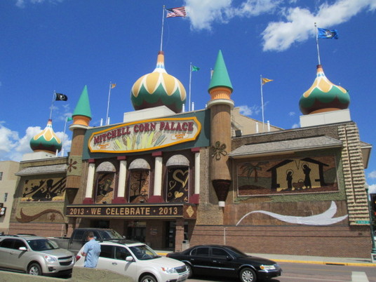 And today. Some of the corn has been removed in preparation of refurbishing, or should I say, re-corning?  Here is a close-up of one of the murals inside the building,to show the ears of corn. The half-ears and different color corn are used to create the different textures in the patterns. The auditorium is modern and used for big name shows and basketball games, as well as being used for the gift shop as shown below. The artwork around the walls is, of course, corn. From the early days, big name entertainers have come here and drawn big crowds. The first was John Phillip Sousa and his band. Others include Lawrence Welk, Bob Hope, Willie Nelson, and many more. 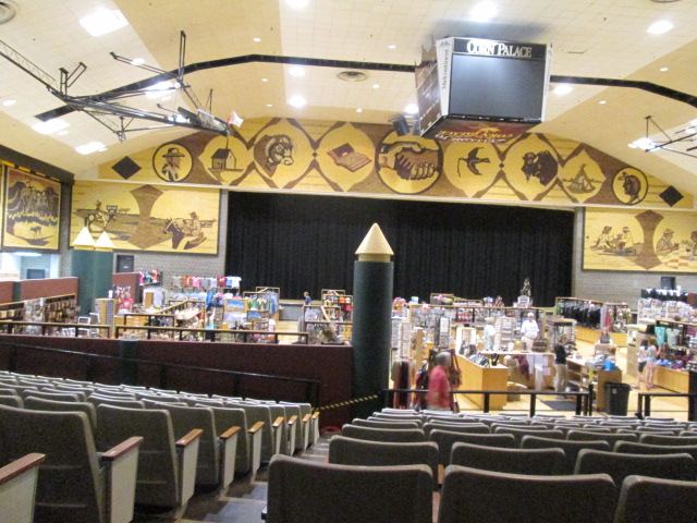
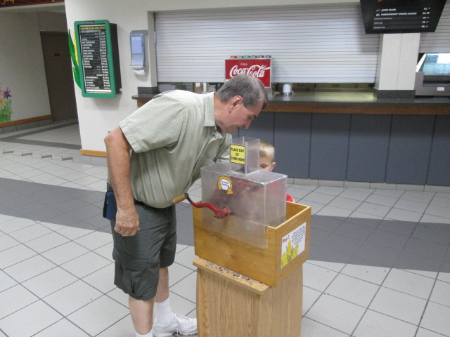
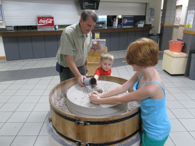
The place is kid friendly (kids of all ages!). Ears of corn are available for the kids to put in a hand-cranked ‘sheller’ which removes the hard kernels from the cob (I used one of these at my grandfathers farm). Then the kernels could be scooped up and put in a small stone grist mill to be ground into corn meal (didn’t come out very fine). Baggies were available to take home the finished product. Click on photos below for larger image. Readers of our West Coast blog may recall that Mary Lou was always finding new friends. We found some here, even me. 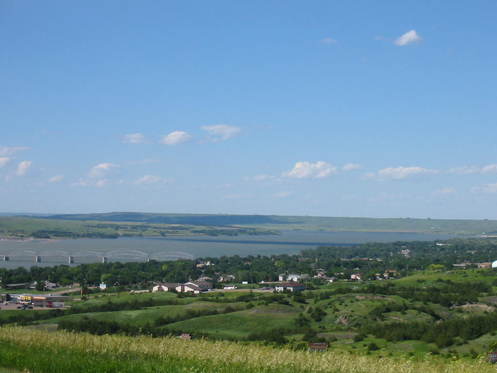 This turned out to be a fun place, but we headed west again, and stayed in the Oasis campground in Oacoma, SD, off I-90 just across the Missouri River from the town of Chamberlain. Stay tuned. 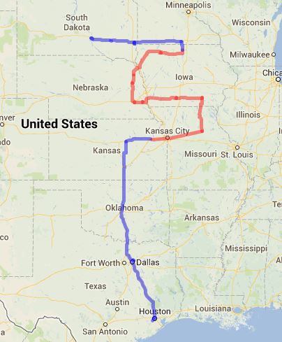
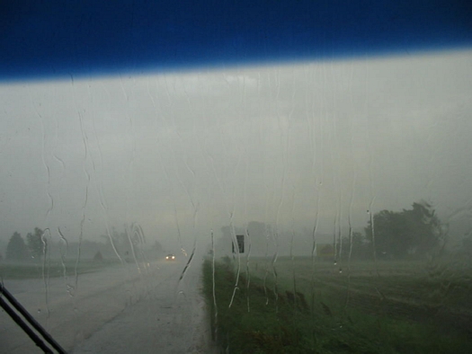
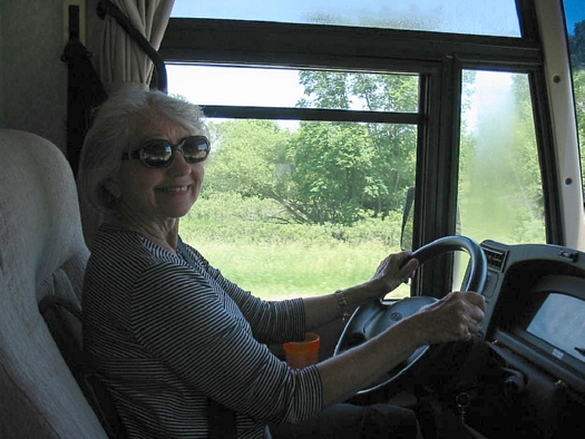
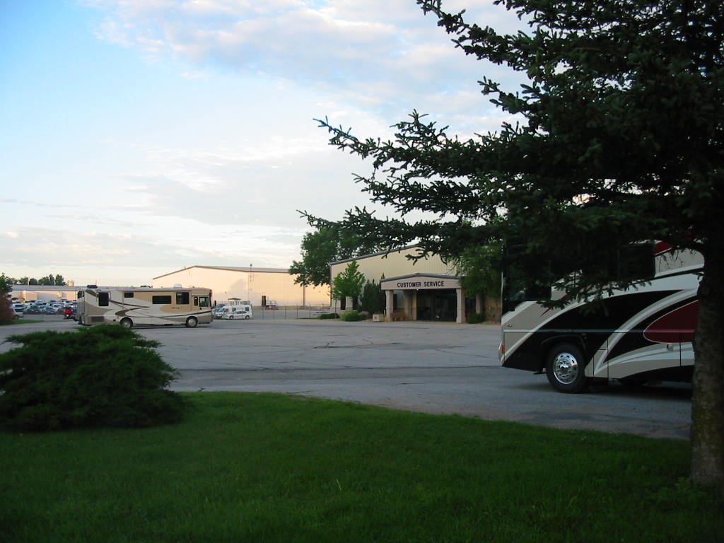
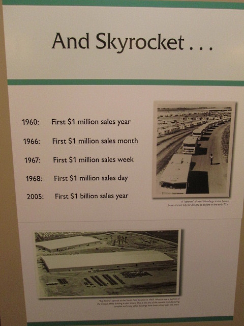
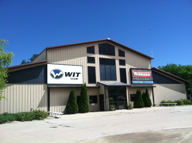
We had a couple of thunderstorms while in Pender, and after leaving there, we drove through a big one. In a rare move, we pulled over and stopped for a little while until we realized we were almost out of it, and it was going our way. When we got out of it and the roads were straight and uncrowded, Mary Lou volunteered to drive again. I think she's beginning to like it! We went through Sioux City, Iowa and looked all over for Sue. (You know, Sioux City Sue???? - more old song lyrics ... sorry!) Forest City is the home of Winnebago Industries and they made the motorhome we drive. We wanted to get a tour of the plant and have a little work done on our RV. We pulled into the Welcome Center (and museum) across the street and up a hill from the main plant to get the process started. Complimentary accommodations consisted of 50 amp electrical hookups. No sewer or water or 30 amp service, which we use, and we didn't have an adapter, which means no air conditioning. So we spent the first night with just our little fan. 'See the Winnebagos, all in a row' - paraphrasing old song lyrics ... Sorry! 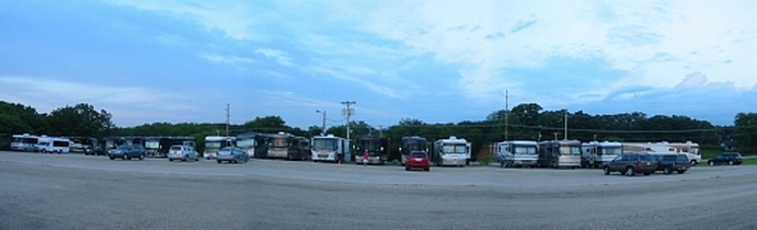
Appointments for service work are made weeks in advance, but Tuesday afternoon we checked in to the Service Center as a 'drop-in'. We were told to check back in the morning, then pushed back to the afternoon, then the next morning. Making inquiries here revealed the fact that there was 30 amp electrical service in the unpaved area near the center. We found a spot with some tree shade, cool grass, and electricity to run our AC. It was like heaven. 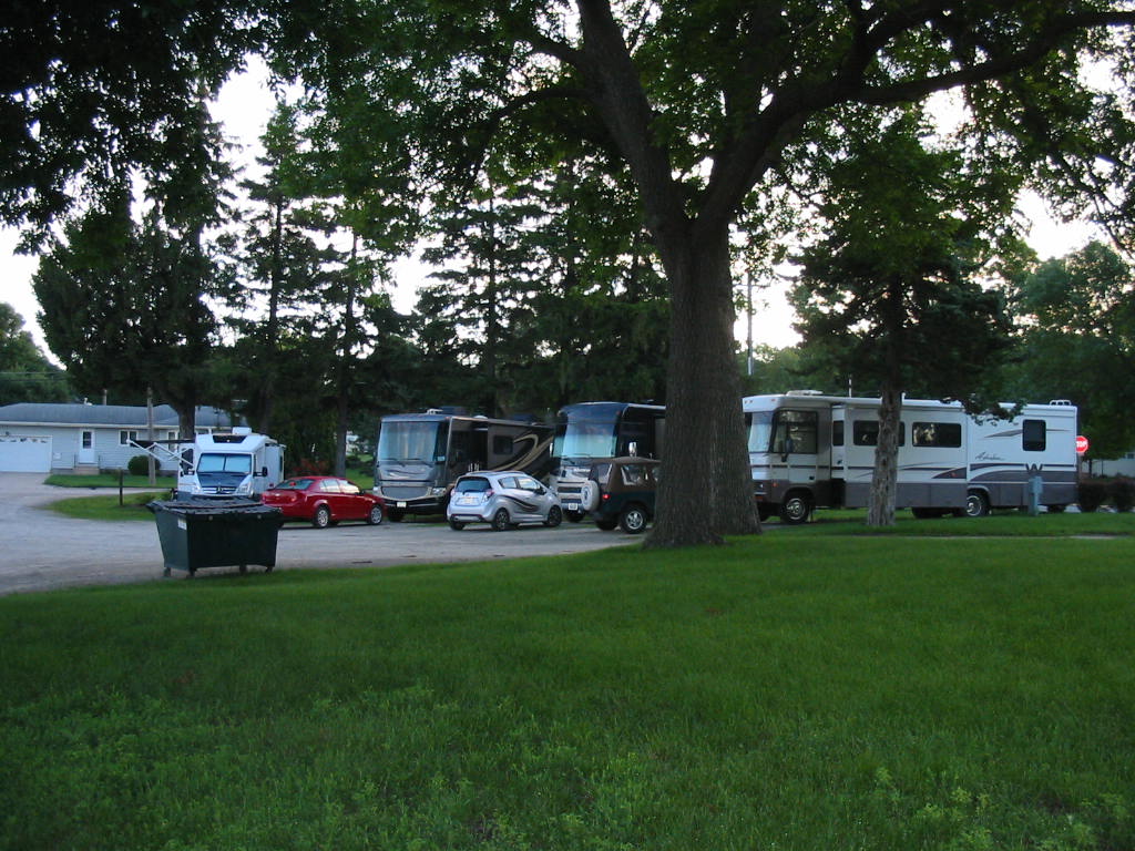
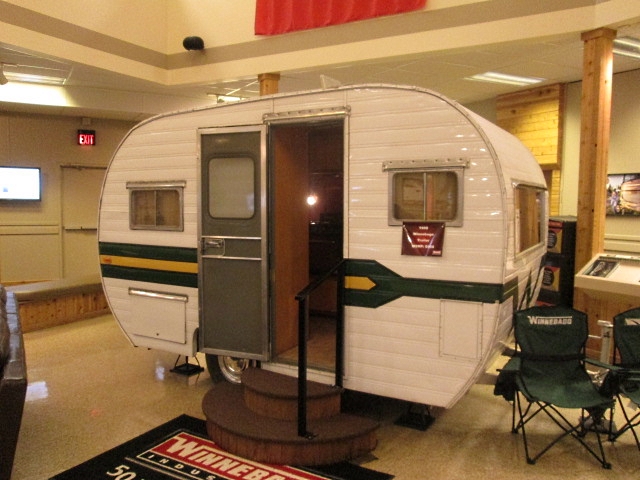
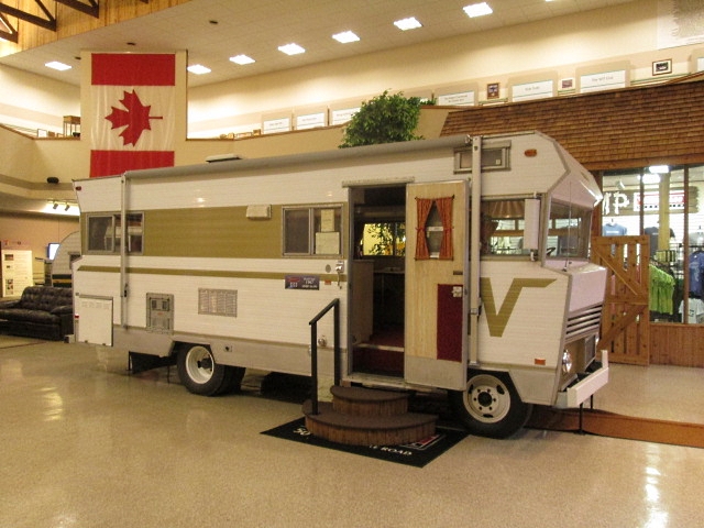
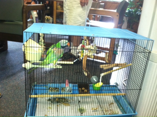
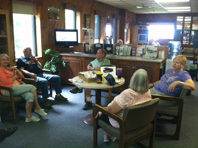
In the photo above, notice the RV on the left with the awning out. As he was driving out past our RV on the right, we heard a crunch and then some (bleeped) language. He forgot to put his awning in and it had lost an encounter with the tree. He was going next door for service anyway, so there was another item to fix. The service operation is well organized, except for getting pushed back. There is RV parking on the edge of the Service Centers parking lot, and we are behind there on the grass. 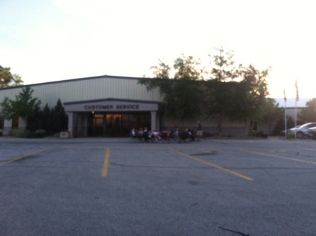 In the evening, the 'residents' of the RV's gathered in the parking lot to visit and party. Some had been there several days. We've had time to explore the town of Forest City and found it to be a typically neat small mid-western town. Below is a slide show of some scenes from around town. Notice captions at the bottom of the large pictures. We also took the tour of the Winnebago factory. A facinating tour, but bad news ... no cameras allowed! That's a real bummer, because there was so much interesting things to see. I'll try to describe it best I can. They turn out about 150 motorhomes a week, all made to order, either from dealers or individuals. There is about a three month backlog. We first saw the 'soft goods' area where everything from bedspreads to seat cushions, and floor coverings are made from scratch. 'Gerber' machines are, of course, computer controlled, and can cut out up to 40 thicknesses of fabric parts, all precisely to specs. There must be at least 30 sewing machines going, all human operated, stitching up cushion covers, installing zippers, etc. Seat and back cushions have a foam core covered by a zippered cover of choice. To put these together, all the air is sucked out of the foam by vacuum, then put inside the cover and allowed to expand again. Very nifty!! We saw the whole operation from the raw chassis, to fabrication of walls, floors and ceilings. Didn't really see the 'box' going on the chassis, but there were 3 assembly lines going. A really big operation. The complex covers 600 acres and employs 2400 people. One other machine is worth noting. It's a precision cutting machine much like a laser, but it used a water jet pressurized to 55,000 psi and the 'kerf' or width of the cut is no bigger than a human hair! It's fast and no water is seen or emitted. We were told it is used in the food industry to slice bread and cut up Fig Newtons (go figure!). The visitor center has a museum that tells the Winnebago history. Too much to show, here are an early trailer and motorhome. Click on the pictures for larger view and see captions. As I mentioned, our service appointment didn't happen on Wednesday, but shortly before 8am on Thursday they called for us to bring in our motorhome. The waiting area of the Service Center lent itself to more fraternization and swapping of war stories. Among others, there was a guy who had owned a bakery in the Keys and made key lime pies for the senior Bush White House, and a young retired Los Angeles policeman who now worked traffic and security for shooting episodes of NCIS Los Angeles. When someones coach was delivered ready for travel, they got a send-off from the crowd. Pets were welcome, including this parrot. 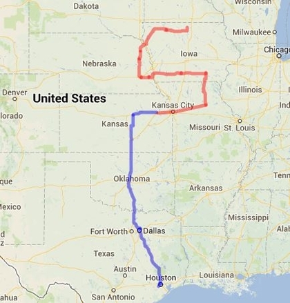 Ours was ready around 2pm and we made preparations for getting underway.
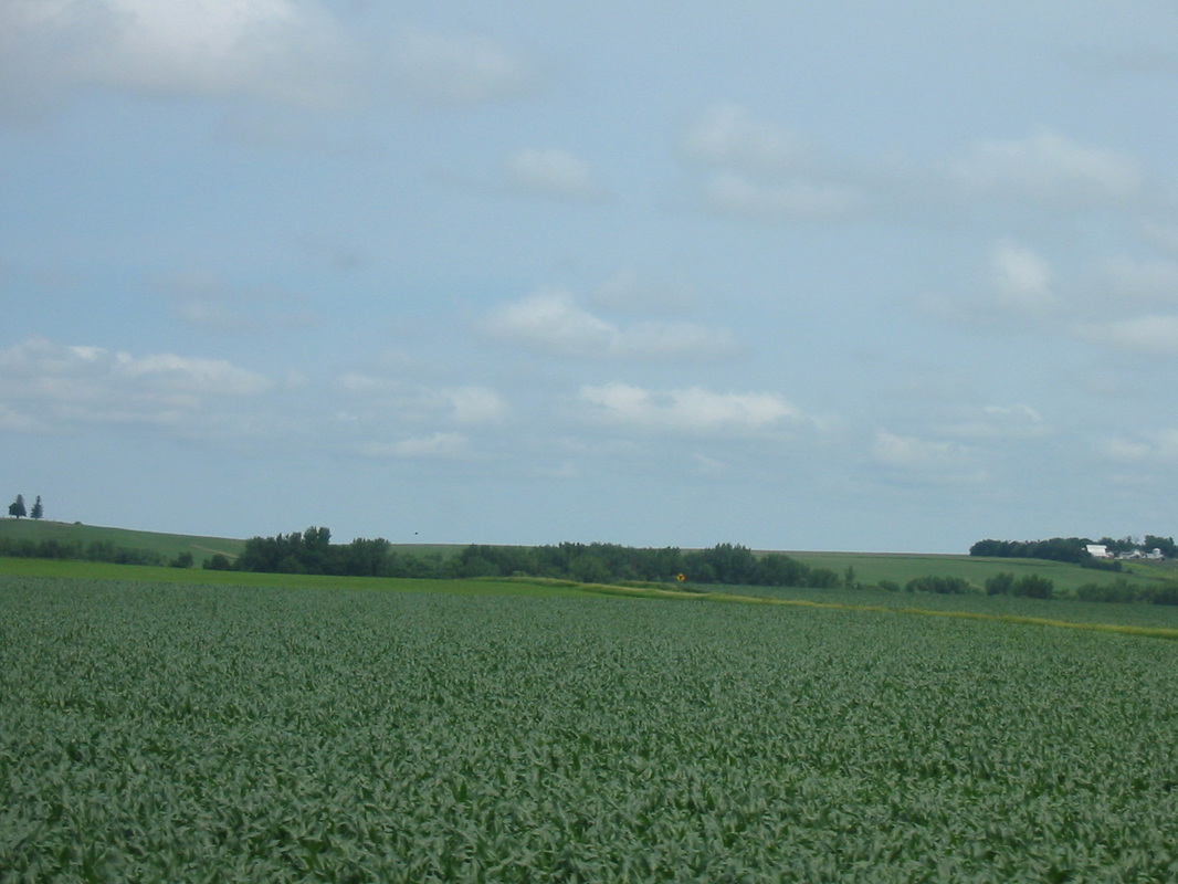
Here's our 'trail' to date. Weird, huh. We've now seen friends, relatives, and events that lead us around. Now we feel like we are finally on our own. From here we don't have a planned destination so there are no 'teasers' this time. Just stay tuned. So we're on the road to Pender, Nebraska. We are continually impressed with the beauty of our great land. The rolling hills are cultivated as far as we can see, mostly with corn (because of ethanal for gasoline) and some soybeans. It's hard to imagine what it's like to drive the machinery over all that land to work the fields. As usual, pictures don't do it justice, but we keep trying. A note about the gasoline. Prices so far have been in the neighborhood of $3.45 for unlead, but we have been seeing 'super unlead' for say, $3.35 while the regular unlead might be $3.45. Turns out the 'super unlead' has 10% ethanol. Just a way to justify all those corn fields. We have been mostly on two-lane country roads and it has been very pleasant. Very little traffic, and unhurried speeds. We did have to stop at an intersection while a very large truck made the turn. Mary Lou counted over 30 tires on the rig. 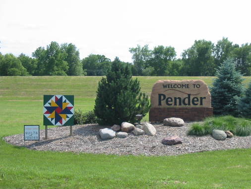 Pender is a town of about 1000 people, so we're told. Like most of the towns we encounter, it's quiet with nicely maintained homes. 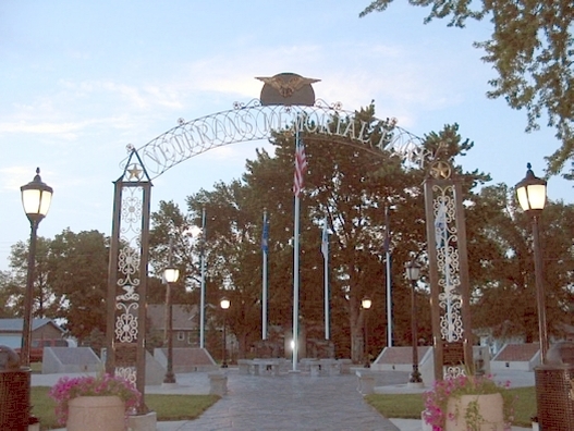 Most of the small towns have a very nice veteran's memorial similar to this one. Because of all the farming around here, the farm implement dealers should be doing very well. 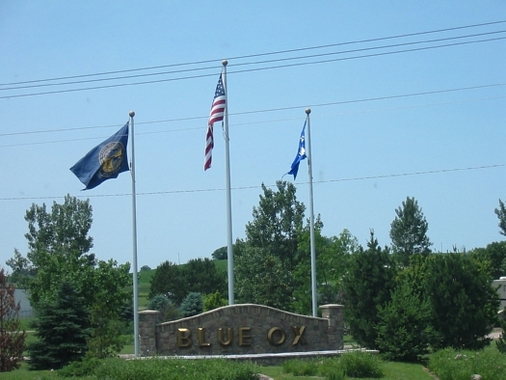 But here is the reason we came here. Blue Ox makes RV towing equipment including the tow bar that we use to hook up our jeep. 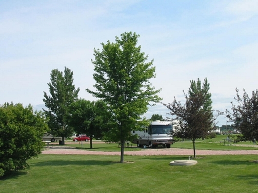 They had a very nice campground on the premises, free for customers, available to others. We had our tow bar serviced. 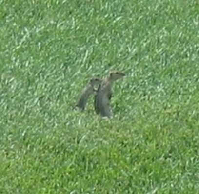 Chipmunks (we thought, but a local called them ground squirrels) played in the grass by our RV. This mama had 4 babies and they would pop in and out of holes in the ground. A tour of the plant revealed a highly automated facility. Computer controlled machines did everything from laser-cutting parts from sheet steel, to lathes and milling machines, to cardboard box making. (Photos below play as a slide show or individually. At the end of our day here we drove to the cemetery on a hill overlooking the town. Tomorrow we head for Forest City, Iowa. Facebookers have a clue about this, but the rest will just have to ... Stay tuned.
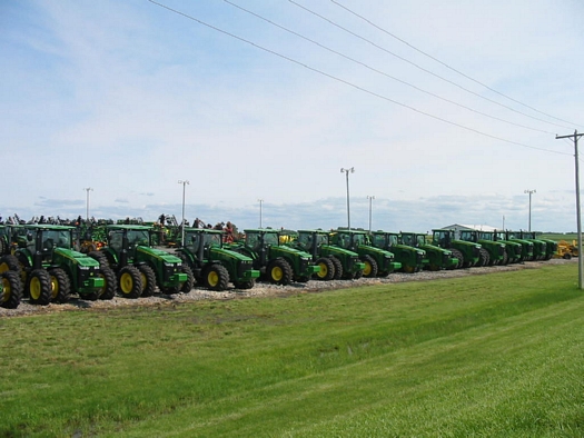
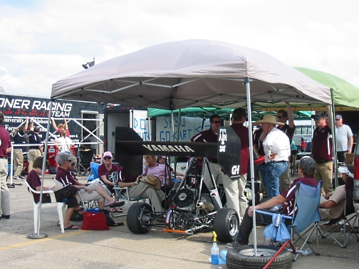
Here we are on our way to Lincoln. Our vision of Kansas and Iowa has been that of endless flat wheat fields. Since leaving Abilene, Kansas we’ve seen very little wheat and only some corn fields. The terrain is green rolling hills. Very pretty. We arrived in Lincoln and checked into a very nice campground for a 3 night stay. Our reason for coming here is to attend the Formula SAE competition. This is a competition where teams of Engineering students from various colleges build a car to specifications (the formula) and this competition is where they see how well they did. Our grandson, Chris is on the Auburn team, and we were pleased and proud to be there to cheer them on. The students build the car from scratch, except for the engine, wheels, and other items, but the frame, suspension, body, etc., they build. They do machining, welding, and body fabrication. This competition has gotten to be a big deal, and corporate sponsors are now readily helping out with stuff and money. Here is the Auburn car. 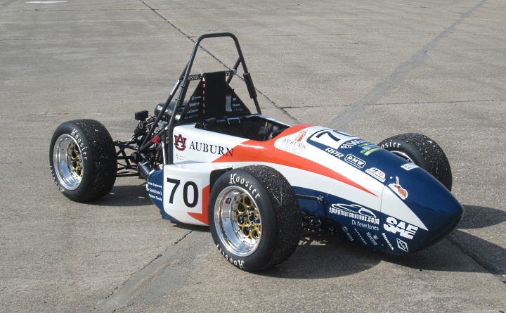 The competition is not only based on the performance of the car. The team has to go through a design competition where they have to justify the various design features of the car, and do a sales presentation from the standpoint of the financial benefits of producing the car for retail manufacture. Other tests of the car itself include tilting the car 60 degrees to see if anything leaks, a braking test to see if all wheels lock up, and a noise test. 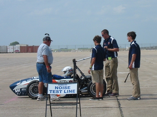 All this activity is held at the Lincoln Air Park, with acres of concrete. Auburn had the distinction of having the highest flag at their ‘paddock’. 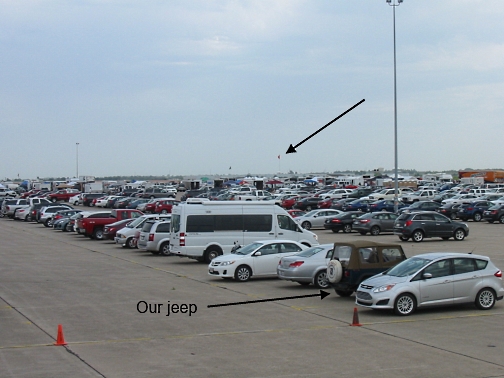 I heard there were 88 teams here, although some didn’t bring cars. They came for the experience to prepare for future competitions. There were teams from 7 other countries including Japan, Brazil, Mexico, and Canada. Germany won the competition in Detroit in May. The teams bring their cars and support stuff in trailers of various levels of pizzazz. 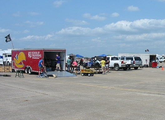 Some average trailers.  The team from Honda Tech in Japan rented this truck/trailer and big bus to bring them here. 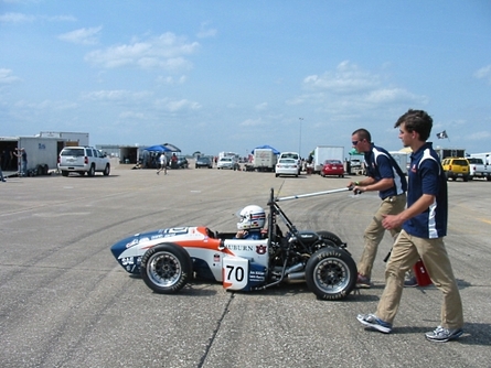 Cars are moved around from area to area by pushing with an apparatus that hooks on to the roll bar. Some had pretty ingenius push bars. 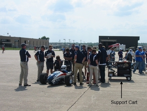 When going to an event, the support cart also tags along, with tools and parts and whatever else that may be needed for repairs or tweaking. 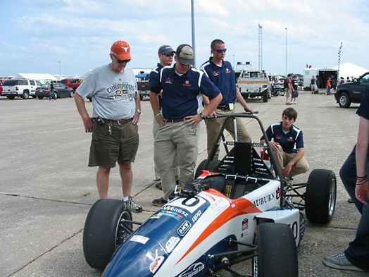 Grandson Chris discusses the car with Grandpa. Other Texas teams were there. UT Austin, UT Arlington (in the finals), UT San Antonio, North Texas, and Texas A&M. A&M set lap records in the Endurance Race on their first two laps, but the car faltered and eventually died, so they didn’t finish and got no score in this important event. In fact, only 50% of the 55 cars who entered the Endurance Race finished, and this is a high number over previous years. (Bear with us, all you non-techies, you had your libraries and Victorian homes!) Below is a short video of part of the Endurance Race. I'm sorry, but I didn't know that when you zoom in, the picture is blurry. But you can get the idea. Most of the cars in this clip have the big 'spoilers' or 'sails' at the back. There are mixed opinions about the utility of these, but the little Auburn car in this video does not have one. It's interesting to see all the zipping around of all the cars on the track. Like insects flitting around  Some spectators were somewhat 'under-whelmed' with the Endurance Race. Even at this wholesome level of competition, there is what may be called ‘corporate espionage’ going on. After the race and Auburn is known to be a contender, other teams came to examine in detail (and take pictures) of what they could see of the car. In the photo below, Auburn’s last year car is on the left (brought along for spare parts) and even that is of interest to the ‘spies’. 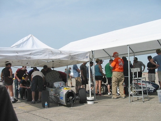 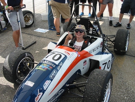 Watch out Andretti, new driver in town. Finally the presentation of awards. The team from Brazil took first place in every category with their electric car (they had the only electric car in the competition). Several awards were given and Auburn was only mentioned twice. We thought that was not a good omen, but in the end, when the overall winners were announced, based on accumulated points in all areas, Auburn took 2nd place!! Talk about proud!! 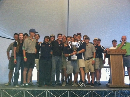 When the last race is over and evening comes on, the flags are furled and trailers packed up for the trip home, the guys still have energy for some Frisbee. 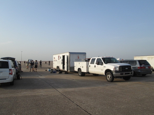 Being here for this event has been fun, interesting, and exciting. Seeing the dedication of these young people who have built these machines (spending many hours) and brought them to an event like this inspires new faith in this generation. They have solved real-time problems with diligence and exhibited good sportsmanship. We are so proud of them 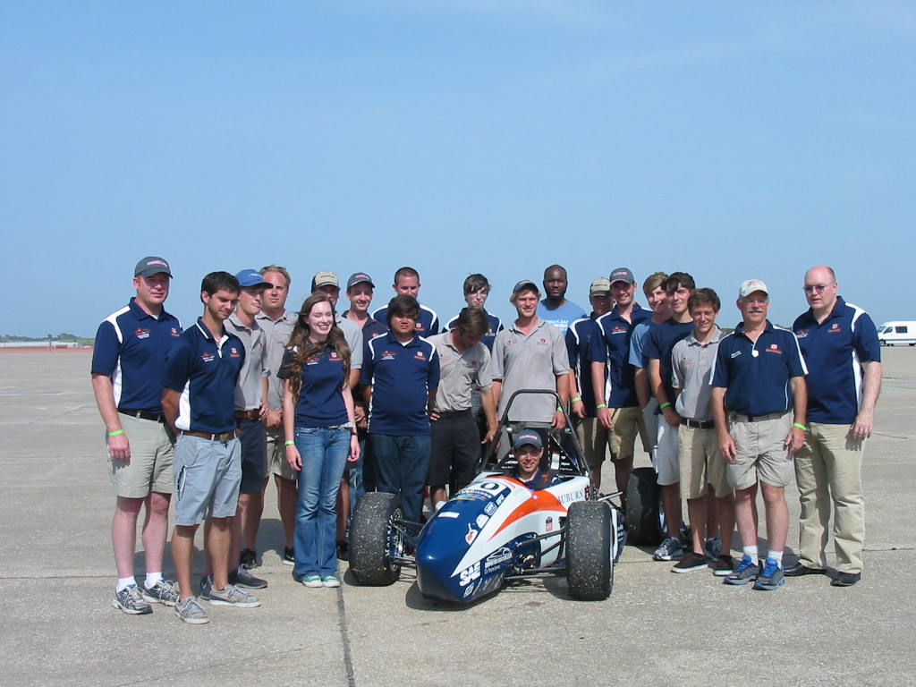 With happy hearts we'll leave Lincoln and head north to Pender, Nebraska. Even the facebookers don't know why we're going to Pender, so you will just have to ... stay tuned.
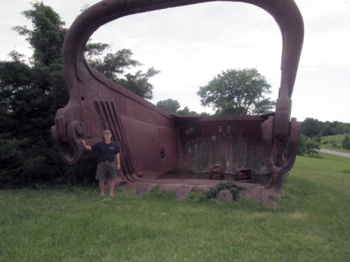
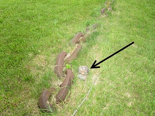
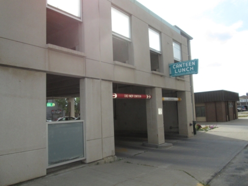
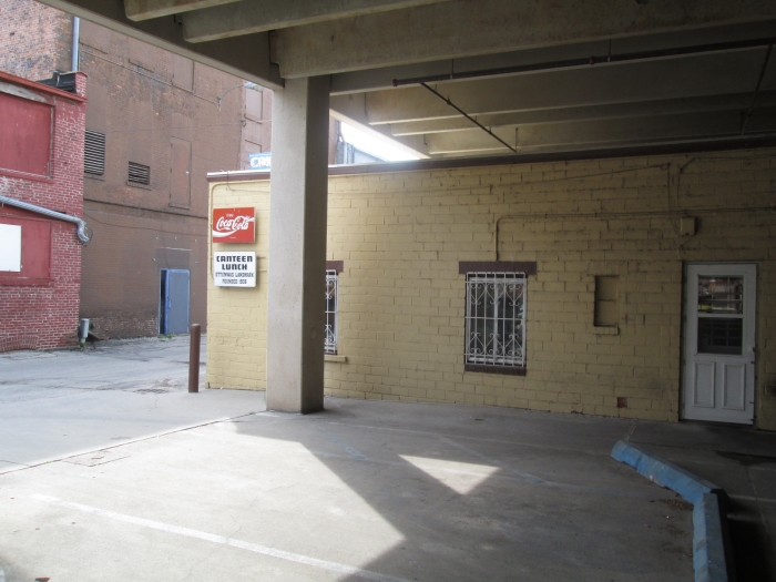
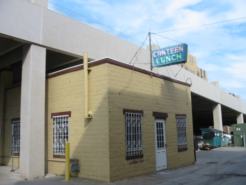
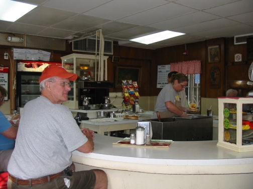
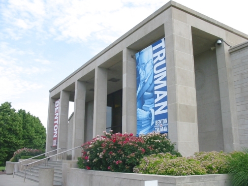
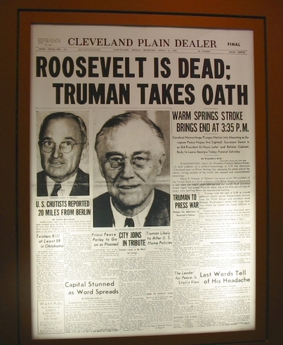
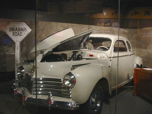
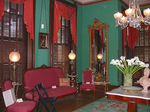
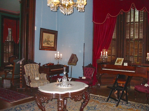
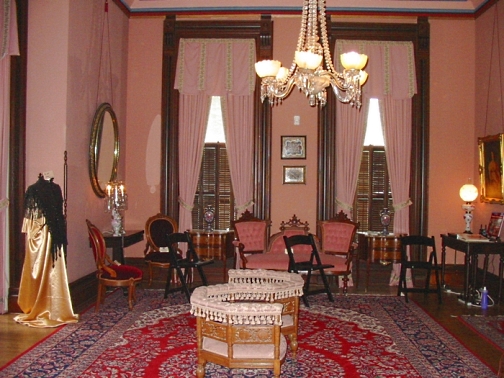
Leaving our idyllic campground at Van Meter State Park, we spotted this barn with a quilt pattern painted on the side. It seems there are several like this in the area to the extent that there is a 'Quilted Barn Trail' published that you can follow to see these barns. 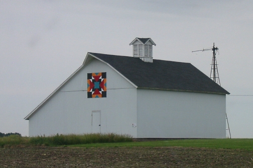 Moving on east, we arrived at the home of Mary Lou's cousins, Dickie and Kristy Waddell in Moberly, Missouri. The accommodations were absolutely fine! A nice place to park and clean place to work on the jeep's electrical problems. We were fortunate that the fire extinguisher in the RV was nearby. Wound up needing a new battery and ECM (computer) which caused us to stay an extra day. 'Course with Kristy's excellent meals of veggies fresh from the garden out back, who's complaining.  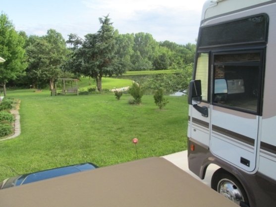 View from our parking spot. We had the opportunity for another 'factory tour' here. The Waddells run an embroidery business called 'Log Home Stitch' in their basement. It's a facinating operation to watch. They have seven sewing machines arranged in a 'U', so they can be conveniently operated from the middle. There are 3 singles and a four-machine unit. 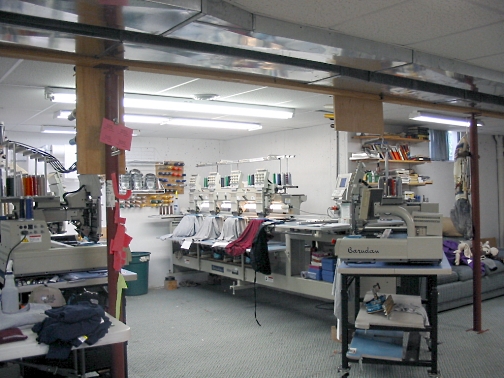 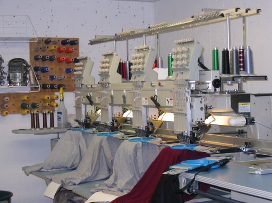 Four machines all stitching simultaneously. The process starts with an image in a computer where the stitching sequence, patterns, and thread colors are programmed. This program is loaded into the sewing machines along with the needed thread colors and once the article to be stitched is 'hooped' and clipped into place, stitching can begin. 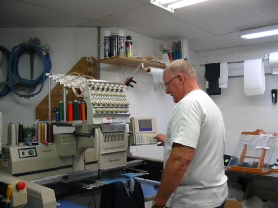 Programming the machine. 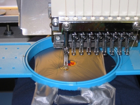 Sequencing of stitching is important. Starts in the middle and works out. Each needle has a different color thread and moves into position as needed. 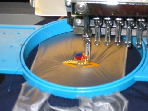 More progress. 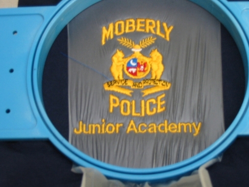 Finished. Note the bears. They are stitched with yellow thread, but because the stitching is in different directions, features of them show up differently. 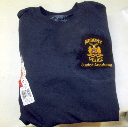 A finished shirt. Water has been sprayed on the new logo to dissolve the plastic overlay used in the stitching process. 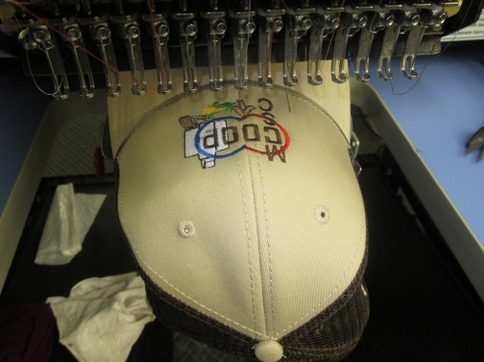 Hats are hooped up differently. The cap rotates as the stitching moves from side-to-side. With the stitching done, we took a ride in the country. They showed us this massive relic of a 'drag line bucket' (I don't know the proper term). This was used to scoop out dirt to expose coal deposits to be mined. Note the size of the scoop relative to me, and the chain relative to the cap on the ground. Finally the jeep part arrived, and with repairs successfully made, we said our goodbyes early afternoon and headed north for Ottumwa, Iowa. Those who are Facebook friends with Mary Lou get a heads-up on why we are going to Ottumwa. Ottumwa was the home town of our dear deceased friend and neighbor, Obe Hokanson. He was always talking about the hamburgers at a hole-in-the-wall in Ottumwa. When he had a chance he would go there just for the burger. Since we were in the neighborhood, we thought we'd stop in and see what the fuss was about. Actually we're making a special trip just to try it. The place is in a little brick building with the business established in 1936 (that's even older than I am). All the other buildings around it were torn down, but due to protests from the citizens, the Canteen survived. A parking garage has been built around and over it, and access is either from 2nd street, through the garage, or from the alley. Inside there is just a u-shaped counter, seating about 8-9 people - local of course. What tourists would come to Ottumwa? The burgers are really 'loose-meat' which means crumbled up ground beef. We first heard of these in the old Roseanne TV show where she opened a Loose-Meat joint. The meat is 'steamed' in a cooking apparatus in the middle of the u-shaped counter. Raw ground meat cooked somehow with dry heat I think, and then shoveled into the right side from whence (!) it is 'spatula-ed' onto the buns which have been prepared with mustard, pickles, onions, and cheese as desired. 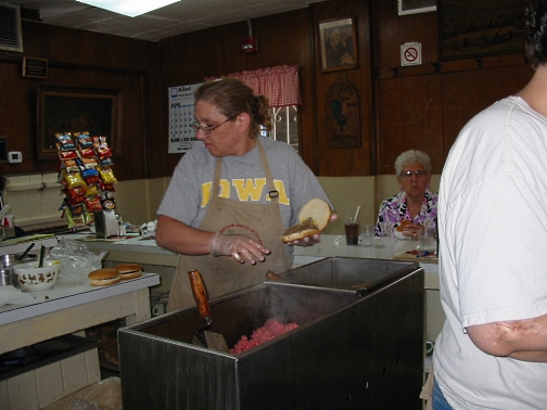 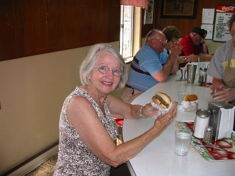 The 'burgers were definitely tasty, but the experience was priceless. A fun stop. 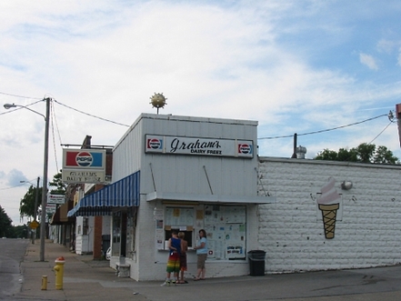 The patrons highly recommended the malts and shakes here, but the burger makers recommended the 100 year old ice cream place down the street, so we did that. Our curiosity satisfied, we left Ottumwa heading west to Lincoln, Nebraska. We made it to Osceola for the night ('far away places with strange sounding names' - old song lyrics). Facebook friends know why we are going to Lincoln - others will have to wait. Stay tuned. View Topeka, Kansas to Os in a larger map The road to Independence from Topeka leads through Kansas City, which spans the Kansas-Missouri border. It looked like a nice city, but we breezed through on the freeway. 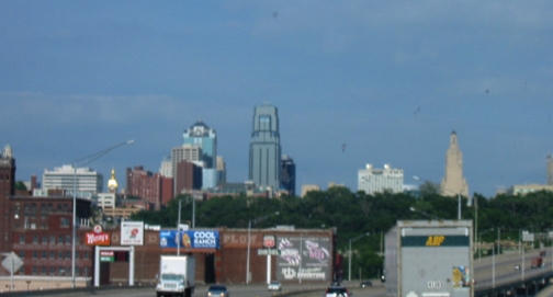 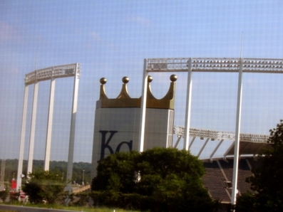 This must be the KC Royals Stadium (ya think?), and another stadium behind was probably for the Chiefs. Independence, Missouri, is a small town suburb of KansasCity, Missouri, and is the home town of Harry S. Truman, the 33rd President of the United States. For the younger readers, he was Vice-President under Franklin D. Roosevelt and became president when Roosevelt died near the end of WWII. He authorized the use of the atomic bomb on Japan, ending the war and likely saving millions of American lives. His Presidential Library was here. 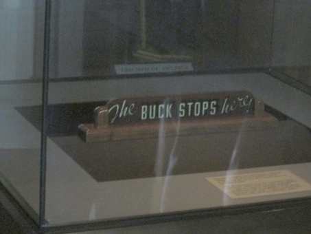 Truman was a no-nonsense man and made famous the phrase ‘The Buck Stops Here’. Meaning when it came time to take responsibility and make a decision, he would do it. Here’s the actual plaque that sat on his desk. 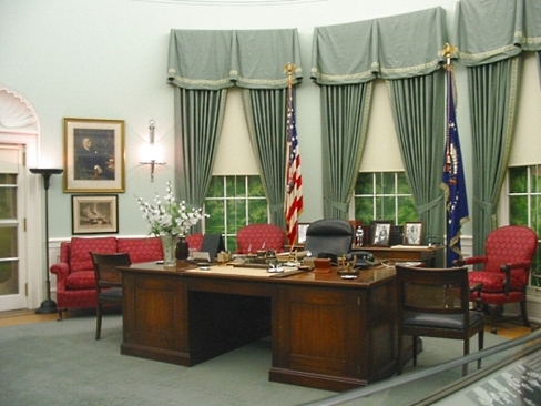 This is a replica of his ‘oval office’. 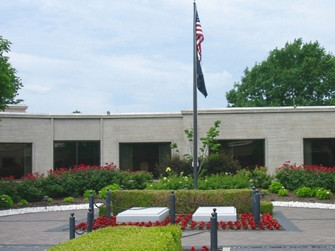 Graves of President and Mrs. Truman (Bess)in the courtyard. Like Eisenhower, who was President after him, he came from very humble beginnings, and remained a ‘common man’ throughout his life. One extravagance he allowed himself was the purchase of two 1941 Chrysler cars in matching dove gray color. A coupe for him and a sedan for Bess. The total cost for both cars was $2700. Another exhibit in the Library is the 1950’s kitchen. The ‘50’s were a time of prosperity after WWII ended. It was a great time in which to grow up, as I can attest. The refrigerator was common to the time, as was the chrome and formica dinette set. A photo on the wall is typical of the homes which sprouted in subdivisions as men returned from the war. 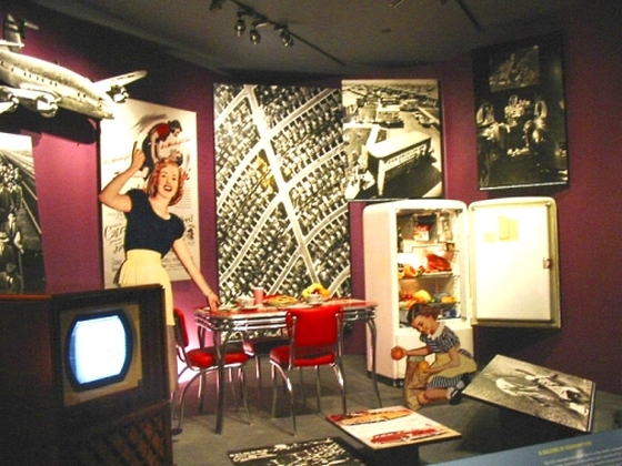 Note the TV set! When Truman left Washington, D.C. after Ike’s swearing in as President, he and Bess rode the train back home to Independence (no government plane ride). He retired from the Presidency with no government pension, and no Secret Service protection. He was just a citizen again. They returned to their home which had been inherited from Bess’s family. It’s in a neighborhood of ordinary homes. (He was afforded Secret Service protection after John F. Kennedy’s assassination in 1963). 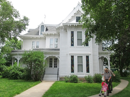 While in Independence, ML wanted to see the Vaile Mansion (I didn’t have to go :-). It was built in 1881 for Harvey Vaile, who was an entrepreneur and US mail contractor (why am I thinking corruption here?). The 31 room mansion is considered one of the best examples of Victorian architecture in the United States. 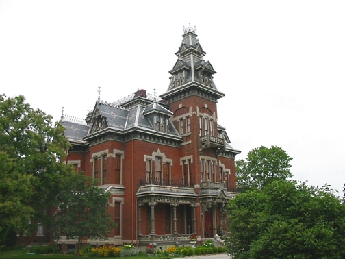 Since Vaile’s death in 1894, the home has been used as a women’s college, an inn, a private asylum & sanitarium, a mineral water company, and a nursing home. Below is pictured a painting on the ceiling over the master bed. The bodice of the dress is only a thin veil, and was considered quite risqué in those days. In fact, members of the community who knew of it (via servants who saw it) ostracized the lady of the house because of it.  Now that we have been steeped in Presidential history for two days, we went to a remote little State Park campground near Miami, Missouri, and spent a couple of nights to relax. Plus we had to kill a little time, before heading to Mary Lou’s cousin’s house in Moberly, Mo.  There's more good stuff to come. See you on down the road. Stay tuned.
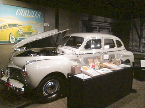
We have discovered that various insects must love the wheat fields. To prove it, just look at our windshield. Our reason for coming to Abilene was to visit the Dwight Eisenhower Presidential Library. This is a little different from some other presidential libraries in that it is a complex over several acres and consisting of several buildings and monuments. The Old Boyhood Home is original and in the same place (not been moved). It is a small house, about 600 sqft on each of two floors. The six brothers slept on the second floor – 3 to one room, 2 to another, and one a little bit bigger than a closet for the oldest son. 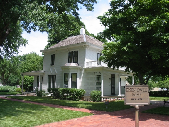 The family was poor, and the only way Dwight could get a college education was to go to a service academy. He wanted to go to the Naval Academy at Annapolis, but couldn’t get in and had to settle for West Point. (another WWII hero, Admiral Nimitz, wanted to go to West Point, but settled for Annapolis. Worked out kinda well, don’t you think!) The actual library building housed all the presidential papers and is used mainly for research. The main focus for tourists is the museum. 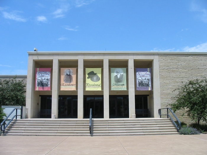 As it is with museums, there is way too much to read in a short time. All interesting and relevant, but too much. Of course there are some displays and interactive features. There is much to cover, from early years, military service in WWII, and the Presidency. Didn’t take any pictures in there, but here is looking in from the entrance. 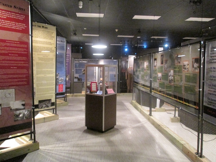 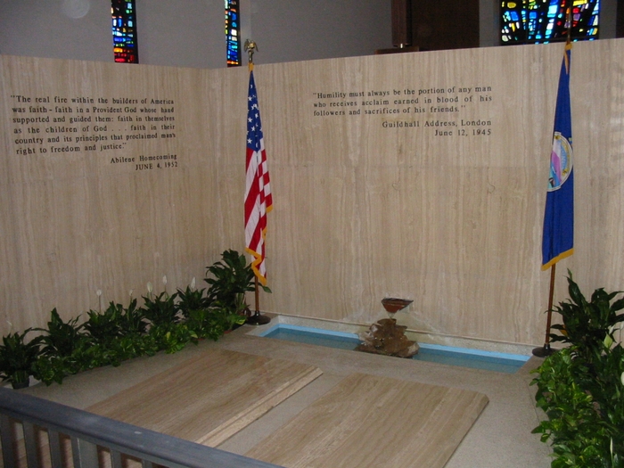 In another ‘chapel’ building on the grounds, President and Mrs. Eisenhower (Mamie) are buried. 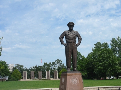 And finally, at the end of the grounds, overlooking the whole thing, is the great man himself. So, at the end of a long day spent mostly on our feet, we checked into a nearby campground and finally relaxed. Until noon the next day. The morning was spent on chores like scrubbing the bugs off the front of the RV. Preparing to leave, something unheard of happened. Mary Lou volunteered to drive!! Invited and declined many times, this time she knew getting through small town Abilene and heading east to Topeka on I-70 would be straight and uncrowded. She did well. 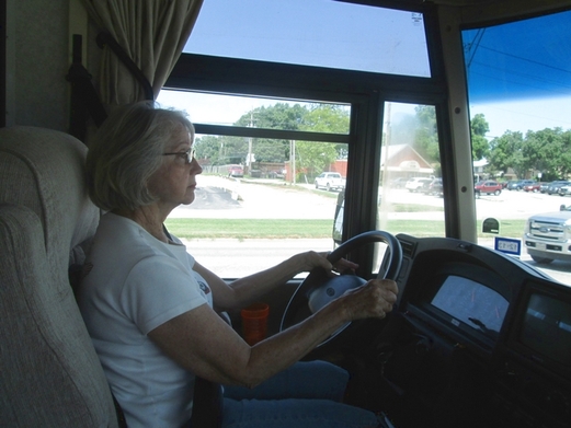 White knuckles? We hadn’t picked Topeka as a destination, but we were heading east anyway and ML had discovered the Great Overland Station, which is the grand old train station built in 1927. Topeka is a prominent railroad hub for several rail lines. Oldsters among you may remember the song ‘Atchison, Topeka, and the Santa Fe. The station is no longer an active train stop, but over 125 trains go by each day. 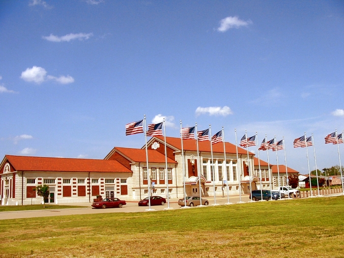 Upon entering the station in what was the baggage area on the left, there is a huge model city with trains (gauge 10, I think) circling the ‘city’. Check out the detail of the buildings and other features. 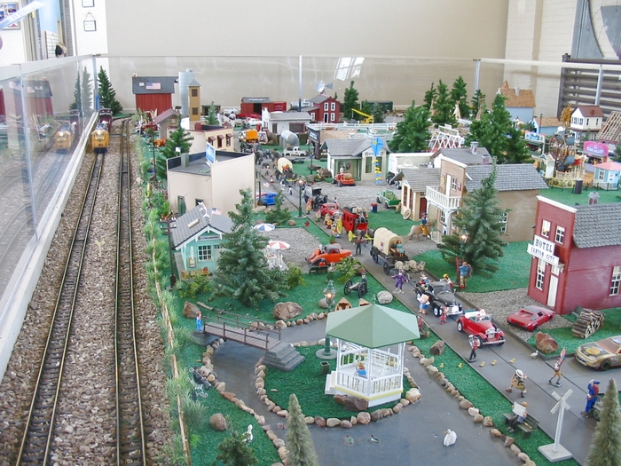  Rail travel back in those days can be described in one word – elegant. For people of means, anyway. Train cars and stations were elegantly appointed, and dining was on white linen with fine china. Below is the main waiting room, minus the benches, and is now available for weddings and other functions. 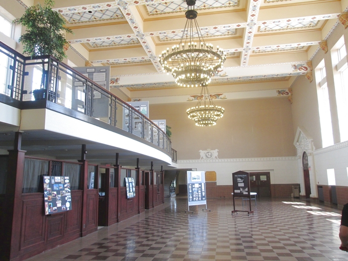 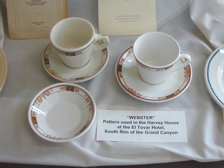 Different patterns of china were used in different areas and on different trains. Railroads often sponsored hotels at stops along their line.  Across the street from the station is the Veteran’s Memorial. The large spiral scupture actually turns a bit, by the wind I guess. Well, lets see. We left Abilene around noon, toured the train station in Topeka, and will spend the night in Independence, Missouri. Stay tuned. Here's a map of our route to Toledo. (Not particularly interesting). View Midwest route 1 in a larger map |