|
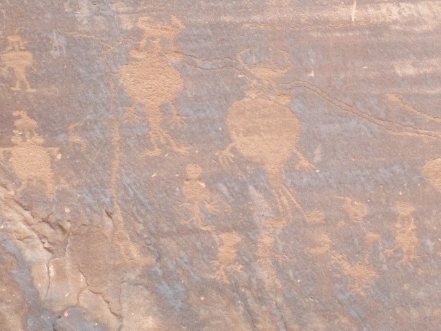
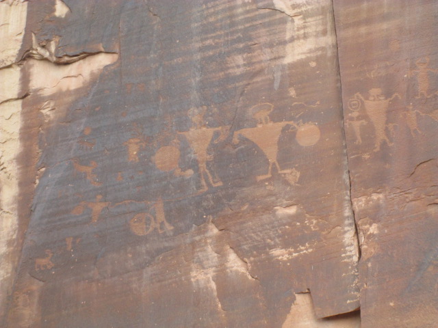
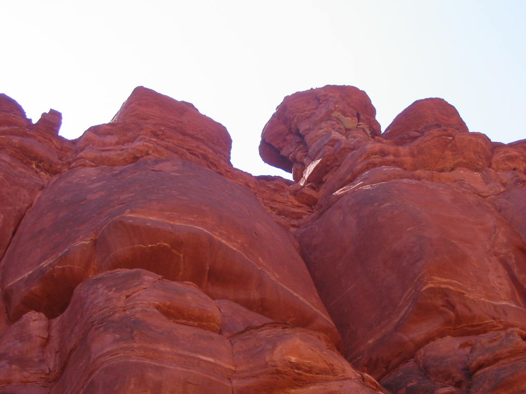
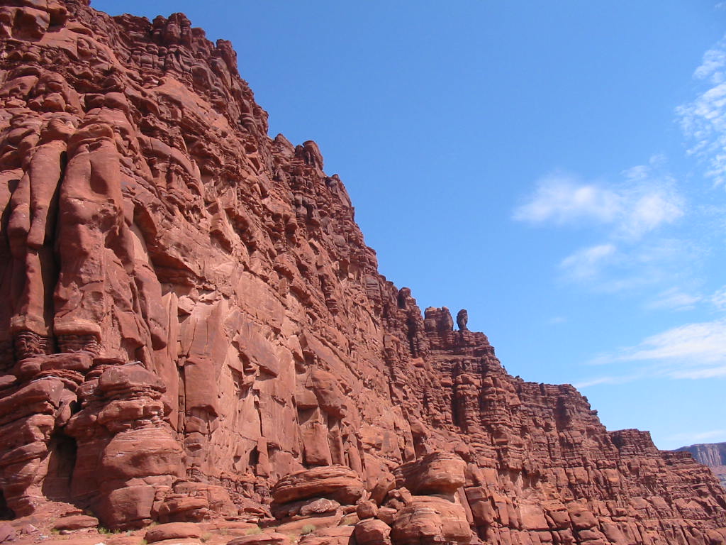
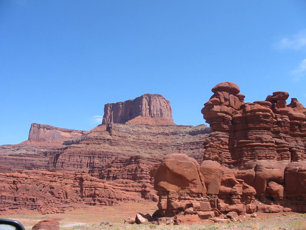
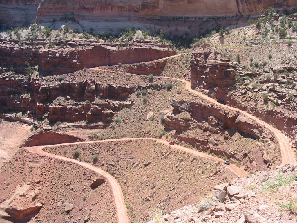
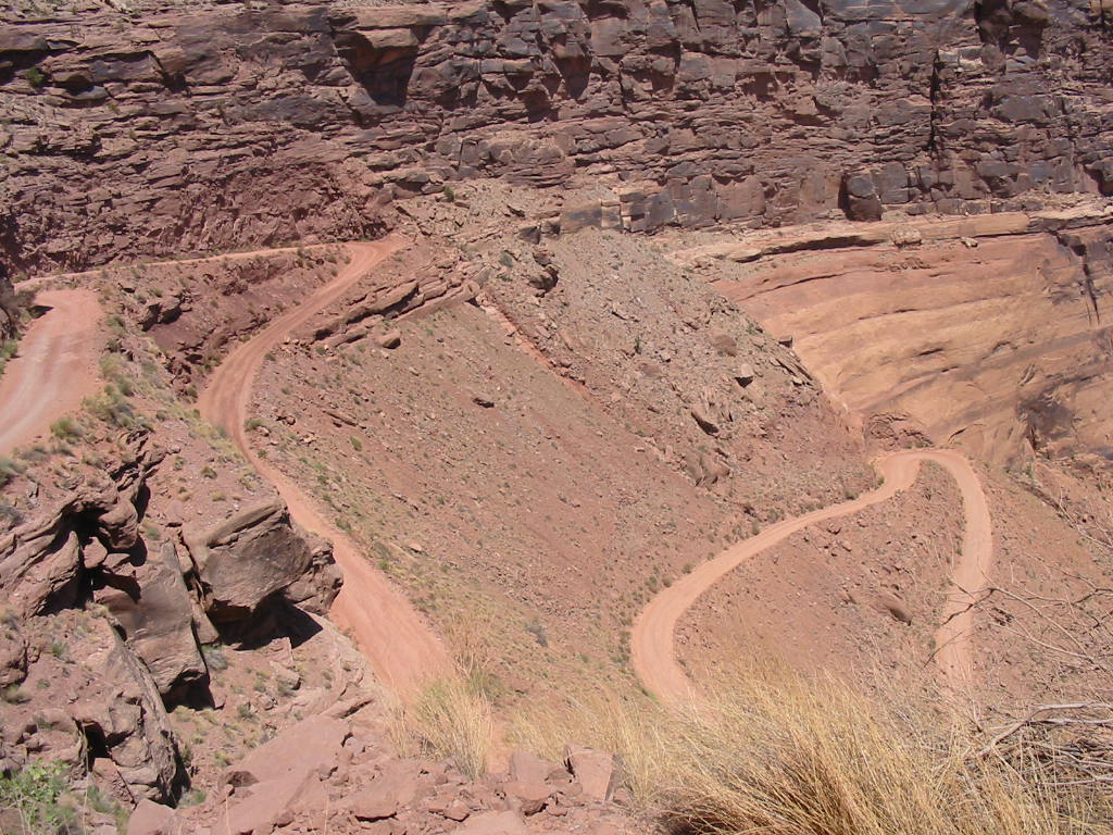
The next morning (after an exhausting day of touring Canyonlands and Arches National Parks), we embarked on an off-road jeep ride. It started out on a paved road which followed the Colorado River (the one that goes through the Grand Canyon). 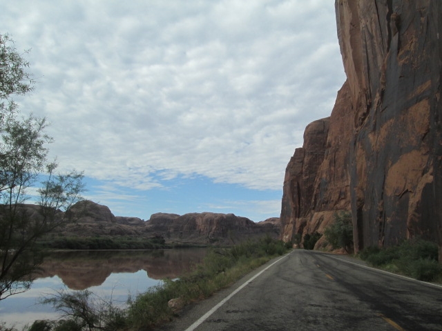 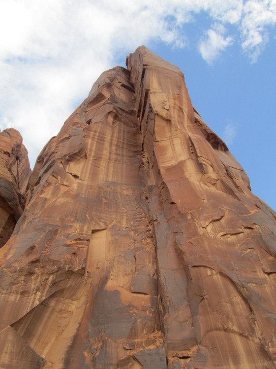 This rock towered over the road. The photo can’t convey the massiveness. These rocks had ancient Indian writings on them. I can’t tell you what they say, but it may have been their method of facebooking. Factoid: pictographs are painted on, and petroglyphs are carved or etched into the rock. I don’t know which these are. At one of our stops we noticed activity across the river. Some cars were there, and an 18 wheeler, plus another truck with a trailer, loaded with 4-wheel off-road vehicles. It’s a rental outfit bringing them to a trailhead. A big operation. 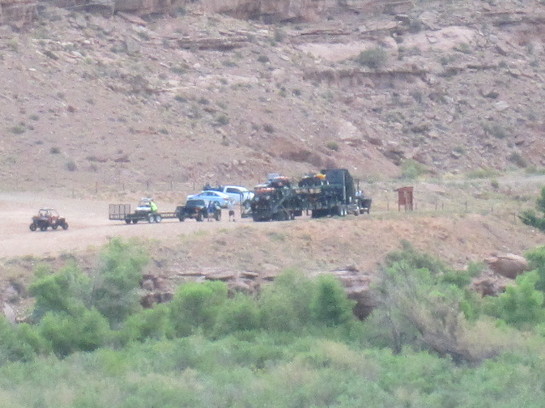 As we got deeper into the wilderness, we came upon this facility. It felt a little spooky, like something from a James Bond movie. Turns out it is a potash mining operation. 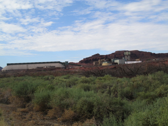 Past this point the road was no longer paved. 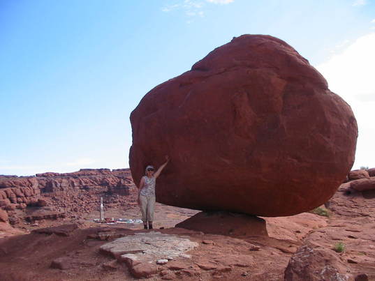 Another balanced rock. But notice what’s to the left of Mary Lou. Here’s another little facility here in the middle of nowhere. Really spooky here. I kept expecting a black helicopter to come rising up and heading our way. No telling what manner of mysterious stuff goes on out here 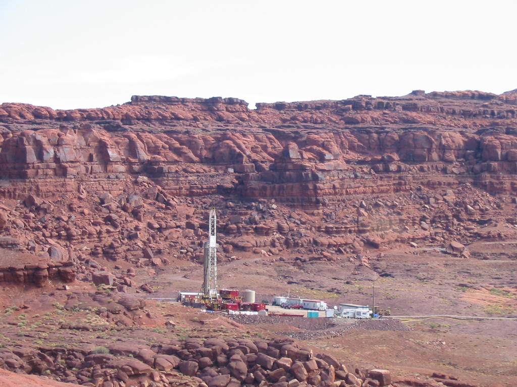 We came upon yet another operation out there. Moab Salt company must have been refining salt in great ponds. Not sure how all that worked, but the ponds were bright blue rimmed with white salt. I have since gotten new information. Potash is defined on Wikipedia as “various mined and manufactured salts that contain potassium in water-soluble form”, mostly used in fertilizer. The article even mentions the potash evaporation ponds near Moab, and has a picture similar to the one below. 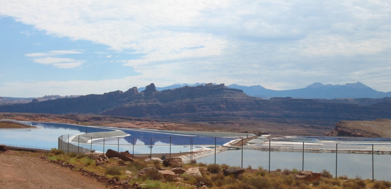 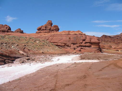 A salty stream. (we tasted it!) A hairpin bend in the Colorado River. Notice how red it is, particularly on the right side. 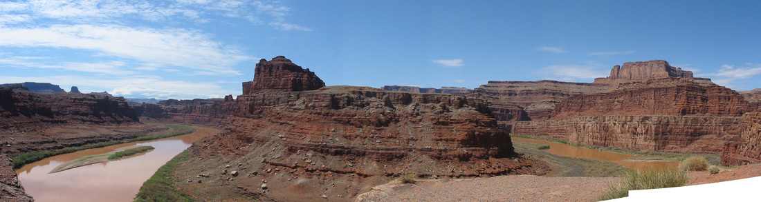 Rocks, rocks, and more rocks. And the last part of the road. We had come from here. 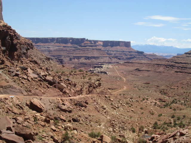 And we assaulted the cliff on this switchback road. Click the photos. And finally the little jeep is triumphant! 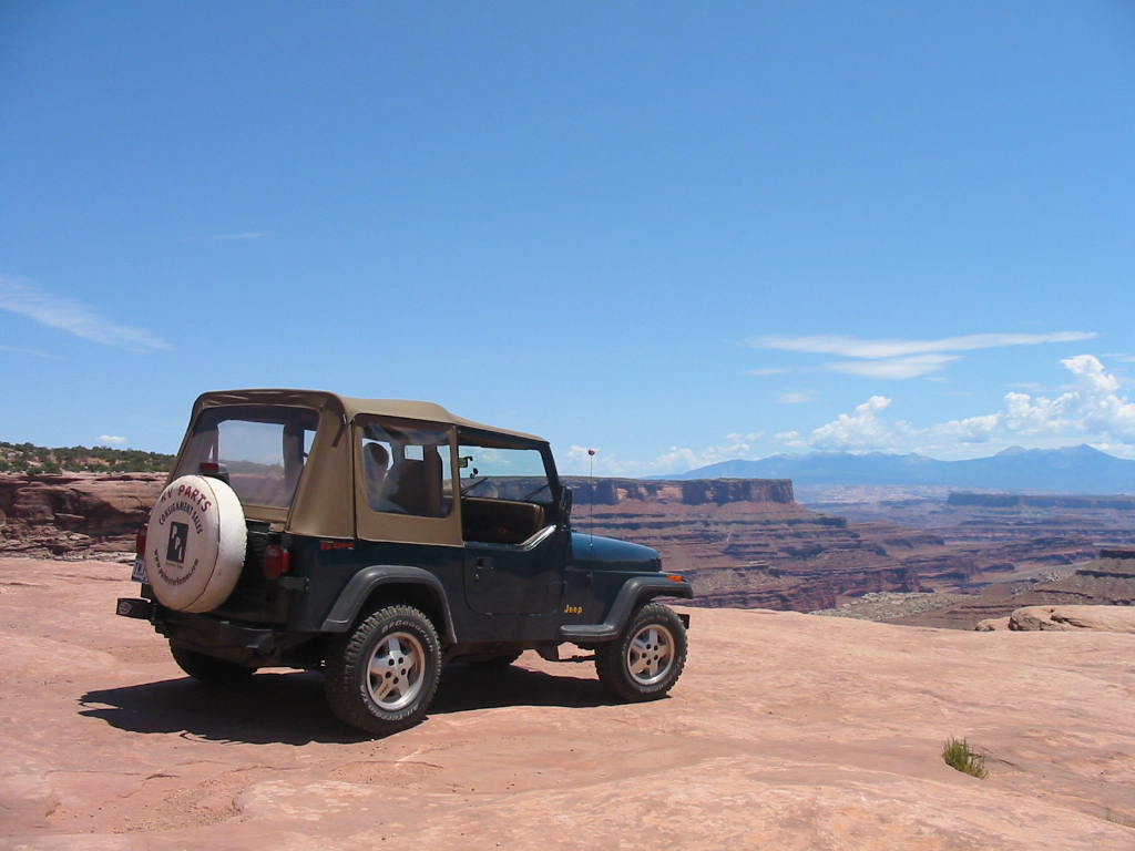 The map on the left is the entire route. The right map shows the road up the cliff (the turkey foot). 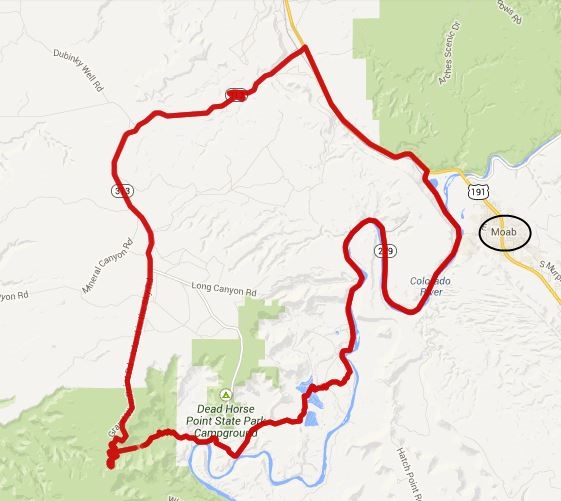 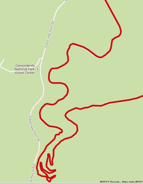 After this fun ride, we still had time to retrieve the RV and head on down the road for more fun and adventures. Stay tuned.
2 Comments
Cheryl White
7/21/2013 12:36:35 pm
Beautiful colors
John Forbes
7/22/2013 12:02:13 pm
You all are exploring through the geological wonderland of the North American continent. That white cross-bedded (festoon) sandstone in some of the photos is the Navajo sandstone and represents an ancient windblown dunefield deposited in a widespread desert (think Sahara sized); it's also present at Capitol Reef and Zion. The massive red (iron) sandstone with the black (manganese) weathering is the Wingate formation and is also very widespread and represents earlier hostile desert-like environment. Kay and I did do the hike to Delicate Arch which is awesome up close but we were still in our 40s, don't think I could make it now. Try to visit Capitol Reef, Natural Bridges, and Mesa Verde while you're in the area. Have a great time. Leave a Reply. |